




Nawigacja
Pobierz tę trasę na swój telefon komórkowy
Mapa
CAT Cycling Around Torino - stage 10

średni
Kolarstwo długodystansowe
45,99 km
Zeskanuj kod QR i rozpocznij nawigację w aplikacji bergfex.
QR Code
Wędrówki i tropienie

CAT Cycling Around Torino - stage 10

średni
Kolarstwo długodystansowe
Odległość
45,99 km
Czas trwania
04:10 h
Ascent
902 hm
Poziom morza
217 - 696 m

Poziom trudności: 2

Ścieżka do pobrania
Mapa
CAT Cycling Around Torino - stage 10
średni
Kolarstwo długodystansowe
45,99 km

Return stage to the city, with an ascent of about 900m. It starts on the shore of Lake Arignano,  an ideal place for birdwatching, and the first climbs are tackled, towards Marentino, a village with rebuses...

Opis

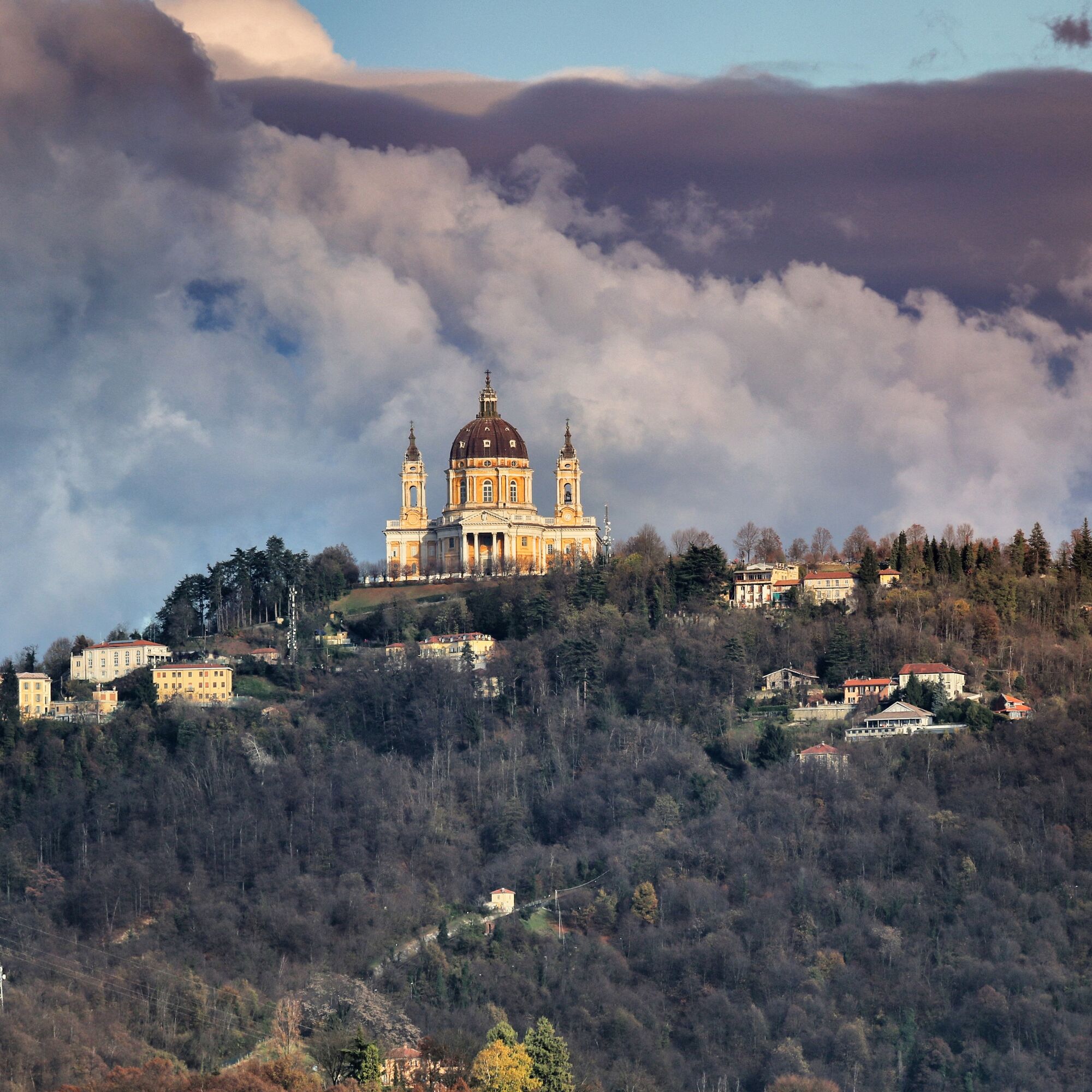
Return stage to the city, with an ascent of about 900m. It starts on the shore of Lake Arignano,  an ideal place for birdwatching, and the first climbs are tackled, towards Marentino, a village with rebuses painted on the walls of the historic center houses, and Sciolze. On secondary and undulating roads, the small village of Bardassano is crossed and then Pavarolo, long home of Felice Casorati, famous painter and designer. Here begins the climb to Superga, with its Basilica and the incomparable view of Turin and the Alps.  Leaving Superga, you travel the road that Turinese call "La Panoramica", for obvious reasons, and reach the top of Maddalena, the highest point of the Turin hill, where there is an imposing monumental lighthouse, which celebrates the victory in the First World War. From here, in a rapid descent, you return to the city.
Trasa
Chiesa di Santa Lucia del Fagnour
(477 m)
Miejsce kultu
9,6 km
Cappella di San Sebastiano
(375 m)
Miejsce kultu
15,9 km
Parrocchia Santa Maria dell'Olmo
(363 m)
Miejsce kultu
16,5 km
Superga
(672 m)
Szczyt
23,8 km
Bric del Duca
(671 m)
Szczyt
25,4 km
Colle della Maddalena
(715 m)
Szczyt
37,6 km
Santi Vito, Modesto e Crescenzia
(405 m)
Miejsce kultu
41,3 km
Trasa
Mapa
CAT Cycling Around Torino - stage 10
średni
Kolarstwo długodystansowe
45,99 km
Arignano
(298 m)
Wioska
0,3 km
Cappella San Rocco
(373 m)
Miejsce kultu
3,4 km
Marentino
(380 m)
Wioska
3,7 km
Sciolze
(410 m)
Wioska
8,6 km
Chiesa di Santa Lucia del Fagnour
(477 m)
Miejsce kultu
9,6 km
Regione Bavento
(422 m)
Rozliczenie
10,2 km
Regione Curlando
(453 m)
Rozliczenie
10,4 km
Tetti Grosso
(436 m)
Rozliczenie
10,9 km
Bardassano
(452 m)
Rozliczenie
12,5 km
Tetti Aprà - San Defendente
(400 m)
Rozliczenie
14,4 km
Chiesa di San Defendente
(415 m)
Miejsce kultu
14,6 km
San Grato
(360 m)
Rozliczenie
15,3 km
Cappella di San Sebastiano
(375 m)
Miejsce kultu
15,9 km
Pavarolo
(363 m)
Wioska
15,9 km
Ristorante dell'allegria Da Maria
(370 m)
Restauracja
16,1 km
Ristorante del Castello
(373 m)
Restauracja
16,2 km
Parrocchia Santa Maria dell'Olmo
(363 m)
Miejsce kultu
16,5 km
Tetti Pesartori
(334 m)
Rozliczenie
17,1 km
Tetti Valentino
(382 m)
Rozliczenie
17,6 km
Baldissero Torinese
(410 m)
Wioska
18,6 km
Il Pilonetto
(556 m)
Wioska
20,9 km
Osteria del Paluch
(556 m)
Restauracja
21,3 km
Village Palouc
(547 m)
Rozliczenie
21,3 km
Bric Palouc
(616 m)
Szczyt
21,5 km
Bel Deuit
(616 m)
Restauracja
23,4 km
Trattoria Superga
(620 m)
Restauracja
23,4 km
Cheers Bistrot Superga
(660 m)
Restauracja
23,8 km
Superga
(672 m)
Szczyt
23,8 km
Tetti Rocco
(566 m)
Rozliczenie
24,3 km
Superga
(669 m)
Rozliczenie
24,4 km
Bric del Duca
(671 m)
Szczyt
25,4 km
Bric San Giacomo
(660 m)
Szczyt
25,8 km
Bric Sueri
(628 m)
Szczyt
26,2 km
Monte Aman
(603 m)
Rozliczenie
26,7 km
Monte Cervet
(568 m)
Szczyt
27,8 km
Bric Caros
(535 m)
Szczyt
29,8 km
Pizzeria La Panoramica
(504 m)
Restauracja
32,1 km
Col d'Arsete
(552 m)
Siodełko górskie
35,0 km
Eremo
(608 m)
Rozliczenie
35,9 km
Il Bric
(693 m)
Restauracja
37,3 km
Colle della Maddalena
(715 m)
Szczyt
37,6 km
Moncalieri
(250 m)
Miasto
38,5 km
Pian del Lot
(503 m)
Rozliczenie
39,9 km
Santi Vito, Modesto e Crescenzia
(405 m)
Miejsce kultu
41,3 km
Piazzale panoramico
(403 m)
Punkt widzenia
41,4 km
San Vito
(381 m)
Rozliczenie
41,5 km
Cappella di Santa Chiara
(271 m)
Miejsce kultu
43,1 km
Turin
(239 m)
Miasto
45,9 km
Porta Nuova
(240 m)
Stacja kolejowa
46,0 km
Informacje o wycieczce

On the crest of the hill of Turin. A balcony over Alpine city.

Technologia
2 / 6
Stan
3 / 6
Krajobraz
6 / 6
Doświadczenie
6 / 6
Dostępny przez cały rok
Sty
Lut
Mar
Kwi
Maj
Cze
Lip
Sie
Wrz
Paź
Lis
Gru
Udostępnij trasę
Mapa
CAT Cycling Around Torino - stage 10
średni
Kolarstwo długodystansowe
45,99 km
Błąd
Wystąpił błąd. Spróbuj ponownie.
Wędrówki i tropienie

Wędrówki i tropienie

Wędrówki i tropienie
Ponad 550.000 propozycji wycieczek, szczegółowe mapy i intuicyjny planer tras sprawiają, że aplikacja jest niezbędna dla wszystkich entuzjastów przyrody.
bergfex


