


Itinerary of the country churches and gullies in the Bormida Valley of Spigno and Erro - CCB
The cycle-excursion itinerary "of the gullies and country churches" offers a journey through the history, culture and landscapes of the Marca Aleramica, and is connected to other itineraries of historical...
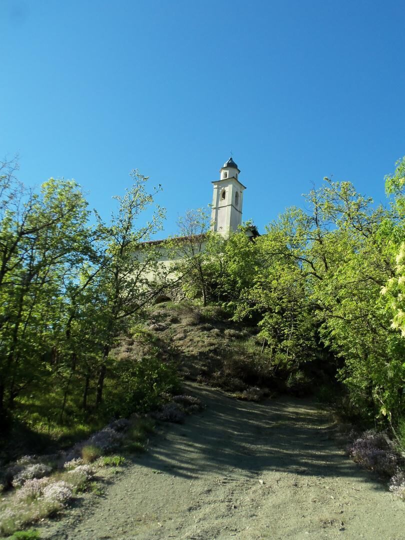
The cycle-excursion itinerary "of the gullies and country churches" offers a journey through the history, culture and landscapes of the Marca Aleramica, and is connected to other itineraries of historical and naturalistic interest in the region. Knowledge of the geomorphological, anthropic, historical and cultural stratification of a territory is also formed by traveling along the ancient roads that cross it. The cycle-hiking itinerary "of the gullies and country churches" crosses part of the Marca Aleramica, retracing ancient road routes connected to a widespread multitude of paths that reach the emergencies of the area and its typical features. The territory presents a significant geomorphological stratification, with hills, gullies and plains crossed by waterways that date back to the Ligurian Apennines. The history of the territory is evident in the vestiges of the conquests of the Roman armies coming from the Ligurian Sea, from the Saracen incursions and from the Spanish, Napoleonic and Savoy dominations, the testimony of which is evident in the villages, in the castles, and along the free roads that dot and plow the ridges, in the parishes and country churches built over the centuries to protect the local populations. The itinerary connects to other cycle-hiking routes, such as the Wine Landscapes of Langhe - Roero and Monferrato, and extends towards the Langa Astigiana, the partisan resistance routes and the Ligurian Apennines, with detours leading to the Alta Via of the Ligurian Mountains and various regional nature reserves.

Tak
Knowledge of the geomorphological, anthropic, historical and cultural stratification of a territory is also formed by traveling along the ancient roads that cross it. The cycle-excursion itinerary "of the gullies and country churches" crosses part of the Marca Aleramica, retracing ancient road routes connected to a widespread multitude of paths that reach the emergencies of the territory and its typical features. The territory presents a significant geomorphological stratification, with hills, gullies and plains crossed by waterways that trace back to the Ligurian Apennines. The history of the territory is evident in the vestiges of the conquests of the Roman armies coming from the Ligurian Sea, from the Saracen incursions and from the Spanish, Napoleonic and Savoy dominations, the testimony of which is evident in the villages, in the castles, and along the free roads that dot and plow the ridges, in the parishes and country churches built over the centuries to protect the local populations. The itinerary connects to other cycle-hiking routes, such as the Wine Landscapes of Langhe - Roero and Monferrato, and extends towards the Langa Astigiana, the partisan resistance routes and the Ligurian Apennines, with detours leading to the Alta Via of the Ligurian Mountains and various regional nature reserves.
Popularne wycieczki w okolicy
-
5,0
Sentiero anello di Bistagno - Sentiero 500 in camminata
Trasa pielgrzymki 14,7 km -
5,0
IL GRANDE CAMMINO DEL MONFERRATO - 7°TAPPA: CANELLI - PONTI
ciężkiTrasa pielgrzymki 20,3 km -
Sentiero "Giro delle 5 Torri" - Sentiero 5T in mountain bike
Mountainbike 29,4 km -
3,0
SV_02 Ring path of Foresta Deiva
Wędrówka 12,0 km -
Rundweg Montechiaro - Weg 573 mit dem Mountainbike
Mountainbike 30,9 km -
Sentiero anello di Cimaferle - Sentiero 534 in mountain bike
Mountainbike 8,13 km -
Sentiero anello di Cimaferle - Sentiero 534 in camminata
Trasa pielgrzymki 8,13 km -
Sentiero anello di Merana - Sentiero 575 in camminata
Trasa pielgrzymki 10,5 km -
Rundwanderweg Montechiaro - Weg 573 zum Wandern
Trasa pielgrzymki 30,8 km -
Sentiero delle Chiese Campestri - Sentiero 571 in camminata
Trasa pielgrzymki 21,5 km
Wędrówki i tropienie


Nie przegap ofert i inspiracji na następne wakacje
Twój adres e-mail została dodana do listy mailingowej.