


Pulkkilanharju nature trail (2.4 km), Asikkala


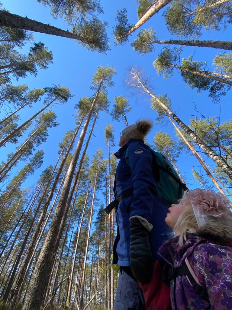
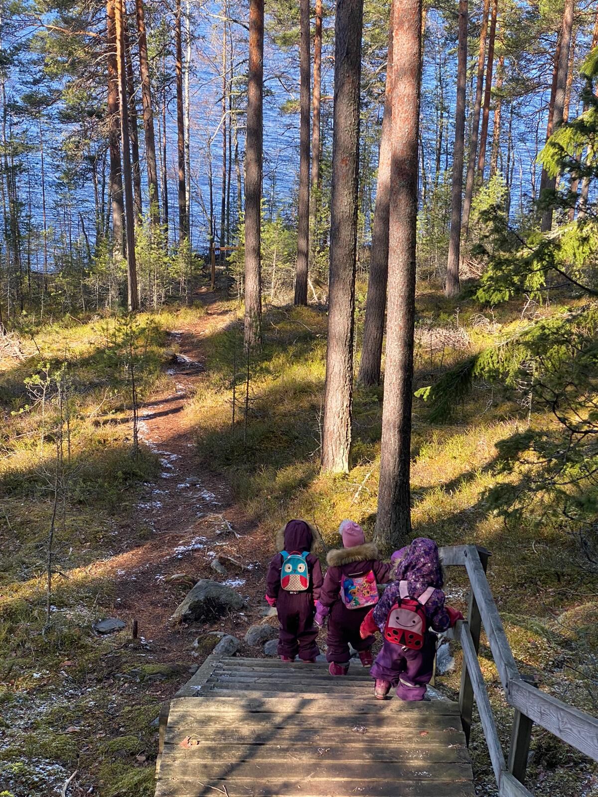
The Pulkkilanharju nature trail follows a well-maintained heath trail through beautiful ridge and lake scenery. On the nature trail, you can enjoy stunning views of Päijänne and the atmosphere of pine...
The Pulkkilanharju nature trail follows a well-maintained heath trail through beautiful ridge and lake scenery. On the nature trail, you can enjoy stunning views of Päijänne and the atmosphere of pine forest. The easy-to-walk route is suitable for hikers of all ages. The information boards along the nature trail tell about the area's geology, nature, and vegetation.
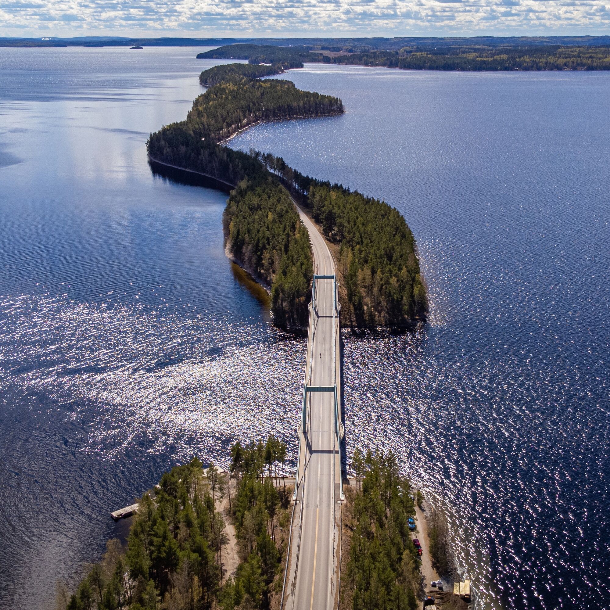
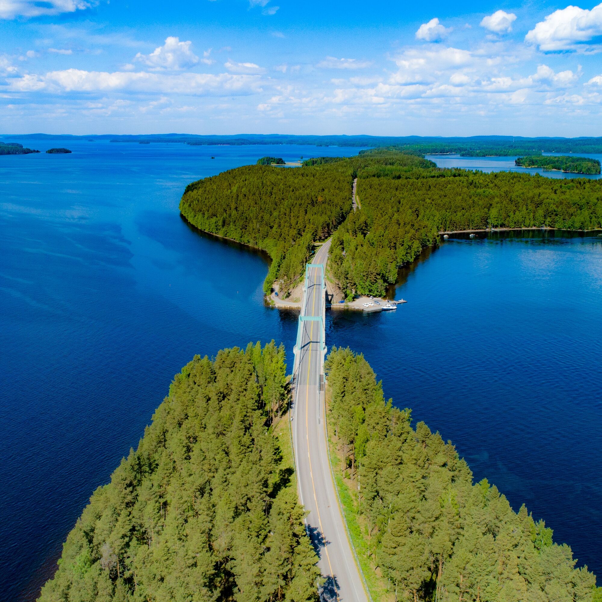
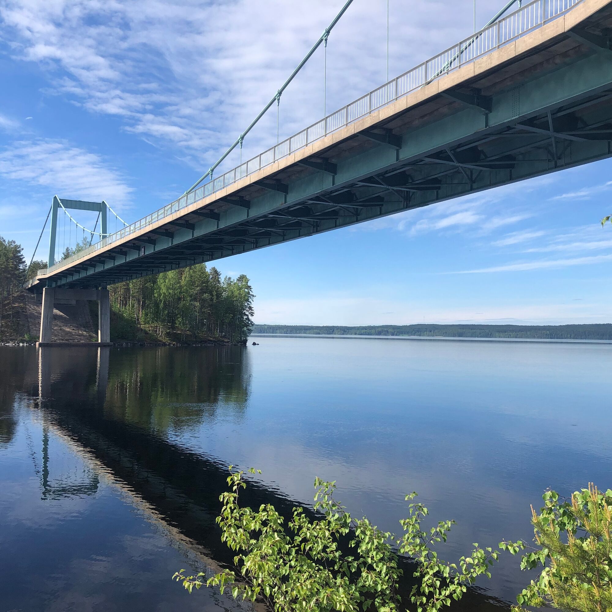
Pulkkilanharju, a narrow ridge crossing Päijänne, is an eight-kilometer-long island chain connected by bridges and one of the most spectacular sights in Lake Finland. Located in Päijänne National Park, Pulkkilanharju is part of a nationally valuable landscape area and an important observation point for spring and autumn bird migrations.
Pulkkilanharju is part of a scenic route, which was rightfully voted Finland's most beautiful in 2014.
Pulkkilanharju is one of the most significant sites in the Salpausselkä UNESCO Global Geopark and an internationally representative example of the latest Ice Age traces. Pulkkilanharju was formed at the site of an ice tunnel draining within the continental glacier from sand and gravel deposited by meltwaters at the end of the Ice Age about 11,500 years ago. Pulkkilanharju is part of a ridge extending from Asikkala's second Salpausselkä far into the Sysmä side.


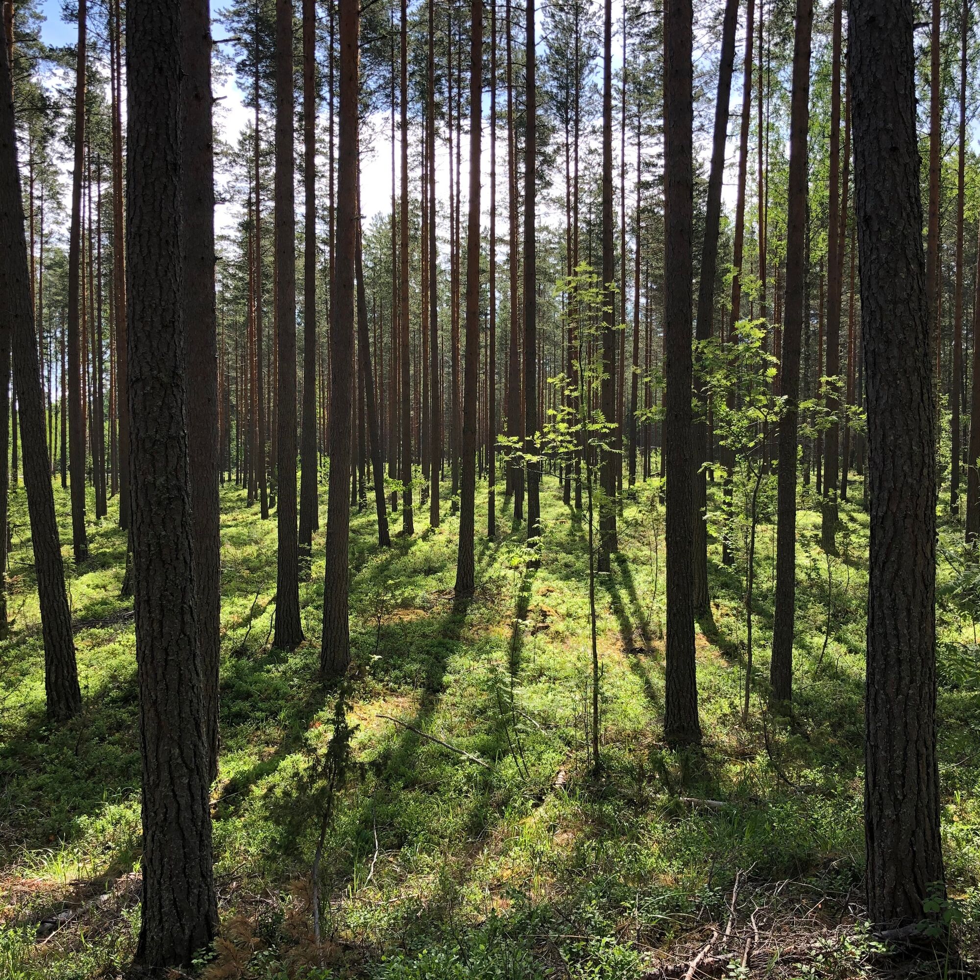
The route starts at the Karisalmi bridge parking lot and runs along a well-maintained heath trail. Follow the ridge trail signs and blue route markings. Be especially careful at intersections and when crossing forest roads.
Tak
Tak
The stairs on the route can be slippery, especially after rain.
You can reach Pulkkilanharju from Vääksy and Sysmä via road 314, either by cycling, driving your own car, or by bus. The start and end point of the route is at the Karisalmi bridge parking lot at Pulkkilantie 955, Asikkala. From Vääksy, there is a light traffic route to Karisalmi.
Pulkkilanharju is also accessible by public transport. See bus timetables at www.matkahuolto.fi.
Bus number 46 goes directly to the Karisalmi parking lot, where the route starts. The Karisalmi stop can be reached by bus from Vääksy and Sysmä. Always check the latest timetables at lsl.fi before departure – timetables and bus lines may change occasionally.
Parking at the Karisalmi bridge parking lot is free of charge.
Please follow the national park regulations and stay on the trail to protect the fragile ridge vegetation.
Learn about the national park instructions and rules: luontoon.fi/paijanne
Hiking guidelines, rules, and tips: luontoon.fi/retkeilynabc
The views from the Karisalmi bridge are magnificent.
In the summer, a route ship operates from Karisalmi to Kelvenne Island in Päijänne National Park.
Popularne wycieczki w okolicy
Kultainen Tassu route, Asikkala
światłoWędrówka1,95 kmKansallispuistomelonta Kelventeelle, Padasjoki
średniKajak / Canoe30,0 kmAurinko-Ilves hiking route, Asikkala
średnidługodystansowy szlak pieszy30,6 kmKaksi Kanavaa, Lahti-Heinola
ciężkiKajak / Canoe72,0 kmCycling the Asikkala Ice Age Route
średniJazda na rowerze78,8 kmPäijänteen Paras -melontareitti Sysmästä
ciężkiKajak / Canoe142,8 kmPäijänteen Paras -melontareitti Padasjoelta
ciężkiKajak / Canoe142,6 kmAurinko-Ilves MTB, Asikkala
średniMountainbike30,5 kmKelvenne ridge trail, Päijänne National Park
średniWędrówka9,40 kmMyllytonttu nature trail, Vääksy
światłoTrasa tematyczna0,43 km
Wędrówki i tropienie


Nie przegap ofert i inspiracji na następne wakacje
Twój adres e-mail została dodana do listy mailingowej.