


Aurinko-Ilves hiking route, Asikkala
The views vary from the esker forests of Aurinkovuori to beautiful lake scenery and the idyllic and nationally valuable cultural landscape of Kurhila-Hillilä.
From the top of Aurinkovuori, you can see...
The views vary from the esker forests of Aurinkovuori to beautiful lake scenery and the idyllic and nationally valuable cultural landscape of Kurhila-Hillilä.
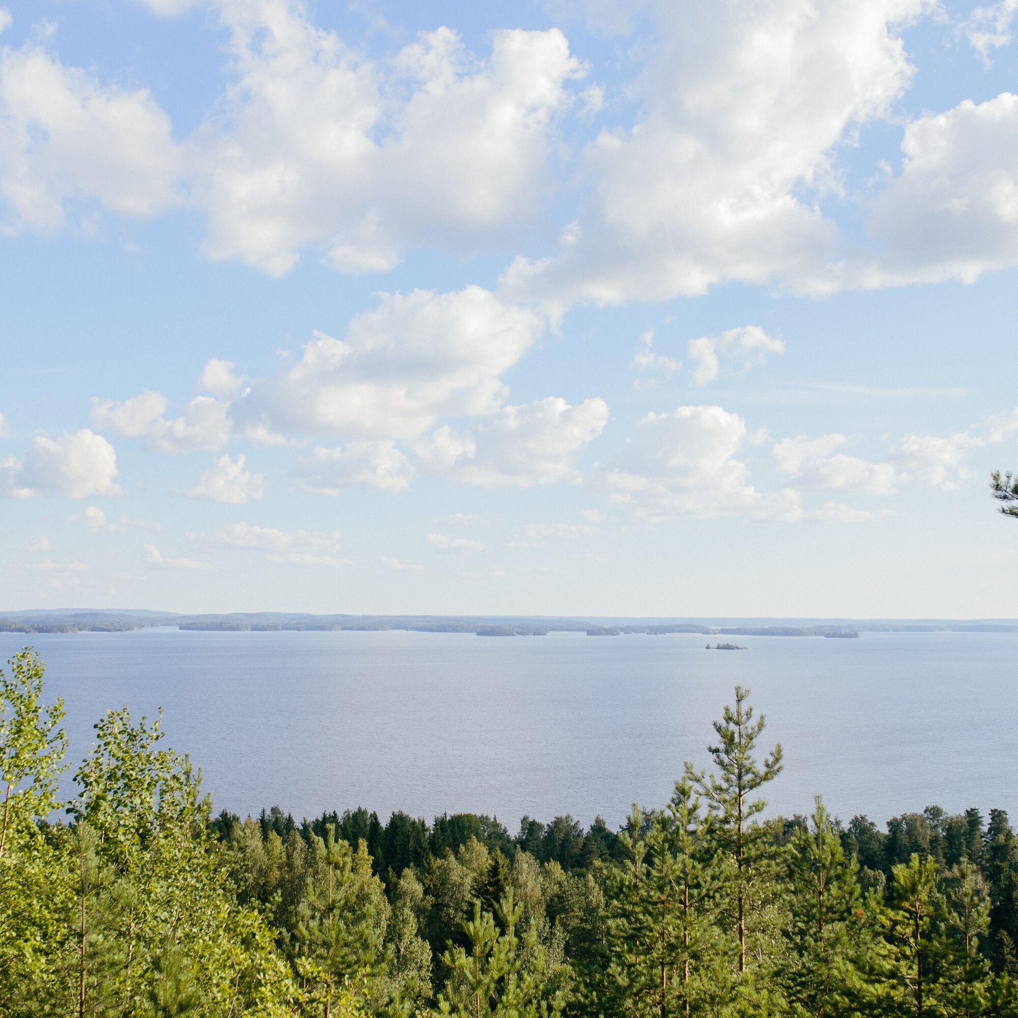
From the top of Aurinkovuori, you can see far towards both Päijänne and Vesijärvi. Aurinkovuori, located between these lakes, is a high ridge belonging to the Second Salpausselkä, rising 70–80 meters above the surfaces of Päijänne and Vesijärvi at its highest. Aurinkovuori is one of the sites of the Salpausselkä UNESCO Global Geopark. Along the route, you also encounter the Ice Age shaped Syrjäsuopa formations, which impress with their great elevation differences.
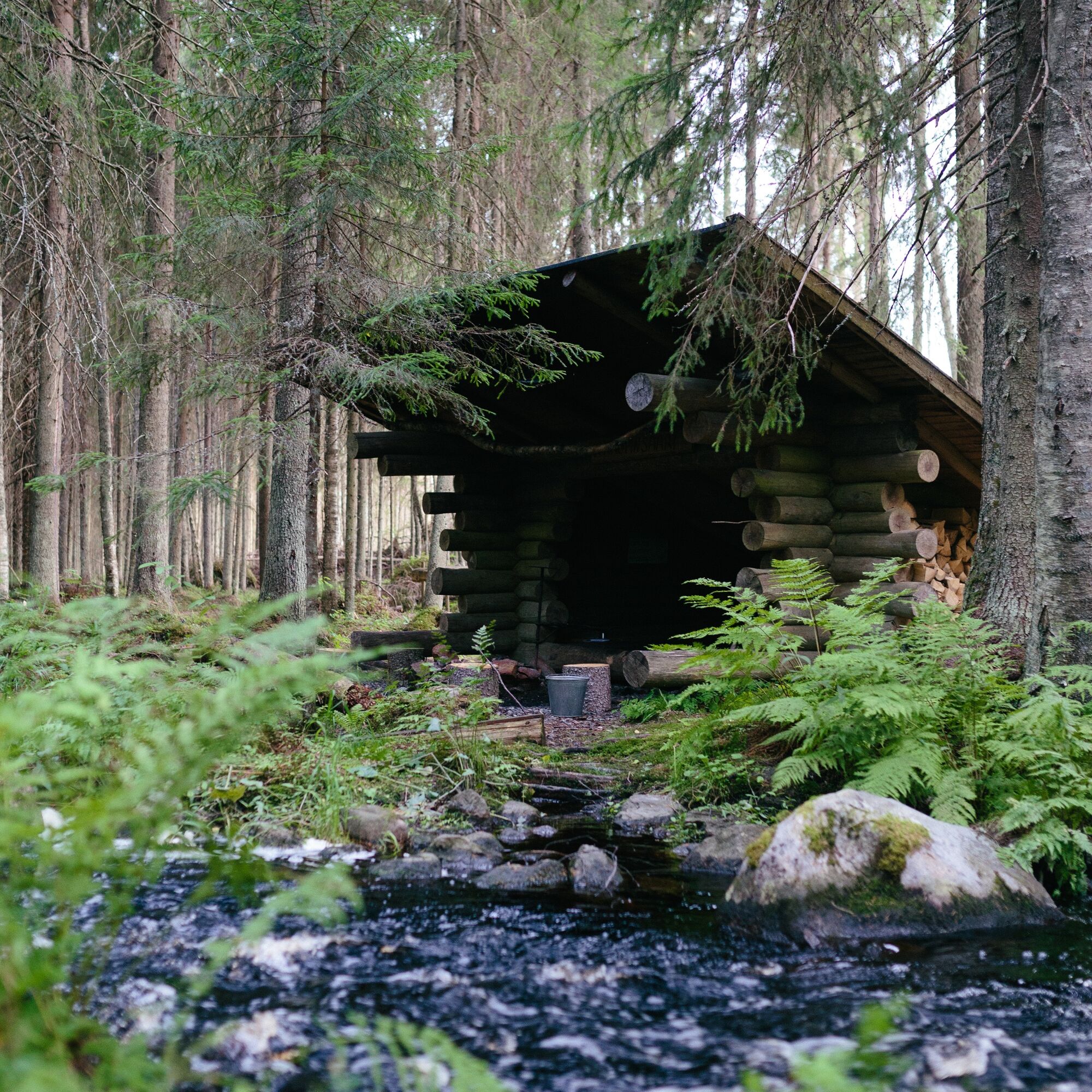
At the forest shade lean-tos and campfire sites, it is good to take a moment to rest and enjoy the day’s hiking rewards on the route. Approaching Evo, the sound of a forest brook reaches the ears of the hiker, adding its own spice to the varied route. The route ends in the great forests of the Evo area, one of the largest forest and hiking areas in Southern Finland.

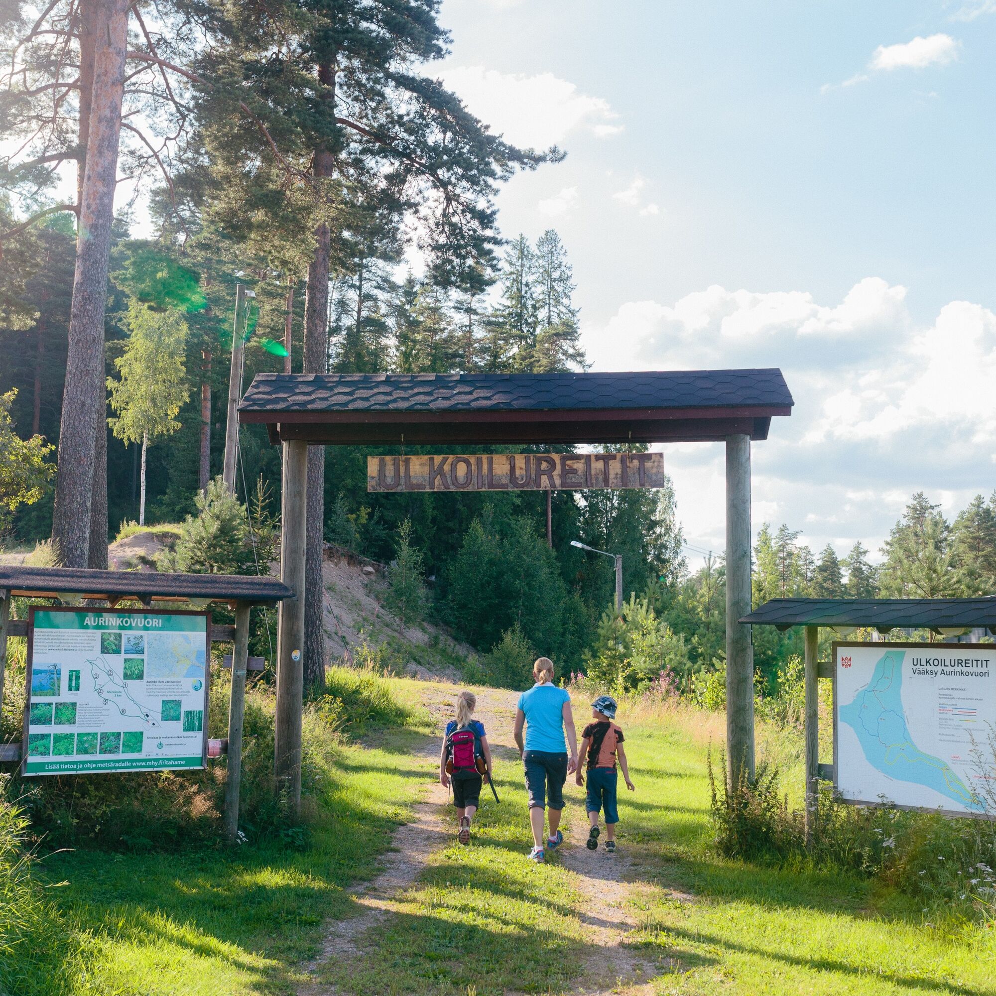


The Aurinko-Ilves route starts from the yard of Vääksy Sports Center. At the beginning, you are guided by the Aurinko-Ilves hiking trail sign. Leaving from the Sports Center, you initially climb a steep hill to the top of Aurinkovuori. The route is marked on the terrain and trees with yellow color and Aurinko-Ilves symbols. The trail markings are incomplete in some parts, so it is advisable to have a good map of the area with you. The route is largely easy to walk and fairly flat. What makes the easy route more demanding are the difficult to pass and overgrown sections as well as the total length of the route.
The Aurinkovuori lean-to shelter and lookout platform are located at the beginning of the route, offering magnificent views of Päijänne. Aurinkovuori belongs to the national esker protection program. The area features geologically significant ancient shorelines, impressive kettle holes, delta-like and ridgelike sections, and in places very steep slopes.
The Syrjäsuopa formations are located about 7 km from the starting point, and you can admire them on a separate 1.5 km loop trail. The Syrjäsuopa were formed at the end of the Ice Age when a massive boulder broke off from the continental glacier and was buried in gravel. As the ice melted, the ground sank and formed a funnel-shaped depression. The holes and especially their shady northern slopes are habitats for species such as the wood anemone (anemone trifolia).
From the impressive landscapes of Syrjäsuopa, the route continues towards the Kuurnamäki lean-to and campfire site with firewood. From the lean-to, there is a beautiful view of farmland and lake scenery. Shortly after the lean-to, you cross a road. It is important to follow the trail markings carefully and cross the busy road cautiously. After crossing the road, the route continues through farmland and forest landscapes towards the village of Kurhila-Hillilä. The rolling farmland landscapes of Kurhila are part of a nationally significant cultural landscape.
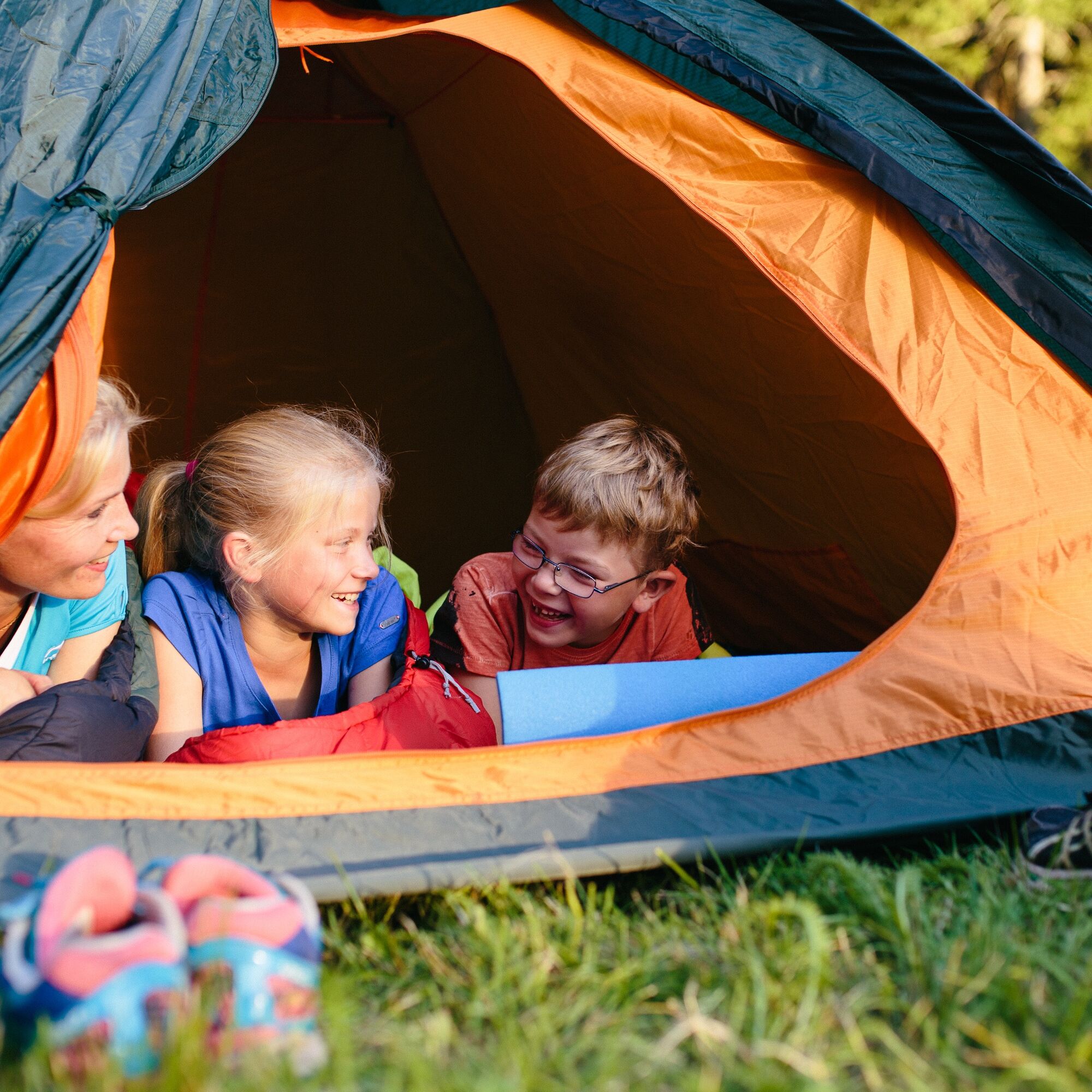
At the Kurhila-Hillilä community house Kuhila’s yard, there is a cooking shelter and possibility to camp with a tent. From here, the route mainly continues along old forest roads, occasionally diverting to small paths. Along the route, there are various clear-cut areas, young forest, old spruce stands, grassy sections, and easily passable sandy roads.
Along the way, there are two atmospheric lean-to shelters by streams: Uusimylly and Kaupinsaari. At the shelters, you can boil campfire coffee, enjoy your snacks, and stay overnight beside the babbling stream.
The Uusimylly lean-to is located by a stream at the spot where there once was a mill. Villagers used to drive horse carts to the mill to grind their grain. You reach Kaupinsaari lean-to by walking through an atmospheric spruce forest and crossing a stream via a bridge. The stream babbles tranquilly in the forest shade, and the lean-to is a nice place to rest for a moment.
From Kaupinsaari lean-to, continue along old forest roads for about ten kilometers to the Evo hiking area. The route ends at the Haarajärvi parking area. At the route’s endpoint, there is an information board with detailed information about the Evo hiking area.
Tak
Tak
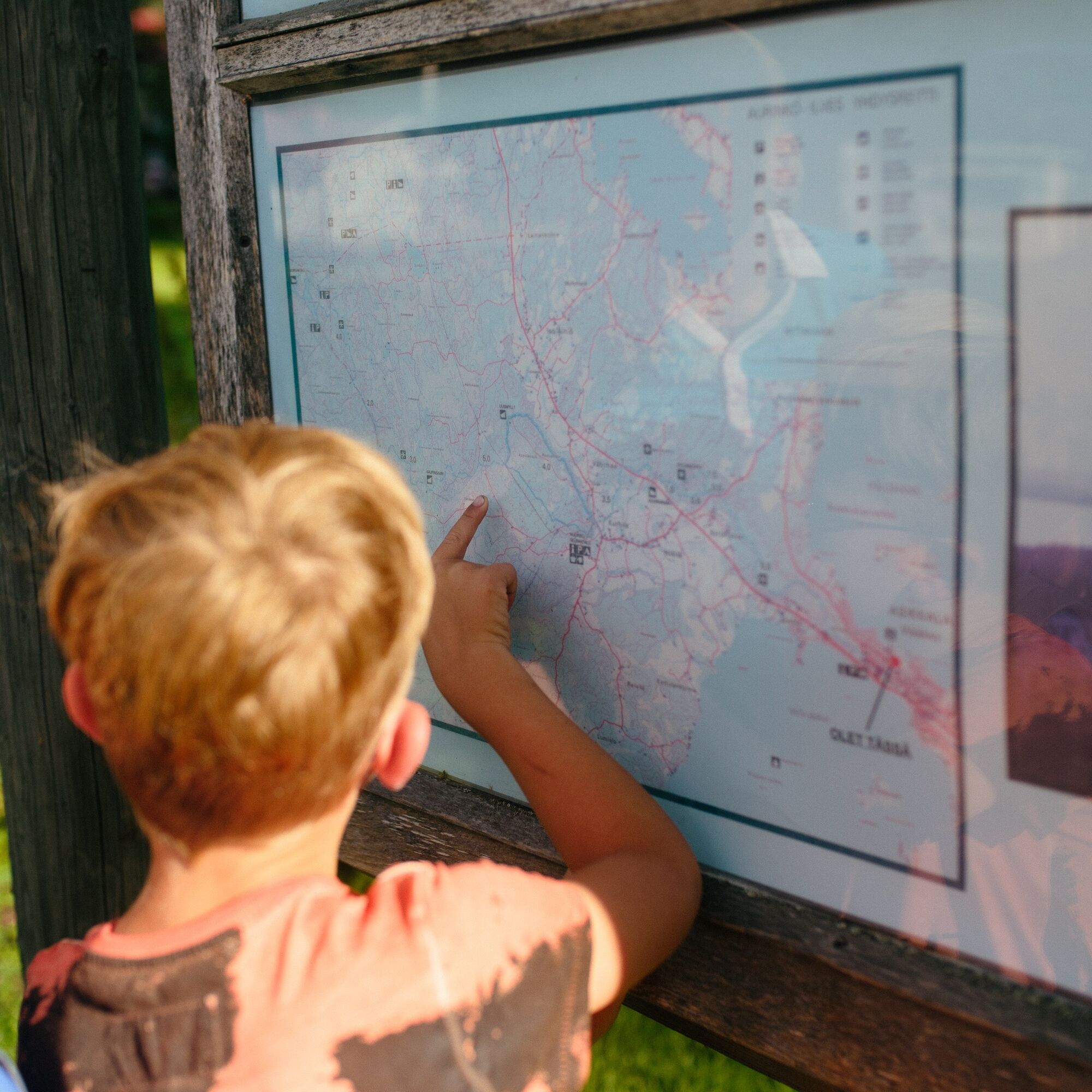
It is good to have a map of the area’s trail network and a compass because the route is sometimes overgrown and the trail markings worn and incomplete, especially towards late summer. You can purchase the map, for example, at Päijännetalo. It is also advisable to bring fire-making equipment and a knife. Firewood is available at the lean-to shelters for campfires. The route’s length is also important to consider, so plan enough time to complete the route as well as sufficient water and snacks.
The route is at times hilly and rocky, so sturdy footwear is recommended. In rainy and wet weather, puddles may form on the route and the grass can be wet especially in the morning, so it’s wise to choose waterproof shoes.
The route has difficult terrain and steep uphill and downhill sections in places. Especially in wet and rainy weather, caution is required as tree roots, slippery rocks, and leaves on the trail can cause slipping hazards. On road sections and at road crossings, it is necessary to be careful and walk along the roadside.
Although Finland’s mobile networks are extensive, hiking destinations may have coverage gaps. It is also wise to consider that different mobile phones may have varying reception. Check the coverage of your mobile network operator before heading out. More information.
At the beginning of the route
The Aurinko-Ilves route can be started from Asikkala’s Päijännetalo or next to the sports field of Asikkala Sports Center. You can leave the route’s endpoint by your own car, taxi, or by hiking back.
Starting point
Vääksy Sports Center
Asikkalantie 16
17200 Vääksy
N61 10.688 E25 31.308
Endpoint
Mustalammi Evo
Talvilammentie 549
16970 Hämeenlinna
N61 14.139 E25.11.524
It is possible to take a bus to the old center of Vääksy, from where the starting point at Vääksy Sports Center is less than a kilometer away. The start of the route is easily accessible by bus from Lahti, Sysmä, or Padasjoki. See more detailed information on Lahden Seudun Liikenne website. Buses from Helsinki and Jyväskylä run to the old Vääksy market square. Public transport information can be found on Matkahuolto’s website.
The route’s endpoint is in a forested area, from where you can return by your own car, taxi, or continue further to the Evo hiking area or to the Päijänne-Ilves route leading to Padasjoki.
Päijät-Häme regional taxi: 060 110 060
There are free parking spaces in the yard of Vääksy Sports Center.
The impressive north Syrjäsuopa sinkholes of Aurinkovuori can be admired on a separate 1.5-kilometer loop trail. From the route’s endpoint, you can continue to the extensive trail network of the Evo hiking area or to the Päijänne-Ilves route leading to Padasjoki.
Explore hiker tips: https://www.luontoon.fi/retkeilynabc
In old Vääksy, there are many charming cafes and shops worth visiting. Enjoy the atmosphere at the Vääksy Canal or visit Päijännetalo, located near the canal, which offers tourist information, a fishing museum, and current exhibitions.
Popularne wycieczki w okolicy
Pulkkilanharju nature trail (2.4 km), Asikkala
światłoTrasa tematyczna 2,35 kmCycling the Asikkala Ice Age Route
średniJazda na rowerze 78,8 kmPäijänne-Ilves, Padasjoki
średniWędrówka 12,9 kmOn the waters of Hollola's Kirkonkylä, Hollola
średniKajak / Canoe 24,4 kmVarjansaari route, Asikkala
światłoKajak / Canoe 8,80 kmSalonsaari nature trail, Asikkala
światłoTrasa tematyczna 3,21 kmLake Vesijärvi from Hollola to Asikkala
średniKajak / Canoe 22,9 kmMyllytonttu nature trail, Vääksy
światłoTrasa tematyczna 0,43 kmPäijänne-Ilves MTB, Padasjoki
średniMountainbike 12,7 kmIso-Äiniö Nature Trail, Asikkala
światłoTrasa tematyczna 0,77 km
Wędrówki i tropienie


Nie przegap ofert i inspiracji na następne wakacje
Twój adres e-mail została dodana do listy mailingowej.