


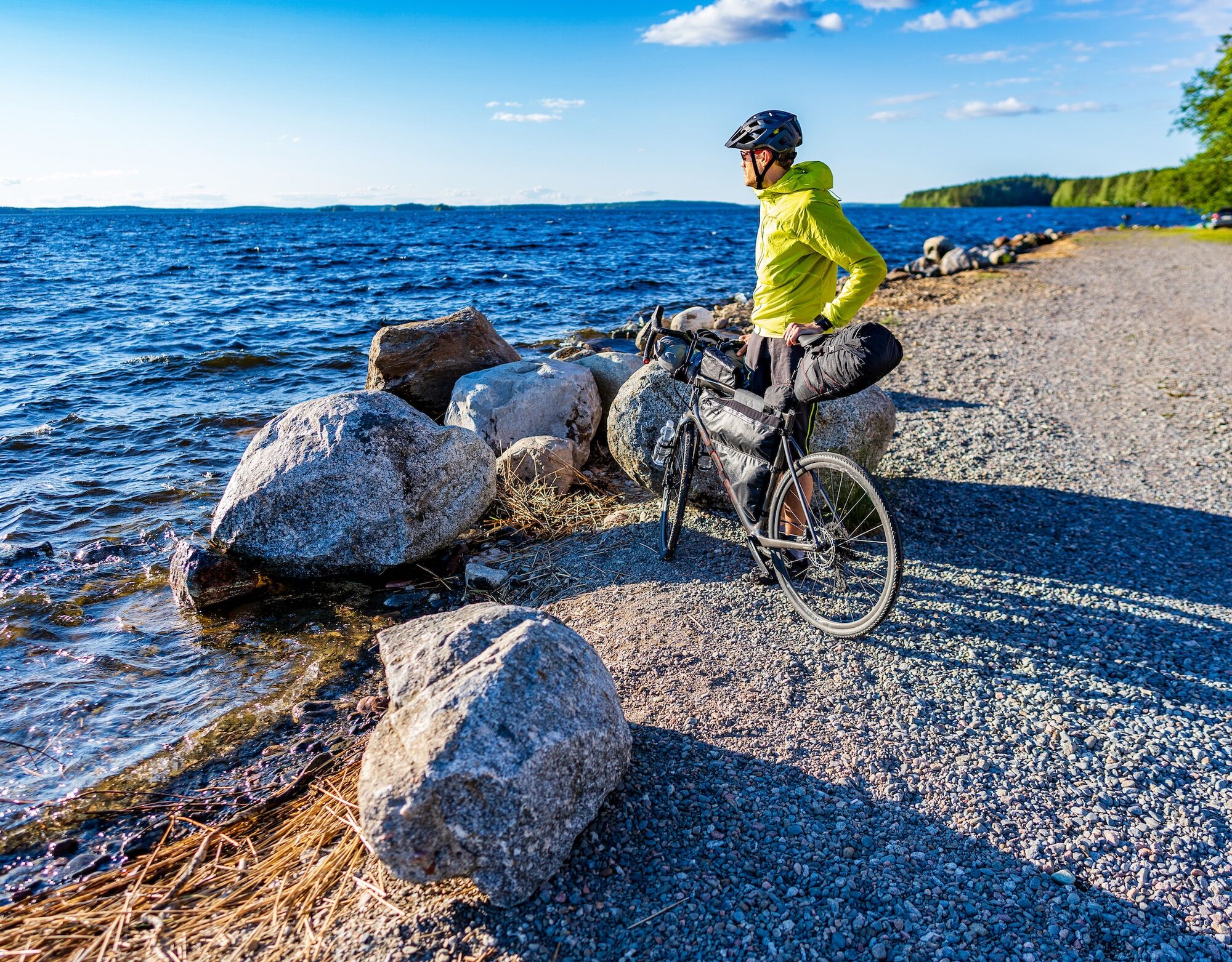
Cycling the Asikkala Ice Age Route
Poziom trudności: 2
The Asikkala Ice Age Route goes through beautiful lake and ridge landscapes, circling the entire municipality of Asikkala. Along the way, there are seven different sites shaped by the latest Ice Age, which...
The Asikkala Ice Age Route goes through beautiful lake and ridge landscapes, circling the entire municipality of Asikkala. Along the way, there are seven different sites shaped by the latest Ice Age, which make the landscape unique.
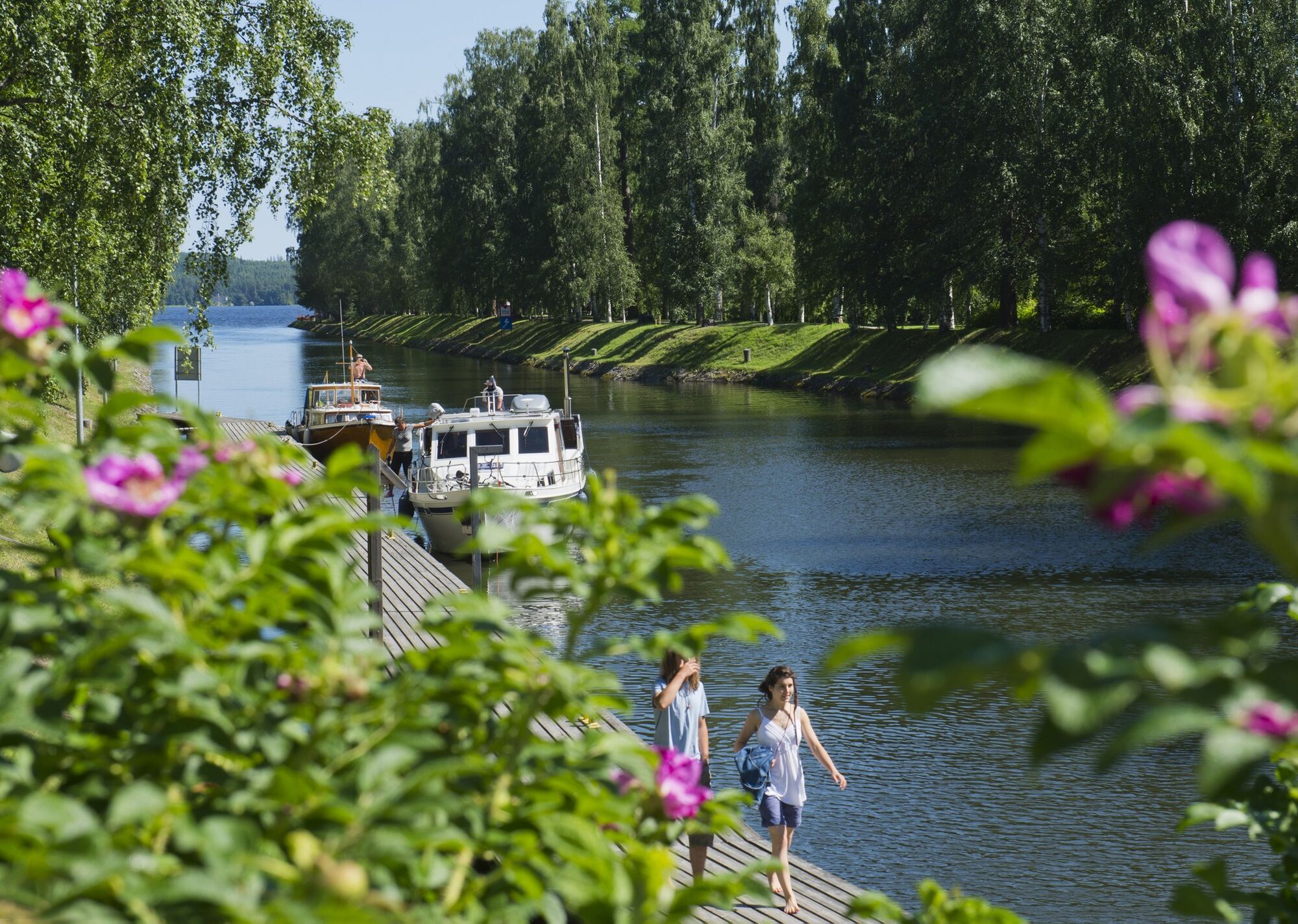
The route starts from Vääksy canal, currently one of Europe's busiest inland waterways. The canal area is especially popular in summer with its sights and shops. In nearby Päijännetalo, visitors can explore the history of nature and fishing, and shop at a renewed local product store. The building also houses guidance points for Asikkala municipality, Päijänne National Park, and the Salpausselkä UNESCO Global Geopark.
After Vääksy, you cycle through charming rural landscapes, passing the million-brick church of Asikkala and the Asikkala Local History Museum, located along the road to Asikkala church village.
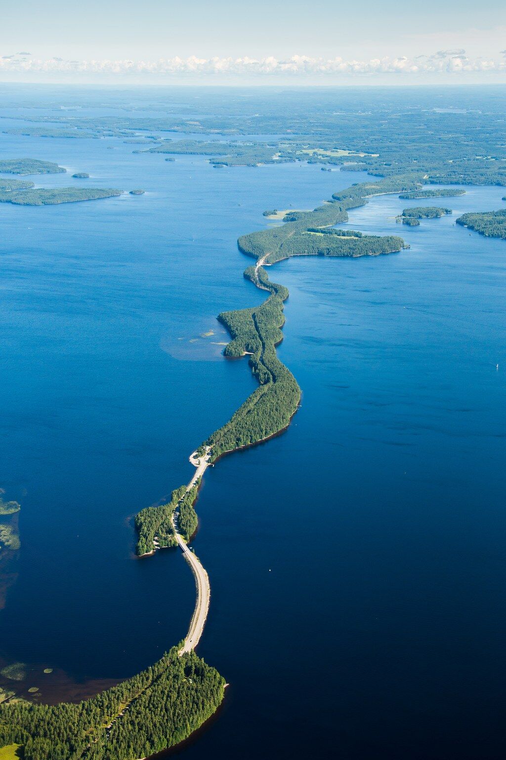
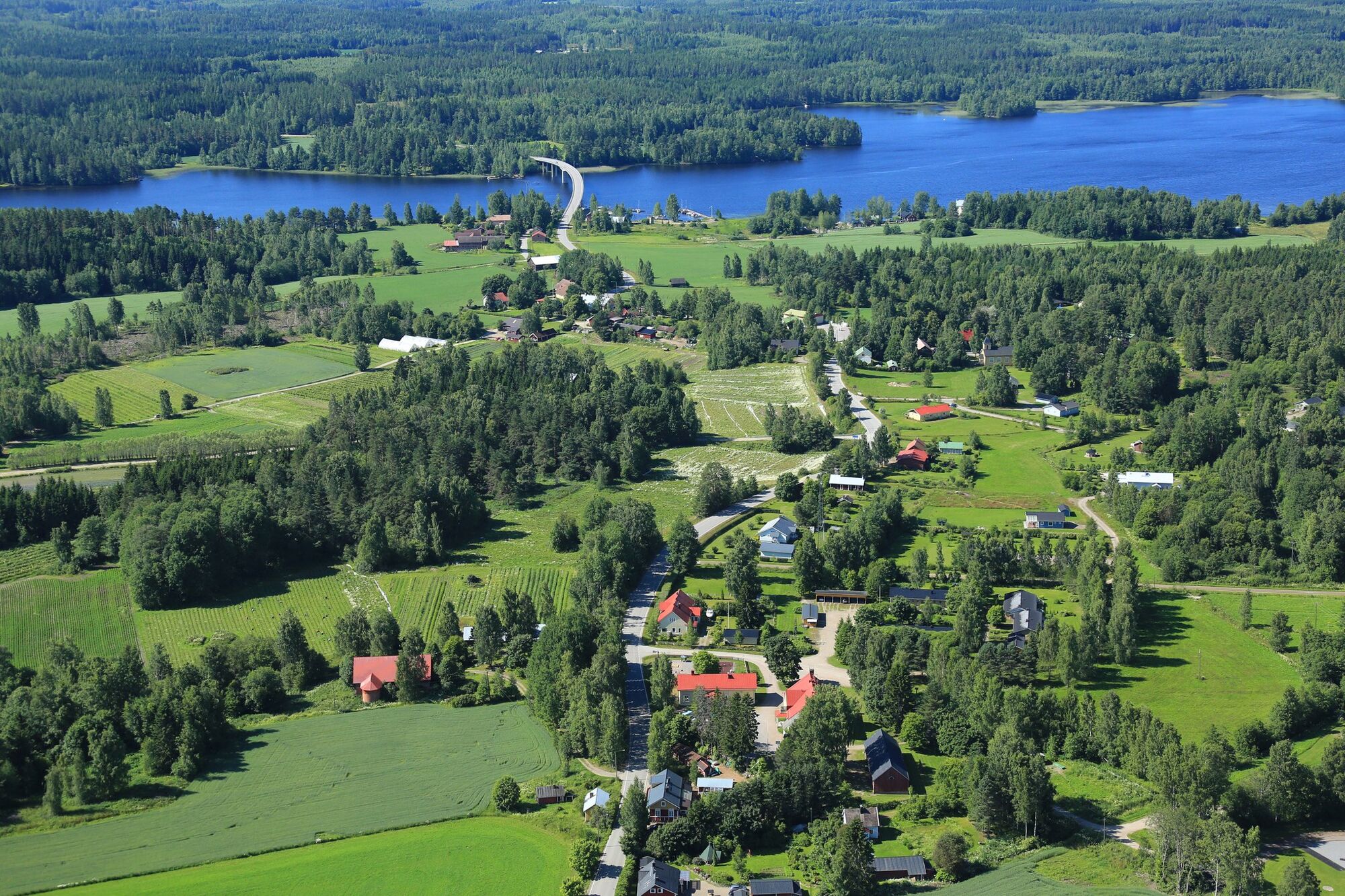
Päijänne glimpses from both sides of the narrow Pulkkilanharju as you cycle northward. While cycling amid these breathtaking views, it is easy to see why the road from Vääksy to Sysmä and further to northern Päijänne has been voted the most beautiful scenic route in Finland. Take a break at the kiosk in Päijänne National Park or visit the Pulkkilanharju nature trail.
After Kalkkisten canal, you can stop at the village of Kalkkisten. At Pihamaa's Country Shop and Cafe-Wine Tavern, you can visit during the summer for shopping or rest longer enjoying the atmosphere and countryside idyll. It’s worth taking a rest break, as the next section on Kopsuontie contains plenty of ups and downs!
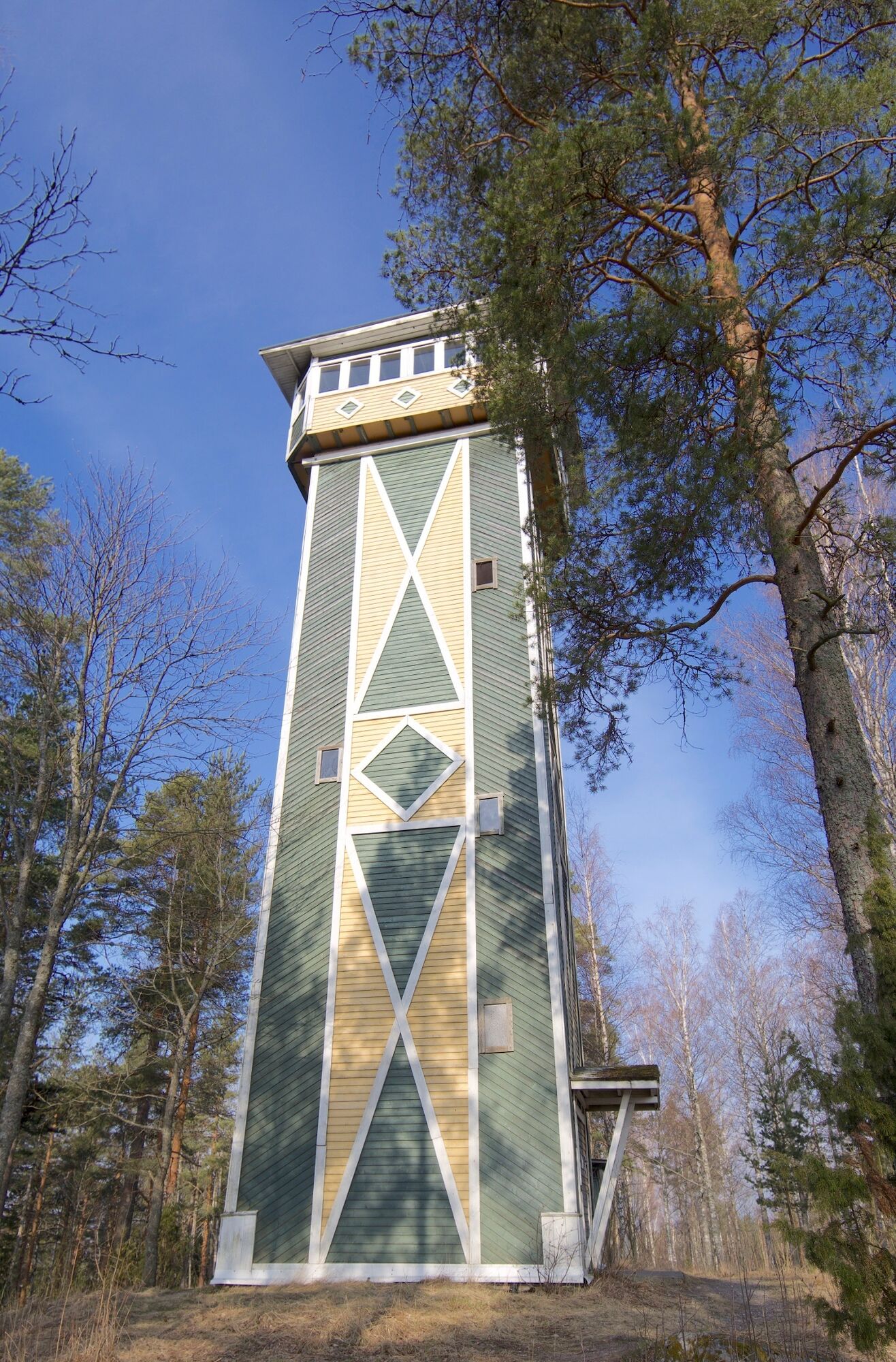
The Tallukka observation tower with its stunning views over Lake Vesijärvi and Päijänne is a great finish to the day trip!

1. Vääksynjoki and canal, Meijeritie 1, 17200 Vääksy
The information board is located at the parking lot near Päijännetalo and Vääksynjoki.
2. Aurinkovuori, Asikkalantie 14, 17200 Vääksy
The information board is located in the area between Aurinkovuori sports field and the sports hall.
3. Syrjänsupat
From Asikkala, drive about 7 km towards Jämsä, then turn right onto the Asikkala church village road (road 3141). Drive about one kilometer, after which a forest truck road starts from a box on the left side of the road. The Syrjänsupa information board is located about 1.5 km from the beginning of the road.
4. Pulkkilanharju, Pulkkilantie 955, Asikkala
From Syrjänsupa, continue along the Asikkala church road (road 3141) to road 314. There is a bike path along road 314 leading to Pulkkilanharju. The route continues about 10 kilometers towards Sysmä, crossing the Karisalmi bridge. The information board is located in the Karisalmi rest area.
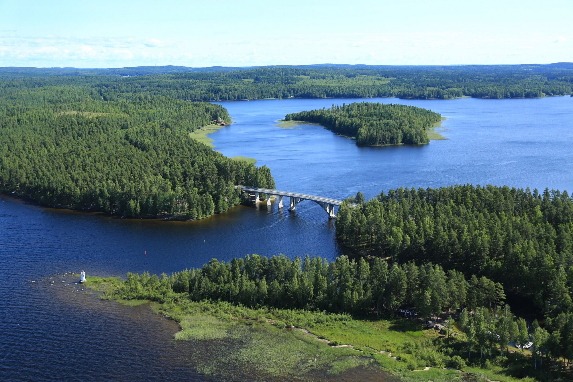
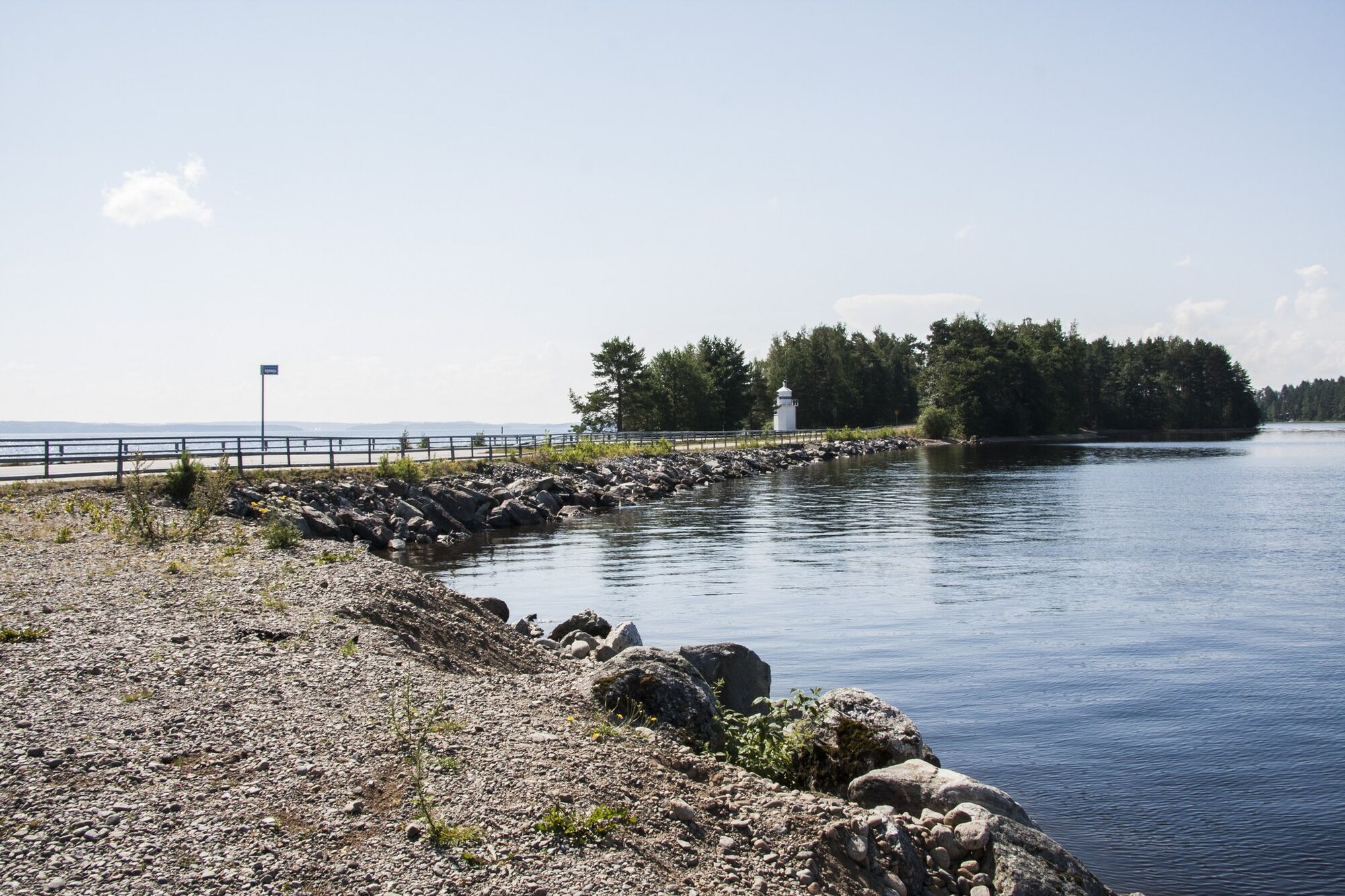
5. Kalkkisten canal and rapids
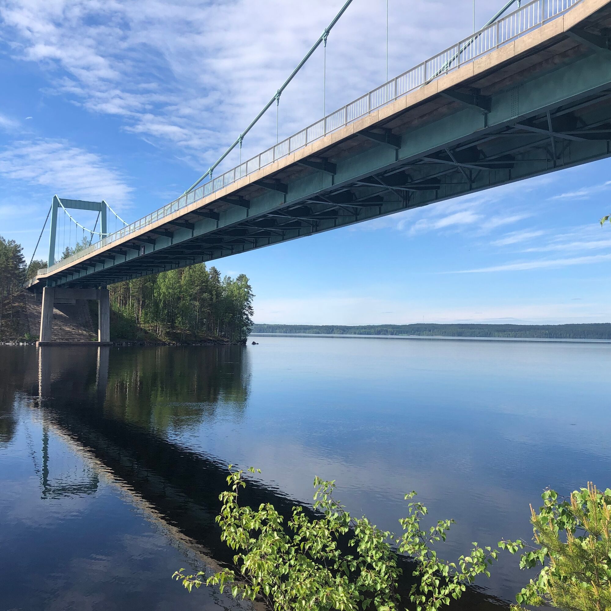
From Pulkkilanharju, continue over the Käkisalmi bridge and turn towards the village of Kalkkisten (road 3142). There are signs before the village to Kalkkisten canal, and about 4 kilometers of gravel road is driven.
6. Vesivehmaankangas
From Kalkkisten canal, return to road 3142 and continue through the village of Kalkkisten, crossing a beautiful bridge to Kopsuontie (road 3132), which leads to road 313. At the intersection, turn left towards Vesivehmaa/Vierumäki. There are signs from road 313 to the Vesivehmaa airport (to the left), which is just over a kilometer away. The information board is located near the control tower at Vesivehmaa airport.
7. Tallukanmäki, Tallukantie 1, 17200 Vääksy
From Vesivehmaa, continue back towards Vääksy along road 313. Upon arriving at Hotel Tallukka, the information board is located next to the observation tower.
Tak
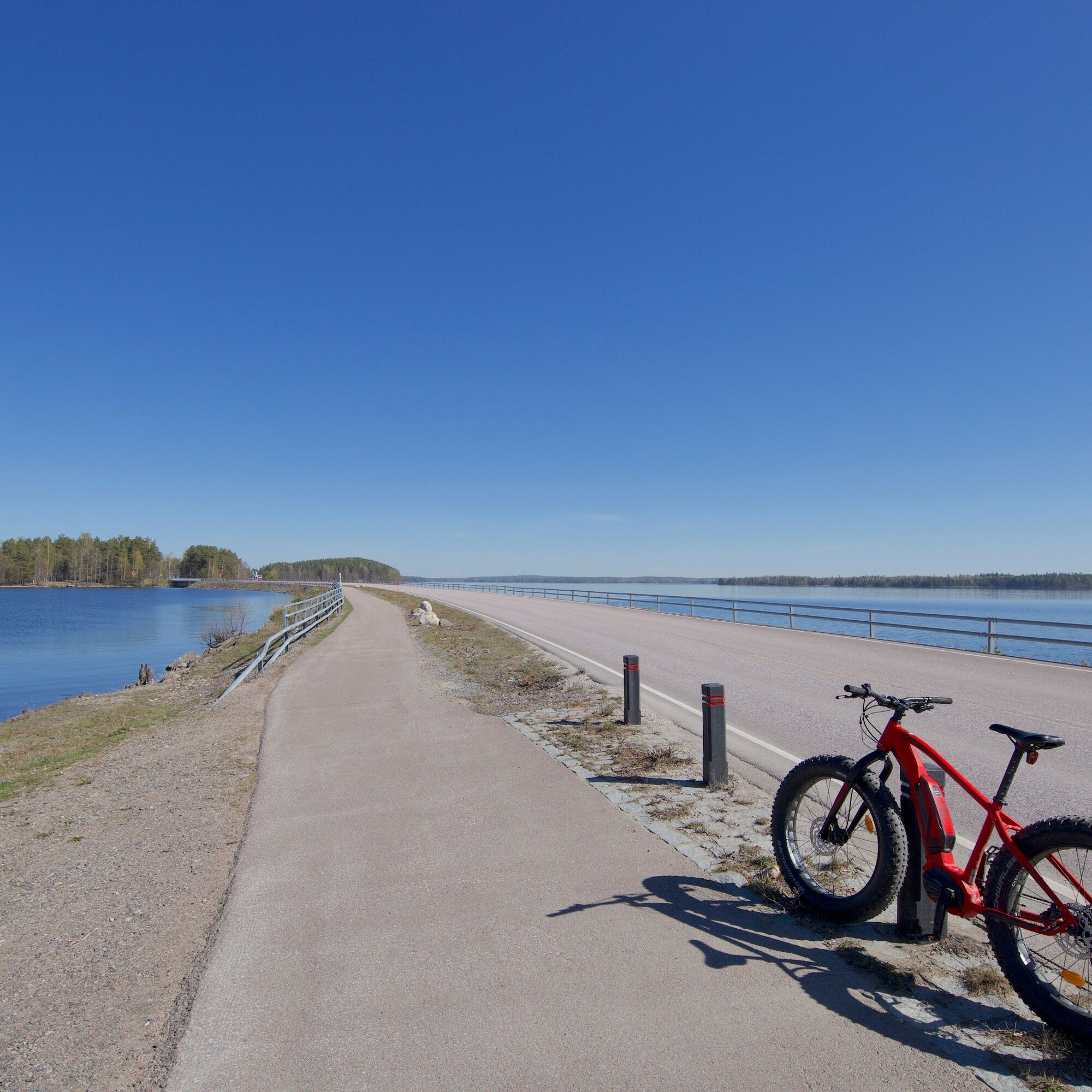
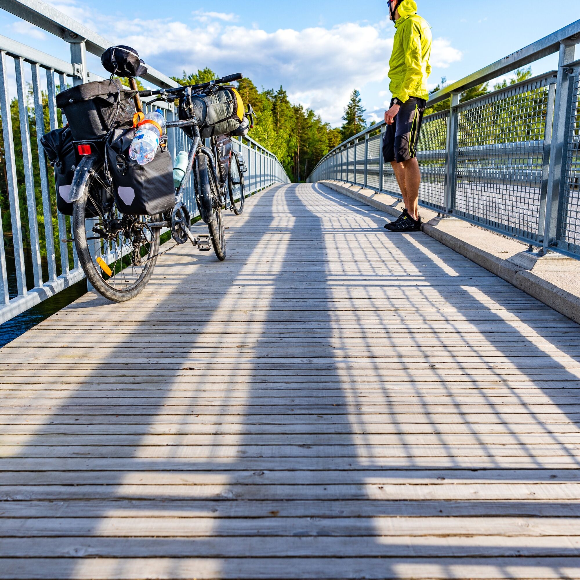
The trip is suitable to be done with an ordinary or electric-assisted bicycle.
On the route, there are bike paths from Vääksy to Pulkkilanharju; otherwise, you mainly cycle along the edges of paved roads. There are small sections of gravel roads along the way.
From road 24, follow signs to Vääksy canal.
You can easily reach Vääksy canal by local bus, for example from Lahti; see more information on the Lahti Region Transport website. Buses from Helsinki and Jyväskylä run to Vanha Vääksy square and the Tallukka express stop; see schedules on the Matkahuolto website.
There is free parking at Vääksy canal parking lot and in front of Päijännetalo.
2
Read tips for planning a bike trip here.
Besides natural attractions, the route includes many interesting places to visit such as the Päijät-Häme Aviation Museum, Asikkala Local History Museum, or Asikkala Church.
Popularne wycieczki w okolicy
Pulkkilanharju nature trail (4.7 km), Päijänne National Park
światłoTrasa tematyczna 4,72 kmPulkkilanharju nature trail (2.4 km), Asikkala
światłoTrasa tematyczna 2,35 kmKultainen Tassu route, Asikkala
światłoWędrówka 1,95 kmAurinko-Ilves hiking route, Asikkala
średnidługodystansowy szlak pieszy 30,6 kmCultural route - Industrial history in the heart of nature
Motorrad 156,7 kmVarjansaari route, Asikkala
światłoKajak / Canoe 8,80 kmSalonsaari nature trail, Asikkala
światłoTrasa tematyczna 3,21 kmTwo Canals, Lahti-Heinola
ciężkiKajak / Canoe 72,0 kmThe Industrial history in the lap of nature - Cultural route by bicycle
Jazda na rowerze 156,7 kmLake Vesijärvi from Hollola to Asikkala
średniKajak / Canoe 22,9 km
Wędrówki i tropienie


Nie przegap ofert i inspiracji na następne wakacje
Twój adres e-mail została dodana do listy mailingowej.