


Circular hike Hemishofen (via Hohenklingen Castle)


Zdjęcia naszych użytkowników
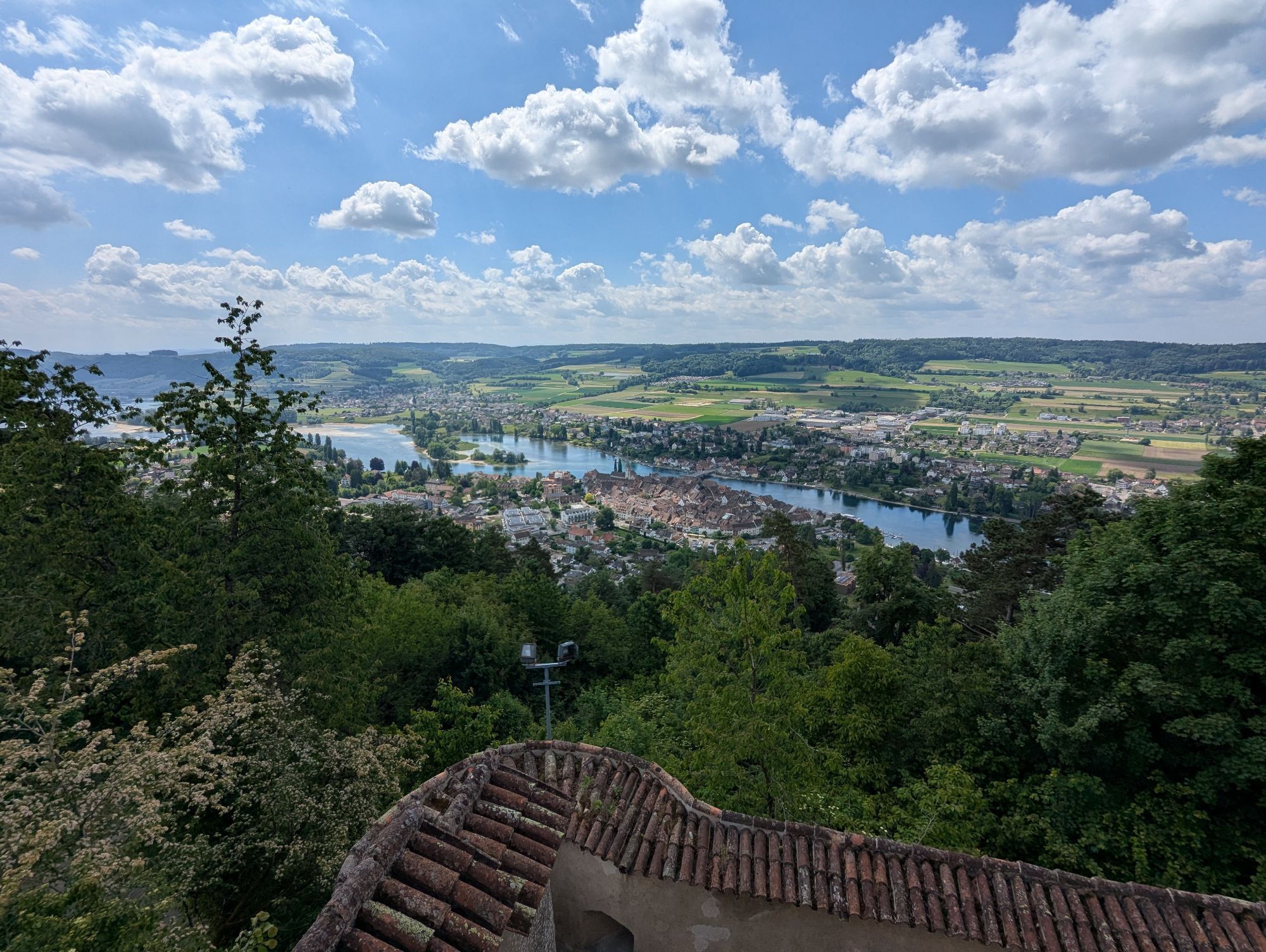
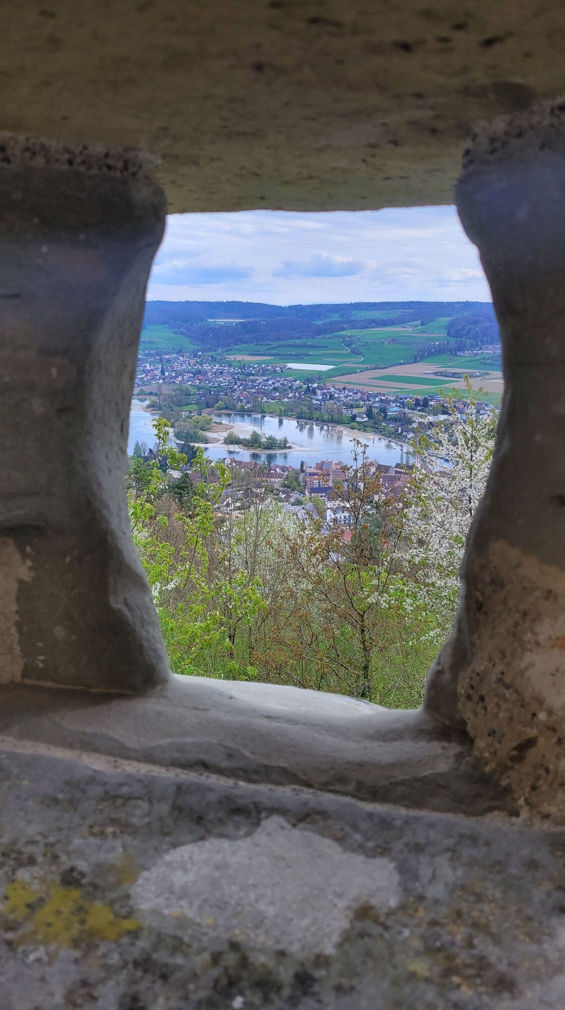
The circular hike starting in Hemishofen takes you past various viewpoints, offering a great view over the Stein am Rhein region. The highlight of this hike is Hohenklingen Castle (can be visited), which...
The circular hike starting in Hemishofen takes you past various viewpoints, offering a great view over the Stein am Rhein region. The highlight of this hike is Hohenklingen Castle (can be visited), which is also a restaurant. Afterwards, the route mostly passes through forest areas until you finally return to Hemishofen.


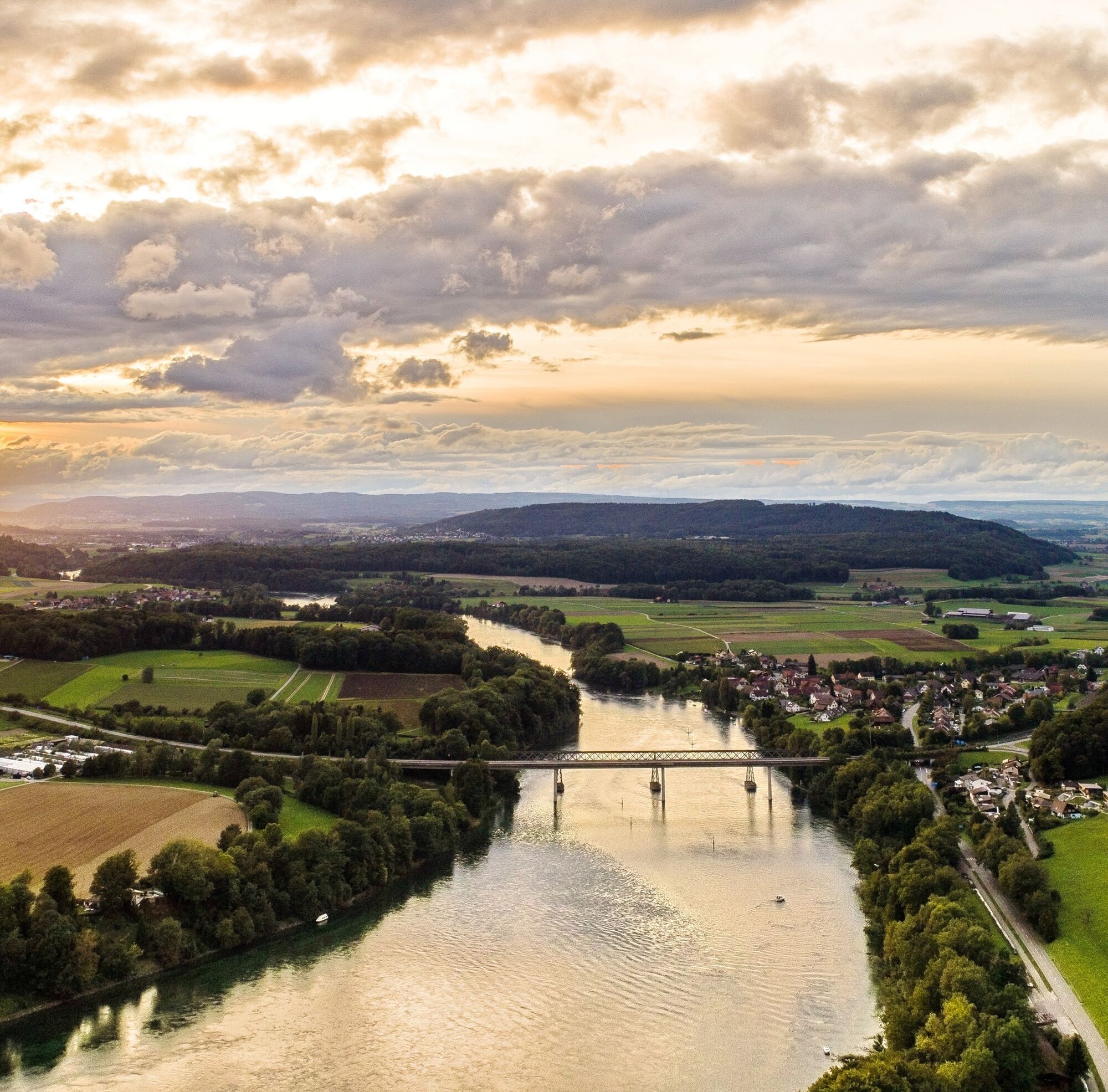
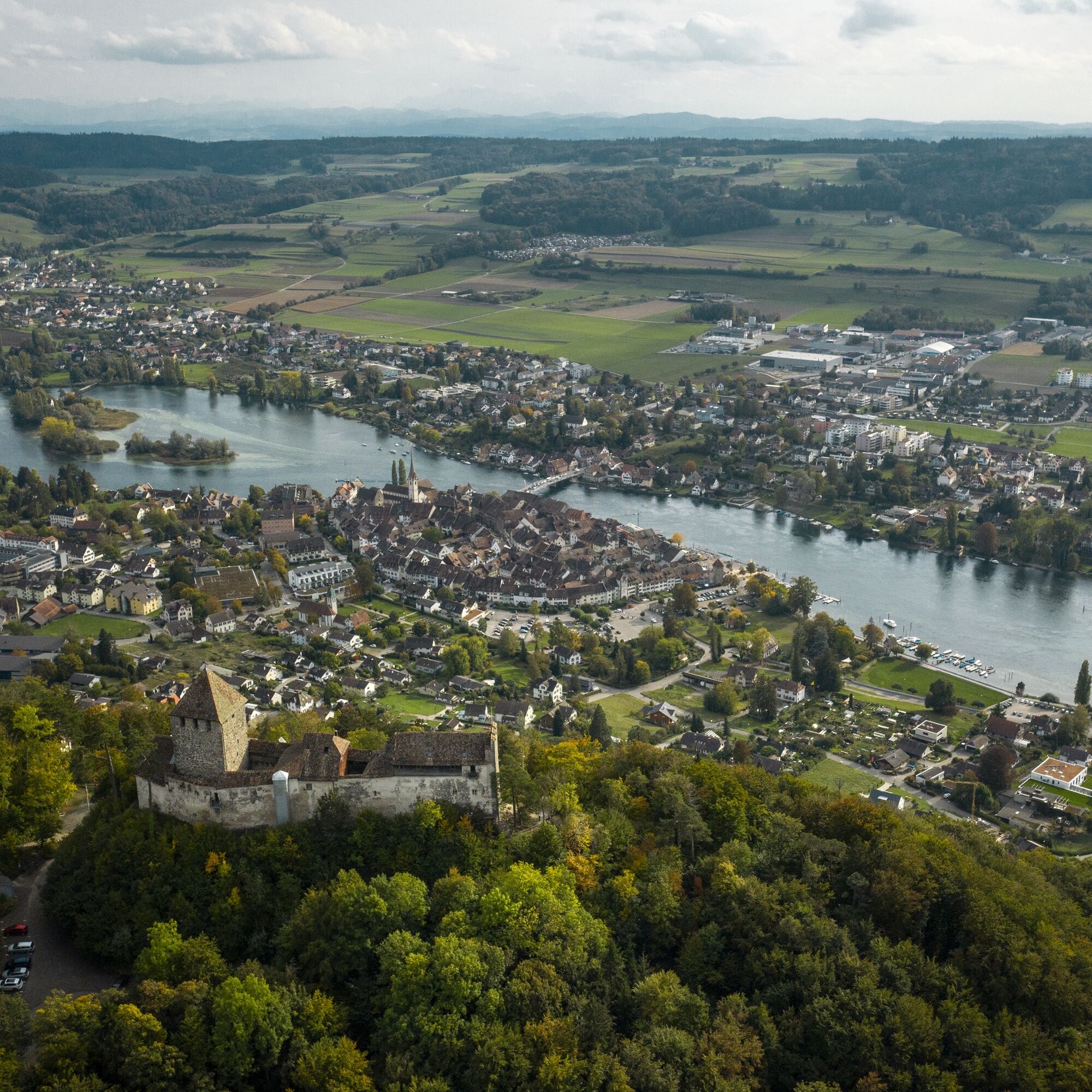
The starting point of the hike is the railway and road underpass at the entrance to Hemishofen coming from Ramsen on the left side of the road. Just behind the underpass, we see the yellow hiking signs and head towards Wolkenstein. First, we walk about 100 m on the parallel path to the road towards Stein, then turn left and now follow exactly the designation "hiking trail". After about 600 m, the sign from the drivable forest road sharply points us to the right onto a narrow hiking trail that leads us up to the next forest road. Where the "hiking trail" sign again points us from the road to the right onto a narrow hiking trail, it is best to continue on the road for about 200 m uphill and then turn sharply right to continue up the road and arrive at a point where a sign points us right to the "Wolkenstein viewpoint 4 minutes". This detour to the right is rewarded with a great view of the Hegau. After returning, we hike uphill towards Firstweg-Hohenklingen. If we constantly follow our hiking trail sign, we walk along the Firstweg for about 1200 m and then descend to a timber storage area which we cross and on the other side steeply ascend towards Hohenklingen up to a forest road, where we continue and after about 250 m cross the road. The hiking trail now leads us to Hohenklingen Castle (there is a restaurant in the castle). After visiting the castle, we continue towards the "viewpoint 5 minutes". We walk up a meadow to the viewpoint and then continue on the Firstweg towards Bleiki until after about 1 km we reach the border crossing (sign). From the border crossing, we follow the hiking sign with the white square in the green hexagon towards Elmenhof-Kreuzhof-Schienen (uphill). We are led on a narrow hiking trail through the forest. We pass through a meadow twice with views of the Untersee, walk behind Elmenhof in the forest and then descend to the right onto the paved road between Elmenhof and Kreuzhof. At the junction before Kreuzhof, we turn left towards Schienen-Litzelshausen. Upon entering the forest (after about 150 m), we go about 50 m downhill on the forest path and then turn right downhill into the ravine. We cross the small stream and ascend again on the other side to a forest road. On this, we go left towards Litzelshausen. After about 1 km, we come to a meadow by a log cabin right of the path. We walk a short stretch of the road along the edge of the forest and then continue to the Litzelshausen district, where we meet the paved district road. We follow this road to the left and continue on it through the Riedern district and uphill to the school hostel. We bypass the school hostel, cross the national border behind the house, and turn right, where after about 200 m there is a place to eat at Oberwaldhof (closed Thursday and Friday). After the meal, we return on our road, leave the school hostel on the left, and continue on the road, again following the hiking trail signs (direction Hemishofen). A little further on, we have a meadow to our left at the end of which a yellow sign points left towards Hemishofen. After about 50 m, at the entrance to the forest, we are guided half-right onto a narrow hiking trail on which we simply cross the first side road and turn right onto the second side road. On this road, the "hiking trail" sign leads us down to the end of the forest. We now continue roughly straight and return to our starting point after about 500 m.
Good footwear, provisions, and snacks for in between.
Partly steep ascents/descents.
Starting point: Hemishofen Dorf
Route planner
Starting point: Hemishofen Dorf stop
End point: Hemishofen Dorf stop
Connection: From Schaffhausen, change in Stein am Rhein, then by bus to Hemishofen. Duration 36 minutes.
Parking options in Hemishofen are limited.
Grill area Hohenklingen Castle, Hohenklingen
Hohenklingen Castle, Hohenklingen
Popularne wycieczki w okolicy
- 3,7
Mindelsee-Runde
światłoWędrówka7,83 km Hike on the panorama route of the Höri Peninsula
średniWędrówka8,11 km- 3,0
Firstweg Langenmos
średniWędrówka5,76 km - 4,0
Homburg-Steig
średniWędrówka5,83 km Stein am Rhein - Hohenklingen Castle - Stein am Rhein
ciężkiWędrówka7,79 km- 5,0
"Hegauer Kegelspiel" Hohentwieler
średniWędrówka7,21 km - 5,0
Höri Erlebnispfad Wangen - Hemmenhofen ( mit Schiff zurück )
średniWędrówka9,53 km Grenzüberschreitender Erlebnispfad Öhningen - Stein am Rhein
średniWędrówka7,49 kmVolcano - Enjoy Hegau - On the tracks of the world champions! 50 km
średniMountainbike49,5 km"Hegauer Kegelspiel" Hegau Volcano Tour
ciężkiWędrówka29,2 km
Wędrówki i tropienie


Nie przegap ofert i inspiracji na następne wakacje
Twój adres e-mail została dodana do listy mailingowej.