



Mountain bike route to the Chrüzegg starting from Wattwil

Poziom trudności: S1
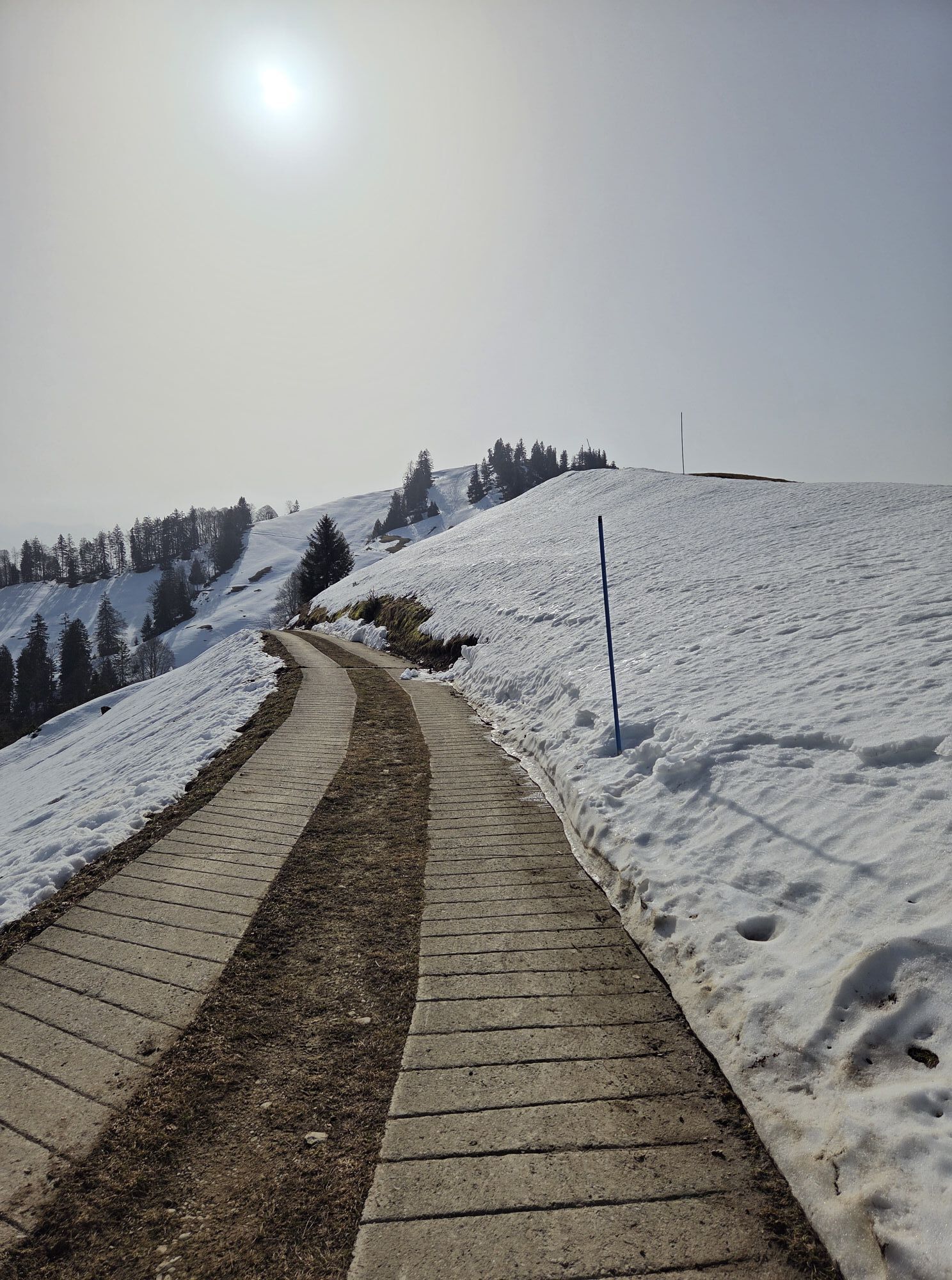
Traditional mountain inn - panoramic view included. Are you still missing a challenging route in your collection? The 700 meters of ascent to Chrüzegg and the varied, sometimes tricky descent are just...
Traditional mountain inn - panoramic view included. Are you still missing a challenging route in your collection? The 700 meters of ascent to Chrüzegg and the varied, sometimes tricky descent are just right for a seasoned biker!
Your nearly three-hour route begins at Wattwil train station. You ride towards Ricken (use the railway underpass at Café Brugger). After 200 meters, turn right towards the hospital and climb up on a paved road, passing the Iberg castle ruins, until you reach Hinterer Rumpf. Here a natural road begins; through cool forest you overcome meter by meter. At point 1019 you have already gained about 400 m; a few more steep curves, finally on a concrete track, and your bike has lifted you to the highest point at 1,230 m. The last section to Chrüzegg is flat and ideal for catching your breath.
The Chrüzegg, a Nagelfluh ridge with embedded molasse layers from the last ice age, is a rarely beautiful viewpoint. To the northeast you see a typical Toggenburg landscape with interlocking forest and meadow areas. To the west, the Zurich Oberland greets you with the Tössstock, Schnebelhorn, and further north the Hörnli.
The Chrüzegg mountain inn already appears in the first brochures of Toggenburg at the beginning of the 20th century. It attracted hiking enthusiasts with good local food and healthy mountain air. So another reason for you to rest here and enjoy yourself.
On the way, it starts quite leisurely over alpine and partially rough stone and gravel paths to the Alp Oberen Zrick. Then you must overcome a very steep section of the path – caution is advised even for experienced bikers, it is worth sometimes carrying your bike. After that, you have a nice, partially forested descent to Jonenholz ahead of you. Through the village of Libingen to Entschwil (covered wooden bridge) you continue comfortably before climbing again to Ober Loh and continuing on a natural road up to Chapf. You can fully enjoy the descent to Krinau. The last stretch on the road from Krinau to Lichtensteig train station is pure relaxation for you, and the remaining section along the Thur river to Wattwil is a classic cool-down after a challenging route.
Note(s)
The routes are only signposted in the direction recommended by bikers.
Alpine farms / mountain restaurants may not be open daily. Check before the tour.
Chrüzegg mountain inn: Tel: +41 (0)71 55 284 54 84


Wattwil - Hinterer Rumpf - Chrüzegg - Ober Zrick - Jonenholz - Libingen - Ober Loh - Chapf - Krinau - Feldmoos - Gurtberg - Lichtensteig - Schomatten - Wattwil
Traffic-safe mountain bike with suspension, bicycle helmet, optionally elbow and knee pads, optionally back and shin protectors, day bike backpack (approx. 20 liters) with rain cover, mountain bike shoes with ankle protection, weather-appropriate and durable clothing in multiple layers (e.g., functional shirt, cycling jersey, bib shorts, arm and leg warmers), shatterproof cycling glasses, full-finger gloves, air pump, bicycle tools, sun and rain protection, provisions and drinking water, water bottle and suitable holder, first aid kit, pocket knife, mobile phone, optionally mobile phone holder for the handlebar, optionally headlamp and reflectors, map material
S1
Toggenburg Tourism
Hauptstrasse 104
9658 Wildhaus
+41 71 999 99 11
info@toggenburg.swiss
www.toggenburg.swiss
A stop at the Chrüzegg mountain inn is especially worthwhile.
Kamery internetowe z trasy

Popularne wycieczki w okolicy
-
4,2
Schnebelhorn Rundwanderung
średniWędrówka 11,9 km -
3,2
Winter hike at the Hulftegg
światłoWędrówka zimą 7,39 km -
4,5
Hulftenegg - Hörndli
światłoWędrówka zimą 6,98 km -
4,5
Hike from Ebnat-Kappel to Tanzboden
średniWędrówka 14,5 km -
4,3
Steg-Schnebelhorn
średniWędrówka 17,9 km -
4,5
Bauma - Chlihörnli - Hörnli - Steg
średniWędrówka 10,3 km -
4,7
Hike at Hulftegg
światłoWędrówka 7,42 km -
4,5
Hike from Ganterschwil to Bruedertöbeli
światłoWędrówka 7,15 km -
4,7
Gratwanderung– Hagheerenloch Runde von Sternenberg
średniWędrówka 9,96 km -
4,7
Atzmännig Chrüzegg Rundwanderung
światłoWędrówka 7,44 km
Wędrówki i tropienie


Nie przegap ofert i inspiracji na następne wakacje
Twój adres e-mail została dodana do listy mailingowej.


