


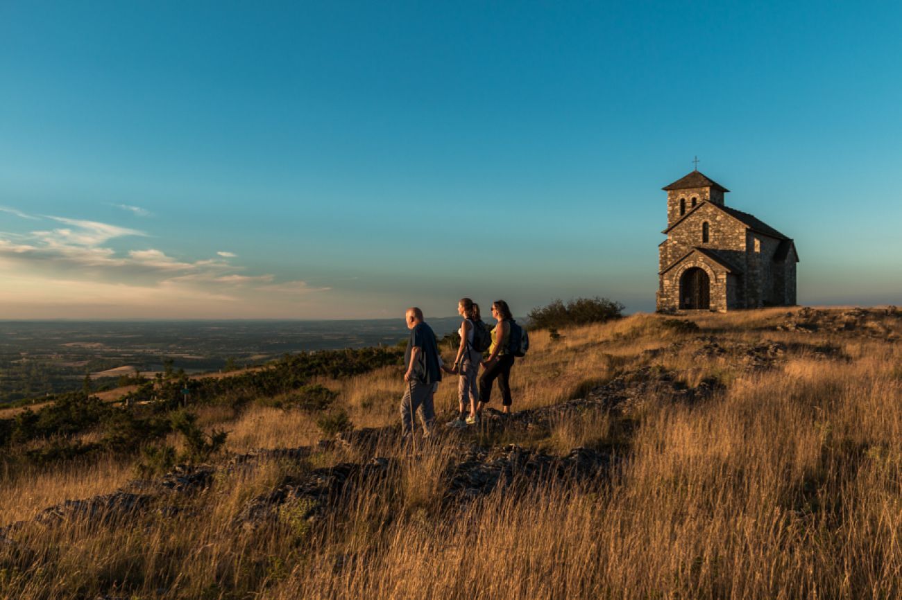
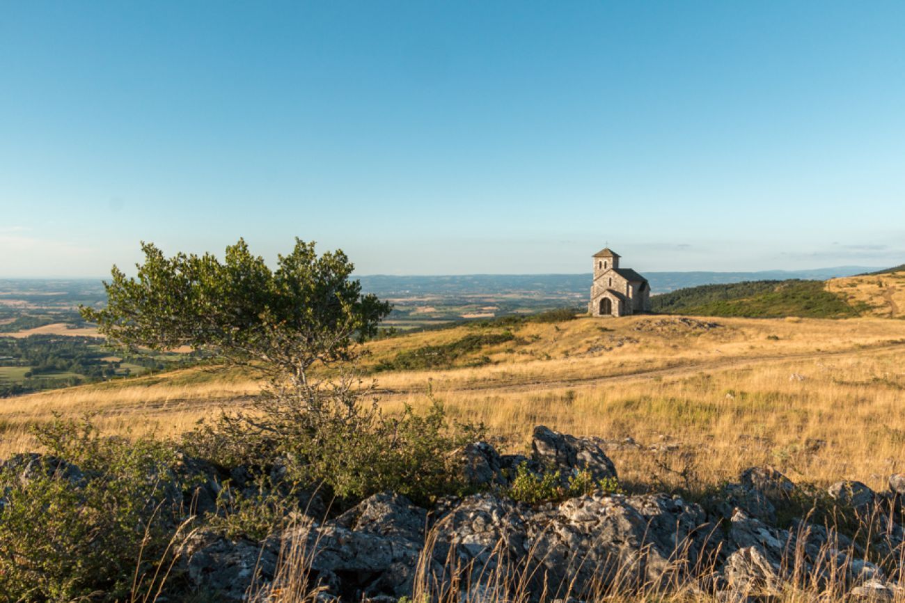
The Capelette of Saint-Ferréol
Original origins
The story of four saints (Macaire, Ferréol, Hippolyte, and Stapin) who lived around Dourgne, a combination of pagan and Christian cults revisited by Catholicism, nurtures a popular fervor...
The story of four saints (Macaire, Ferréol, Hippolyte, and Stapin) who lived around Dourgne, a combination of pagan and Christian cults revisited by Catholicism, nurtures a popular fervor of natural and contingent origin. The Benedictine monks who founded the Abbey of En-Calcat in 1890 were not indifferent, transforming the Mouniès spring, linked to the cult of Saint Macaire, into the Monks' spring in order to claim uncertain local monastic origins dedicated to Saint Stapin. The reputation of the Abbey of En-Calcat, which became an intellectual and artistic center, is probably more due to the religious ancestors of its founder, Romain Banquet, a child of Dourgne and monk at the Morvandelle abbey of La Pierre-qui-Vire.


Steep climb starting from Dourgne (up to Saint Stapin)
Marked route
Clothing suitable for the season and conditions (cold, hot, humid…)
Hiking boots adapted to the terrain (even for children!)
Trekking poles (useful for stability and to relieve joints)
Mobile phone and spare battery
Before you leave:
Check the general and local weather, making sure there is no precipitation Inform yourself about the approach walk, route altitude, duration, possible exit points (IGN map, GPS, guidebook, etc.) Assess possible risks by consulting mountain professionals, refuges, lodges Inform someone close about your objective and contact them again if plans change: departure and return times, number of participants with each phone number, vehicle(s), parking Avoid going alone, use equipment suitable for the activity, adjusted and in good condition, headlamp, complete first aid kit, survival blanket, etc.In case of problem
Alert: call 112 (European emergency number)
5 key points to convey your alert:
Where? Municipality, place, route, altitude Who? Identity, phone number What? Type of accident, number of victims, severity, fall dynamics When? Time of accident Weather? Wind, visibilityExit from Dourgne, Arfons road 81110 Dourgne
An error on this record? Write to the owner quoting these references:
Record name: La Capelette de Saint-Ferréol | Record ID: 851738 | URL of this Outdooractive page.
Near the route and during it, don't miss, among others, the Abbey of En Calcat, the statue of Saint-Stapin, the Saint-Ferréol plateau… For wonderful memories.
Popularne wycieczki w okolicy
-
Le Carbonéral
ciężkiWędrówka 18,3 km -
Sentier Randonnée du Patrimoine 13km / 3h30
światłoWędrówka 13,0 km -
La boucle de l'Agout à Fréjeville
światłoWędrówka 14,6 km -
GR®653 the Arles Way to Santiago de Compostela
ciężkiWędrówka 83,1 km -
Le sentier des trois ruisseaux
światłoWędrówka 13,0 km -
Le chemin des oiseaux
światłoWędrówka 5,65 km -
Tour du Tarn on horseback: Escoussens / Dourgne
ciężkiJazda konna 21,3 km -
Sentier des Pigeonniers
średniWędrówka 12,2 km -
Grand Avaris hiking trail
światłoWędrówka 11,4 km -
Lou Cami de Viviers
średniWędrówka 14,6 km
Wędrówki i tropienie


Nie przegap ofert i inspiracji na następne wakacje
Twój adres e-mail została dodana do listy mailingowej.