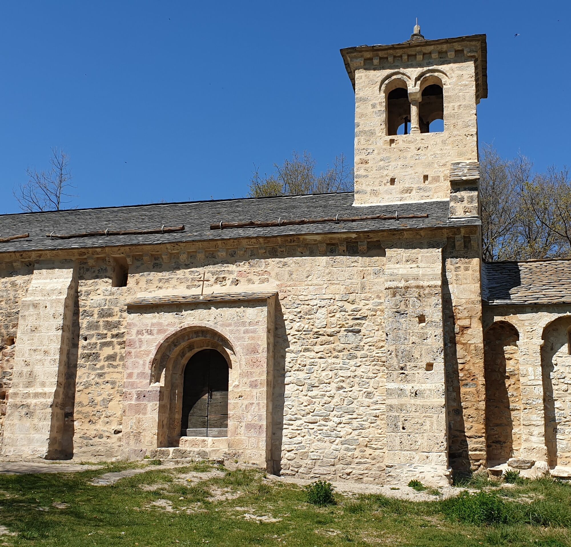
St-Paul d'Arnave chapel
światło
Pobierz tę trasę na swój telefon komórkowy
St-Paul d'Arnave chapel
światło
Wędrówka
5,22
km
Zeskanuj kod QR i rozpocznij nawigację w aplikacji bergfex.

Wędrówki i tropienie


St-Paul d'Arnave chapel
światło
Odległość
5,22
km
Czas trwania
02:10
h
Ascent
369
hm
Poziom morza
554 -
844
m
Ścieżka do pobrania
St-Paul d'Arnave chapel
światło
Wędrówka
5,22
km
Access: By car, north of Tarascon, take the D618 towards Mercus. On leaving Bompas, turn right onto the D20, Route des Corniches, dotted with fine Romanesque chapels. In Arnave, park your car on the village...
Opis
Access: By car, north of Tarascon, take the D618 towards Mercus. On leaving Bompas, turn right onto the D20, Route des Corniches, dotted with fine Romanesque chapels. In Arnave, park your car on the village square near the plane trees and fountain.
Trasa
Église Saint-Pierre
(563 m)
Miejsce kultu
0,0 km
Église Saint-Pierre
(563 m)
Miejsce kultu
5,1 km
Arnave
(572 m)
Wioska
5,2 km
Trasa
St-Paul d'Arnave chapel
światło
Wędrówka
5,22
km
Église Saint-Pierre
(563 m)
Miejsce kultu
0,0 km
Église Saint-Pierre
(563 m)
Miejsce kultu
5,1 km
Arnave
(572 m)
Wioska
5,2 km
Autor
Dostarczone przez Ariège Pyrénées Tourismus
Wycieczkę St-Paul d'Arnave chapel zapewnia outdooractive.com.

Informacje o trasie
Trasa
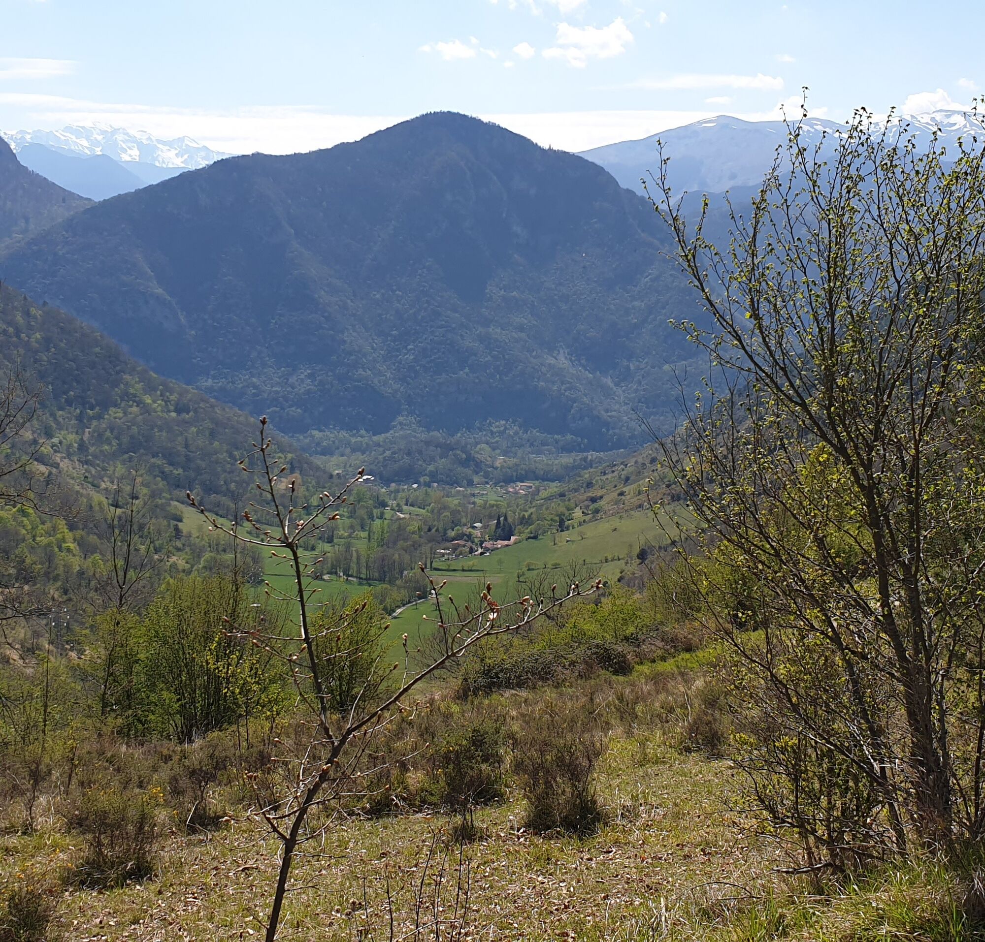
(D/A) From the village square at 570m, cross the Arnave bridge and immediately turn right. If you look carefully, you'll find the chapel on its promontory at the top of Saint-Paul. After ten minutes or so, close to the stream, the track begins to climb. Past the wide meadows of Miédevièle and the reservoir on the right, the track begins to climb steadily. You abandon it after a twenty-metre steep incline as it gets lost in the fields. Shortly afterwards, the track heads straight for the chapel.
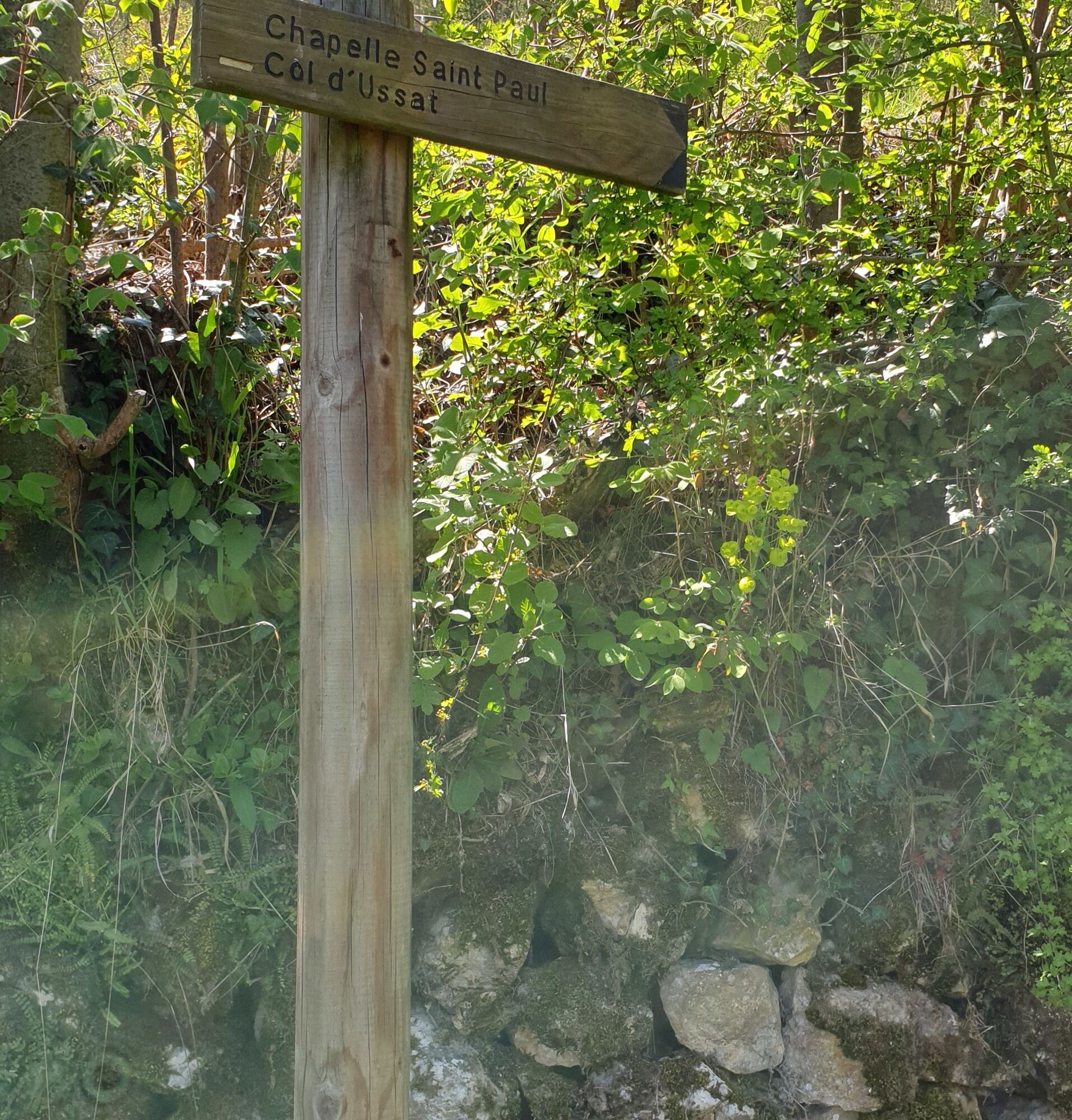
0h30 - CHAPELLE SAINT-PAUL (722m). Go left, due south, for the Col d'Ussat. You're entering the Forêt de Barthala. Descend, ascend, descend, and you pass to the right of the Orri de Pédissol.
0h55 - REPLAT DU PEDISSOL (755m). From the flat, you must make a right-hand turn. You'll soon reach the last hairpin bends of the climb up to the pass.
1h15 - COL D'USSAT (859m). At the crossroads. Go east at the pylon, towards Arnave.
1h40 - CHEMIN DE FRANQUE. The path takes you back to the D20, which you will have to climb for 200m.
2h10 - Via impasse de Trapadou and rue du Bayle, turn right into the village square.
Nie ma jeszcze recenzji
Popularne wycieczki w okolicy
-
5,0
Blue Pond
światłoWędrówka 9,90 km -
Cyclosport route 11 - The Ariège cyclotour - Stage 5: from Ax-les-Thermes to Foix
ciężkiDroga rowerowa 93,0 km -
Cyclotour de l'Ariège in 5 days
ciężkiDroga rowerowa 441,0 km -
Le chemin des 3 cascades
średniWędrówka 7,20 km -
Cyclosport route 10 - The three bumps near Foix
ciężkiDroga rowerowa 78,8 km -
Les terrasses du Pech
światłoWędrówka 3,22 km -
Circuit cyclotourisme - Au tour du pic des trois seigneurs
ciężkiDroga rowerowa 74,2 km -
Saint-Sauveur Walk
światłoWędrówka 3,17 km -
Cyclosportive route 11 - The Ariège cycle route - Stage 3: from Auzat to Prades
ciężkiDroga rowerowa 107,4 km -
Cyclosport route 9 - The wall of Péguère
ciężkiDroga rowerowa 69,7 km

Wędrówki i tropienie

Ponad 550.000 propozycji wycieczek, szczegółowe mapy i intuicyjny planer tras sprawiają, że aplikacja jest niezbędna dla wszystkich entuzjastów przyrody.

Nie przegap ofert i inspiracji na następne wakacje
Zapisz się do newslettera
Błąd
Wystąpił błąd. Spróbuj ponownie.
Dziękujemy za rejestrację
Twój adres e-mail została dodana do listy mailingowej.
Wycieczki po całej Europie
Austria
Szwajcaria
Niemcy
Włochy
Słowenię
Francja
Holandia
Belgia
Polska
Liechtenstein
Czechy
Słowacja
Hiszpania
Chorwacja
Bośnia i Hercegowina
Luksemburg
Andorra
Portugalia
Islandia
Wielka Brytania
Irlandia
Grecja
Albania
Macedonia Północna
Malta
Norwegia
Czarnogóra
Mołdawia
Kosowo
Węgry
San Marino
Rumunia
Estonia
Łotwa
Białoruś
Cypr
Litwa
Serbia
Bułgaria
Monako
Dania
Szwecja
Finlandia