Refuge du Rulhe via Le Rieutort
światło
Nawigacja
Nawigacja
Pobierz tę trasę na swój telefon komórkowy
Refuge du Rulhe via Le Rieutort
światło
Wędrówka
13,16
km
Zeskanuj kod QR i rozpocznij nawigację w aplikacji bergfex.


Wędrówki i tropienie





Refuge du Rulhe via Le Rieutort
światło
Odległość
13,16
km
Czas trwania
04:30
h
Ascent
667
hm
Poziom morza
1 540 -
2 245
m
Ścieżka do pobrania
Refuge du Rulhe via Le Rieutort
światło
Wędrówka
13,16
km
Access: Leave the RN20 between Aulos and Les Cabannes and take the D 520 which, after the village of Aston, skirts the Riète dam and continues on to the Laparan dam, where you follow the road for 500m...
Opis
Access: Leave the RN20 between Aulos and Les Cabannes and take the D 520 which, after the village of Aston, skirts the Riète dam and continues on to the Laparan dam, where you follow the road for 500m to park at the CASCADE DU RUISSEAU DU RIEUTORT parking lot (1,540 m).
Trasa
Cabane du Pla de las Peyres
(1 698 m)
Refuge (niezarządzany)
2,8 km
Cabane de Garsan
(1 898 m)
Refuge (niezarządzany)
4,3 km
Refuge du Rulhe
(2 189 m)
Schronienie
5,9 km
Col de Belh
(2 220 m)
Siodełko górskie
6,2 km
Col du Rieutort
(2 250 m)
Siodełko górskie
6,9 km
Trasa
Refuge du Rulhe via Le Rieutort
światło
Wędrówka
13,16
km
Autor
Dostarczone przez Ariège Pyrénées Tourismus
Wycieczkę Refuge du Rulhe via Le Rieutort zapewnia outdooractive.com.

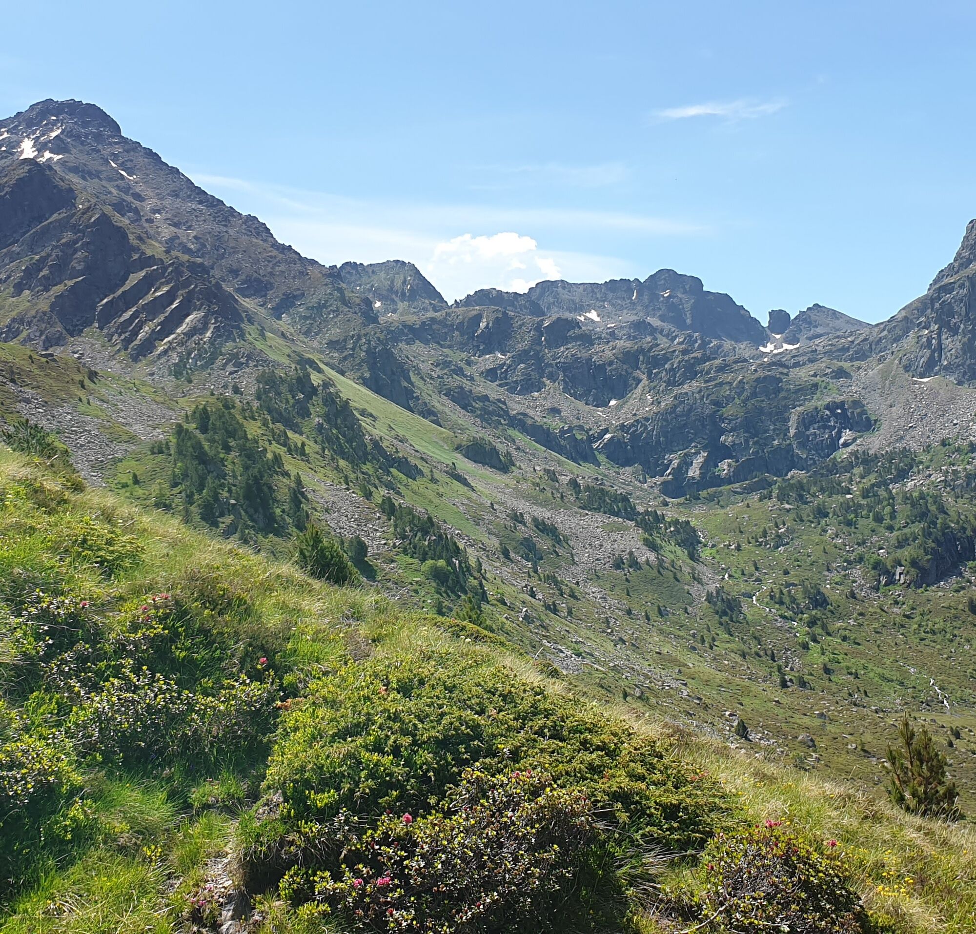
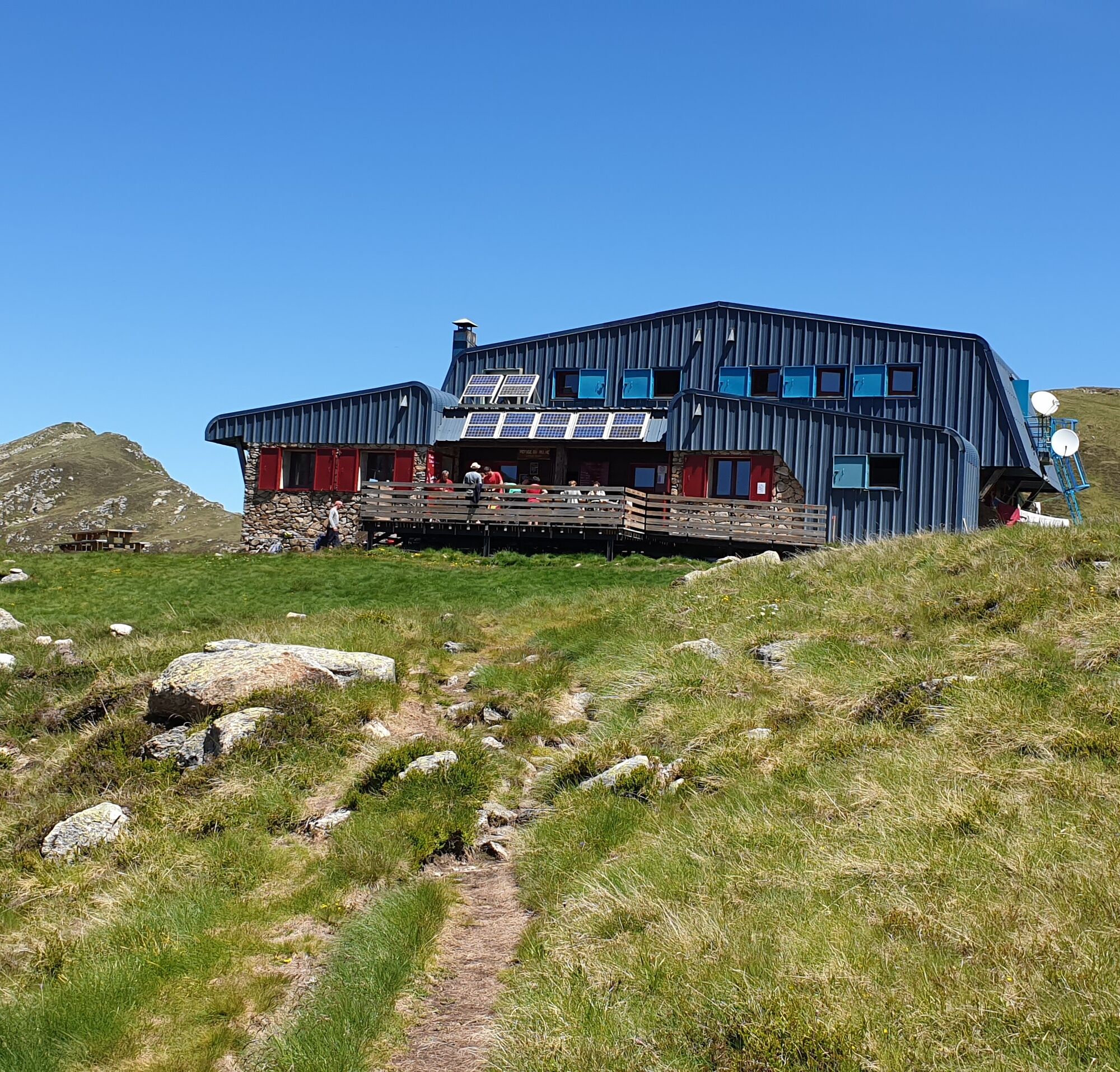


Informacje o trasie
Trasa
0h00 - PARKING (1,560 m). Follow the pastoral path that runs alongside the reservoir.
0:50 - PLA DE LAS PEYRES (1,700 m). End of the track. Turn left from the hut and climb the right bank of the Estagnol stream.
1h20 - CABANE DE GARSAN (1,900 m). Leave the valley floor and climb NE straight up the slope, then gradually flank to the west.
2h10 - REFUGE DU RULHE (2 185 m). Find the GR10 markings (white and red), which we follow in a N direction.
2h15 - INTERSECTION (2,220 m). Leave the GR10 to the right and follow the GR Transfrontalier (GRT) to the left, continuing due N.
2:30 - COL DU RIEUTORT (2,250 m). Go straight down the Rieutort valley to the edge of the Rulhe pond, which you leave on your left to descend to the valley floor.
3h30 - CABANE DU RIEUTORT (1,825 m). Cross the stream and descend to the right bank. In the forest, the path twists and turns towards the Laparan pond. Back on the track, turn right.
4h30 - Back to PARKING (1,560 m).
0:50 - PLA DE LAS PEYRES (1,700 m). End of the track. Turn left from the hut and climb the right bank of the Estagnol stream.
1h20 - CABANE DE GARSAN (1,900 m). Leave the valley floor and climb NE straight up the slope, then gradually flank to the west.
2h10 - REFUGE DU RULHE (2 185 m). Find the GR10 markings (white and red), which we follow in a N direction.
2h15 - INTERSECTION (2,220 m). Leave the GR10 to the right and follow the GR Transfrontalier (GRT) to the left, continuing due N.
2:30 - COL DU RIEUTORT (2,250 m). Go straight down the Rieutort valley to the edge of the Rulhe pond, which you leave on your left to descend to the valley floor.
3h30 - CABANE DU RIEUTORT (1,825 m). Cross the stream and descend to the right bank. In the forest, the path twists and turns towards the Laparan pond. Back on the track, turn right.
4h30 - Back to PARKING (1,560 m).
Nie ma jeszcze recenzji
Popularne wycieczki w okolicy
-
4,0
Soldeu - Vall d'Incles - Picnic - Cami de l'Obac
światłoWędrówka 10,8 km -
The Bonshommes Trail GR®107
średniWędrówka 224,7 km -
Soldeu - Estany de Querol - Basses de les Salamandres - near Estany Cabana Sorda
ciężkiWędrówka 11,1 km -
Chemin de la Transhumance Plateau de Beille - Val d'Incles
ciężkiWędrówka 37,2 km -
Fontargente ponds
światłoWędrówka 7,78 km -
Étang des Bésines and its refuge
światłoWędrówka 14,6 km -
The Ariège MTB Crossing - Stage 01: Ax-les-Thermes to the Refuge du Chioula
ciężkiMountainbike 17,6 km -
C 3. Etappe Artigues-Tarascon, Okzitanien/Frankreich
ciężkiJazda na rowerze 63,2 km -
Soldeu - Estanys Siscaro - Soldeu
średniWędrówka 14,3 km -
Soldeu - Estany Querol - Estanys Salamandre - Cabana Sorda
średniWędrówka 13,8 km
Wędrówki i tropienie

Ponad 550.000 propozycji wycieczek, szczegółowe mapy i intuicyjny planer tras sprawiają, że aplikacja jest niezbędna dla wszystkich entuzjastów przyrody.

Nie przegap ofert i inspiracji na następne wakacje
Zapisz się do newslettera
Błąd
Wystąpił błąd. Spróbuj ponownie.
Dziękujemy za rejestrację
Twój adres e-mail została dodana do listy mailingowej.
Wycieczki po całej Europie
Austria
Szwajcaria
Niemcy
Włochy
Słowenię
Francja
Holandia
Belgia
Polska
Liechtenstein
Czechy
Słowacja
Hiszpania
Chorwacja
Bośnia i Hercegowina
Luksemburg
Andorra
Portugalia
Islandia
Wielka Brytania
Irlandia
Grecja
Albania
Macedonia Północna
Malta
Norwegia
Czarnogóra
Mołdawia
Kosowo
Węgry
San Marino
Rumunia
Estonia
Łotwa
Białoruś
Cypr
Litwa
Serbia
Bułgaria
Monako
Dania
Szwecja
Finlandia





