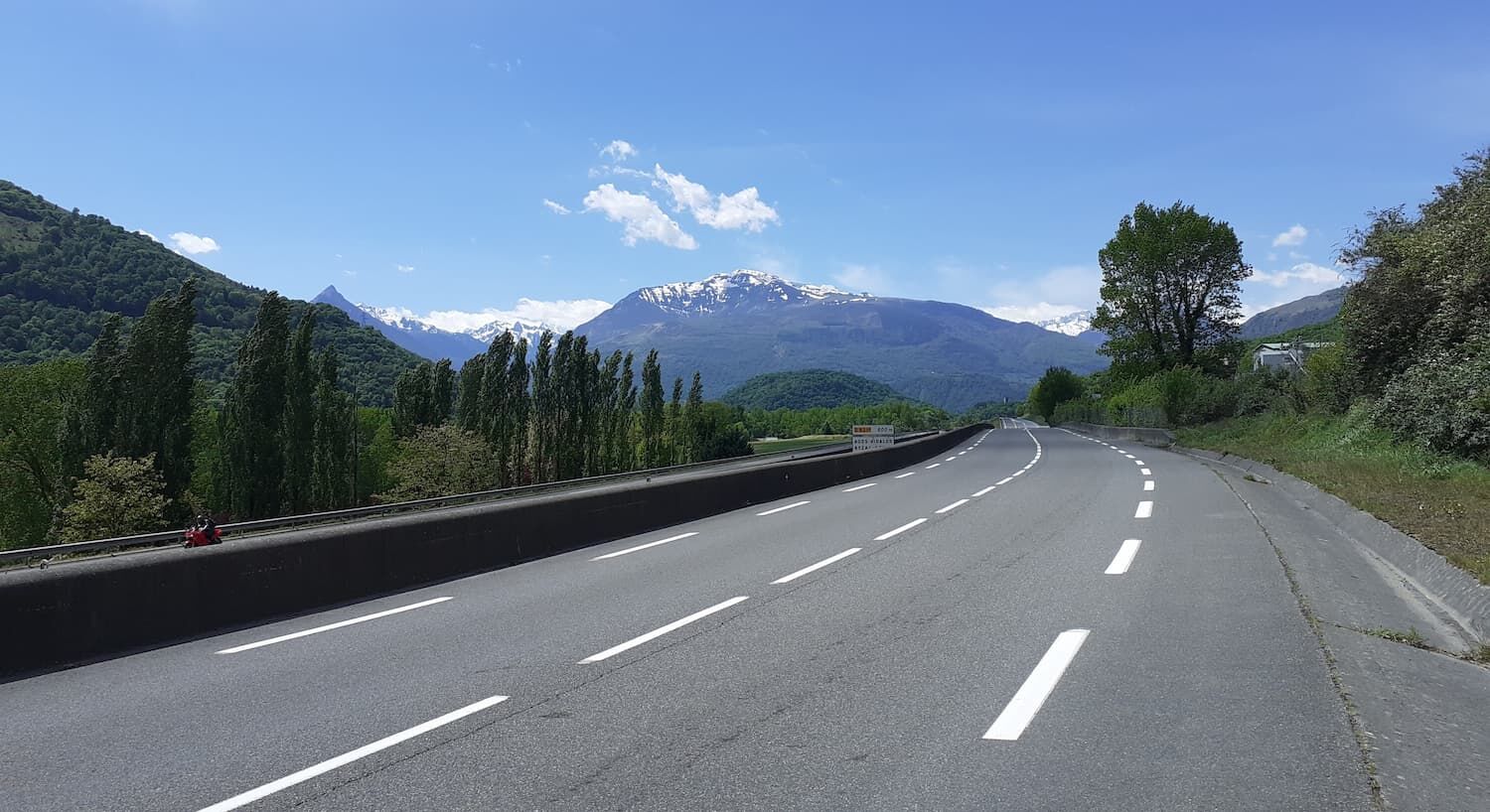
Valley of the Gaves Val d'Azun ride
średni
Nawigacja
Nawigacja
Pobierz tę trasę na swój telefon komórkowy
Valley of the Gaves Val d'Azun ride
średni
Droga rowerowa
55,60
km
Zeskanuj kod QR i rozpocznij nawigację w aplikacji bergfex.

Wędrówki i tropienie


Valley of the Gaves Val d'Azun ride
średni
Odległość
55,60
km
Czas trwania
03:20
h
Ascent
669
hm
Poziom morza
382 -
839
m
Poziom trudności: 3
Ścieżka do pobrania
Valley of the Gaves Val d'Azun ride
średni
Droga rowerowa
55,60
km
No major technical difficulty, a moderate outing.
Trasa
Lourdes
(402 m)
Miasto
0,0 km
Chapelle Notre-Dame de Piétat
(579 m)
Miejsce kultu
21,8 km
Église Saint-Martin
(802 m)
Miejsce kultu
30,0 km
Gaillagos
(918 m)
Wioska
31,8 km
Église Saint-Jacques
(629 m)
Miejsce kultu
43,1 km
Église Saint-Michel
(419 m)
Miejsce kultu
46,5 km
Lourdes
(402 m)
Miasto
55,5 km
Trasa
Valley of the Gaves Val d'Azun ride
średni
Droga rowerowa
55,60
km
Lourdes
(402 m)
Miasto
0,0 km
Aspin-en-Lavedan
(434 m)
Wioska
1,8 km
Pont-Neuf
(387 m)
Korytarz/teren
2,9 km
La Gare
(390 m)
Rozliczenie
3,1 km
Lugagnan
(430 m)
Wioska
3,3 km
Ger
(394 m)
Wioska
4,2 km
Boô-Silhen
(407 m)
Wioska
7,9 km
Argelès-Gazost
(446 m)
Wioska
12,2 km
Adast
(443 m)
Wioska
14,6 km
Église Saint-André
(496 m)
Miejsce kultu
19,1 km
Soulom
(497 m)
Wioska
19,3 km
Mr Vagabont
(489 m)
Restauracja
19,5 km
Pierrefitte-Nestalas
(483 m)
Wioska
19,6 km
Adast
(443 m)
Wioska
21,3 km
Chapelle Notre-Dame de Piétat
(579 m)
Miejsce kultu
21,8 km
Saint-Savin
(542 m)
Wioska
22,5 km
Le Viscos
(543 m)
Restauracja
22,6 km
Arcizans-Avant
(650 m)
Wioska
24,1 km
Chez Pierrot
(638 m)
Restauracja
24,2 km
Sougnious
(678 m)
Korytarz/teren
28,1 km
Sireix
(815 m)
Wioska
28,4 km
Cudet
(755 m)
Korytarz/teren
28,8 km
Bun
(805 m)
Wioska
30,0 km
Église Saint-Martin
(802 m)
Miejsce kultu
30,0 km
Gaillagos
(918 m)
Wioska
31,8 km
Auberge Les Saveurs d'Azun
(820 m)
Restauracja
33,1 km
Arcizans-Dessus
(869 m)
Wioska
33,2 km
Les Arribères
(773 m)
Korytarz/teren
33,5 km
Arras-en-Lavedan
(685 m)
Wioska
36,3 km
Le Kairn Bistro-Librairie
(693 m)
Restauracja
36,3 km
Argelès-Gazost
(446 m)
Wioska
39,1 km
Table de pisque nique
(576 m)
Stół piknikowy
39,5 km
table de pique-nique
(575 m)
Stół piknikowy
39,6 km
Gez
(618 m)
Wioska
40,2 km
Sère-en-Lavedan
(595 m)
Wioska
41,8 km
Salles
(623 m)
Wioska
43,0 km
Église Saint-Jacques
(629 m)
Miejsce kultu
43,1 km
La Lane
(591 m)
Korytarz/teren
43,5 km
Ouzous
(572 m)
Wioska
43,9 km
Ayzac-Ost
(423 m)
Wioska
45,3 km
Ost
(429 m)
Rozliczenie
45,4 km
Église Saint-Michel
(419 m)
Miejsce kultu
46,5 km
Agos-Vidalos
(403 m)
Wioska
47,5 km
Hôtel-Restaurant Chez Pierre d'Agos
(402 m)
Restauracja
47,6 km
Layous
(452 m)
Korytarz/teren
50,6 km
L'Asticotière
(393 m)
Korytarz/teren
51,2 km
Viger
(558 m)
Wioska
51,2 km
Lugagnan
(430 m)
Wioska
51,5 km
La Gare
(390 m)
Rozliczenie
51,7 km
Pont-Neuf
(387 m)
Korytarz/teren
52,4 km
Aspin-en-Lavedan
(434 m)
Wioska
53,5 km
Lourdes
(402 m)
Miasto
55,5 km
Autor
Dostarczone przez Office de Tourisme de Lourdes
Wycieczkę Valley of the Gaves Val d'Azun ride zapewnia outdooractive.com.
Informacje o trasie
Najważniejsze informacje geologiczne
Tak
Sprzęt
Before setting off:
Make sure the bike is in perfect mechanical condition, including tires and brakes Ensure the bike is properly adjusted to your body Wearing a helmet is highly recommended Carry a repair kit Remember that traffic laws apply to cyclists in all circumstances Never ride more than two abreast and move into a single file when traffic conditions require it Respect other road users as you would like to be respected Choose a route suited to your physical abilities Inform someone about your itinerary Check the weather conditions A first aid kit is not essential but can be very useful Know and keep emergency numbers handy Respect the environment by not throwing food wrappers on the roadside If you must return at dusk, make sure you can see and be seen
Instrukcje bezpieczeństwa
In case of emergency, call 112
Informacje o przyjeździe
Przybycie
Consider carpooling
Transport publiczny
Parking
Parking near the starting point
Dodatkowe informacje i wskazówki
Poziom trudności
3
Dodatkowe informacje
To learn more about our destination, visit our website
Nie ma jeszcze recenzji
Popularne wycieczki w okolicy
-
THE GAVES GREENWAY BY BIKE
światłoJazda na rowerze 18,8 km -
THE TOURMALET LOOP VIA LA MONGIE
ciężkiJazda na rowerze 99,0 km -
Lourdes Hautacam
ciężkiDroga rowerowa 55,4 km -
Der Pic du Montaigu
ciężkiWędrówka 4,65 km -
BERNADETTE'S PATH TO BARTRÈS
światłoWędrówka 4,52 km -
Lourdes Vélosud (V81) along the Gave
światłoJazda na rowerze 33,0 km -
Lingous Pass Loop, Castelloubon valley
światłoJazda na rowerze 20,9 km -
SOUM DE CAUBI ET DE BASTA
światłoWędrówka 19,1 km -
5,0
Lourdes - Lourdes Lake Circuit
światłoMountainbike 6 km -
Soulor - Aubisque par le col des Spandelles
ciężkiDroga rowerowa 83,7 km

Wędrówki i tropienie

Ponad 550.000 propozycji wycieczek, szczegółowe mapy i intuicyjny planer tras sprawiają, że aplikacja jest niezbędna dla wszystkich entuzjastów przyrody.

Nie przegap ofert i inspiracji na następne wakacje
Zapisz się do newslettera
Błąd
Wystąpił błąd. Spróbuj ponownie.
Dziękujemy za rejestrację
Twój adres e-mail została dodana do listy mailingowej.
Wycieczki po całej Europie
Austria
Szwajcaria
Niemcy
Włochy
Słowenię
Francja
Holandia
Belgia
Polska
Liechtenstein
Czechy
Słowacja
Hiszpania
Chorwacja
Bośnia i Hercegowina
Luksemburg
Andorra
Portugalia
Islandia
Wielka Brytania
Irlandia
Grecja
Albania
Macedonia Północna
Malta
Norwegia
Czarnogóra
Mołdawia
Kosowo
Węgry
San Marino
Rumunia
Estonia
Łotwa
Białoruś
Cypr
Litwa
Serbia
Bułgaria
Monako
Dania
Szwecja
Finlandia