


THE GAVES GREENWAY BY BIKE
Poziom trudności: 2
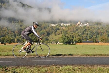
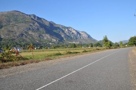
Along this 17.5 km route, signs inform you about the villages you pass and the services they offer, and provide remarkable views of the Gave de Pau, the Hautacam, and Pibeste massifs.On both sides of the...
Along this 17.5 km route, signs inform you about the villages you pass and the services they offer, and provide remarkable views of the Gave de Pau, the Hautacam, and Pibeste massifs.
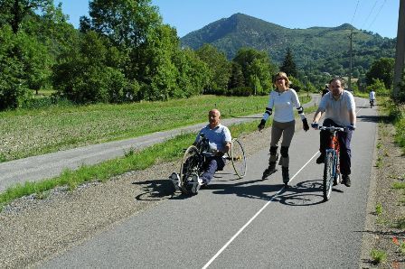
On both sides of the Greenway, other routes allow you to make loops or reach the major mountain passes. A 100% natural route, ideal for families and sports enthusiasts alike.


Adast / Saint Savin: 0.9 km
Saint Savin / Lau Balagnas: 1.1 km
Lau Balagnas / Argelès-Gazost: 1.4 km
Argelès-Gazost / Ayzac-Ost: 1.8 km At Argelès-Gazost: Parking, Water point, Toilets
Ayzac Ost / Boo Silhen: 1.4 km At Ayzac: Water point
Boo Silhen / Agos-Vidalos: 0.7 km
Agos-Vidalos / Geu: 2.3 km
Geu / Ger: 1.4 km
Ger / Lugagnan: 1.5 km
Lugagnan / Lourdes: 3.9 km Parking at Lugagnan and Lourdes
In case of emergency, dial 112
Former railway line converted into a cycle path along the Gave de Pau.
Prefer the train for your trips
Pierrefitte-Nestalas / Argelès-Gazost / Lugagnan / Lourdes
2
Dedicated route.
All year round.
Route not recommended for experts during the busy summer period.
Popularne wycieczki w okolicy
Lourdes Hautacam
ciężkiDroga rowerowa 55,4 kmTHE TOURMALET LOOP VIA LA MONGIE
ciężkiJazda na rowerze 99,0 kmBERNADETTE'S PATH TO BARTRÈS
światłoWędrówka 4,52 kmLourdes Vélosud (V81) along the Gave
światłoJazda na rowerze 33,0 kmLe Pic du Montaigu
ciężkiWędrówka 4,65 km- 5,0
Lourdes - Lourdes Lake Circuit
światłoMountainbike 6 km Le circuit du lac Bleu
średniWędrówka 14,9 kmLingous Pass Loop, Castelloubon valley
światłoJazda na rowerze 20,9 kmSOUM DE CAUBI ET DE BASTA
światłoWędrówka 19,1 kmSoulor - Aubisque par le col des Spandelles
ciężkiDroga rowerowa 83,8 km
Wędrówki i tropienie


Nie przegap ofert i inspiracji na następne wakacje
Twój adres e-mail została dodana do listy mailingowej.