


TOUR OF THE PAYS DE LOURDES
Poziom trudności: 3
Starting from Lourdes (or from Saint-Pé-de-Bigorre, your choice), you will ride on the roads of the Pays de Lourdes. First, climbing towards the green valley of Batsurguère, you will find yourself at the...
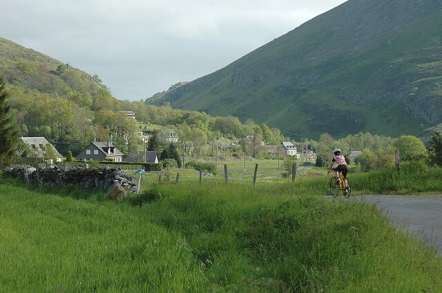
Starting from Lourdes (or from Saint-Pé-de-Bigorre, your choice), you will ride on the roads of the Pays de Lourdes. First, climbing towards the green valley of Batsurguère, you will find yourself at the foot of the Pibeste-Aoulhet Nature Reserve, the largest in France. You will then ride along the Gave de Pau, towards Saint-Pé-de-Bigorre, a historic place on the Way of Saint James to Compostela. The road will lead you towards the Bartrès plateau. Located north of the Marian city, these places have been occupied since the Neolithic, as evidenced by the megalithic graves of the Bartrès heath.

In case of emergency, dial 112
This foothill route, accessible to all, offers an unusual discovery of the Pays de Lourdes, the small adjacent valleys, and the welcoming villages.
Prefer the train for your travel
Lourdes - Pic du Jer
3
none
Recommended period: all year round
Gears: from 39x23 to 39x25
Popularne wycieczki w okolicy
Lourdes Hautacam
ciężkiDroga rowerowa 55,4 km- 5,0
La boucle du camp de César (Bouhaben)
światłoWędrówka 6,25 km BERNADETTE'S PATH TO BARTRÈS
światłoWędrówka 4,52 kmLourdes Vélosud (V81) along the Gave
światłoJazda na rowerze 33,0 kmTHE GAVES GREENWAY BY BIKE
światłoJazda na rowerze 18,8 km- 5,0
Lourdes - Lourdes Lake Circuit
światłoMountainbike 6 km Lingous Pass Loop, Castelloubon valley
światłoJazda na rowerze 20,9 kmSOUM DE CAUBI ET DE BASTA
światłoWędrówka 19,1 kmLourdes Lake Estaing
średniJazda na rowerze 63,2 kmOrincles und Umland
średniE-MTB 32,7 km
Wędrówki i tropienie


Nie przegap ofert i inspiracji na następne wakacje
Twój adres e-mail została dodana do listy mailingowej.