Samatan - Le circuit de la Trillote
światło
Pobierz tę trasę na swój telefon komórkowy
Samatan - Le circuit de la Trillote
światło
Mountainbike
19,35
km
Zeskanuj kod QR i rozpocznij nawigację w aplikacji bergfex.

Wędrówki i tropienie


Samatan - Le circuit de la Trillote
światło
Odległość
19,35
km
Czas trwania
01:46
h
Ascent
289
hm
Poziom morza
163 -
273
m
Ścieżka do pobrania
Samatan - Le circuit de la Trillote
światło
Mountainbike
19,35
km
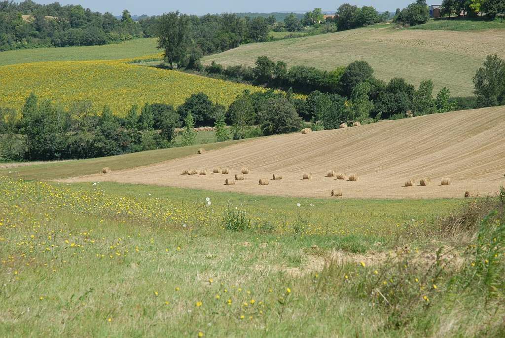
Le Savès, un territoire à déguster lentement !
Trasa
Samatan
(165 m)
Wioska
1,2 km
Le Château
(241 m)
Korytarz/teren
9,3 km
Montiège
(272 m)
Korytarz/teren
11,6 km
Peyet
(251 m)
Korytarz/teren
12,5 km
Antin
(224 m)
Korytarz/teren
13,0 km
Trasa
Samatan - Le circuit de la Trillote
światło
Mountainbike
19,35
km
Samatan
(165 m)
Wioska
1,2 km
Le Château
(241 m)
Korytarz/teren
9,3 km
Montiège
(272 m)
Korytarz/teren
11,6 km
Peyet
(251 m)
Korytarz/teren
12,5 km
Antin
(224 m)
Korytarz/teren
13,0 km
Autor
Dostarczone przez Pays Portes de Gascogne
Wycieczkę Samatan - Le circuit de la Trillote zapewnia outdooractive.com.
Informacje o trasie
Najważniejsze informacje geologiczne
Tak
Odpowiedni dla rodzin
Tak
Instrukcje bezpieczeństwa
En cas d'urgence, composer le 112
Informacje o przyjeździe
Przybycie
D4
Parking
Parking à proximité du point de départ
Dodatkowe informacje i wskazówki
Dodatkowe informacje
Pour aller plus loin sur la destination, visitez notre site Pays Portes de Gascogne
Nie ma jeszcze recenzji
Popularne wycieczki w okolicy
-
Artistic Itinerary (e-bike): "Lines of Escape". Perspectives between Save and Gimone
ciężkiJazda na rowerze 53,2 km -
Discovery of the Gimone hills by electric bike
średniJazda na rowerze 35,2 km -
Discovery route of the Artistic Routes on the Arrats-Gimone hillsides
światłoJazda na rowerze 11,1 km -
De rivières en coteaux
średniDroga rowerowa 79,3 km -
Gimone and Arrats with e-bike
średniJazda na rowerze 41,8 km -
The Gimone and its villages
średniJazda na rowerze 42,7 km -
Gimont - Villages et collines.
średniJazda na rowerze 17,4 km -
Vélo Pour Tous en Savès
światłoDroga rowerowa 6,95 km -
Itinéraire Artistique (VAE) : "Crêtes et arêtes" - En Couleurs Sur Les Coteaux Du Savès
Jazda na rowerze 39,7 km -
Le circuit du foie gras – Samatan
średniDroga rowerowa 66,6 km

Wędrówki i tropienie

Ponad 550.000 propozycji wycieczek, szczegółowe mapy i intuicyjny planer tras sprawiają, że aplikacja jest niezbędna dla wszystkich entuzjastów przyrody.

Nie przegap ofert i inspiracji na następne wakacje
Zapisz się do newslettera
Błąd
Wystąpił błąd. Spróbuj ponownie.
Dziękujemy za rejestrację
Twój adres e-mail została dodana do listy mailingowej.
Wycieczki po całej Europie
Austria
Szwajcaria
Niemcy
Włochy
Słowenię
Francja
Holandia
Belgia
Polska
Liechtenstein
Czechy
Słowacja
Hiszpania
Chorwacja
Bośnia i Hercegowina
Luksemburg
Andorra
Portugalia
Islandia
Wielka Brytania
Irlandia
Grecja
Albania
Macedonia Północna
Malta
Norwegia
Czarnogóra
Mołdawia
Kosowo
Węgry
San Marino
Rumunia
Estonia
Łotwa
Białoruś
Cypr
Litwa
Serbia
Bułgaria
Monako
Dania
Szwecja
Finlandia