


hike to the waterfall wall


Hike towards the sunBetween the Catholic church and the Maislinger bakery, the starting point of the hike branches off from Seestraße, uphill along "Stiegergasse". After about 200 m of asphalt road we...
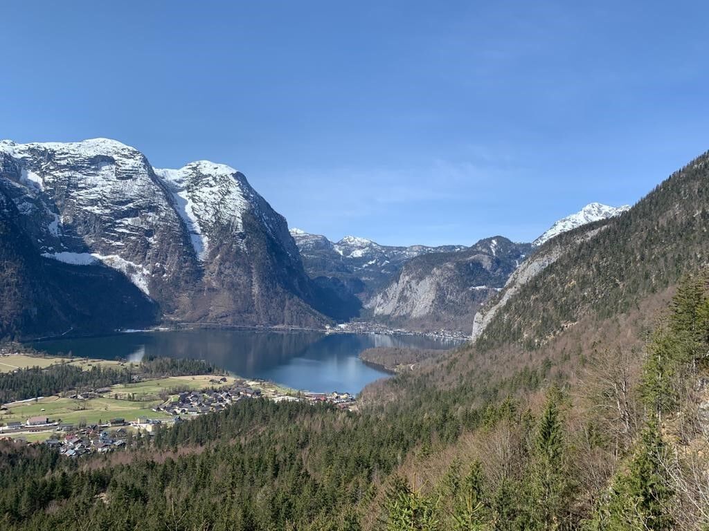
Hike towards the sunBetween the Catholic church and the Maislinger bakery, the starting point of the hike branches off from Seestraße, uphill along "Stiegergasse". After about 200 m of asphalt road we cross the Höhenweg and the actual ascent begins. It takes us about 40 minutes to reach our destination, where some benches invite us to rest. From here we have a magnificent view of the Obertraun basin, Lake Hallstatt and the surrounding mountains.
Altitude difference approx. 250 m, suggested hiking route incl. ascent and descent approx. 3 km, walking time approx. 1.5 hours
Experience a 360° panorama tour through Obertraun


Popularne wycieczki w okolicy
- 4,8
Heilbronner circular trail
światłoWędrówka7,78 km - 4,5
Hike to the Hütteneckalm
światłoWędrówka8,70 km - 4,8
Loserrunde über Augstsee, Loserfenster, Losergipfel und Loserhütte
średniWędrówka4,69 km - 4,0
Predigtstuhl 1.278m
średniWędrówka6,77 km - 4,7
Vorderer u. hinterer Gosausee
średniWędrówka15,0 km - 4,9
„Hoher Sarstein 1975m“ - Hallstätter Genusstour - Hallstatt - Obertraun - Bad Ischl
ciężkiWędrówka23,2 km - 4,6
Frühlingsausflug auf den Predigtstuhl
średniWędrówka4,43 km - 4,7
Hütteneck ski & snowshoe tour
średniRakieta do chodzenia po śniegu3,88 km - 4,2
Jungfrauensteig Rundtour
średniWędrówka7,63 km - 4,3
Trisselwand
średniWędrówka4,39 km
Wędrówki i tropienie


Nie przegap ofert i inspiracji na następne wakacje
Twój adres e-mail została dodana do listy mailingowej.