
Boucle Langoiran/ Le Tourne
średni
Pobierz tę trasę na swój telefon komórkowy
Boucle Langoiran/ Le Tourne
średni
Wędrówka
7,76
km
Zeskanuj kod QR i rozpocznij nawigację w aplikacji bergfex.


Wędrówki i tropienie





Boucle Langoiran/ Le Tourne
średni
Odległość
7,76
km
Czas trwania
02:07
h
Ascent
136
hm
Poziom morza
2 -
86
m
Ścieżka do pobrania
Boucle Langoiran/ Le Tourne
średni
Wędrówka
7,76
km
This pretty loop on Le Tourne leads you along the Garonne river and through the vineyards on the hillsides. The view on the medieval castle of Langoiran and the valley below is a must.Departure from the...
Opis
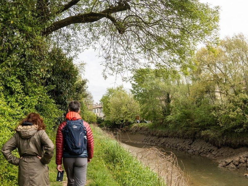
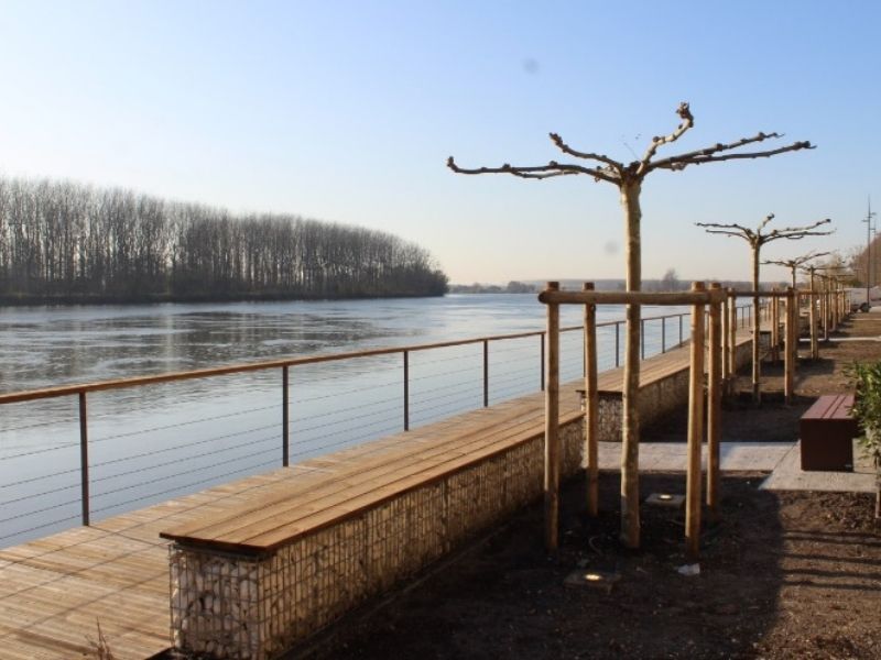
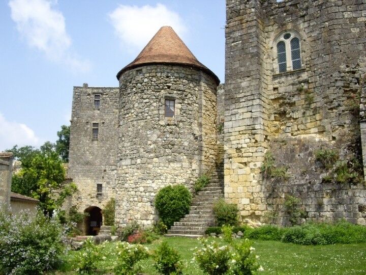
This pretty loop on Le Tourne leads you along the Garonne river and through the vineyards on the hillsides. The view on the medieval castle of Langoiran and the valley below is a must.
Departure from the square Alaric Desmond.
Trasa
Église Saint-Étienne
(9 m)
Miejsce kultu
0,0 km
Au Canton
(38 m)
Rozliczenie
0,4 km
Graman
(9 m)
Sąsiedztwo
1,5 km
Église Saint-Étienne
(9 m)
Miejsce kultu
7,7 km
Trasa
Boucle Langoiran/ Le Tourne
średni
Wędrówka
7,76
km
Le Bourg Sud
(7 m)
Rozliczenie
0,0 km
Le Tourne
(7 m)
Wioska
0,0 km
Langoiran
(9 m)
Wioska
0,0 km
Église Saint-Étienne
(9 m)
Miejsce kultu
0,0 km
Sentier des Écoles
(8 m)
Rozliczenie
0,1 km
Le Bourg Nord
(13 m)
Rozliczenie
0,2 km
Le Bayle
(25 m)
Korytarz/teren
0,3 km
Au Canton
(38 m)
Rozliczenie
0,4 km
Martin Rey
(11 m)
Rozliczenie
0,6 km
Appia pizza
(8 m)
Restauracja
1,2 km
La Fosse
(12 m)
Rozliczenie
1,3 km
Berquin
(25 m)
Rozliczenie
1,5 km
Marche Carrat
(13 m)
Korytarz/teren
1,5 km
Graman
(9 m)
Sąsiedztwo
1,5 km
Le Bourg
(83 m)
Rozliczenie
4,0 km
Le Pied du Château
(12 m)
Rozliczenie
5,2 km
Le Garderà
(45 m)
Rozliczenie
6,0 km
Le Port
(6 m)
Sąsiedztwo
7,0 km
Aire de Jeu
(5 m)
Plac zabaw
7,0 km
Langoiran
(9 m)
Wioska
7,4 km
Le Tourne
(7 m)
Wioska
7,5 km
Le Bourg Sud
(7 m)
Rozliczenie
7,7 km
Sentier des Écoles
(8 m)
Rozliczenie
7,7 km
Église Saint-Étienne
(9 m)
Miejsce kultu
7,7 km
Le Bourg Nord
(13 m)
Rozliczenie
7,7 km
Autor
Dostarczone przez Gironde tourisme
Wycieczkę Boucle Langoiran/ Le Tourne zapewnia outdooractive.com.

Informacje o trasie
Odpowiedni dla wózków inwalidzkich
Tak
Dodatkowe informacje i wskazówki
Dodatkowe informacje
OT de l'Entre-deux-Mers
Wskazówki
Nie ma jeszcze recenzji
Popularne wycieczki w okolicy
-
Boucle Saint Caprais-de-Bordeaux/ Quinsac/ Cambes
średniWędrówka 11,6 km -
Boucle "Entre Garonne et Vignes"
światłoWędrówka 8,05 km -
Boucle Tabanac/ Le Tourne
średniWędrówka 10 km -
Les Pistes de Robin : Martillac d'hier et d'aujourd'hui
Wędrówka 2,20 km -
Boucle des anciennes landes
światłoWędrówka 6,45 km -
Boucle vélo n°17 Baron
światłoJazda na rowerze 16,7 km -
Boucle vélo n°12 Sadirac - Langoiran
światłoJazda na rowerze 26,4 km -
Saint-Emilion - Bordeaux par la piste Roger Lapébie
średniJazda na rowerze 49,7 km -
La Sauve-Majeure grande boucle
światłoWędrówka 14,7 km -
Boucle des vignes
Wędrówka 4,43 km
Wędrówki i tropienie

Ponad 550.000 propozycji wycieczek, szczegółowe mapy i intuicyjny planer tras sprawiają, że aplikacja jest niezbędna dla wszystkich entuzjastów przyrody.

Nie przegap ofert i inspiracji na następne wakacje
Zapisz się do newslettera
Błąd
Wystąpił błąd. Spróbuj ponownie.
Dziękujemy za rejestrację
Twój adres e-mail została dodana do listy mailingowej.
Wycieczki po całej Europie
Austria
Szwajcaria
Niemcy
Włochy
Słowenię
Francja
Holandia
Belgia
Polska
Liechtenstein
Czechy
Słowacja
Hiszpania
Chorwacja
Bośnia i Hercegowina
Luksemburg
Andorra
Portugalia
Islandia
Wielka Brytania
Irlandia
Grecja
Albania
Macedonia Północna
Malta
Norwegia
Czarnogóra
Mołdawia
Kosowo
Węgry
San Marino
Rumunia
Estonia
Łotwa
Białoruś
Cypr
Litwa
Serbia
Bułgaria
Monako
Dania
Szwecja
Finlandia





