


GR® de Pays "Waterfalls, moors and peat bogs"
Throughout these 65 km, you will be able to appreciate the quality of our environment, discover unique natural sites and get to know local traditions through the elements of the built heritage that mark...
Throughout these 65 km, you will be able to appreciate the quality of our environment, discover unique natural sites and get to know local traditions through the elements of the built heritage that mark the route.
Starting signs are installed at the four possible starting points: Bourganeuf, Morterolles, Royère-de-Vassivière and Saint-Junien-la-Bregère.
By completing this great hiking route, you will have the opportunity to find on your way protected sites full of mystery:
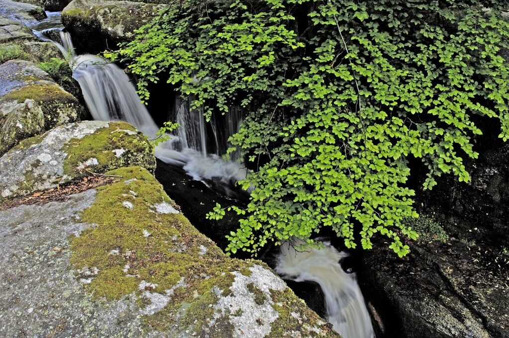
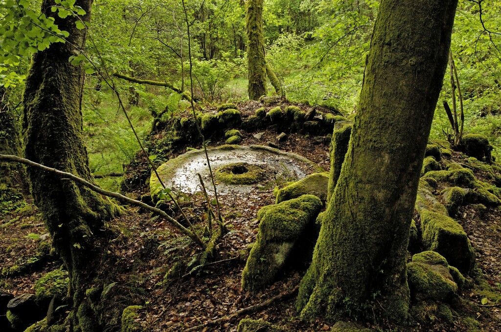
the classified site of the Gorges du Verger (Bourganeuf), the Natura 2000 site of the Etang du Bourdeau (Saint Pardoux Morterolles), the classified site of the stone fields and waterfalls of Augerolles (Saint Pardoux Morterolles), the classified site of the Jarrauds waterfall (Saint Martin Château), the inscribed site of the rocks of Mazuras (Faux-Mazuras),but also the characteristic hamlets of the territory: Chignat (Soubrebost), Morterolles (Saint-Pardoux Morterolles), Haute-Faye and the Bordes (Royère de Vassivière), the Grand Mazuras and Petit Mazuras (Faux Mazuras), or elements of the local built heritage: Haute-Faye hydraulic complex, numerous crosses, washhouses, wells, mills (including the fully restored Augerolles one), etc.
... and finally museums of Art and History: Museum of Electrification (in Bourganeuf) and the Grande Brodée (in Le Breuil - Saint Pardoux Morterolles)
This trail can be completed in several stages depending on the accommodation and food facilities.
On foot in 4 days from Bourganeuf
Red and yellow signposting
Day 1 : Bourganeuf - Saint Junien la Brégère = 13 km
possible return via the Mazuras rocks.2nd day : Saint Junien la Brégère - Royère de Vassivière = 21 km
passage through Montayaud, passage by Saint Martin Château possible return to the Cascades des Jarrauds passage by Les BordesDay 3 : Royère de Vassivière - Morterolles = 18 km
passage through Haute Faye possible return to the peak signal viewpoint. passing through La Chaize, the village and the moor of Augerolles possible return via the discovery trail of the Augerolles waterfalls passing through Freisseix possible diversions via the Natura 2000 site of the Bourdeau pond passage by Morterolles4th day : Morterolles - Bourganeuf = 13 km
passage through Chanteloube, Chignat, Chadoulénas, and Faux Mazuras passing through the classified site of the Gorges du VergerOn foot in 3 days from Royère de Vassivière
Day 1: Royère de Vassivière - Saint Junien la Brégère = 21 km
passage through Les Bordes possible return to the Cascades des Jarrauds passage by Saint Martin Château passage by MontayaudDay 2: Saint Junien la Brégère - Le Breuil = 24 km
passage through Grand Mazuras possible return via the Mazuras rocks passage by Bourganeuf passage by the classified site of the Gorges du Verger passing through Faux Mazuras, Chadoulénas, Chignat and ChanteloubeDay 3: Le Breuil - Royère de Vassivière = 20 km
passage through Morterolles possible return via the Natura 2000 site of the Bourdeau pond passage by Freisseix possible diversions via the discovery trail of the Augerolles waterfalls passing through La Chaize, the village and the moor of Augerolles possible return to the viewpoint of the Signal du Pic passage by Haute FayeHiking shoes are strongly recommended.
Don't forget to take water.
European emergency number: 112
For people with hearing or speech difficulties: 114 by SMS
Office de Tourisme Intercommunal Eaux, Tours de Bourganeuf et Royère de Vassivière
Place du champ de foire - BP 42
23400 Bourganeuf
Tel. 05 55 64 12 20
Email: contact@ot-bourganeuf.com
Popularne wycieczki w okolicy
-
Shoreline path of Vassivière lake
średniWędrówka 26,0 km -
Lake Vassivière lakeside path
światłoMountainbike 26,0 km -
GR de Pays "Cascades, landes et tourbières" GRP65
ciężkiJazda konna 67,1 km -
Circuit Pédestre N°21 CC : "Sentier de découverte de la Rigole du Diable"
światłoWędrówka 2,91 km -
The moors and peat bogs of the Mazure
światłoTrasa tematyczna 7,41 km -
Tour du lac de Vassivière, "Sentier de rives"
średniJazda konna 25,9 km -
Bike loop 50 - Saint-Dizier-Leyrenne and the Thaurion valley
średniDroga rowerowa 19,1 km -
Circuit N°63 CC : Sentier "Histoire et Patrimoine" - Variante Est
średniJazda konna 18,6 km -
La Vélidéale in Creuse: Royère-de-Vassivière / Bujaleuf
światłoKolarstwo długodystansowe 35,0 km -
Circuit N°63 CC : Sentier "Histoire et Patrimoine"
ciężkiJazda konna 27,6 km
Wędrówki i tropienie


Nie przegap ofert i inspiracji na następne wakacje
Twój adres e-mail została dodana do listy mailingowej.