


WasserWegeWinkel (Lippstadt-Soest)
Impressive landscapes, historic cultural monuments, and exciting nature experiences – all this is offered by the explorer route WasserWegeWinkel. It becomes truly relaxing when you combine it as a premium...
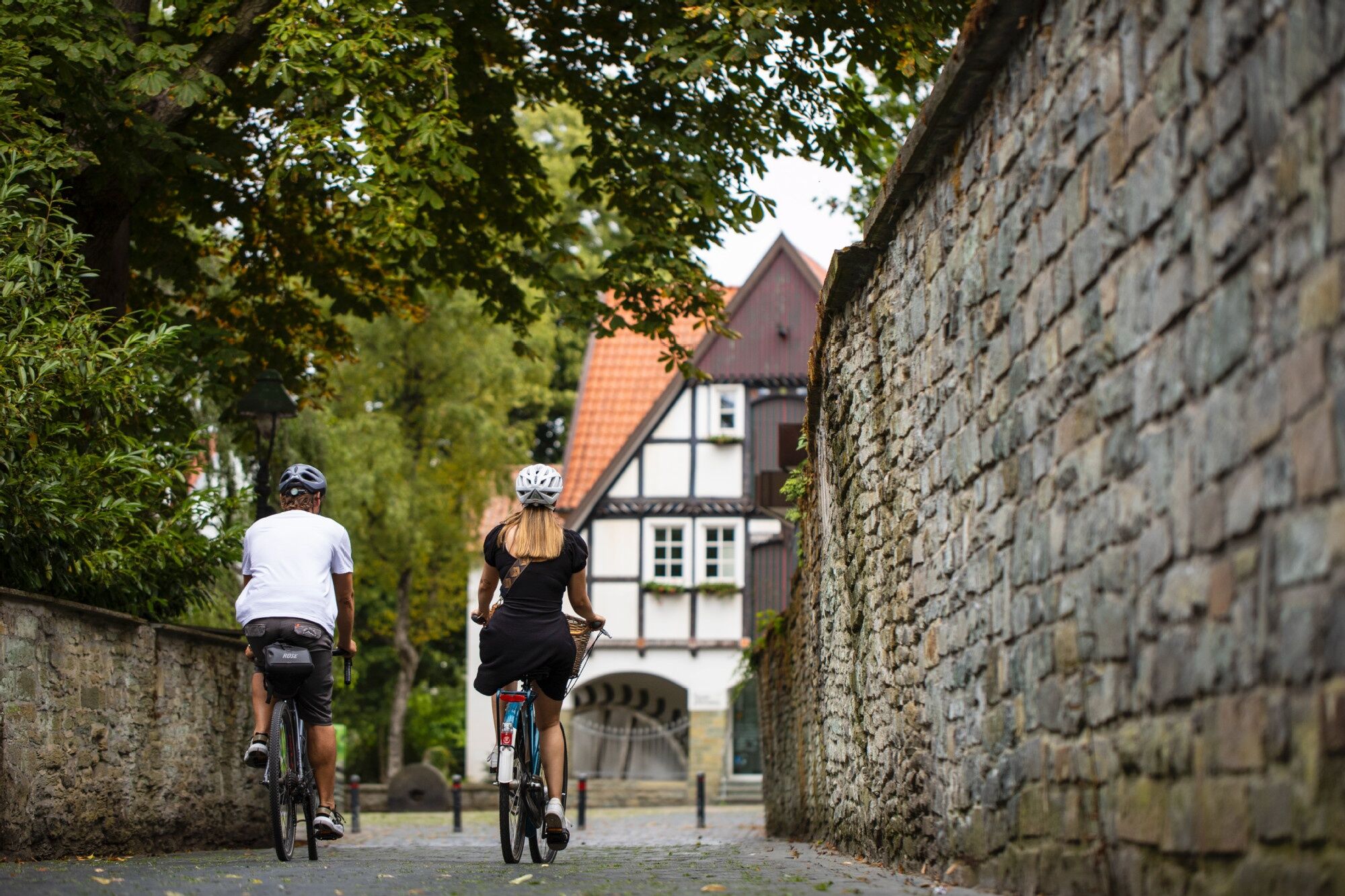
Impressive landscapes, historic cultural monuments, and exciting nature experiences – all this is offered by the explorer route WasserWegeWinkel. It becomes truly relaxing when you combine it as a premium route of the Hellwegbörde cycling holiday region in the Sauerland with arrival and departure by public transport. From the starting point at Soest station, the route goes along the historic old town with its picturesque alleys and charming half-timbered rows out into the picturesque Hellwegbörde.
The first stop on the route is the spa town of Bad Sassendorf, where the motto "better living" is emphasized. Here, various activities can ideally be combined with enjoyment and relaxation. Passing through Lippetal, with options for interesting detours such as the water castle Hovestadt with the restored baroque garden or the pilgrimage basilica St. Ida Herzfeld with the burial crypt in the oldest pilgrimage site in Westphalia, and Wadersloh in the Warendorf district, the route leads through the picturesque Lippe floodplains to Lippstadt, the largest city in the Soest district with around 68,000 inhabitants.
Landmarks such as the Marienkirche, the historic town hall, or the impressive city palace speak of tradition, permanence, and almost 1,000 years of history before reaching the station and the end of the approximately 59-kilometer tour.

Popularne wycieczki w okolicy
Erwitte: Muckenbruch March
średniWędrówka 4,93 km- 4,0
Pilgerweg "Anders gehen", Bad Westernkotten, Regierungsbezirk Arnsberg/Deutschland
Wędrówka 9,74 km Hellweg Radio Bäder-Route
światłoJazda na rowerze 56,4 kmLandesGartenSchau-Route
średniJazda na rowerze 191,0 kmLauschtour Beckum
światłoWędrówka 1,49 kmA8 - Kleine Wanderung für Naturentdecker
światłoWędrówka 5,13 kmLippstadt: Green Corner walking path
średniWędrówka 3,12 kmNature-Saline-Moor Discovery Trail
średniWędrówka 14,2 kmWadersloh, Deutschland
światłoWędrówka 9,57 kmA4 - Kleine Genießerwanderung II
światłoWędrówka 5,93 km
Wędrówki i tropienie


Nie przegap ofert i inspiracji na następne wakacje
Twój adres e-mail została dodana do listy mailingowej.