


Geomantic walk
Geomancy is an ancient Western wisdom tradition that essentially corresponds to Chinese Feng Shui or Indian Vastu Veda. It involves the intuitive perception of the energetic qualities of a place. To revive...
Geomancy is an ancient Western wisdom tradition that essentially corresponds to Chinese Feng Shui or Indian Vastu Veda. It involves the intuitive perception of the energetic qualities of a place. To revive power spots in nature, these insights should be incorporated into the planning of architecture, urban planning, etc.
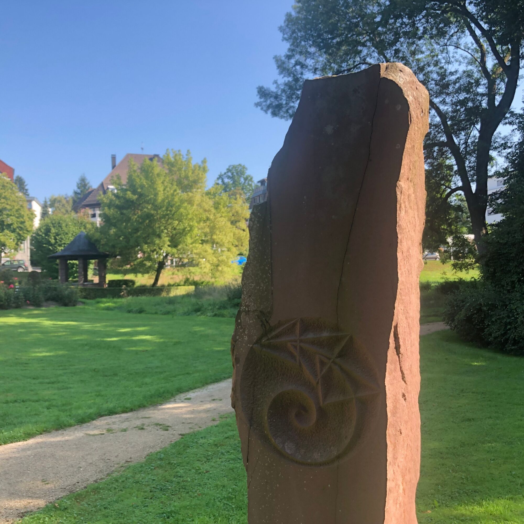
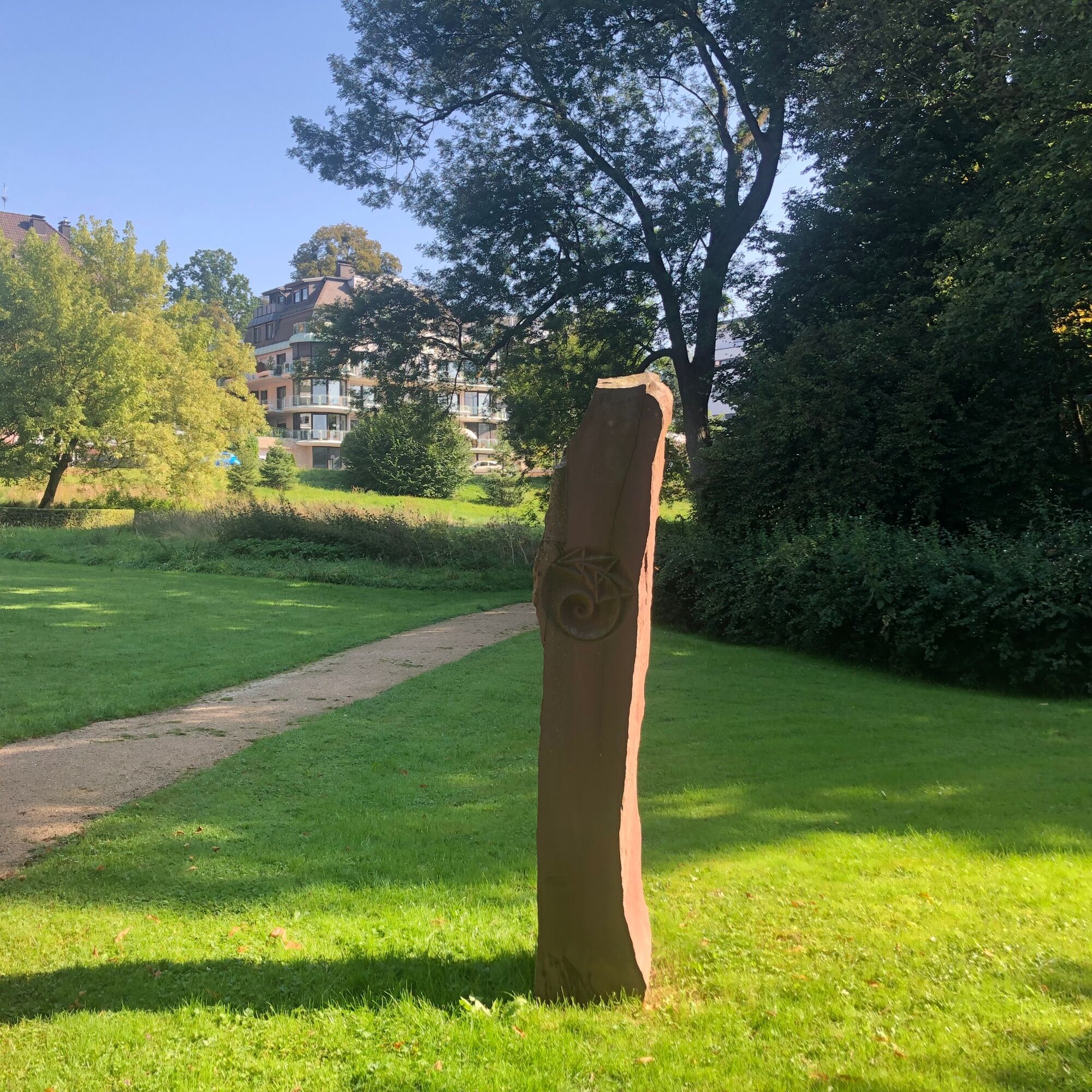
The English architect and geomant Peter Dawkins discovered a complete chakra system and a full life wheel located around the city center of Bad Pyrmont. The eight power points of the life wheel have been highlighted by various architects over the centuries. Some of these markers include the HUFELAND Thermal Baths, the Dunsthöhle, the castle island, or the fountain at Oesdorfer Platz. The center of this life wheel is the Hyllige Born – the foundation stone that made the development of the site as a health resort possible in the first place.


Tak
Remember the flyer that accompanies you on the way.
There are no safety instructions.
Arrival by train
From Hanover: S5 from Hanover central station towards Paderborn (travel time approx. 1 h to Bad Pyrmont)
From Paderborn: S5 from Paderborn central station towards Hanover airport (travel time approx. 50 min to Bad Pyrmont)
Arrival by car
(A 2) Dortmund - Hanover to exit Bad Eilsen, direction Rinteln, Barntrup, Bad Pyrmont
(A 44) Dortmund - Kassel to exit Wünnenberg - Haaren, Paderborn, B1 towards Hameln, Barntrup, Bad Pyrmont
(A 7) Hanover - Kassel to exit Seesen, B64 towards Hameln, Bad Pyrmont
From Bad Pyrmont station, city buses regularly run towards the center (lines 61/62).
Bus lines 61 and 62 stop at the "Untere Hauptallee" stop, which is within walking distance from the tourist information office.
Directly opposite the tourist information office, bus line 63 stops at the "Europa-Platz" stop.
A spacious parking lot is located directly in front of the tourist information office.
The walk can be experienced alone or as a guided round walk. A guided walk through the Staatsbad Pyrmont takes place annually in June, around the summer solstice. You can find the current date in the event calendar of the Staatsbad Pyrmont.
Popularne wycieczki w okolicy
-
3,7
Naturparktrail Südteil-Schwalenberger Wald und Mörth
średniWędrówka 17,1 km -
4,0
Nature park hiking trail “Great Pyrmonter Mountain Route,” 15.5 km
ciężkiWędrówka 15,3 km -
4,0
Durch das Habichtstal (Po 2)
średniWędrówka 7,10 km -
Emmer-Radweg
średniJazda na rowerze 47,7 km -
5,0
Ottensteiner Plateau
Jazda na rowerze 28,0 km -
3,0
NaturZeitReise
ciężkiTrasa tematyczna 59,8 km -
Weserbergland-Weg, 8. Etappe: Bodenwerder bis Lüntorf
średniWędrówka 18,9 km -
Wide views and sunny heights (Ot 2)
średniWędrówka 10,1 km -
Niesetalweg
średniWędrówka 25,1 km -
Lügder Mythenweg
średniTrasa tematyczna 6,20 km
Wędrówki i tropienie


Nie przegap ofert i inspiracji na następne wakacje
Twój adres e-mail została dodana do listy mailingowej.