


From Scheibbs to the lonely tree
We start in front of the town hall and turn right into the narrow Rathausgasse, a pedestrian shortcut to the Gürtel. Here we first go left and at the next opportunity right into Berggasse. Our path leads...
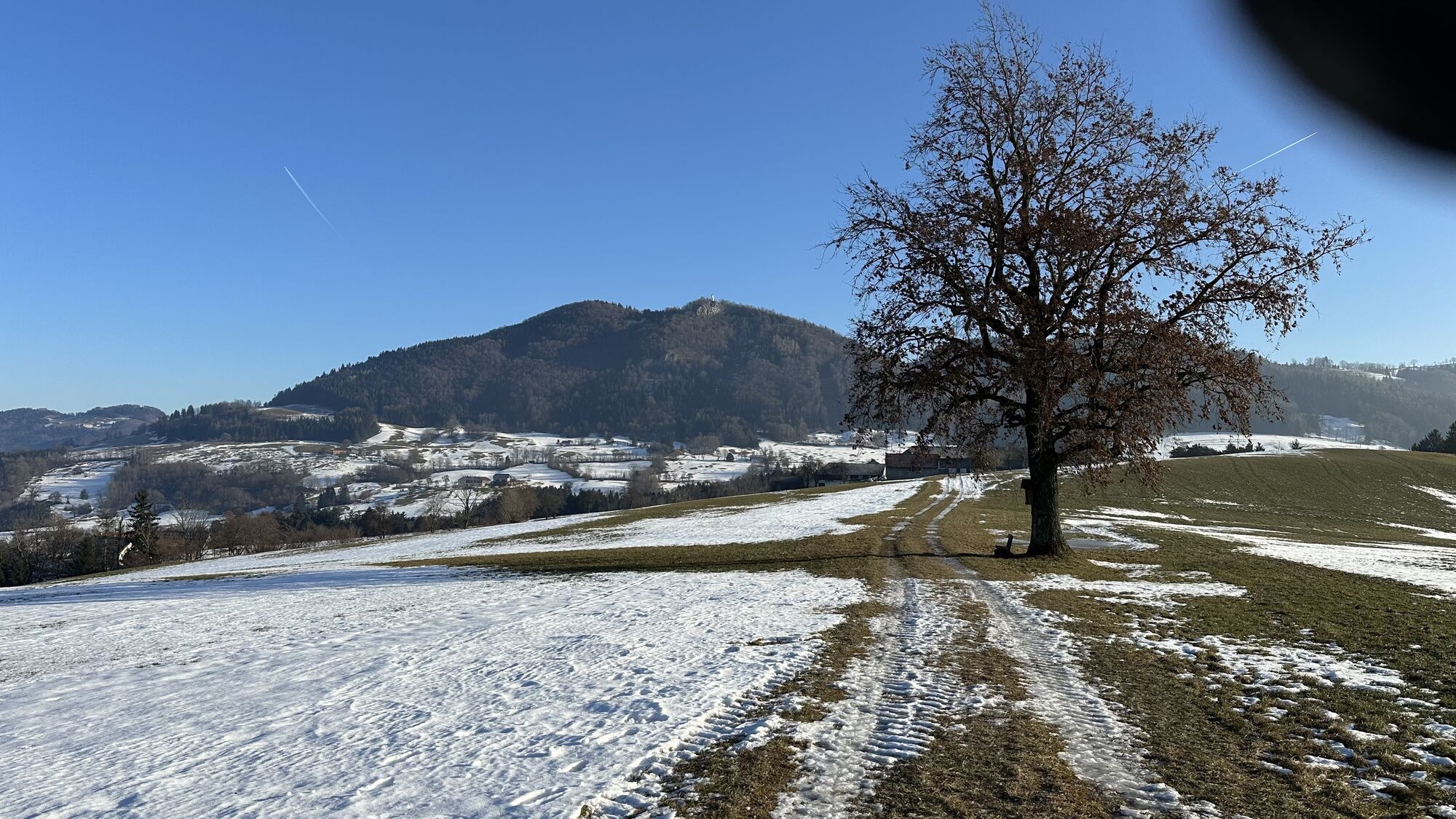
We start in front of the town hall and turn right into the narrow Rathausgasse, a pedestrian shortcut to the Gürtel. Here we first go left and at the next opportunity right into Berggasse. Our path leads through a cozy residential area along Blassensteinweg steadily uphill to Ginning at the Pastelöd house. Here our route turns slightly left and descends again toward Sollböck. We cross the federal road and then go straight ahead on a forest path always along the mountain ridge to our destination at the lonely tree. The return route leads straight ahead through the Armenwald to the Punzengrub house. Now we follow the Hochweinberg farm track downhill, past the Windhag house and the organic cider tavern Fenzl with its beautiful orchard meadow back into the residential area. We are now on the Hochweinberg path which leads us back into the town. Along the elongated Feldgasse, past the state clinic, to the main street and back to our starting point at Rathausplatz.

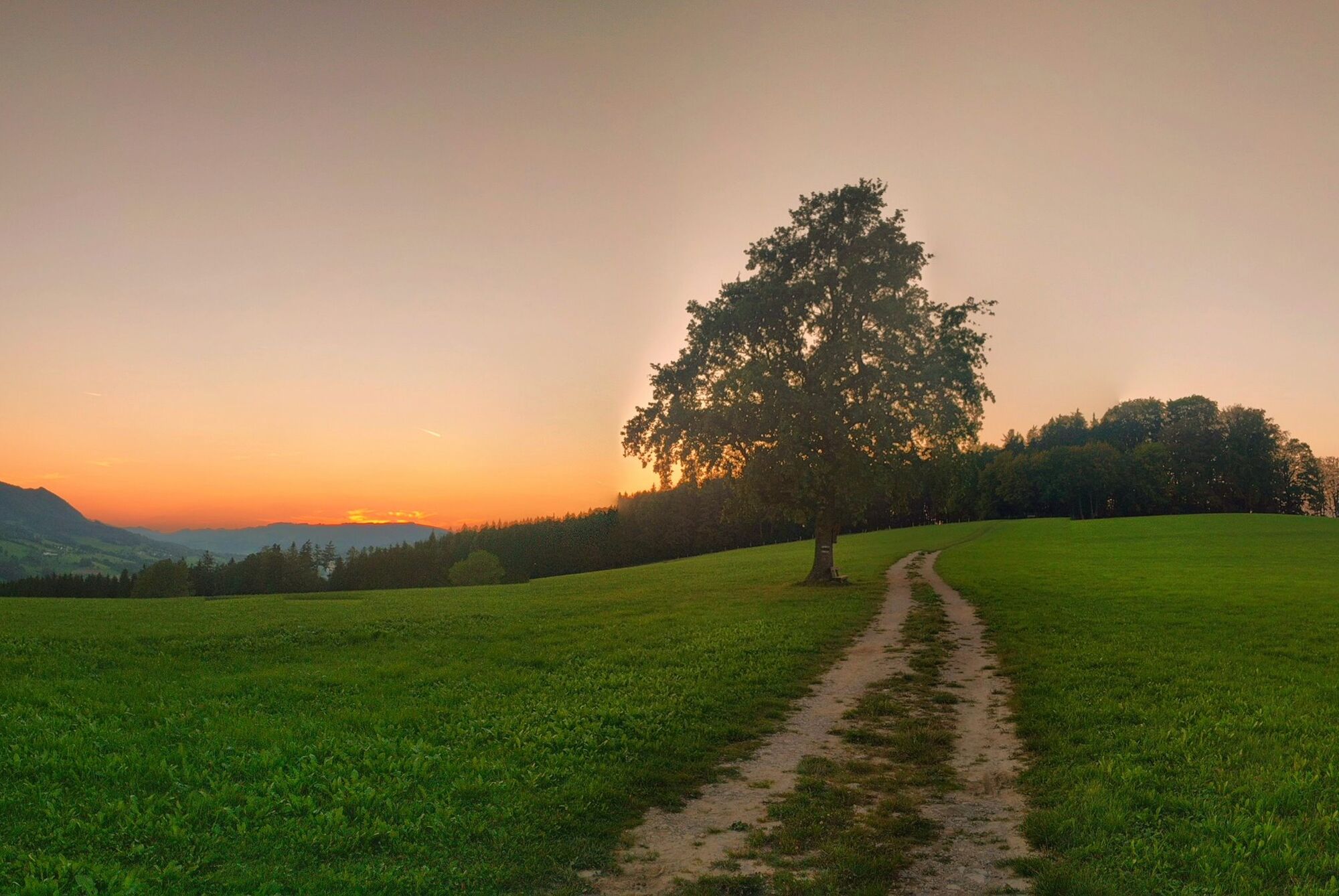
Rathausplatz – Burgerhofstraße – Gürtell – Berggasse – Ginning – Pastelöd – Cross the street – Corner houses – Lonely tree – through Armenwald – Punzengrub – Hochweinberg farm track – Windhag – Organic cider tavern Fenzl – Hochweinberg path – Feldgasse – Main street – Rathausplatz
Tak
Sturdy footwear is recommended
From the north via the A1 motorway, motorway exit Ybbs/Kemmelbach, then federal road B25 to Scheibbs, from the southeast via federal road B28 and from the south via federal road B25
By ÖBB Erlauftalbahn to the final stop Scheibbs.
By postbus or Mostviertel line.
Timetables at www.vor.at
Please observe the parking guidance system at the Scheibbs city entrances.
Short-term parking zone from Monday to Saturday around noon in the city center – parking duration 2 hours.
Municipality of Scheibbs
Rathausplatz 1, 3270 Scheibbs
07482/42511-63
kulturservice@scheibbs.gv.at
Please check the opening hours of the organic cider tavern Fenzl on Heuberg before the hike. For larger groups, the establishment also opens outside regular hours by prior arrangement.
Popularne wycieczki w okolicy
- 4,7
Trefflingfall über Hochbärneckhütte
średniWędrówka 12,2 km - 4,5
Purgstall Route 3 entlang der Erlauf und Umgebung
światłoWędrówka 12,5 km - 4,5
Gföhler Alm - Rainstock - Schleierfall
średniWędrówka 13,6 km - 4,9
Erlaufschlucht
światłoCanyoning 4,58 km - 3,7
Auf den Blassenstein
światłoWędrówka 8,30 km - 4,2
Grüntalkogelhütte
światłoWędrówka 5,11 km - 4,4
Kappleralm Runde
światłoWędrówka 6,65 km - 4,6
Hochbärneckrunde
średniWędrówka 10,1 km - 4,1
Blassenstein - Greinberg - Jelinekwarte
średniWędrówka 11,5 km - 3,7
GeBIERgsweg Gaming
światłoWędrówka 6,51 km
Wędrówki i tropienie


Nie przegap ofert i inspiracji na następne wakacje
Twój adres e-mail została dodana do listy mailingowej.