







Planeten-Rundweg Weiten

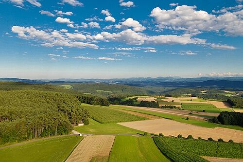
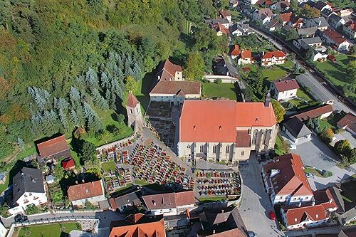
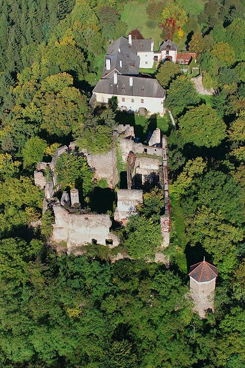

From the Gewerbebaum, we walk the first section of the trail along the B216 toward Pöggstall, starting with the planet “Sun.” We then pass “Mercury, Venus, Earth, Moon, Sun, Mars, and Jupiter.” We follow the main road until we cross the Weitenbach. Here we turn left and then immediately right again after 20 meters, and soon pass the municipal maintenance yard. Here, the trail turns into a beautiful meadow path, and we soon come upon the planet “Saturn”—directly below Mollenburg Castle. We hike straight uphill along the meadow path (parallel to Dr.-Jörg-Mauthe-Weg) until we reach the road leading to Mollendorf. Here, we turn left and head uphill, soon crossing the Dr.-Jörg-Mauthe-Weg. We follow the road for about 200 meters, then turn right onto a dirt road and reach the Ossertfelder. Here, we can enjoy views of the beautiful rolling hills of the Weitentals. Soon we come to the next planet, “Uranus.” Here we follow the dirt road (a left turn) until we reach a small paved road. At this point, we turn right. At the next intersection, we continue straight ahead, always following the paved road. Shortly thereafter, we reach the next planet, “Neptune,” where we can take a leisurely break on a bench near some apple trees. At the next Y-intersection, the path turns into a dirt road. We take the right-hand path, which leads us downhill. Here we can already see the first houses of “Am Schuß.” Soon we come to a bench, near which an interesting loess cliff rises up. After a few meters, we spot a small pond down to the left. At the next bench, the path turns back into an asphalt road, and we follow it downhill in a gentle left curve. We now reach the sawmill after a final right curve. Right at the sawmill, we keep to the left and soon cross the B216. Here, right in front of the “Weitentalhof” inn, we reach our final planet, “Pluto.” From here, we walk about 2 km along the Weitenbach stream and the B216 back to the Gewerbebaum in Weiten.
Hiking boots, rain gear, and drinking water. The Wachau hiking map is available from Donau Niederösterreich Tourismus, www.wachau.at
Wachau Mountain Rescue Emergency Number: 140
Take the A1 to Melk, then the B3 to Weitenegg; there, turn right onto the B216 toward Leiben/Pöggstall and continue to Weiten.
From Monday through Friday, buses on Route 790 run between Melk and Pöggstall. (Timetable 790)
On weekends, the Jauerlinger on-demand bus operates. It connects the Jauerlinger Nature Park communities (Aggsbach, Emmersdorf, Maria Laach, Mühldorf, Raxendorf, Spitz, and Weiten). The on-demand bus must be requested by phone at +43(0)810/810278.
Route planner: www.vor.at. A detailed“Mobil in der Wachau” schedule is available from Donau Lower Austria Tourism.
Weiten, town center along the B 216
Person responsible for the content of this tour
Wachau-Nibelungengau-Krems Valley ("Krems Valley" in German)
For dining and lodging, we recommend Gasthaus Familie Karl Fischl, 3653 Weiten 22, Phone: 0043/2758/8224, and the “Zur Post” Inn—run by the Leopold Kremser family, 3653 Weiten 59, Phone: +43(0)2758/8202, the “Almwirtin” Inn—Elisabeth Schilling, 3653 Weiten, Jasenegg 8, Phone: +43(0)2758/8237, and Weitentalhof Inn, the Blauensteiner family, Am Schuss 7, 3653 Weiten, Tel. & Fax: +43(0)2758/8201, www.weitentalhof.at.
In Weiten, it's worth visiting the Jindra family's sundial workshop and Gerda Gassner's camel riding school, www.sonnenuhren.com; www.kamelreiten.com
Popularne wycieczki w okolicy
-
4,0
Yspertal: Druidenweg - Ysperklamm
średniWędrówka 9,56 km -
4,6
Maria Langegg - Rote Wand - Hoher Stein - Kastlkreuz
średniWędrówka 11,4 km -
4,6
Ausgedehnte Peilsteinrunde
średniWędrówka 13,7 km -
4,5
Durch die Steinwandklamm von Maria Taferl aus
światłoWędrówka 8,26 km -
4,9
LAIMBACH Ostrong Peilstein 20220716
średniWędrówka 7,70 km -
3,9
Spitz a. d. Donau Jauerling Schwallenbach retour 16.04.2016
średniWędrówka 20 km -
3,9
Spitz - Buchberg - Runde
średniWędrówka 9,60 km -
4,5
Welterbesteig Wachau 08: Emmersdorf-Melk
światłodługodystansowy szlak pieszy 9,90 km -
4,5
AGGSTEIN Ruine, Aggstein, Druidentürme und zurück 20241019
średniWędrówka 7,50 km -
4,0
Rote Wand und Hoher Stein
średniWędrówka 7,80 km
Wędrówki i tropienie


Nie przegap ofert i inspiracji na następne wakacje
Twój adres e-mail została dodana do listy mailingowej.





