


Small circular route Emmersdorf (No. 15)
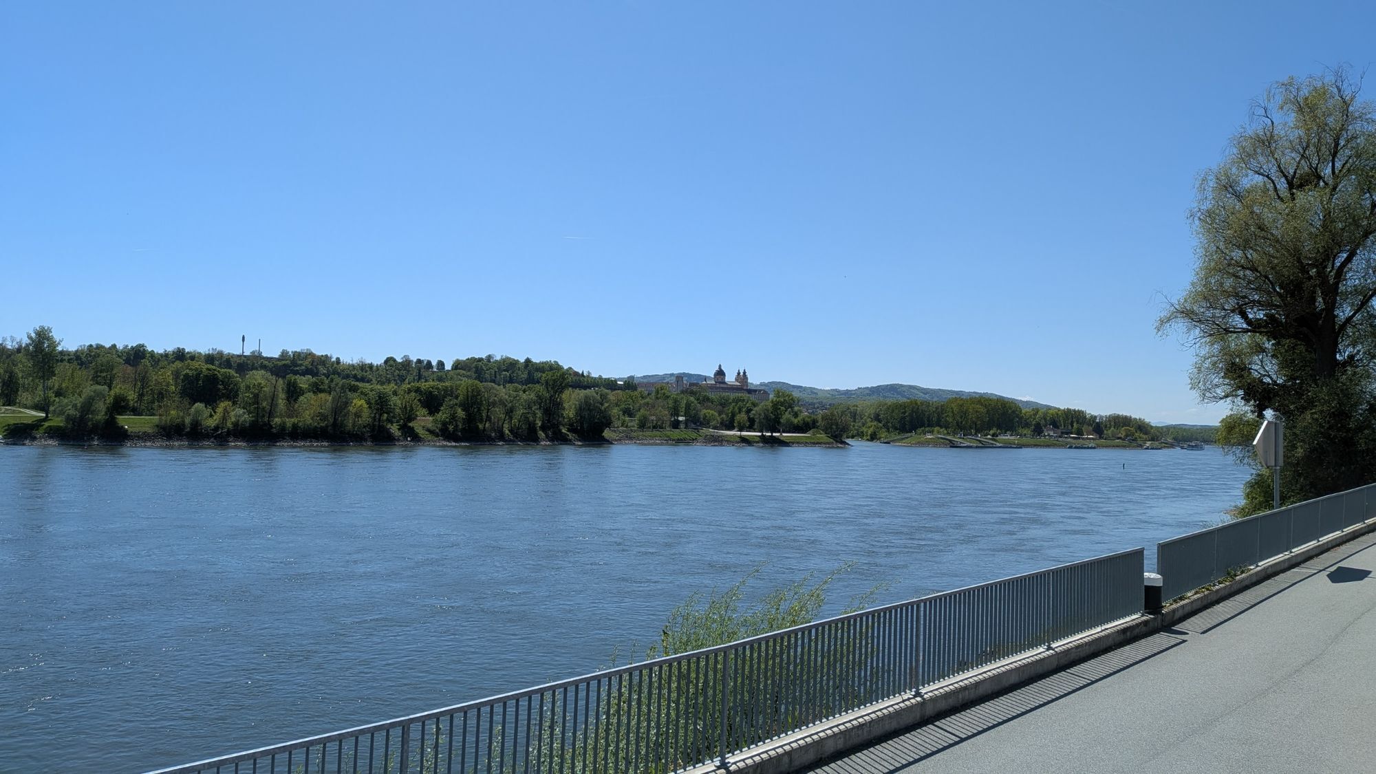
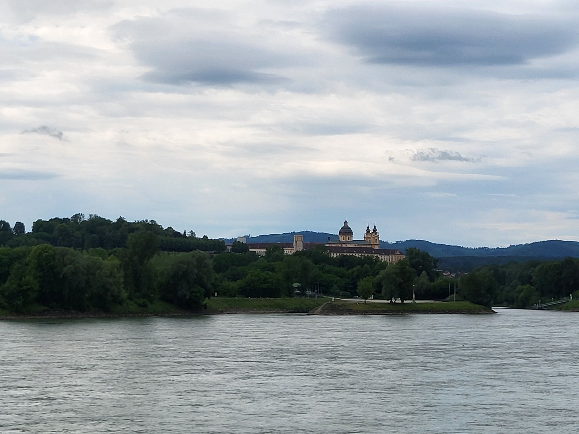
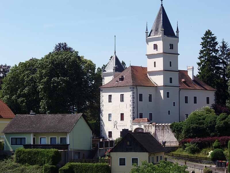
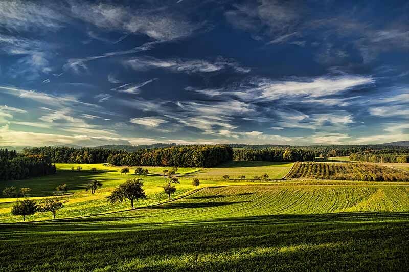
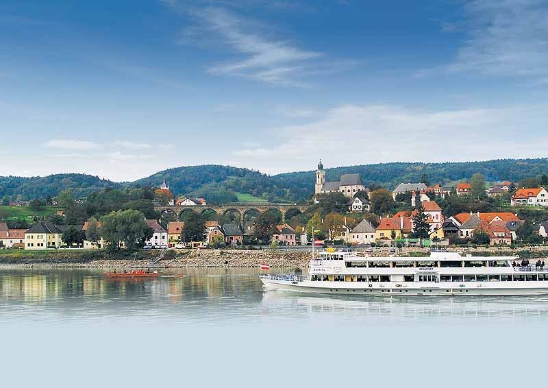
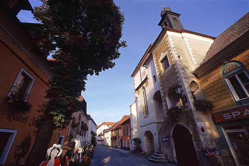
From Georg Prunner Square, we head east past "Keramik Kummer" and turn left at the next intersection, go under the viaduct, and now follow the "Rote Kreuz Street" to the outskirts of Emmersdorf. On the right side of the path lies Rothenhof Castle. At the "Rote Kreuz" (254m), a bench under the chestnut tree invites us to enjoy the magnificent view. Here we follow the left asphalt road into the village of Hain and pass on the right a wayside shrine with a walnut tree and bench. On the right, high in the forest, lies the Dachbergwarte (a wonderful viewpoint). In Hain, we stay right towards Pömling/Gh Langthaler until we reach the outskirts of Hain or the beginning of St. Georgen. After about 30 m, we go left downhill and immediately right into a small street, which we follow straight at the next intersection. After a right curve, we see a small chapel on the left and go straight through a short, narrow alley. Then we turn left (following the long-distance hiking trail Jauerling-Runde) and now leave St. Georgen straight over a larger street. Shortly thereafter, the asphalt road ends and after about 100 m the path branches right into a hollow way. We follow this until we reach a clearing and after a right curve see a small cross on an acacia tree on the left. Soon it goes back into the forest ("Propermaiß") and after about 300 m we turn left into a small forest path, crossing the next intersection straight ahead. At the following fork, we keep right and soon see a sign "Saure Lacke" on a pine to the right. Now we cross a small clearing with a small fenced wooden hut (left) and shortly afterwards reach a street we follow twice left to the hamlet of Pömling. Right at the beginning of the path, a bench between two birches invites you to take a short break. In Pömling, at the first intersection, we follow the right road towards Maria Laach/Fahnsdorf until the edge of the forest, where we meet a larger street which we follow right downhill about 20 m to then hike left through a pine-spruce forest. After about 150 m, we see a board attached to a pine (left, "Schinderreut") where the path splits into four. We choose the second from the right (clearly more used path). On this path, which leads gently downhill, we stay until the next large intersection where the small and the large Emmersdorf circular routes meet. At the next fork, we keep straight and already see the first houses of Mödelsdorf. At the bell tower, we turn right and here meet the long-distance trail Welterbesteig Wachau (white "W" color marking), which we now follow all the way to Emmersdorf. Soon we leave Mödelsdorf and after about 300 m turn left at the large pear tree, the next also left uphill slightly along the forest edge until we discover a cross and a bench on the right. Then we go right slightly downhill, then 2x straight ahead (always downhill). At the next Y-intersection, turn right; shortly afterwards, there is a "Bildbuche" on the left side of the path. About 300 m later, the path makes a left turn, at the apex of which the small circular route leads straight downhill into a small path. Immediately after, there is a bench on the left. We follow the small path to the forest edge, where at the last oak we enjoy a charming view of Schönbühel Castle (left) and Emmersdorf with church and Rothenhof Castle (straight ahead). Now we finally leave the forest and hike along a wonderful meadow path that merges into a small asphalt road in Emmersdorf until its end. At the T-junction, turn right and shortly afterwards 2x left into Josef Kaiserlehner-Weg, which leads to the fortified church of St. Nicholas. Past the school, go straight at the next intersection past the cemetery. We cross the Wachau Railway tracks and then follow the Kolomanistiege (231 m) downhill. Under a "house tunnel," we reach the old town center onto Market Street (207 m). Diagonally opposite on the corner is the old ship master's house from the 16th century. From here, we go west into the next side alley and a few meters later are back at Georg Prunner Square, our starting point.
Hiking boots, rainproof clothing, drinking water, as well as the Wachau hiking map and the annual program of the nature park "Nature.Wine.Hiking." including the Heurigen calendar, are available at Donau Niederösterreich Tourismus, www.wachau.at
Emergency call mountain rescue Wachau: 140
A1 to Melk and via the B3a and B3 to Emmersdorf or via the S5 or S33 to Krems and via the B3 to Emmersdorf.
Emmersdorf can be reached by bus line 715 on an hourly basis from the Melk and Krems train stations, timetables: www.vor.at. Other arrival and departure options: Wachau Railway, operating between Emmersdorf and Krems, www.wachaubahn.at or the Danube shipping www.ddsg-blue-danube.at. A Nextbike rental station is located in Emmersdorf at the roundabout on the B3. www.nextbike.at
Emmersdorf, parking lot roundabout B3
As dining and overnight accommodation options, we recommend the certified Best of Wachau businesses: Bauer und Wirt Langthaler, www.gasthaus-langthaler.at, tel +43(0)2752/71427; Hotel & Restaurant Donauhof ****, www.pichler-wachau.com, tel +43(0)2752/71777; Hotel & Restaurant "Zum Schwarzen Bären" ****, www.hotelpritz.at, tel +43(0)2752/71249. Further opening times can be found at www.bestof-wachau.at
Popularne wycieczki w okolicy
-
4,5
Durch die Steinwandklamm von Maria Taferl aus
światłoWędrówka 8,26 km -
4,5
Maria Langegg - Rote Wand - Hoher Stein - Kastlkreuz
średniWędrówka 11,4 km -
3,9
Spitz a. d. Donau Jauerling Schwallenbach retour 16.04.2016
średniWędrówka 20 km -
4,5
Welterbesteig Wachau 08: Emmersdorf-Melk
światłodługodystansowy szlak pieszy 9,90 km -
4,0
Rote Wand und Hoher Stein
średniWędrówka 7,80 km -
4,4
AGGSTEIN Ruine, Aggstein, Druidentürme und zurück 20241019
średniWędrówka 7,50 km -
4,6
Welterbesteig Wachau 06: Maria Laach-Aggsbach Markt (Naturpark Jauerling-Wachau)
światłodługodystansowy szlak pieszy 7,04 km -
4,2
Spitz - Jauerling - Mühldorf
średniWędrówka 12,4 km -
4,0
Welterbesteig Wachau 07: Aggsbach Markt-Emmersdorf (Naturpark Jauerling-Wachau)
światłodługodystansowy szlak pieszy 14,6 km -
5,0
Wachauer Radtour
światłoJazda na rowerze 64,7 km
Wędrówki i tropienie


Nie przegap ofert i inspiracji na następne wakacje
Twój adres e-mail została dodana do listy mailingowej.