







Great mountain circuit route

Our 3.5 km long hike leads us from the idyllic village of Trandorf right past the historic church of Saint Ulrich with its valuable bell (1504) and its baroque high altar featuring a portrait of Ulrich...
Our 3.5 km long hike leads us from the idyllic village of Trandorf right past the historic church of Saint Ulrich with its valuable bell (1504) and its baroque high altar featuring a portrait of Ulrich by Antonius Haeml (1747). Then it goes over a forest road, from which we repeatedly enjoy wonderful views of Trandorf. We hike through spruce and pine forests in a loop back to Trandorf, where we pass by a yellow house with a fountain on the village street commemorating the 60th anniversary of the reign (1848-1908) of Emperor Franz Josef. From there, it goes back to the car park.
The hiking trail is uniformly and continuously marked with yellow signs.
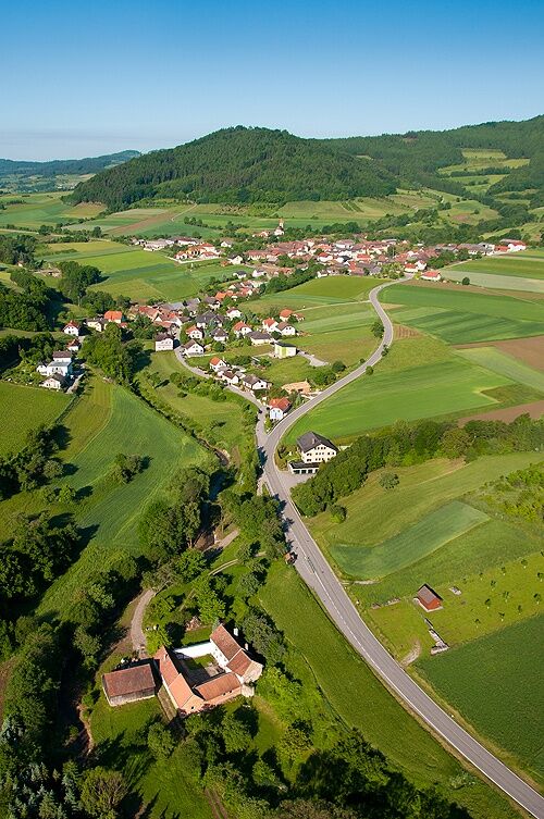
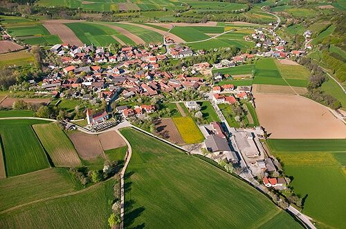
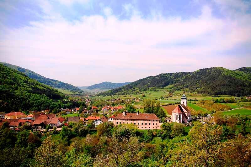

Standing in front of the "Trandorf" location sign, we walk left on the village street past the kindergarten and after about 50 m turn right into a small asphalt road called "Brandstatt" and before the church turn left slightly uphill towards Saint Ulrich and at the next Y-junction turn left onto the asphalt road, which soon leads into a spruce forest. In the forest, at the large Y-junction, we turn right and follow the Jauerling circular long-distance hiking trail (yellow color marking). Soon we pass a bench under a birch tree, inviting us to rest and from where we can enjoy a beautiful view of Trandorf, gently nestled among meadows, fields, and wooded hills. We continue on the main path for about 80 m straight ahead; then it goes right onto a soft forest path through spruce and pine forest gently downhill. At the forest edge, we again have a romantic view of Trandorf. At the next junction, we keep right downhill and immediately after that straight ahead. The next time, we turn right downhill, pass a bench, and always follow the beginning asphalt road straight ahead until we reach a T-junction. There we sharply follow the mountain bike trail to the right along a lower-lying small stream to our right. At the next opportunity, after about 100 m, we keep left downhill until we reach the village street again. On the left is a small yellow house with a fountain erected in memory of the 60th anniversary of the reign (1848-1908) of Emperor Franz Josef. Here we follow the village street to the right and return to the parking lot at the Trandorf fire station.
Hiking boots, rainproof clothing, and drinking water. The Wachau hiking map is available from Donau Niederösterreich Tourismus, www.wachau.at
Emergency call Mountain Rescue Wachau: 140
Take the A1 to Melk and then the B3 to Spitz or take the S5 or S33 to Krems and then the B3 to Spitz. From Spitz, take the B217 to Mühldorf (direction Ottenschlag). In Mühldorf, just before the town exit, turn left towards Trandorf.
Unfortunately, Trandorf is difficult to almost impossible to reach by public transport. As an alternative, taxi companies are available: Taxi Bernhardt from Spitz, Tel.: 02713/2222 or Taxi Stummvoll from Mühldorf, Tel.: 0676/6242892.
Trandorf, fire station
In the center of Trandorf is the cafe/restaurant "In der Kurve", owner Heinz Gafko, Tel. 0664/3449586. As another dining and accommodation option, we recommend the certified Best of Wachau establishment in the main town Mühldorf: Gasthof Weißes Rössl ***, www.7handl.at, Tel +43(0)2713/8257.
More opening times and businesses in neighboring towns can be found at www.bestof-wachau.at
Uzyskaj wgląd
Zawsze na żywo z ponad 9 500 kamer internetowych. bergfex Jako użytkownik Pro, możesz teraz zobaczyć odpowiednie kamery internetowe dla wielu wycieczek w aplikacji wycieczki od. Pozwala to na bezpośredni podgląd aktualnych warunków.
Popularne wycieczki w okolicy
-
4,4
Welterbesteig Wachau 03: Weißenkirchen-Spitz
światłodługodystansowy szlak pieszy 10,4 km -
4,7
Rundhöhenwanderweg Weißenkirchen in der Wachau - Schildhütten - Cholerakreuz - Weißenkirchen
światłoWędrówka 8,75 km -
4,7
Wachau: Seekopf - Hirschwand
średniWędrówka 10,4 km -
4,5
Panoramaweg Weissenkirchen
światłoWędrówka 5,04 km -
4,5
Maria Langegg - Rote Wand - Hoher Stein - Kastlkreuz
średniWędrówka 11,4 km -
4,5
Seekopf und Hirschwand
średniWędrówka 2,83 km -
4,8
Wachau: Panoramaweg Rossatz
światłoWędrówka 10,8 km -
4,5
Hirschwand und Seekopf
średniWędrówka 9,09 km -
3,9
Spitz a. d. Donau Jauerling Schwallenbach retour 16.04.2016
średniWędrówka 20 km -
3,9
Spitz - Buchberg - Runde
średniWędrówka 9,60 km
Wędrówki i tropienie


Nie przegap ofert i inspiracji na następne wakacje
Twój adres e-mail została dodana do listy mailingowej.





