







Waldlehrpfadwanderung
The market town of Dietmanns lies 625 m above sea level on the southern slope of the Buchberg in a hilly, wooded area. From the Buchberg and the Predigtstuhl, which at 718 m is the highest elevation in...
The market town of Dietmanns lies 625 m above sea level on the southern slope of the Buchberg in a hilly, wooded area. From the Buchberg and the Predigtstuhl, which at 718 m is the highest elevation in the area, you have a wonderful view on a clear day, reaching as far as the Schneeberg, the Rax and southern Moravia. Magnificent coniferous forests and the gently undulating landscape invite nature lovers away from mass tourism to go hiking and cycling. Extensive, well-marked hiking trails are available for hikers, while cyclists can enjoy themselves on well-maintained roads with little traffic. You will find peace and relaxation in our pleasant climate. Clean air, pure water, green forests, charming meadows and fields are the ambience for active recreation.


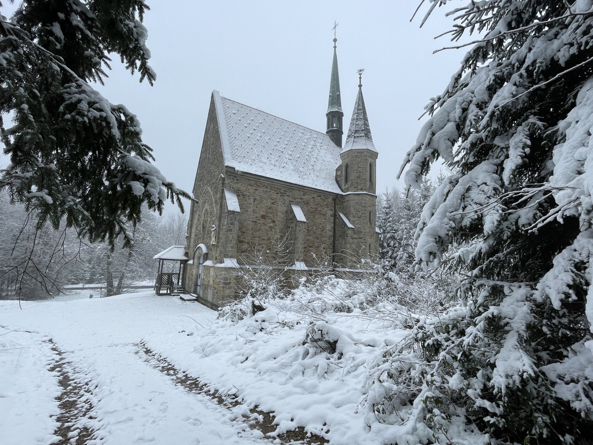
You’ll start your hike from the parking lot in front of the town hall, heading south, cross the “Hauptstraße,” and follow the “Mühlweg” into the “Graben.” You’ll cross the stream and face a short climb up to the farm road. Continue along the farm road to the right until you reach the first houses of the Neudietmanns district. After the third house, take a hairpin turn onto “Sechshauserstraße.” At the end of “Sechshauserstraße,” turn left toward Götzles. After about 300 m, you’ll reach the starting point of the forest nature trail. Follow this trail until you reach the Kuenringer Long-Distance Hiking Trail 611, which will take you to the Ulreichs Memorial Stone and the Bründl Chapel. After the Bründl Chapel, cross the street, keep to the right, and walk a short distance toward Dietmanns. At the parking lot, turn left onto the forest path and follow the long-distance hiking trail. At the large intersection, turn right. You’ll pass the deer enclosure and reach the end of the forest nature trail at “Hollenbacher Straße.” In Dietmanns, turn left at the town sign onto “Scherzerberg” and continue onto “Alte Straße.” Follow this road until you reach the intersection with “Buchbergstraße.” Take “Buchbergstraße” back to the starting point of the hike.
Vienna: A 22 – Stockerau – B 4 to Horn – B 2 to Göpfritz an der Wild – L 55 to Groß Siegharts – L 60 to Dietmanns
Linz: A 7 toward Freistadt – B 310 to Freistadt – B 38 to Karlstift – B 41 to Schrems – B 2 to Vitis – B 36 to Waidhofen/Thaya – L 60 to Dietmanns
WALDVIERTEL Tourism
3910 Zwettl, Sparkassenplatz 1/2/2
(T) +43(0)2822/54109, Fax Ext. 36
Toll-free within Austria:
(T) +43(0)800/300 350
(E) info@waldviertel.at
(I) www.waldviertel.at
Dietmanns Municipality
3813 Dietmanns, Schulgasse 13-15
T 02847/24 64, F Ext. 10
gemeinde@dietmanns.at
www.dietmanns.gv.at
Bründl Chapel
Ulreich Memorial Stone
Kronentor
Schiel Park
Collection of Oak Specimens
Uzyskaj wgląd
Zawsze na żywo z ponad 9 500 kamer internetowych. bergfex Jako użytkownik Pro, możesz teraz zobaczyć odpowiednie kamery internetowe dla wielu wycieczek w aplikacji wycieczki od. Pozwala to na bezpośredni podgląd aktualnych warunków.
Popularne wycieczki w okolicy
-
4,5
Teiche-Radroute (Strecke 2020) Niederösterreich
średniJazda na rowerze 48,7 km -
4,5
Thayarunde Waldviertel - 3. Etappe
światłoKolarstwo długodystansowe 28,2 km -
3,7
Knödel-Landradweg
średniJazda na rowerze 42,6 km -
5,0
Ritterweg Ruine Kollmitz Raabs an der Thaya, Niederösterreich
Wędrówka 12,0 km -
5,0
Thayarunde Slavonice-Waidhofen-Göpfritz
średniJazda na rowerze 47,5 km -
5,0
Wasser und Felsen
światłoWędrówka 8,31 km -
3,0
Thayarunde Waldviertel - 1. Etappe
światłoKolarstwo długodystansowe 20,9 km -
Thayarunde 5.Etappe
średniJazda na rowerze 47,2 km -
2,0
Seebsbachrunde
średniJazda na rowerze 28,3 km -
Natur und Kultur
światłoWędrówka 2,75 km

Wędrówki i tropienie


Nie przegap ofert i inspiracji na następne wakacje
Twój adres e-mail została dodana do listy mailingowej.





