


Thayatalweg 630 - 8th stage: Karlstein - Raabs/Thaya

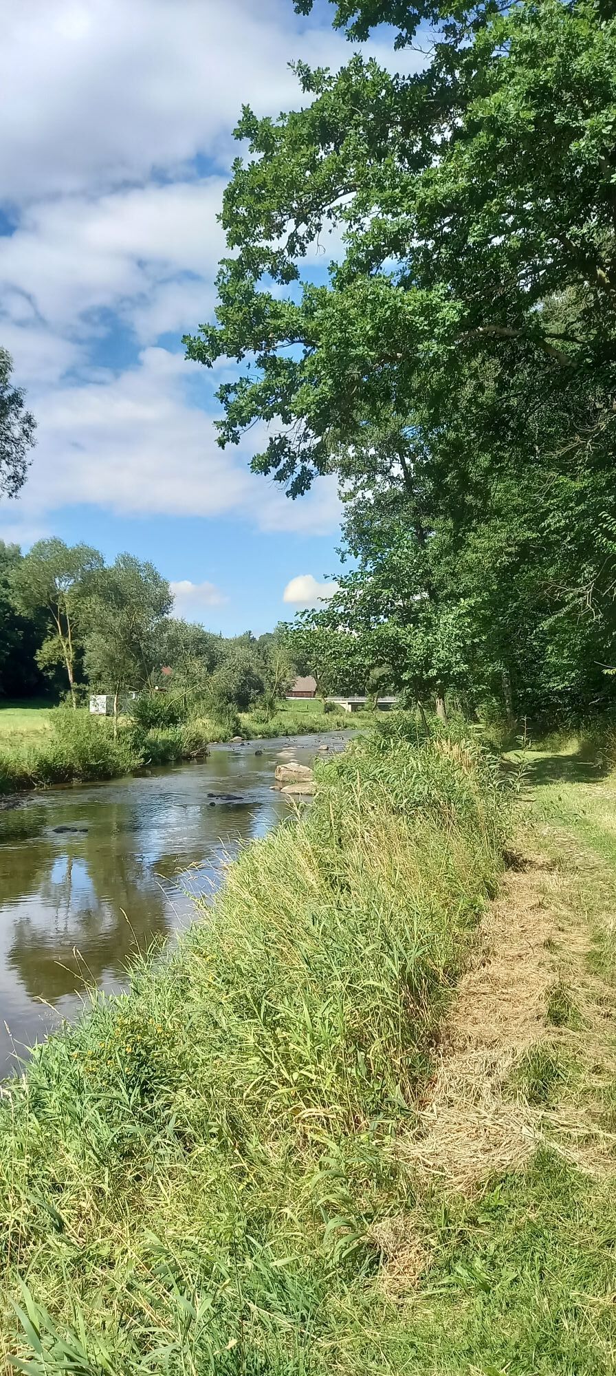
This stage follows the winding course of the Thaya - sometimes through dense riverside woodland, sometimes on narrow paths with views of the river valley. The trail leads through small villages, over bridges...
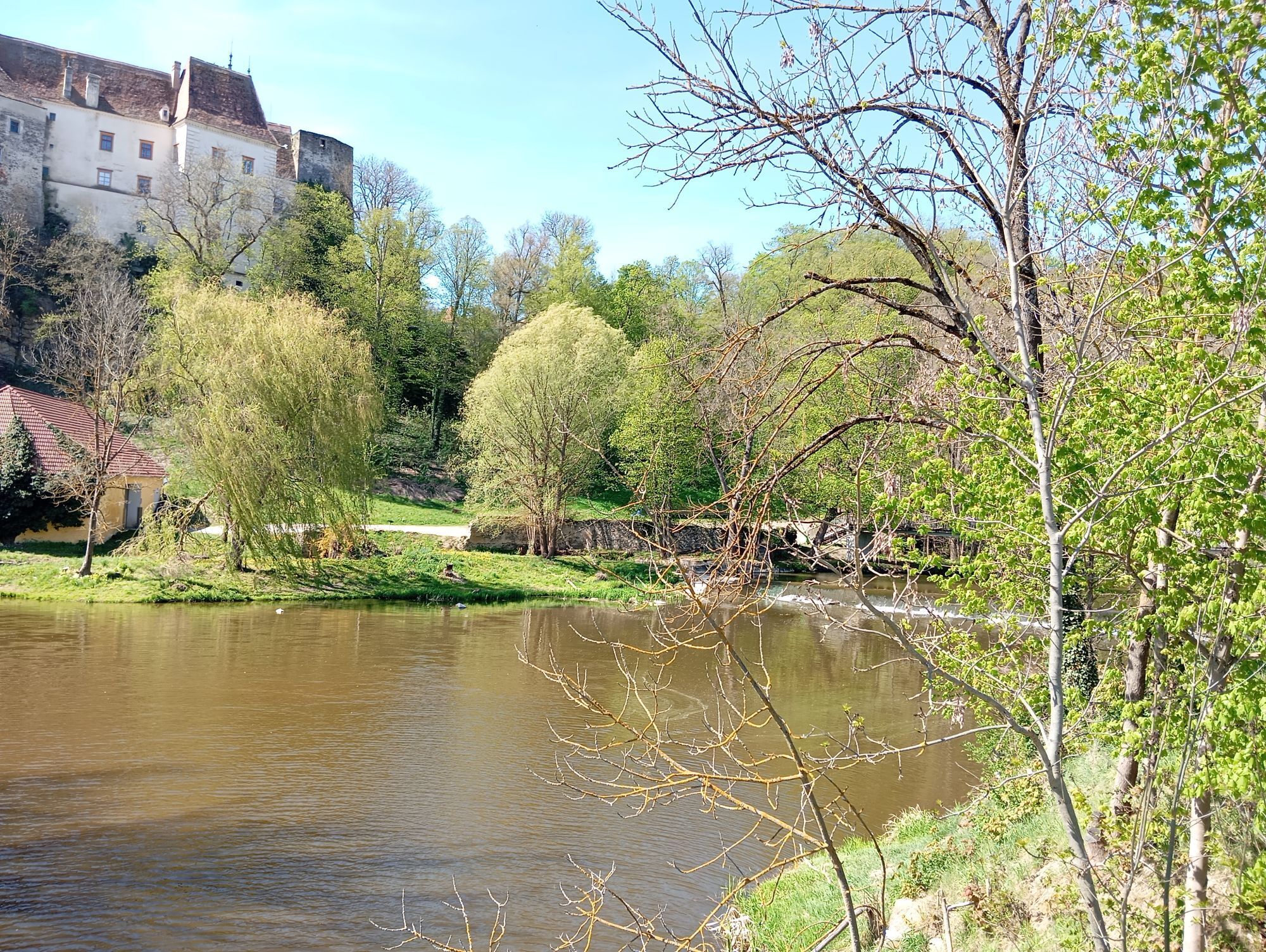
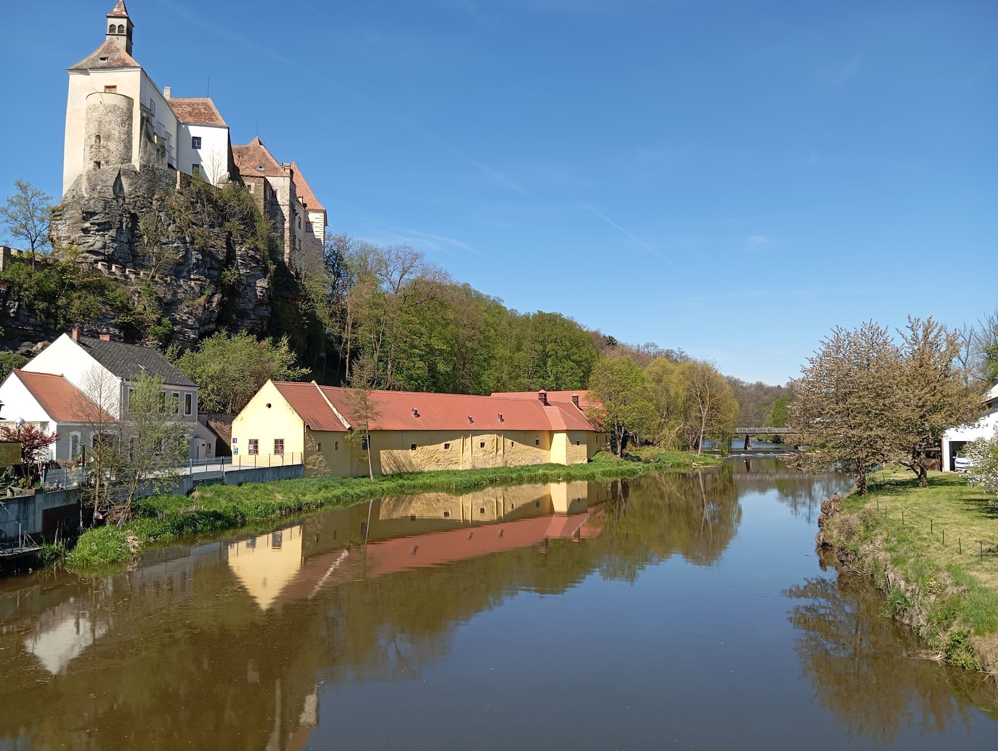
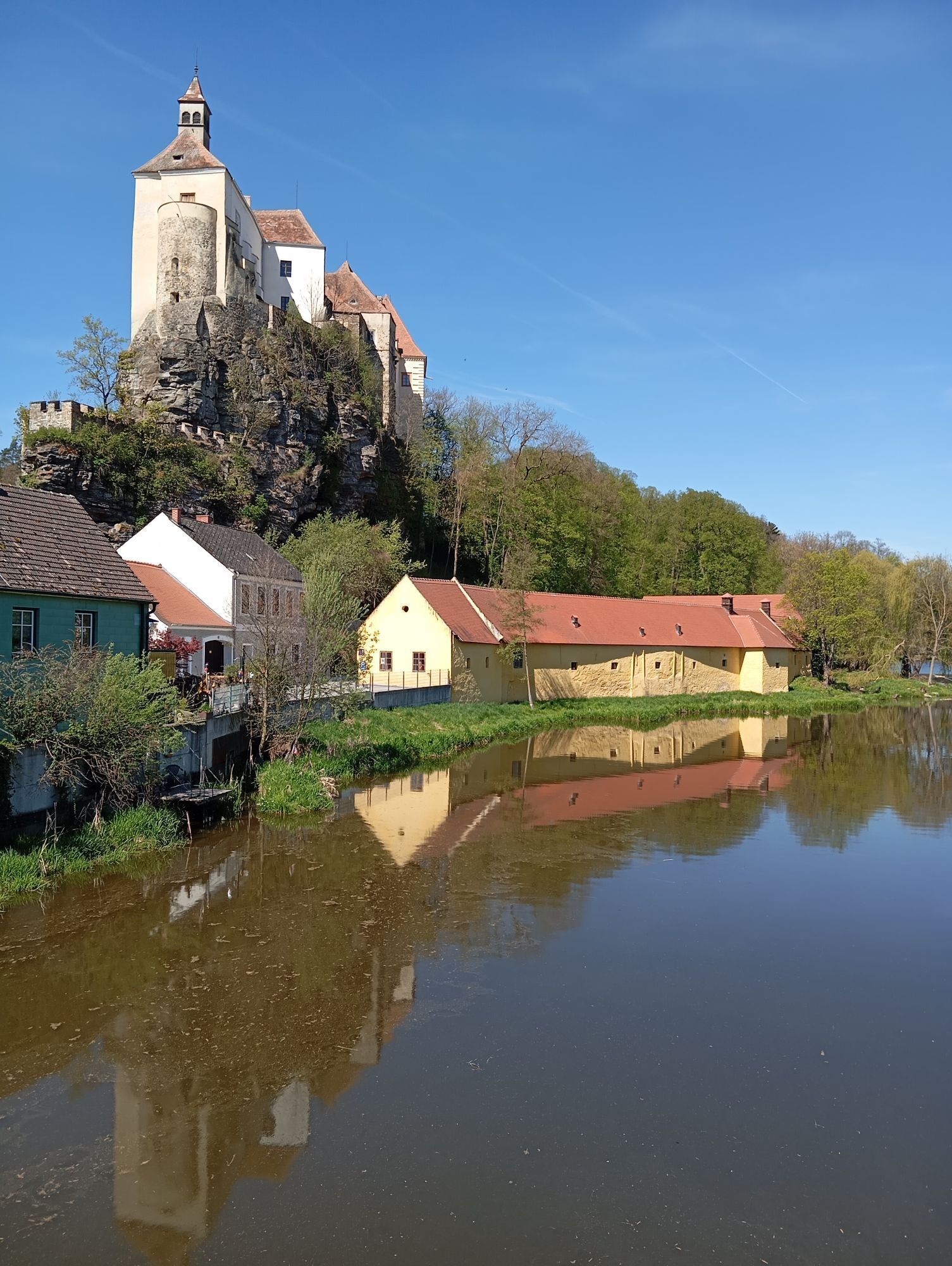
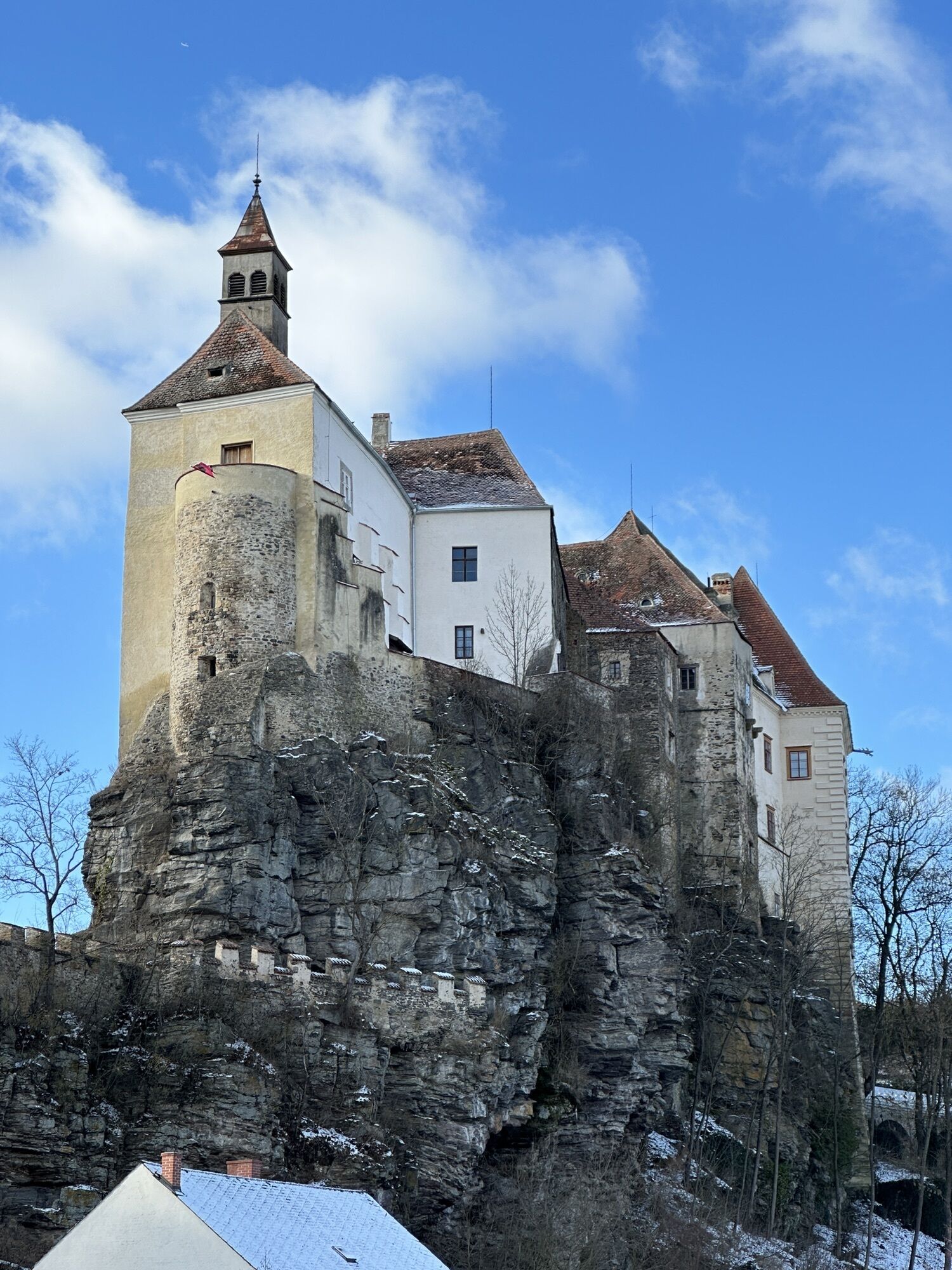
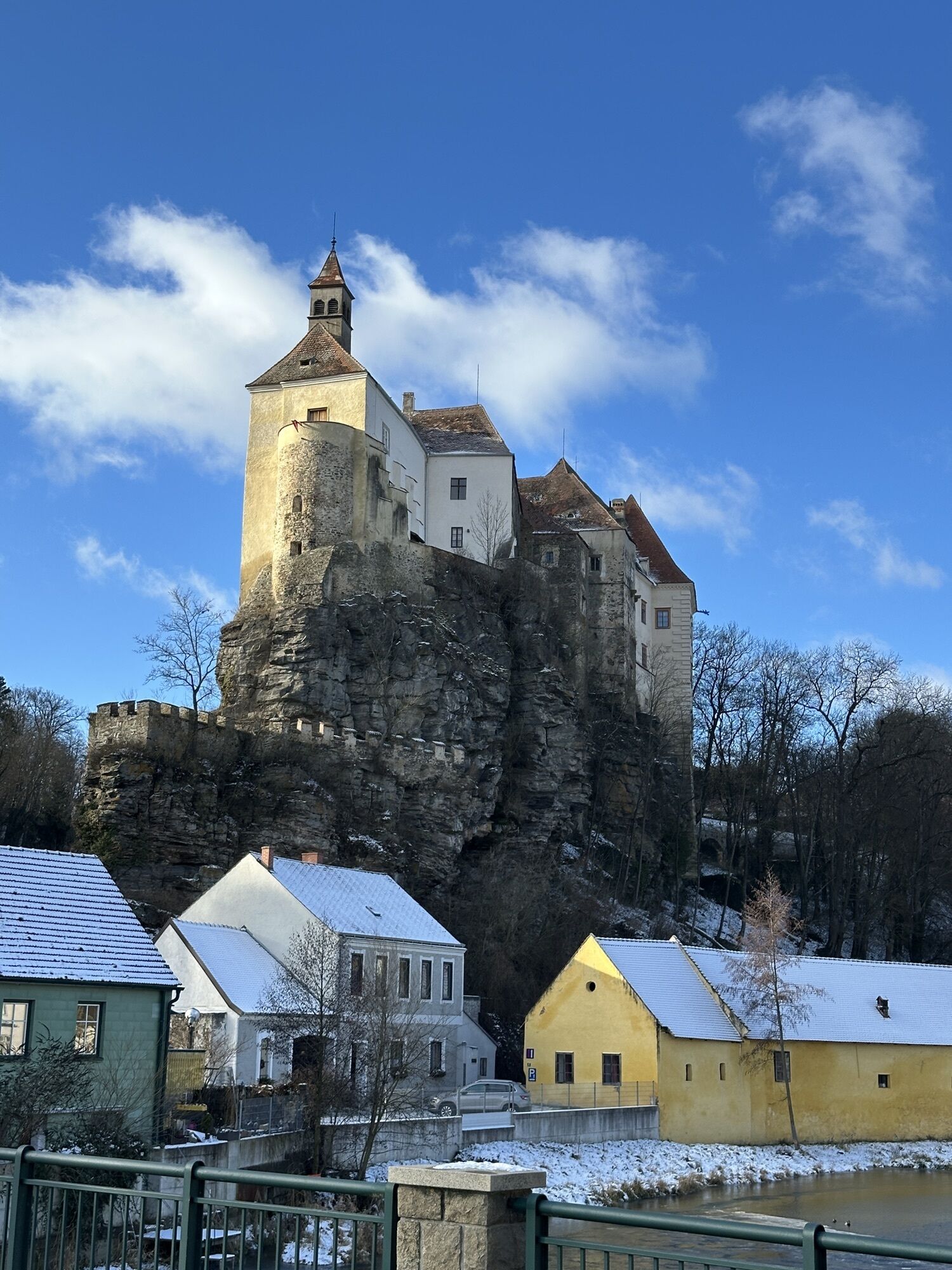
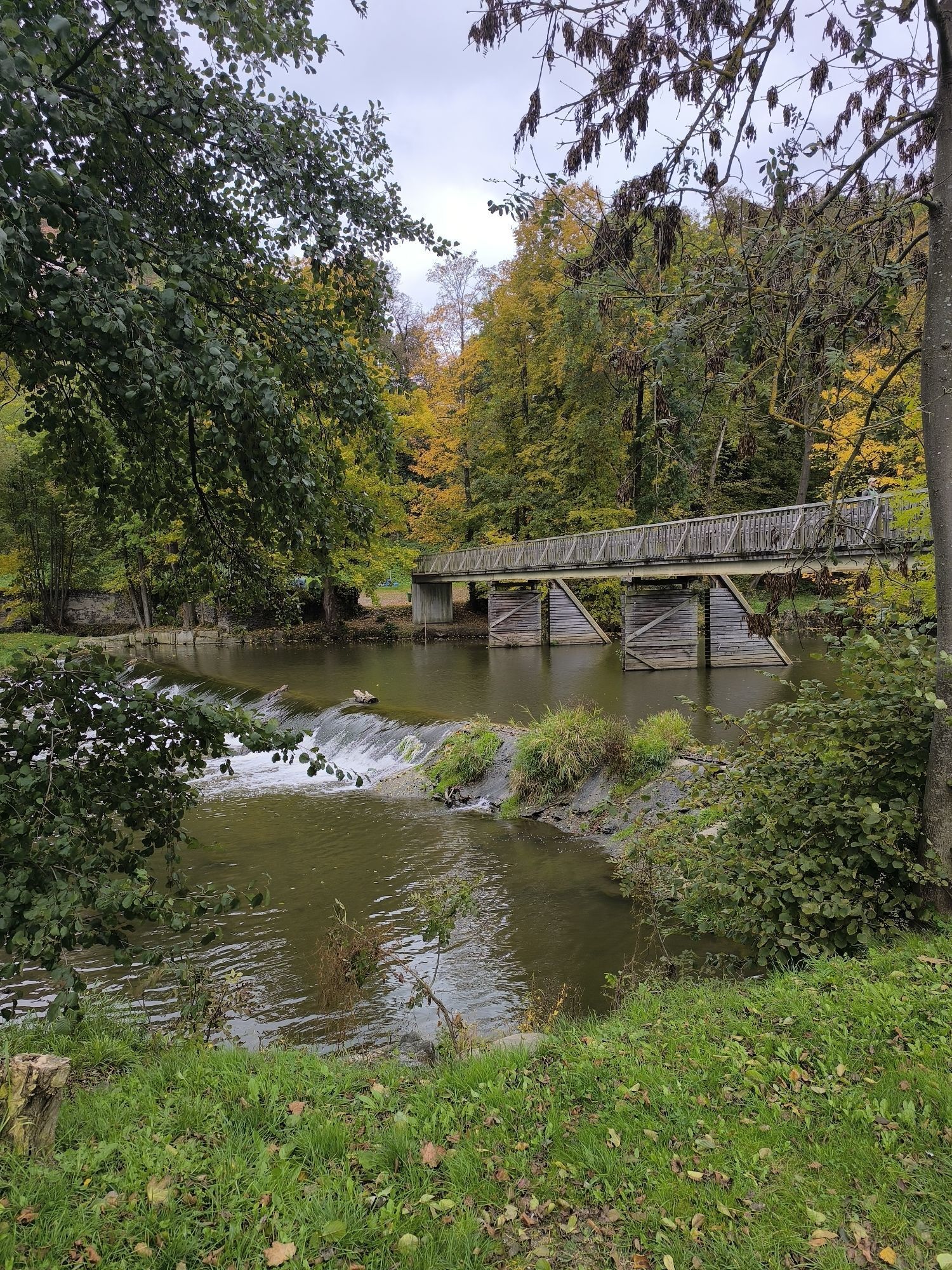
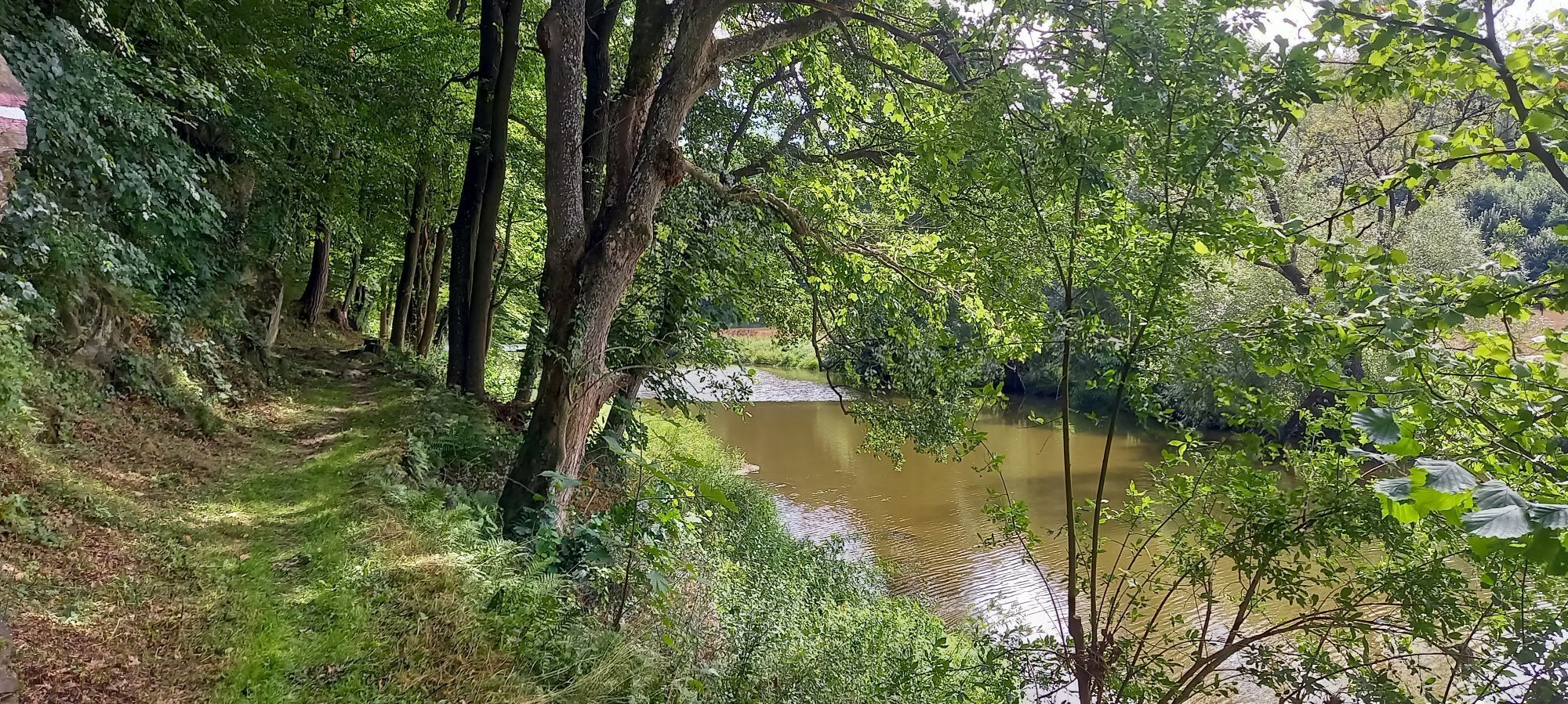
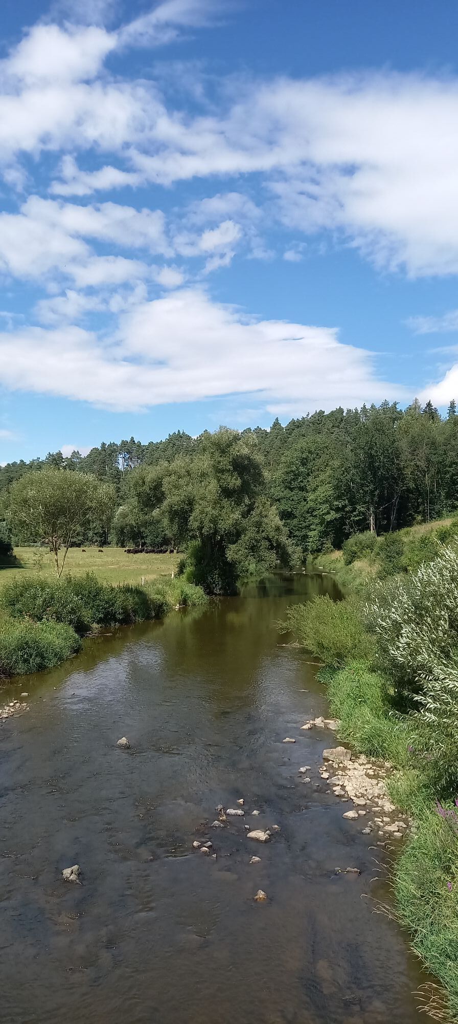
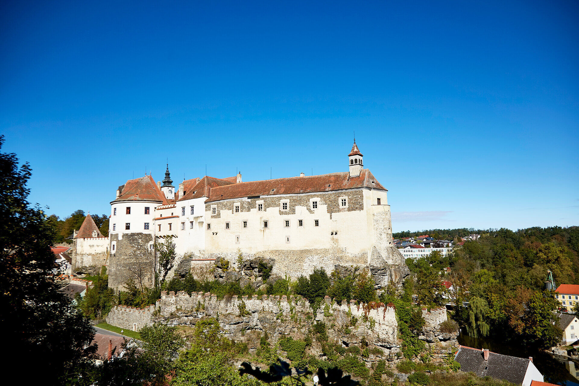
This stage follows the winding course of the Thaya - sometimes through dense riverside woodland, sometimes on narrow paths with views of the river valley. The trail leads through small villages, over bridges and past oxbow lakes, riparian forests and steep embankments. The confluence of the Moravian and German Dyje rivers can be easily observed in Raabs. Above the river landscape on a rocky spur, you are greeted by Raabs Castle.
Highlights along the stage:
Raabs CastleThayatal Vitalbad
Shortly before the Thaya bridge, the path follows the street to Groß-Siegharts. In a sharp right turn, the path leaves the street over a footbridge and on a forest trail leads after some hiking time to Speisendorf. Passing the entire village, the path branches off to the right after crossing the Thaya, and after another bridge, leaving a water reservoir on the right, you arrive at Liebnitz.
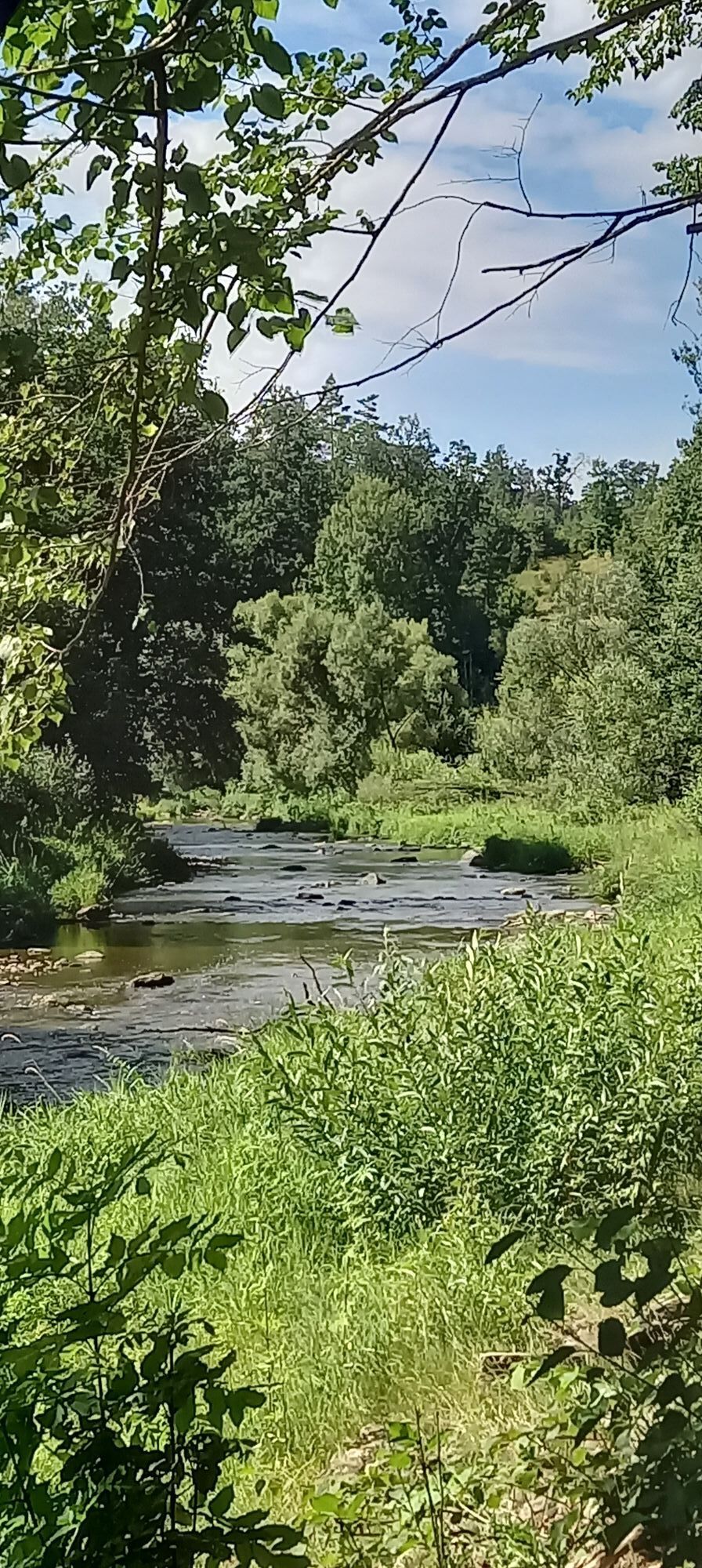
We follow the road to the Hahnmühle, turn left there, and on a beautiful trail along the Thaya (caution when wet), passing the Reismühle, ascend a small hill. You should not miss the wonderful view of the Thaya river. A small hut invites you to rest. On the opposite bank, Oberpfaffendorf can then be seen. We cross the Thaya once again and, after the first houses, turn off the road again between two houses, and along the river, you reach the sports ground of Raabs. Furthermore, you pass the indoor swimming pool, and shortly after, you arrive at the confluence of the Moravian Thaya with the German Thaya. Now it is not far to the main square of Raabs, where you can enjoy a magnificent view of the castle.
Vienna - Stockerau - Horn - Irnfritz - Raabs an der Thaya - Karlstein
Linz - Freistadt - Weitra - Gmünd - Schrems - Vitis - Waidhofen an der Thaya - Karlstein
Information at: www.vor.at
Waldviertel Tourism
3910 Zwettl, Sparkassenplatz 1/2/2
(T) +43 2822 54109,
(E) info@waldviertel.at
(I) www.waldviertel.at
Popularne wycieczki w okolicy
-
5,0
Drosendorf - Gaberbachweg
średniWędrówka 12,6 km -
5,0
Thayarunde Slavonice-Waidhofen-Göpfritz
średniJazda na rowerze 47,5 km -
4,2
Thayarunde Waldviertel - 3. Etappe
światłoKolarstwo długodystansowe 28,2 km -
5,0
Wasser und Felsen
światłoWędrówka 8,31 km -
5,0
Ritterweg Ruine Kollmitz Raabs an der Thaya, Niederösterreich
Wędrówka 12,0 km -
Thayarunde
światłoJazda na rowerze 94,2 km -
3,0
Thayarunde Waldviertel - 1. Etappe
światłoKolarstwo długodystansowe 20,9 km -
Thayarunde 5.Etappe
średniJazda na rowerze 47,2 km -
5,0
Kollmitzgraben
średniWędrówka 13,4 km -
2,0
Seebsbachrunde
średniJazda na rowerze 28,3 km
Wędrówki i tropienie


Nie przegap ofert i inspiracji na następne wakacje
Twój adres e-mail została dodana do listy mailingowej.