


Predigtstuhlweg Gr. Siegharts
Zdjęcia naszych użytkowników
Groß-Siegharts lies at 534 m above sea level. Nestled in the gently undulating landscape of the Waldviertel, the town has its own special history. At the beginning of the 18th century, the landowner Count...
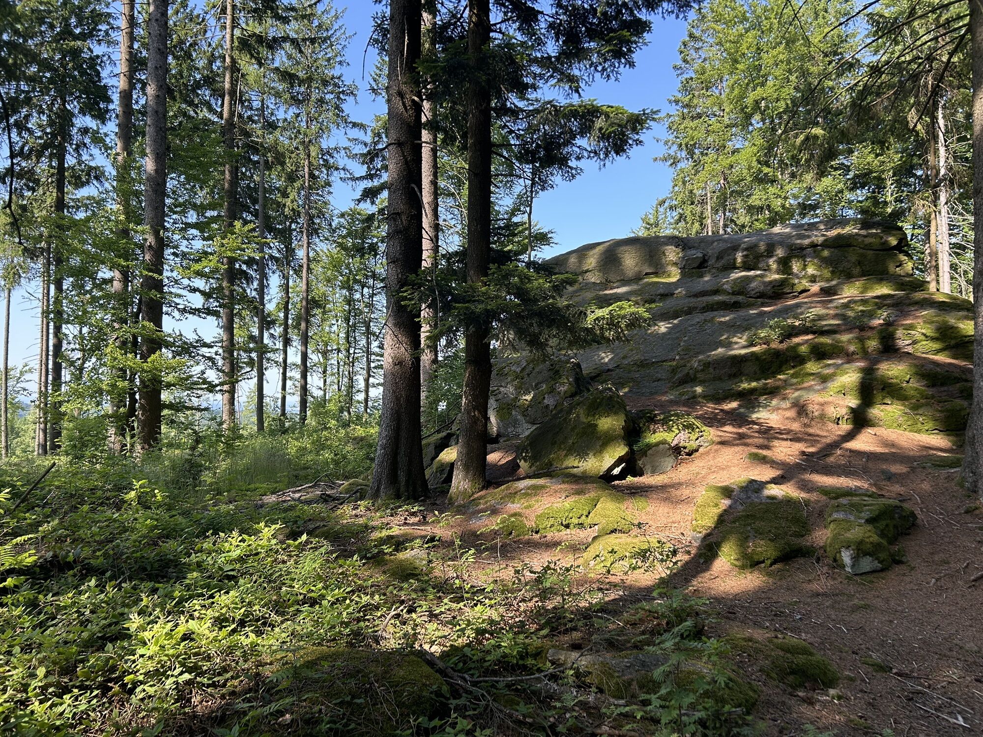
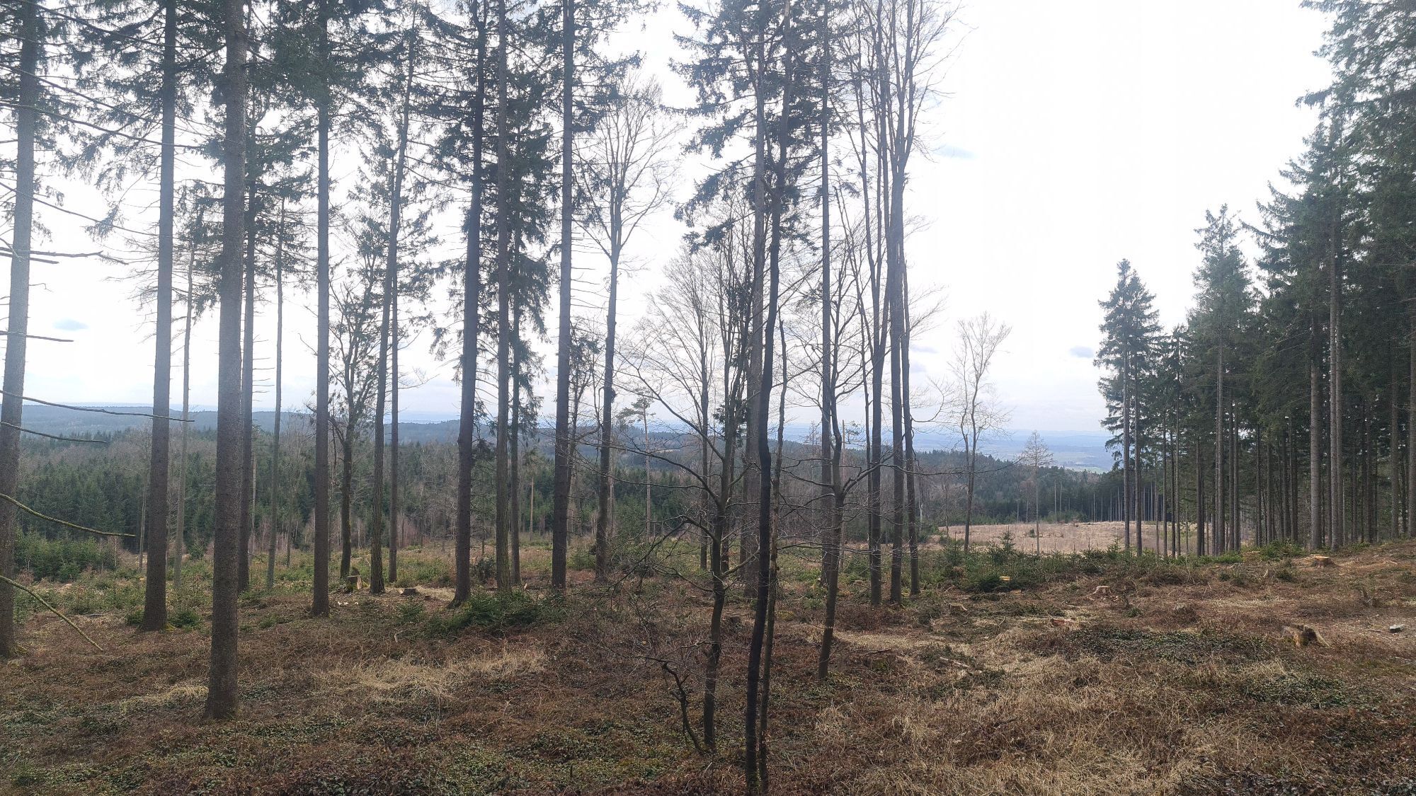
Groß-Siegharts lies at 534 m above sea level. Nestled in the gently undulating landscape of the Waldviertel, the town has its own special history. At the beginning of the 18th century, the landowner Count Ferdinand von Mallenthein introduced spinning and weaving as a cottage industry. The ribbons produced were carried by the "Bandlkramern" throughout the Danube monarchy and sold there. Today, the eventful history of the "Bandlkramerlandl" can be traced in the "Living Textile Museum". The centuries-old castle is also worth a visit. The interior of the parish church, built between 1723 and 1727 under Count Mallenthein, is a jewel of the Baroque period. For Groß-Siegharts, the 718-metre-high Predigtstuhl, also the highest point in the district, was a popular destination for Sunday hikes. The way back from Wienings is via the Trabingsweg. The field name "Trabingsfeld" is a reminder that Slavic settlers once roamed or settled in this area. The Slavic word "trebiti" means "to clear". Trabings would therefore mean "clearing - clearing - grassland". On Test Fuchs Strasse, you can see a Tornado MRCA-200 fighter bomber and the Starfighter 104 G fighter plane at the Test Fuchs GmbH company building.

Starting from the hiking trail overview board at the Main Square at the intersection of Bahnhofstraße Mallentheingasse, turn left. After a few meters, the carved Bandlkramers, the symbol of Groß-Siegharts, can be seen on the right side. Here turn right and walk straight through the city park (on the left side is the city café with a garden café). At the tennis courts, go a bit to the left and then immediately right along the tennis courts. Turn left into Hamerlingsstraße, cross Raabser Straße, continue through Schwabengasse towards Waldreichs. At the end of Schwabengasse, go a little to the right onto L8117 Karlsteinerstraße and at the chapel turn left into Bäckersteig and go up to the main street of Waldreichs. Cross it and continue straight uphill to the edge of the village. Continue straight on the nature path to the forest edge. From here, you have a beautiful view of the "Bandlkramerlandl". Always continue straight through the wooded area of the Wieningsberg until you see the signpost to Predigtstuhl on the right. A nice hiking path now leads directly to the summit of Predigtstuhl (718 m). At the top, there is a resting place and a summit book for memory entries. The return path follows a stretch of the long-distance trail 611 through the wooded area to Wienings (refreshment option at Gasthaus Schimmel). In the lower area of Wienings, turn right over a bridge. Here you leave the long-distance trail 611, then keep left to the last house on the right, turn right and after crossing a stream keep left. After some time, the village Sieghartsles becomes visible. Continue uphill on an asphalted field path to a crossroads. This area is called Trabingsfeld. Turn left here to return to Groß Siegharts. Turn left into Testfuchsstraße. Pass the fighter bomber Tornado MRCA-200, up to Raabserstraße where you turn right. Here you can admire the fighter jet Starfighter 104 G. Pass the Gasthaus Jünger (refreshment option) to the intersection with Hamerlingstraße. Turn left, go up to the kindergarten, then turn right into the castle garden. Pass Schlossplatzl (refreshment option) to the castle (municipal office and tourist information). Between the primary school and the church, the path leads into Schulgasse, past Landgasthof Fischer (refreshment option) and over Bahnhofstraße past Cafe Elfi (refreshment option) to the war memorial. From there, turn left to the Main Square and back to the starting point of the hike.
Vienna: A 22 - Stockerau - B4 to Horn - B 2 to Göpfritz an der Wild - L 55 to Groß Siegharts
Linz: A 7 towards Freistadt - B 310 to Freistadt - B 38 to Karlstift - B 41 to Schrems - B 2 to Vitis - B 36 to Waidhofen/Thaya - L 60 to Groß Siegharts
Take the Franz-Josefs-Bahn to the Göpfritz an der Wild stop and then continue by bus to Groß-Siegharts Dr. Rudolf Krausplatz.
Information at: www.vor.at
Parking is available at Dr. Rudolf Krausplatz.
Tourism Information Municipality of Groß Siegharts
3812, Schlossplatz 1
(T) +43 (0) 2847 237
(E) stadtamt@gde.siegharts.at
(I) www.siegharts.at
Waldviertel Tourism
3910 Zwettl, Sparkassenplatz 1/2/2
(T) +43 (0) 2822 54109
(E) info@waldviertel.at
(I) www.waldviertel.at
In Wienings, there is the Kaiser Franz-Joseph Museum with more than 3,000 exhibits from the time of the Habsburgs (advance registration at +43 664 972 22 23).
Popularne wycieczki w okolicy
-
4,4
Teiche-Radroute (Strecke 2020) Niederösterreich
średniJazda na rowerze 48,7 km -
5,0
Thayarunde Slavonice-Waidhofen-Göpfritz
średniJazda na rowerze 47,5 km -
Thayarunde
światłoJazda na rowerze 94,2 km -
3,2
Knödel-Landradweg
średniJazda na rowerze 42,6 km -
5,0
Wasser und Felsen
światłoWędrówka 8,31 km -
4,2
Thayarunde Waldviertel - 3. Etappe
światłoKolarstwo długodystansowe 28,2 km -
2,0
Seebsbachrunde
średniJazda na rowerze 28,3 km -
07 Grenzlandweg, 07. Etappe: Raabs an der Thaya - Drosendorf
światłodługodystansowy szlak pieszy 20,4 km -
5,0
07 Grenzlandweg, 06. Etappe: Dobersberg - Raabs an der Thaya
światłodługodystansowy szlak pieszy 25,8 km -
5,0
Kollmitzgraben
średniWędrówka 13,4 km
Wędrówki i tropienie


Nie przegap ofert i inspiracji na następne wakacje
Twój adres e-mail została dodana do listy mailingowej.