







Alpine panorama view - Kraftquellenweg (Power Source Path) No. 18
The strange stone shapes of the Yspertal valley have always fascinated people, as numerous legends and myths prove. They have yet to reveal their secrets. The 5 m high heart stone - after which two circular...
The strange stone shapes of the Yspertal valley have always fascinated people, as numerous legends and myths prove. They have yet to reveal their secrets. The 5 m high heart stone - after which two circular hiking trails are named - reminds some people of the human organ, while others - who lean towards geomancy and esotericism - recognize female forms and life symbols here and consider the granite block to be a double cult stone. In any case, it is an extremely interesting stop on a tour that also leads to other strange stone figures, such as the "skull" - which can be climbed on a staircase - or the "stone corn almond". A walk to remember.
A beautiful hike through woods and meadows with a magnificent view of the Alps from the water reservoir.

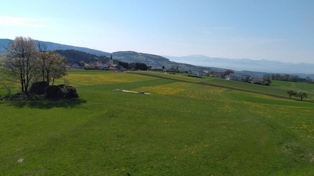
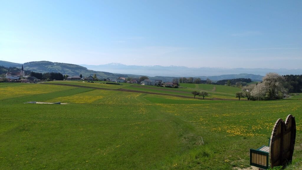
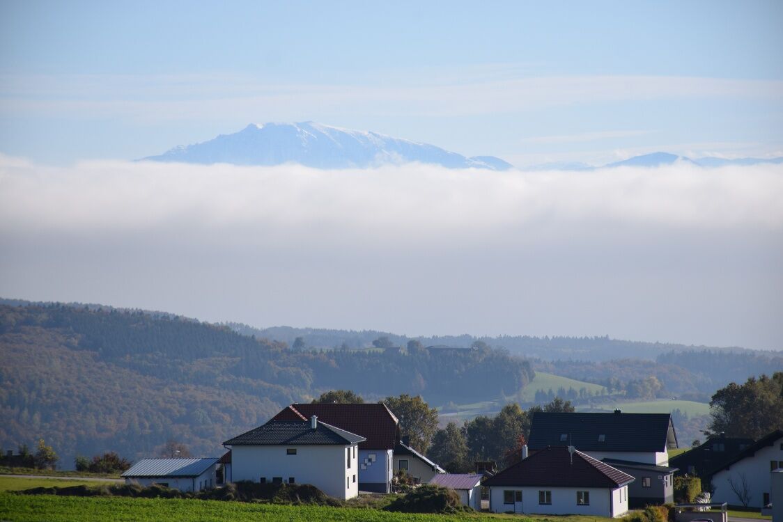
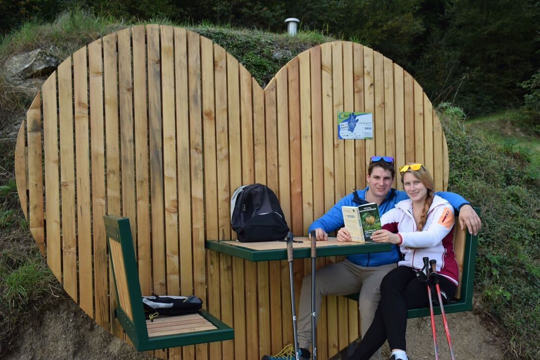

From the Church Square towards the fire station to the Wackelstein, then up to the water reservoir. At the new Herzrastplatz you can enjoy the magnificent Alpine view to recharge your energy (power source). With renewed energy continue towards Stockberg. At the turning point, turn left through the forest to the sports field, back to the starting point or join hiking trail No. 19 and then back to St. Oswald.
Access from the West Autobahn A1 via Ybbs on the Danube either via B 36 through Yspertal to St. Oswald or via Ybbs along the Danube west of Ysperdorf, towards Yspertal via Fell to St. Oswald.
Free parking in front of the primary school or in front of the municipal depot. Free charging station for e-cars at the “Leithenweg” parking lot.
Municipality of St. Oswald
3684 St. Oswald, Untere Hauptstraße 3
(T) +43 7415 7291
(I) www.stoswald.com
(Webcam) http://www.stoswald.com/Aktuelles/Webcam
Tourism Office Ysper-Weitental
3683 Yspertal, Hauptstraße 9
(T) +43 7415 6767 25
Waldviertel Tourism
3910 Zwettl, Sparkassenplatz 1/2/2
(T) +43 2822 54109
Uzyskaj wgląd
Zawsze na żywo z ponad 9 500 kamer internetowych. bergfex Jako użytkownik Pro, możesz teraz zobaczyć odpowiednie kamery internetowe dla wielu wycieczek w aplikacji wycieczki od. Pozwala to na bezpośredni podgląd aktualnych warunków.
Popularne wycieczki w okolicy
-
4,0
Yspertal: Druidenweg - Ysperklamm
średniWędrówka 9,56 km -
4,6
Waldhausen: Outlook circuit
średniWędrówka 14,0 km -
4,7
Stillensteinklamm, Grein
światłoWędrówka 10,4 km -
4,6
Ausgedehnte Peilsteinrunde
średniWędrówka 13,7 km -
4,9
Stillensteinklamm Rundweg über Struden
światłoWędrówka 12,6 km -
4,5
Durch die Steinwandklamm von Maria Taferl aus
światłoWędrówka 8,26 km -
4,4
Gobelwarte - Grein, Oberösterreich
średniWędrówka 5,41 km -
4,4
Gobelwarte-Runde, Grein
średniWędrówka 8 km -
4,6
Brandstetterkogel über Matras Steig
światłoWędrówka 6,28 km -
4,8
Herzsteinweg Ysper und Burgsteinmauer
średniWędrówka 14,7 km
Wędrówki i tropienie


Nie przegap ofert i inspiracji na następne wakacje
Twój adres e-mail została dodana do listy mailingowej.





