


Hardegg circular hiking route
Zdjęcia naszych użytkowników
-

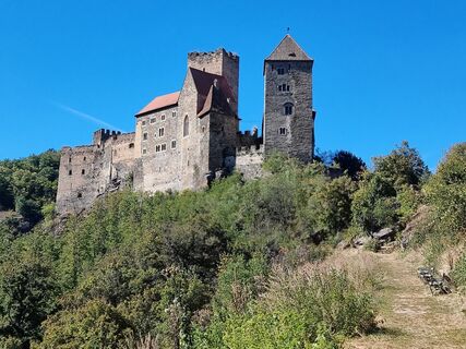
 © guenvollUtworzono dnia 11.09.2025
 -
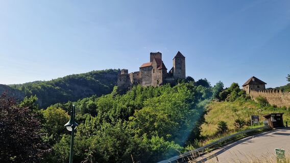
 © Helmut NeuholdUtworzono dnia 04.09.2025
 -
 © Helmut NeuholdUtworzono dnia 04.09.2025
 -

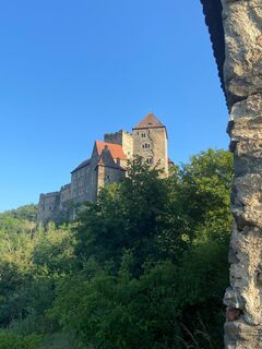
 © Friedrich SchlagerUtworzono dnia 23.07.2025
 -

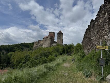
 © Sintra KanoUtworzono dnia 26.04.2025
 -
 © fschwarzenbergerUtworzono dnia 20.06.2025
 -
 © Christian SchüllerUtworzono dnia 14.06.2025
 -
 © KleinlehnersUtworzono dnia 16.05.2025
 -
 © Hans FelliUtworzono dnia 31.10.2024
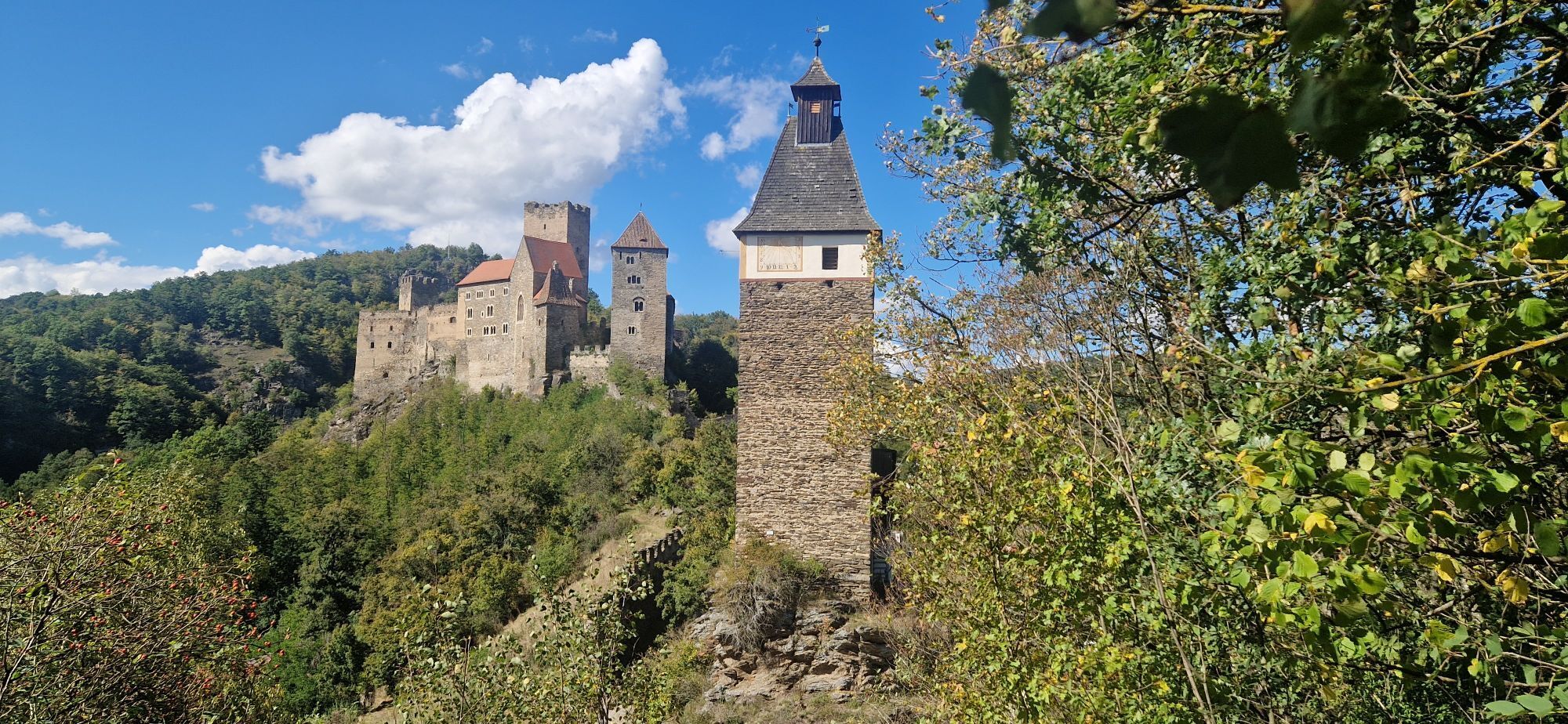

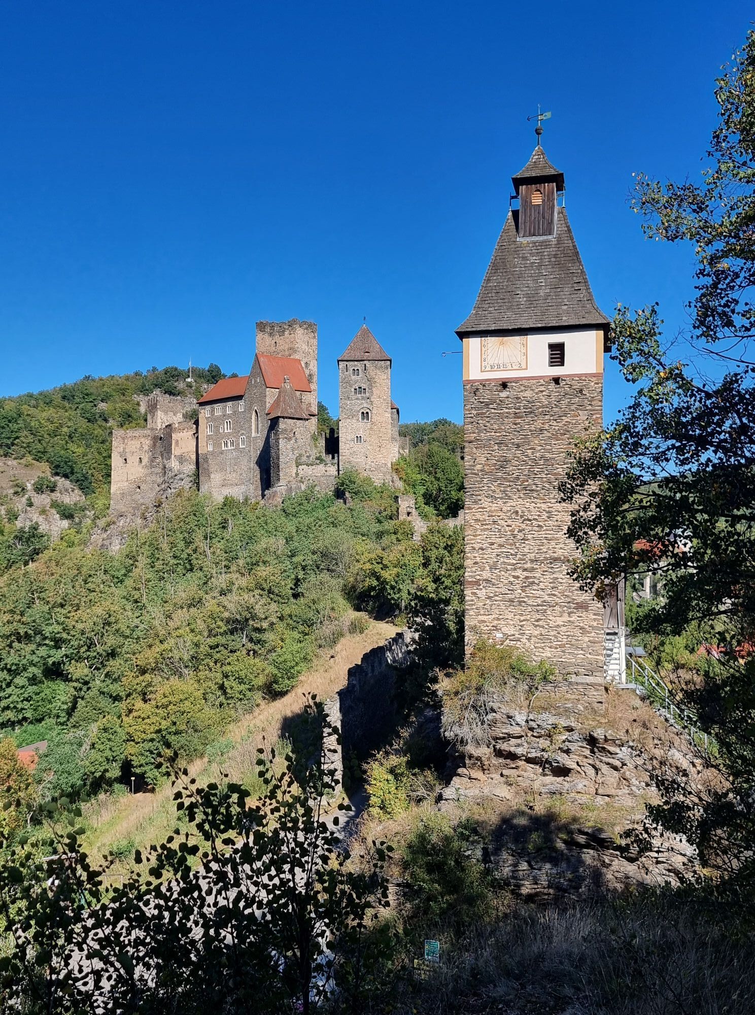
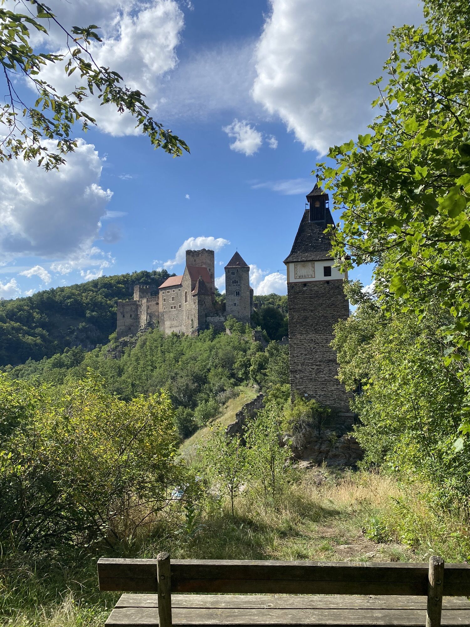


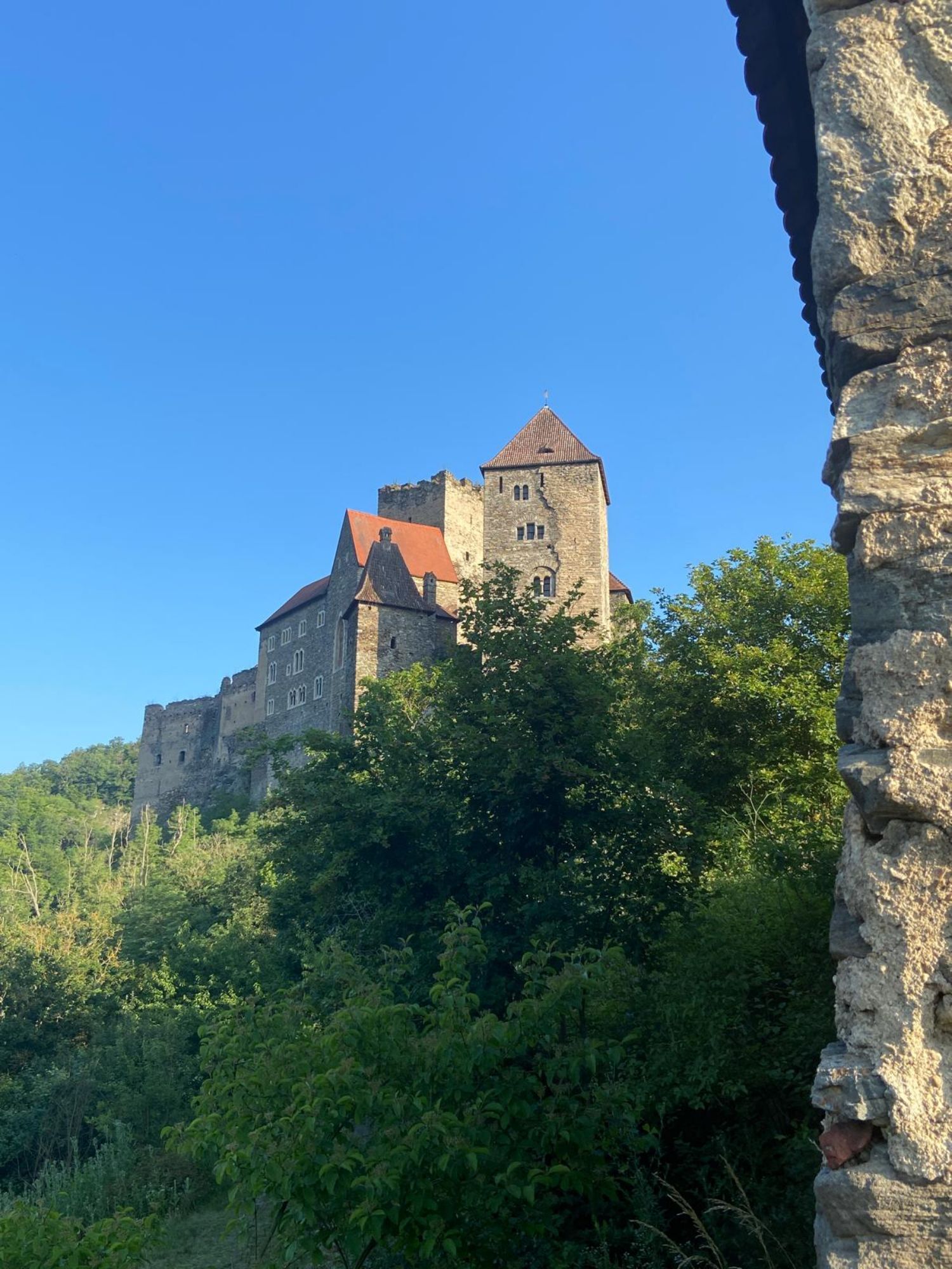
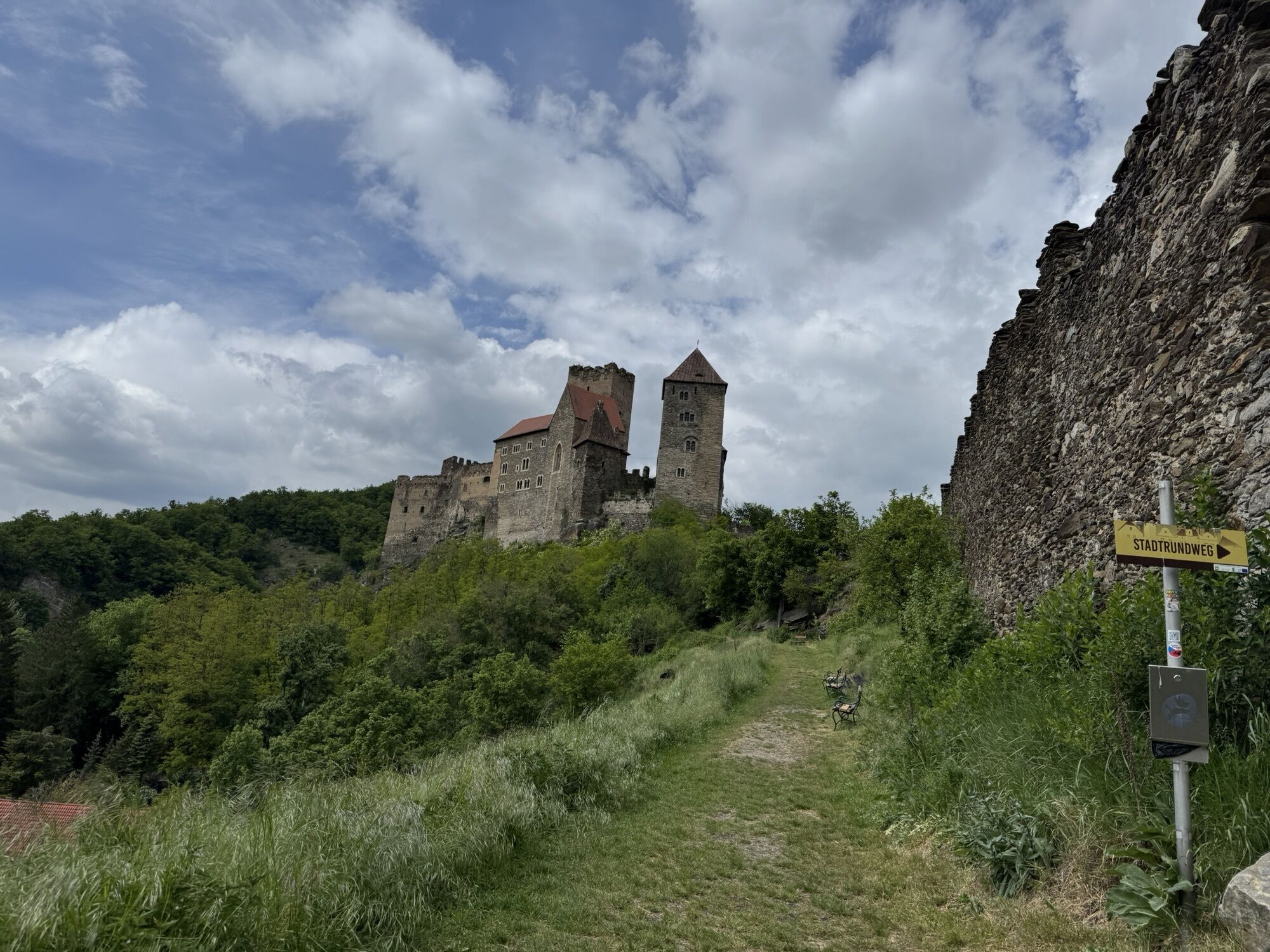
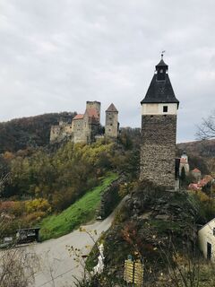
The hike around the town and Hardegg Castle leads over the legendary Regina Rock to the Max Plateau. The view here is unique, as the town and Hardegg Castle lie almost at the visitor’s feet.
The hike around the town and Hardegg Castle leads over the legendary Regina Rock to the Max Plateau. The view here is unique, as the town and Hardegg Castle lie almost at the visitor’s feet.

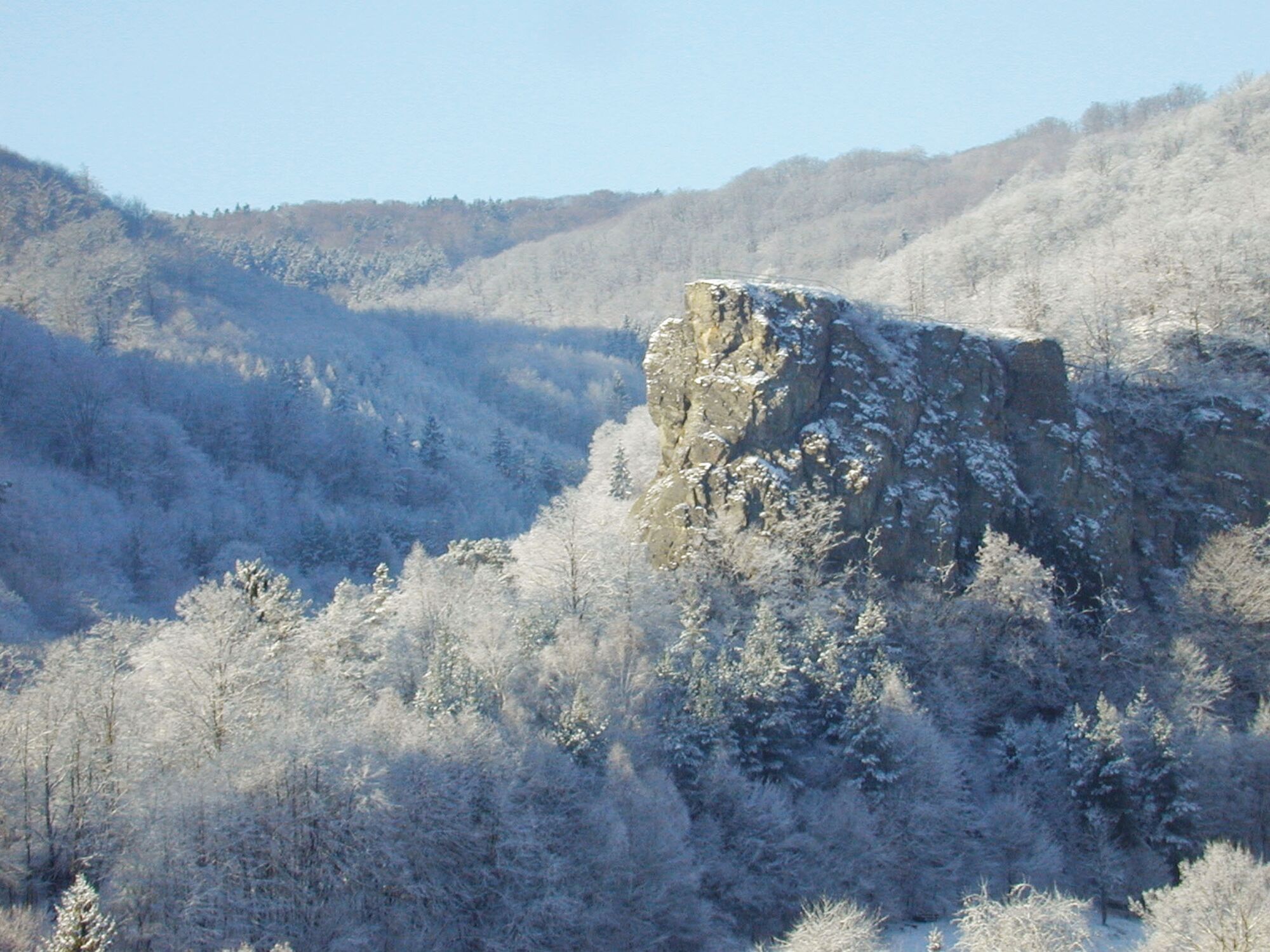
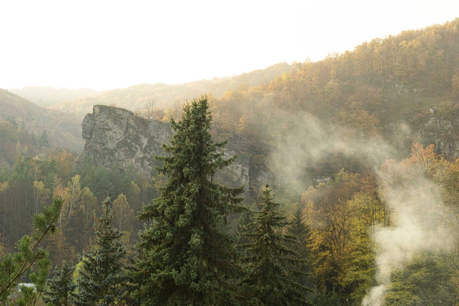
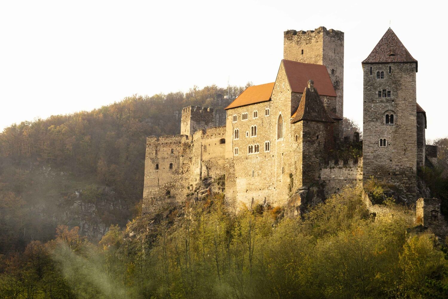
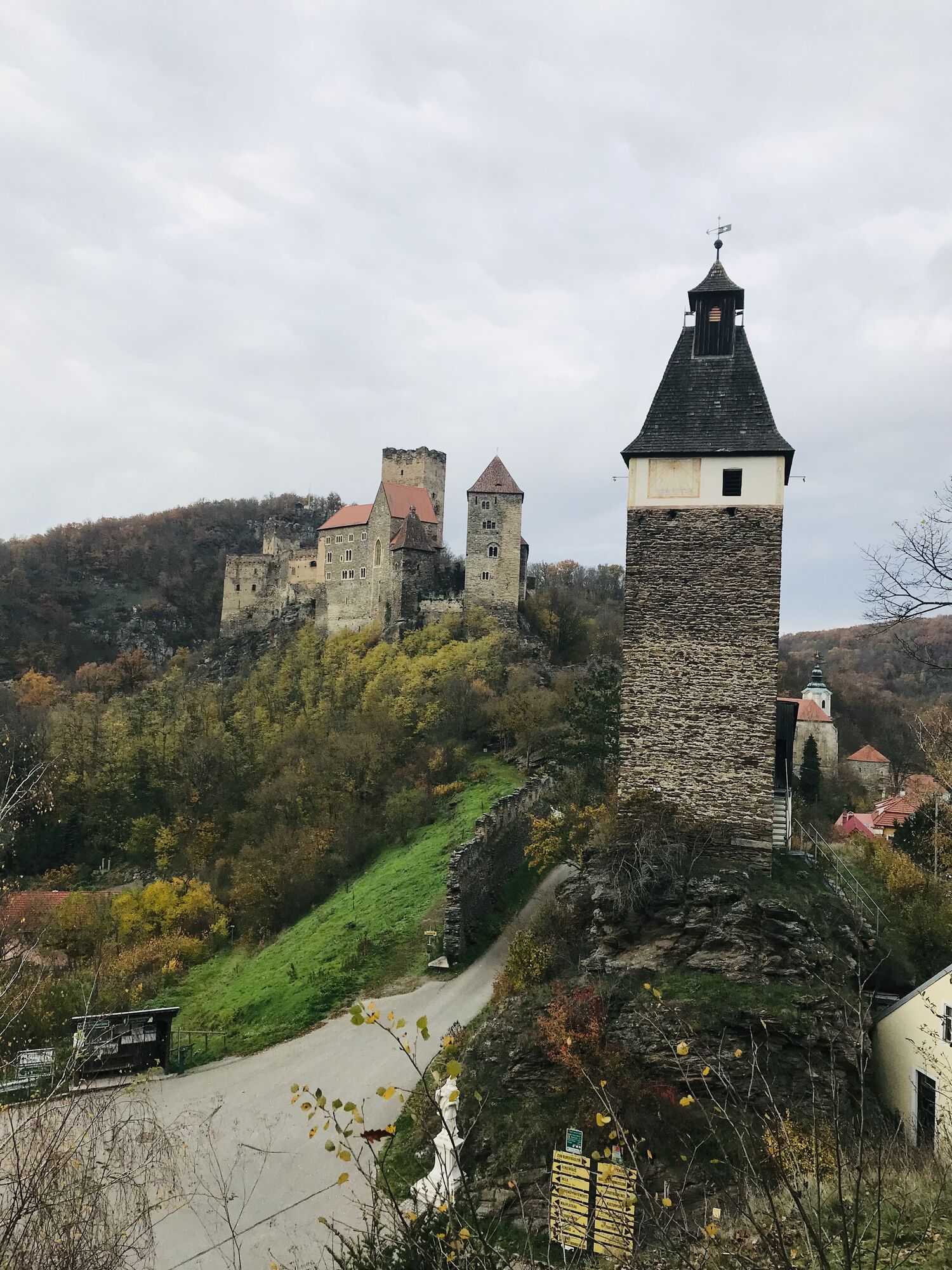
From the Hardegg clock tower at the ascent to the castle, a rock nose stretching far into the suburbs to the southwest attracts attention: the Regina Rock. The Hardegg circular hiking route leads there and further to the Max Plateau (ORF broadcasting facility). To the left of the clock tower, a footpath leads into the valley to the Fugnitz bridge and then ends in a dead end to the right to the hiking trail. High above the Fugnitz, it goes directly to the foot of Regina Rock. The hard calcareous silicate rock has withstood while the Fugnitz shaped the valley basin.
At the next fork, go straight ahead to Regina Rock with a wonderful view of the suburb and Hardegg Castle (do not climb over railings, risk of falling!). Back at the fork, now turn right through an oak and hornbeam forest to the Max Plateau. The undergrowth consists of yellow dogwood, blackthorn, and privet. This highest elevation in the immediate urban area is typical for the Thaya valley. The steep drops to the east and south are home to warmth-loving plants that also tolerate dryness and are not typical for the Waldviertel. Insects find good living conditions here. The western and northern slopes have a completely different plant cover. Beech, ash, birch, lime, and maple like the shadier, moist slopes.
Back to the town it goes via an easily passable forest road, or you take the shortcut via the steep Christbaumsteig (3a), which branches off directly from the Max Plateau. At the old bathing place, the two paths meet again and lead back to the town.
Sturdy footwear
Some steep, rocky sections and climbs
Vienna: A 22 – Stockerau – S3 – B 303 to Hollabrunn – up to the roundabout with L 1027 (Unterretzbach) continue to Niederfladnitz on L 38 to Hardegg
Linz: A 7 towards Freistadt - B 310 to Freistadt - B 38 via Zwettl to Rastenfeld – turn left here towards Horn – B 45 to Sigmunsherberg – L 1155 to Weitensfeld – L 1065 to Waschbach – L 1044 to the intersection with L 38 (turn left) and on L 38 to Hardegg.
Train Vienna-Retz, or Znaim-Retz, then further by bus from Retz to Hardegg/National Park House
Traffic days and further info: Railway information: 05/1717
Parking lot available at the National Park House
As a memento of your hike around the Thayatal National Park, you can collect a hiking badge at the ticket office of the Thayatal National Park and at the Kaja ruin.
Hiking badges are round plaques designed and inscribed by wood burning, serving as souvenirs and at the same time as awards for outstanding achievements. Diligent collectors of hiking badges will be rewarded with a free premium badge. More information can be found at http://www.wandermarken.at/
Popularne wycieczki w okolicy
-
4,4
Rundwanderung Nationalpark THAYATAL
światłoWędrówka 14,0 km -
4,5
Ruine Kaya
średniWędrówka 12,5 km -
Ruine Kaya - Thaya Aussichtspunkt
światłoWędrówka 6,82 km -
4,8
Kellergassenrundwanderweg
średniWędrówka 8,69 km -
4,4
Nationalpark Thayatal Radweg Süd und Nord
średniMountainbike 63,2 km -
5,0
Über NP Thaya zu historischen Städten / Etappe 2 Retz - Znaim
światłoWędrówka 17,2 km -
07 Grenzlandweg, 10. Etappe: Hardegg - Retz
światłodługodystansowy szlak pieszy 23,2 km -
5,0
Über NP Thaya zu historischen Städten / Etappe 3 Znaim - Hardegg
światłoWędrówka 24,6 km -
3,0
MERKERSDORF Kajarevier Nationalparkhaus Thayatal Hardegg 20210501
średniWędrówka 20 km -
5,0
07 Grenzlandweg, 09. Etappe: Geras - Hardegg
światłodługodystansowy szlak pieszy 23,2 km
Wędrówki i tropienie


Nie przegap ofert i inspiracji na następne wakacje
Twój adres e-mail została dodana do listy mailingowej.