







Kirchschlag Circular Route D1+D12 via Stanger Berg and Lembach
<p>The path leads past some sights and inns, over field and forest paths or on little-trafficked roads.</p><p><strong>More under Tips.</strong></p>


<p><strong>Marking D12 + D1</strong></p><p>Pass right by the Rosengarten and the fortified church Kirchschlag, turn right at the T-junction, pass Gasthaus/Butchery Pürrer and Café Winhofer, turn left at the next intersection onto Stanger Straße, turn right, then immediately left to the school center. Then turn right at the second opportunity (after the bridge) and go left at the last house up the Everlsteig (narrow, root-covered trail) towards St. Wolfgang. Then pass the model airfield and turn left onto the state road and follow the road to Stang.</p><p>Pass Lamprecht's farm shop, then turn right. Pass the Lilienhof scout farm, follow the path until the forest begins. Here turn left onto the forest path, follow it, cross the main road and keep right. Follow the path, a longer stretch of forest follows. At the T-junction after the forest, turn right and after the farmhouse turn left.</p><p>Follow the road to Lembach, turn left at the next T-junction and pass Gasthaus Kräuterwirtin Gerda Stocker along the road. Shortly afterwards, turn right into Steinriegelweg up to the transmission mast, from here follow the Mitterbacher Weg/Mariazellerweg to Bäckergasse. From here turn right over a small wooden bridge over the Äußeren Markt back to the starting point.</p>
<p>Always take suitable hiking maps with you. Wear sturdy shoes adapted to the route, take sun and rain protection as well as water and something to eat. Take your mobile phone with you and save the mountain rescue emergency number: 140</p>
<p>Make sure when choosing the route that it corresponds to your experience and your fitness. Check the weather forecast in advance. The weather can change rapidly in the mountains. Therefore, always start suitably equipped (e.g., rain protection, snacks, drinks,...). Check whether the restaurants and huts you want to visit are open. Inform someone about your chosen route and expected return before you leave.</p>
<p><strong>From Vienna:</strong> Take the South Motorway A2, exit at Krumbach. Continue on the Krumbach junction. Continue on Kirchschlager Str./B55 to Kirchschlag.</p><p><strong>From Graz:</strong> Take the South Motorway A2, exit at Aspang-Zöbern. Turn right onto L137. Continue on Kampichl and Hauptstraße. Hauptstraße turns left in Zöbern and becomes Austraße. Follow L137 to Unterhaus near Krumbach and turn right to Kirchschlag.</p>
<p>By train to Edlitz/Grimmenstein station, then take regional bus 390 to "Gemeindeamt" Kirchschlag</p><p>VOR route planner: <a href="anachb.vor.at/">https://anach... <a href="www.oebb.at/">www.oebb.at<...
<p>Ample parking available</p>
Places to dine:
Kräuterwirtin Gerda Stocker, Lembach
Hotel Post / Hönig Wirt, Kirchschlag
Gasthof Bräuhaus Kogelbauer, Kirchschlag
Gasthaus Pürrer, Kirchschlag
Sights along the way:
Rosengarten Kirchschlag
Fortified Church Kirchschlag
City Museum Kirchschlag
Lamprecht's farm shop
Other:
Burgbad Kirchschlag
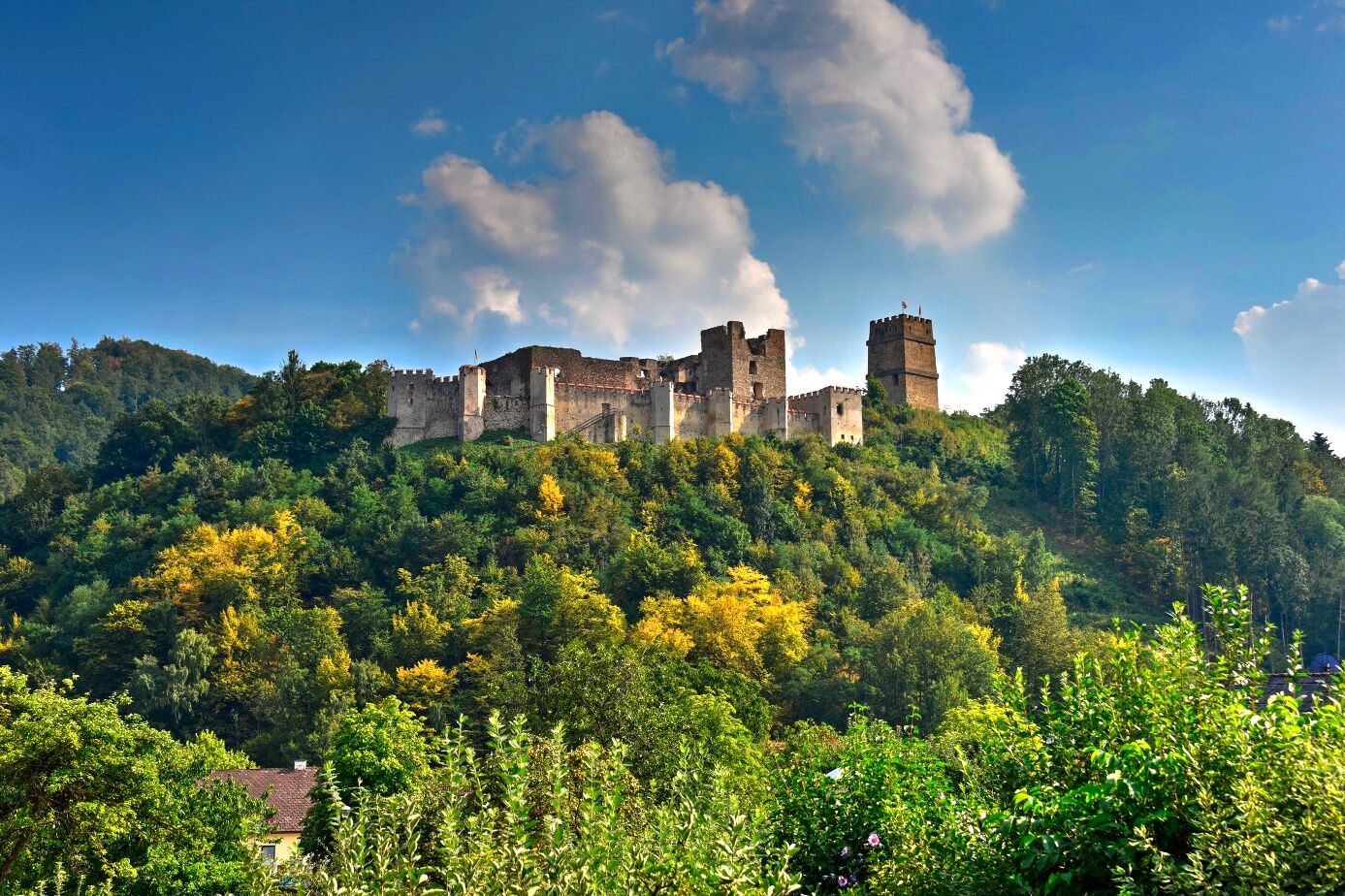
Castle Ruin Kirchschlag
Popularne wycieczki w okolicy
-
4,5
Bad Schönau - Hutwisch
światłoWędrówka 9,99 km -
4,2
"Weg der Blicke"
światłoWędrówka 5,86 km -
4,4
BAD-SCHÖNAU Hutwisch und wieder zurück 20220611
średniWędrówka 10,8 km -
4,8
Bakabu children's adventure trail to Hutwisch
średniTrasa tematyczna 5,42 km -
2,9
Sonnenland Draisinentour
światłoJazda na rowerze 23,0 km -
4,8
B41 Zöberntal-Rabnitztal cycle trail
średniJazda na rowerze 40,7 km -
4,6
Petersbaumgarten/Kienegg/Windhoh Runde
światłoWędrówka 9,86 km -
3,0
R1 anniversary cycle path
ciężkiKolarstwo długodystansowe 272,3 km -
2,5
Landsee-Pauliberg Hike
średniWędrówka 25,8 km -
5,0
Zöbernbach Radweg
średniJazda na rowerze 28,5 km
Wędrówki i tropienie


Nie przegap ofert i inspiracji na następne wakacje
Twój adres e-mail została dodana do listy mailingowej.





