


St. Michael circular route


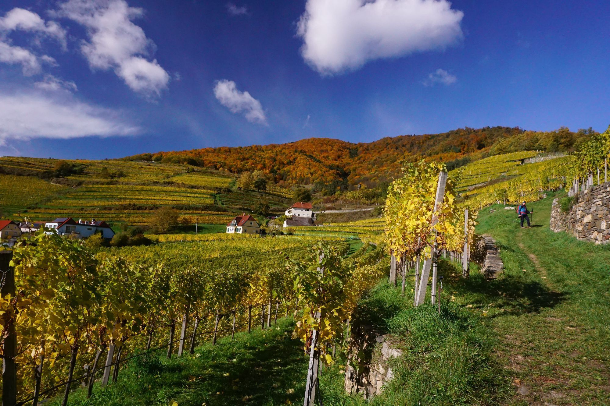
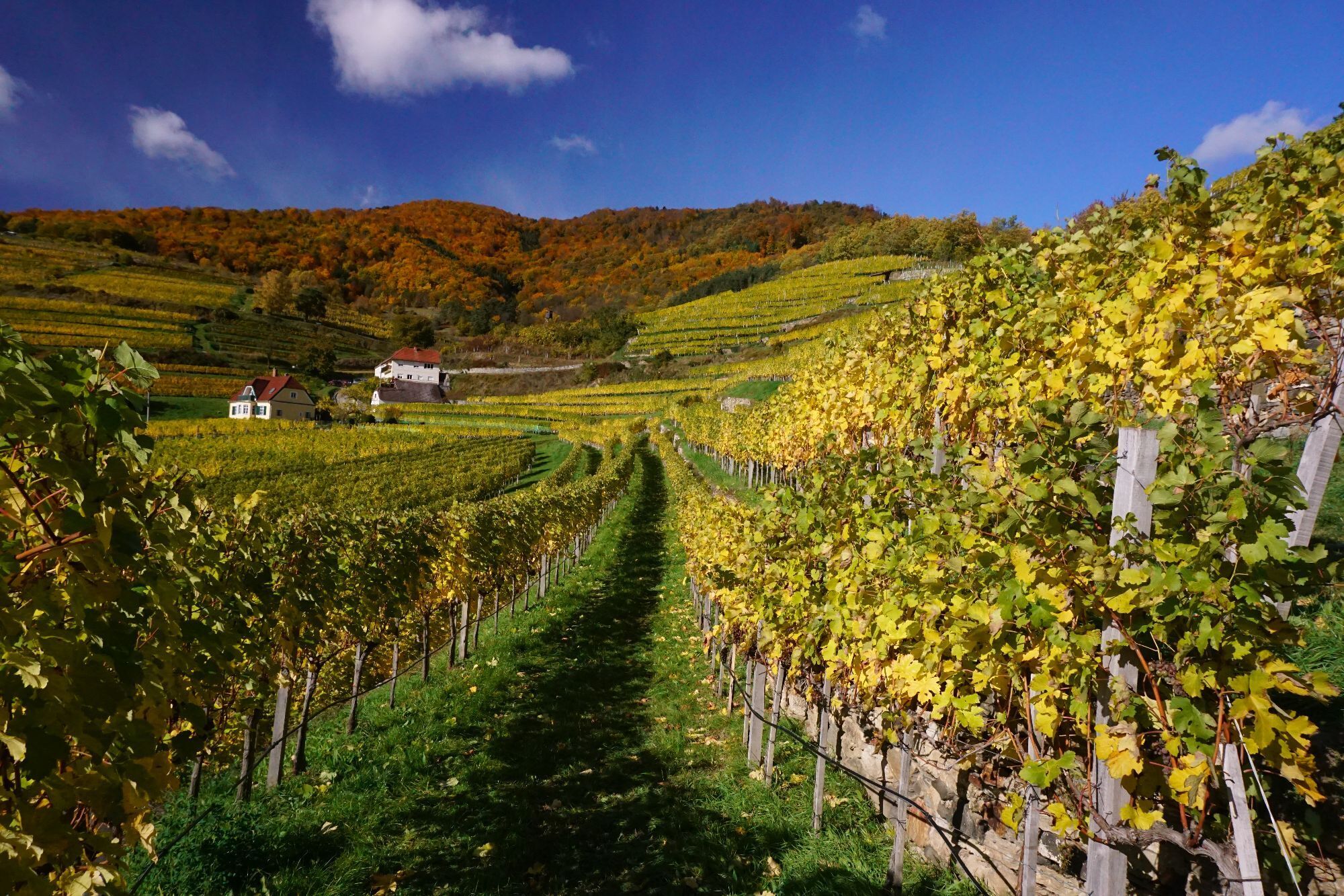
Starting from the well-known wine-growing town of Spitz, we begin our seven-km-long hike through the wine-growing town of Spitz. We walk through the famous vineyards already within the town (Pluris, Achspoint,...
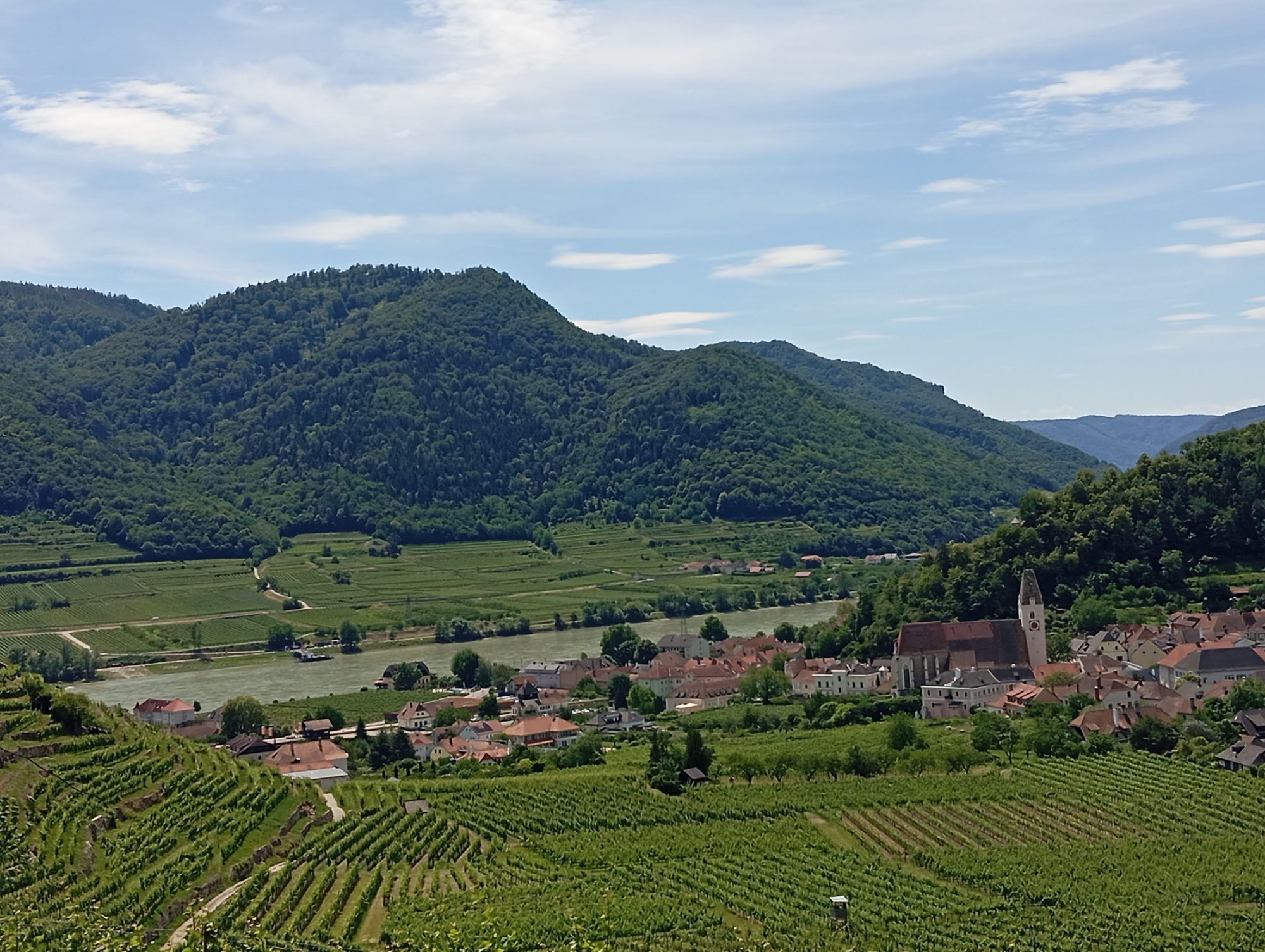
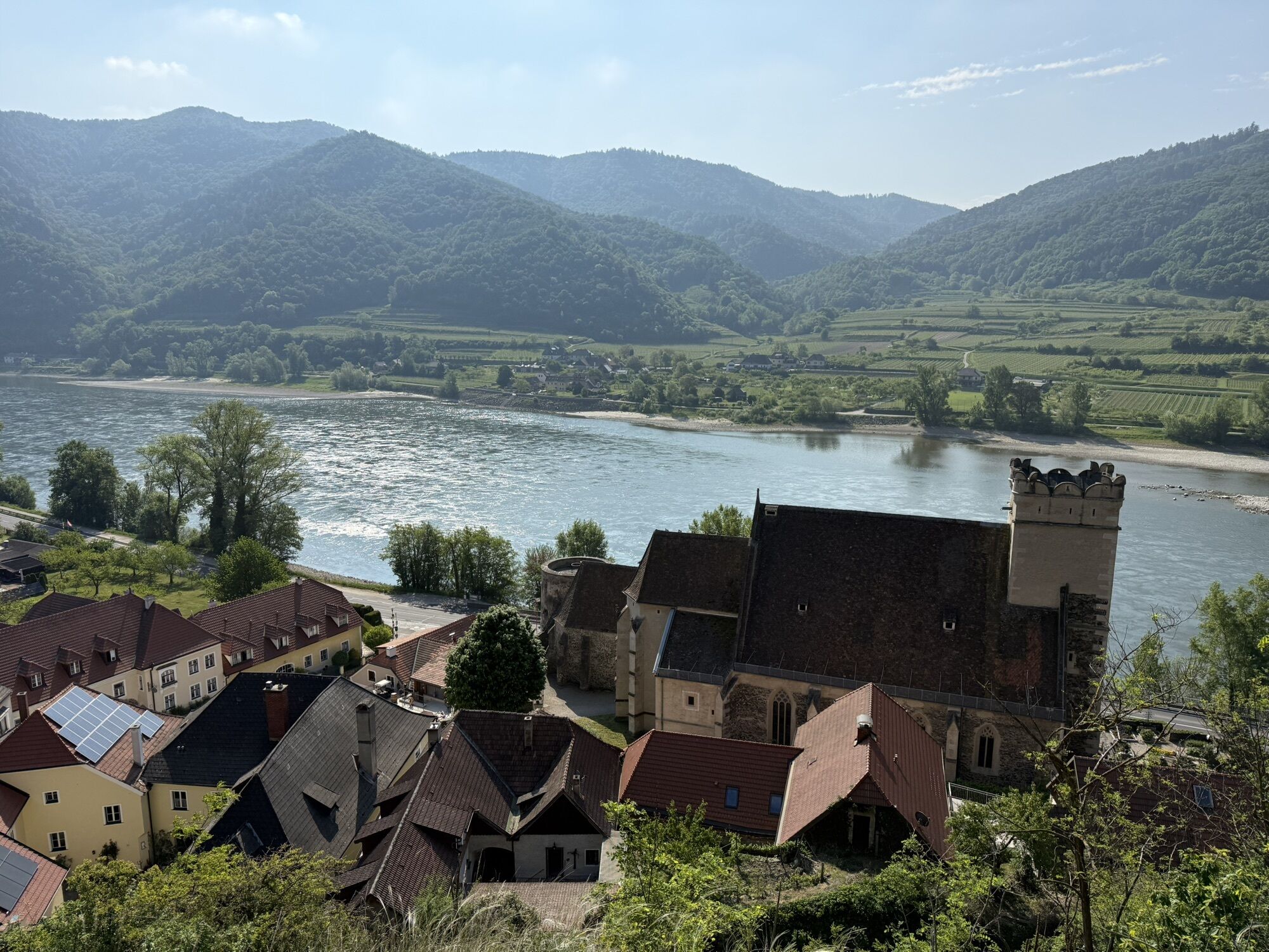
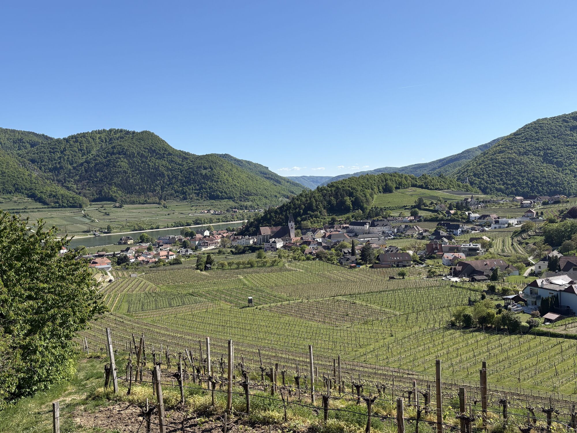
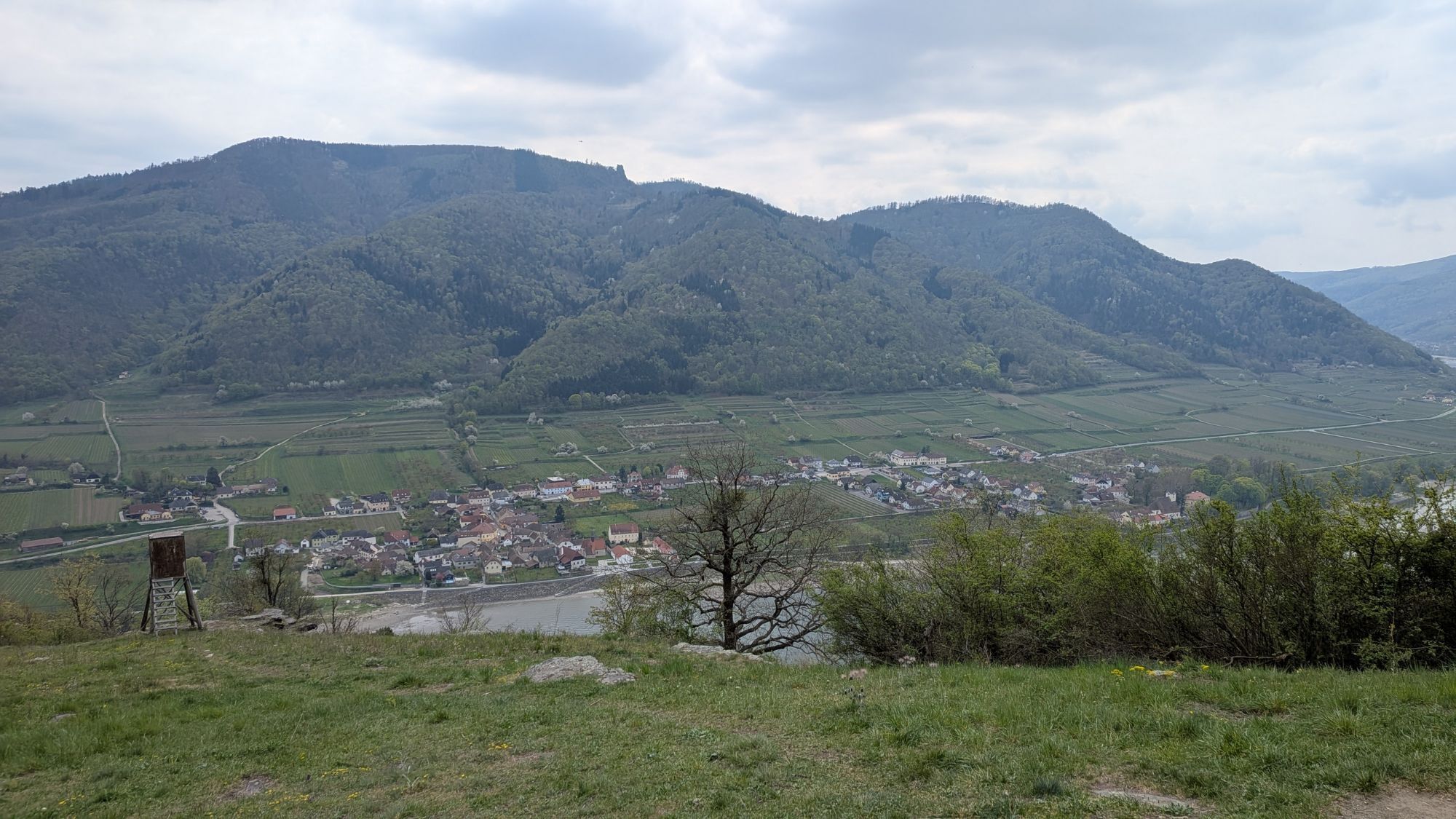
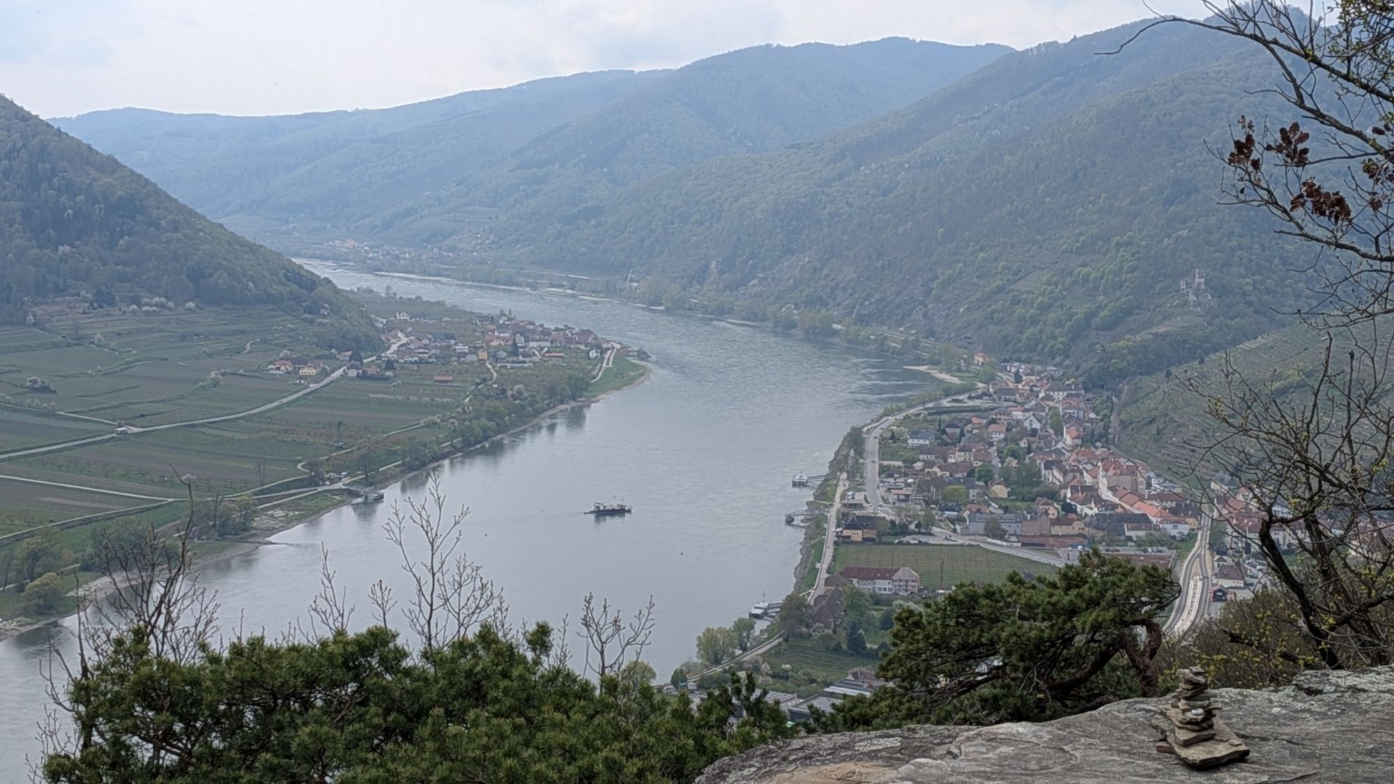
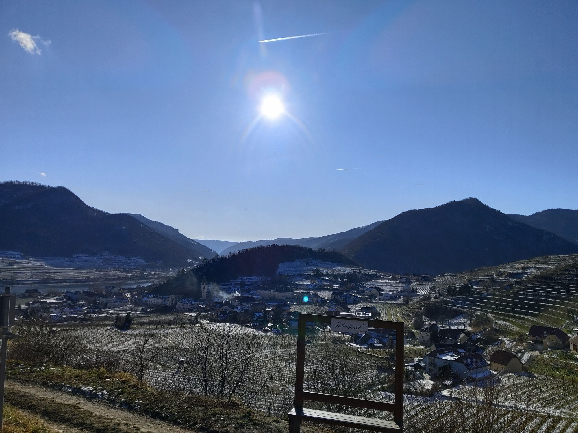
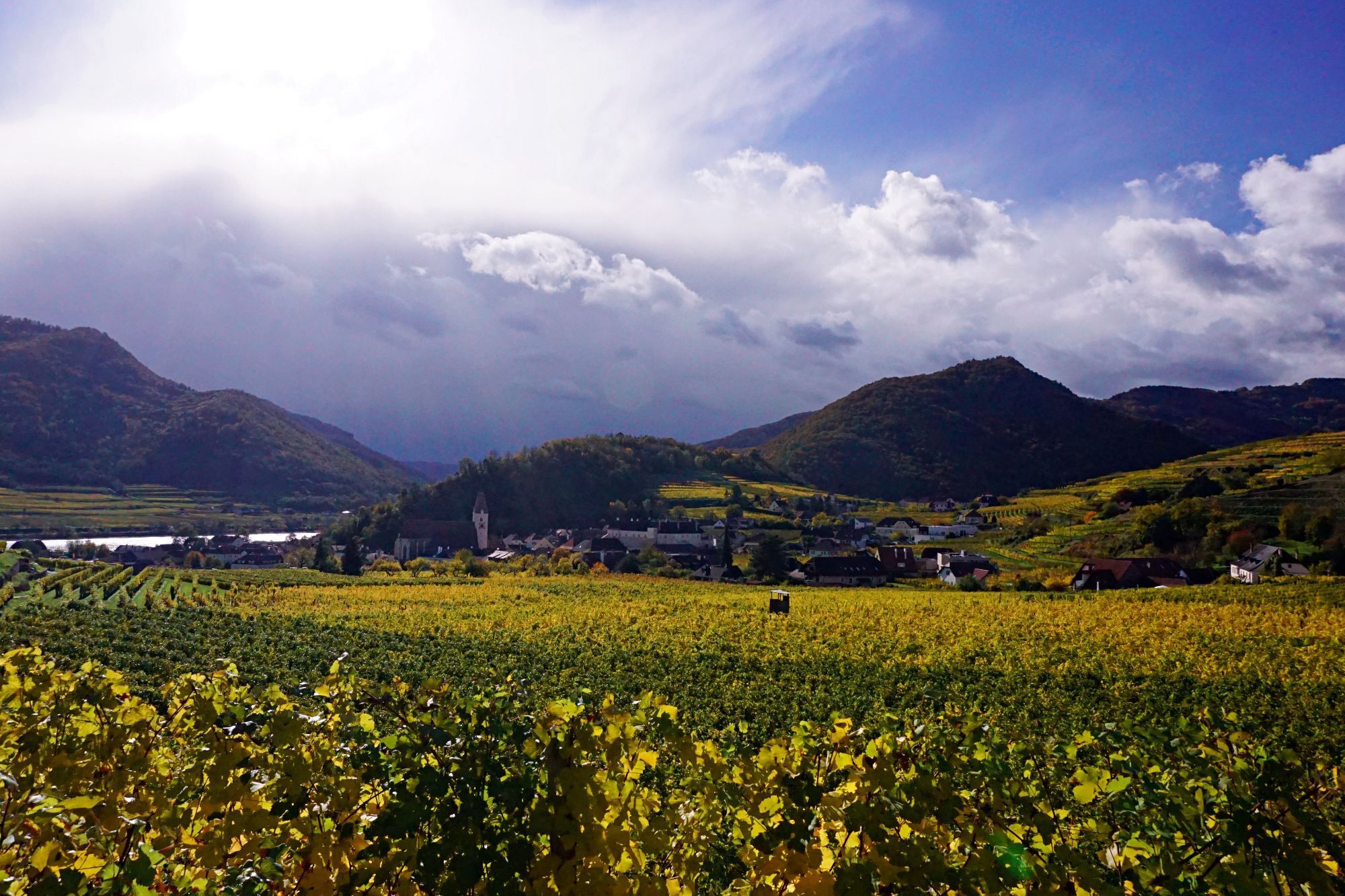
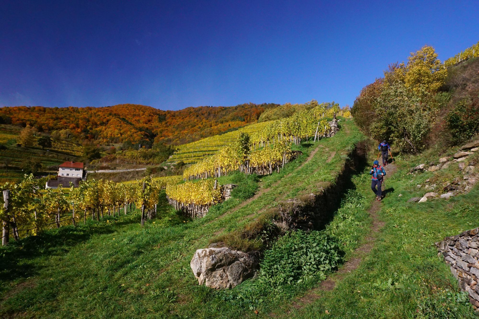
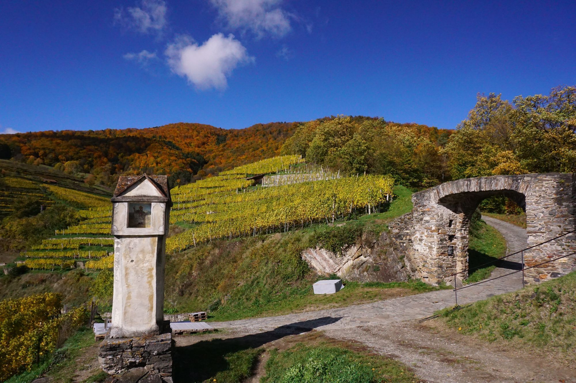
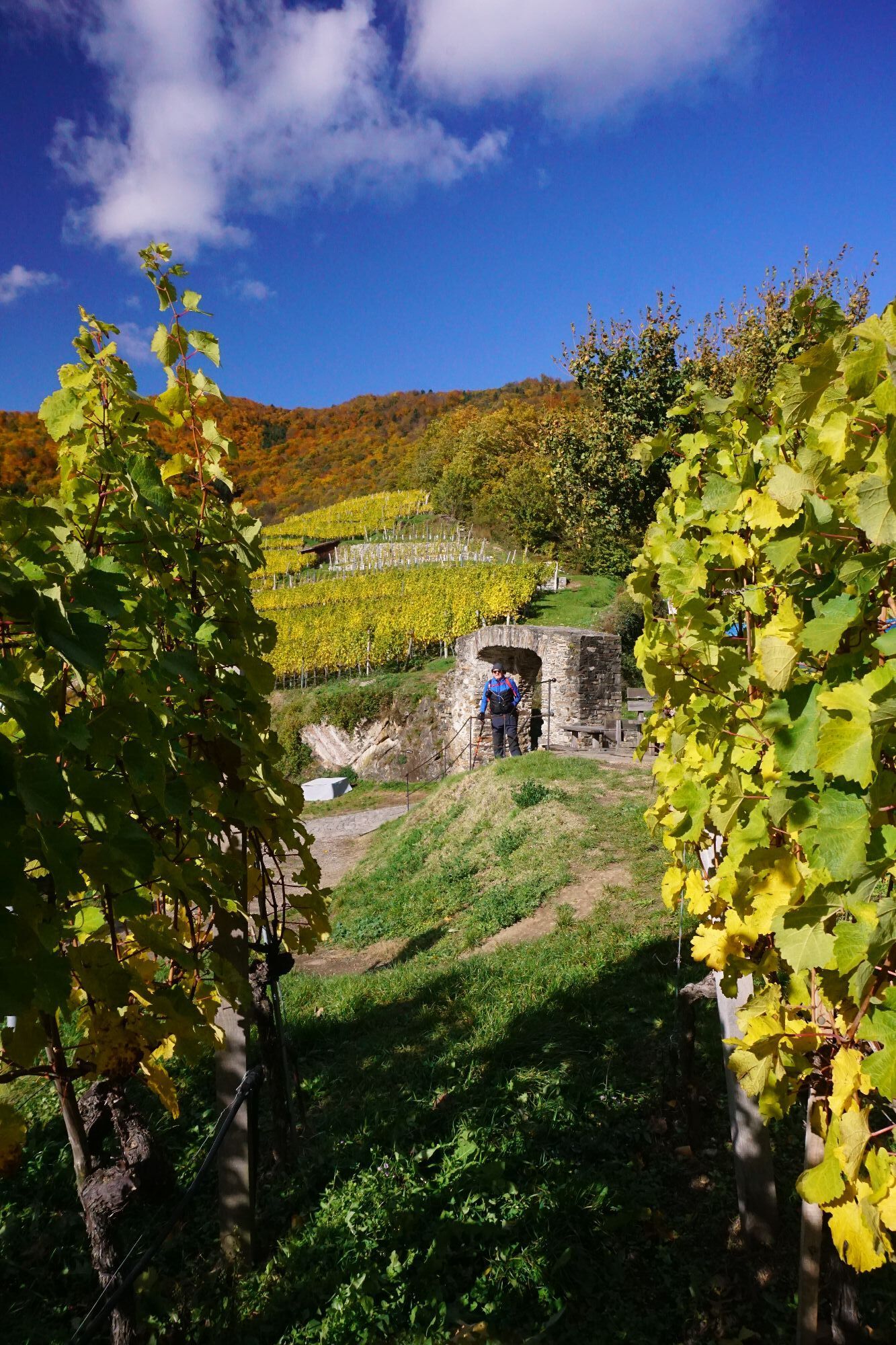
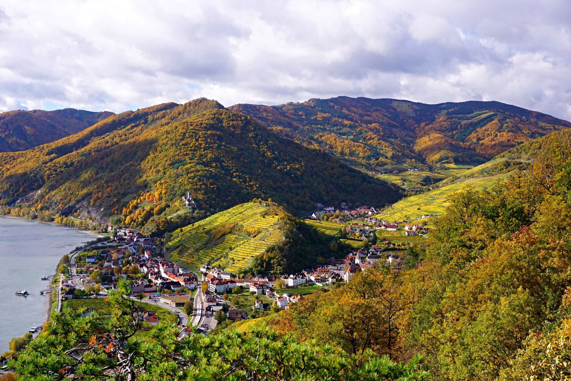
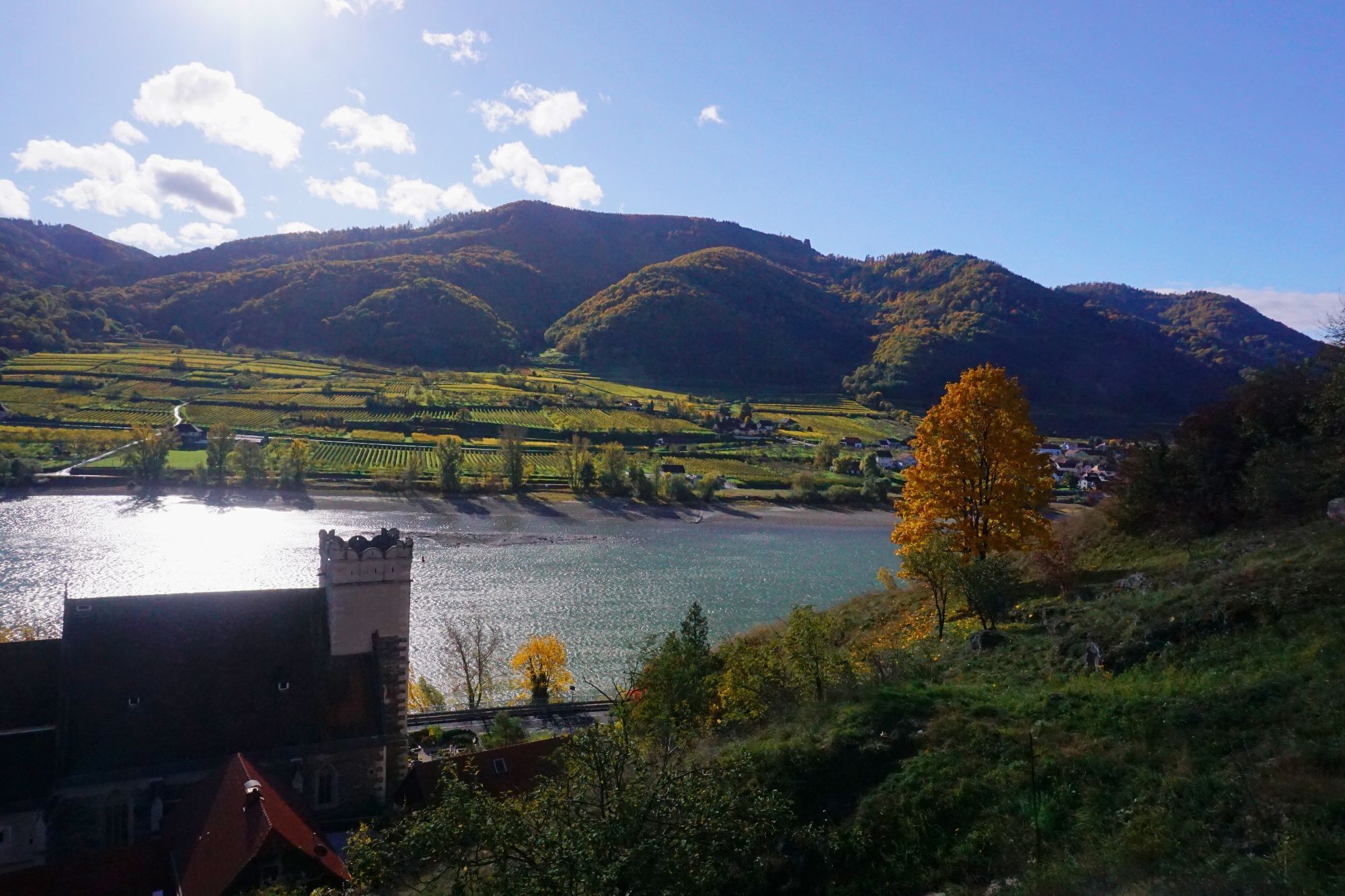
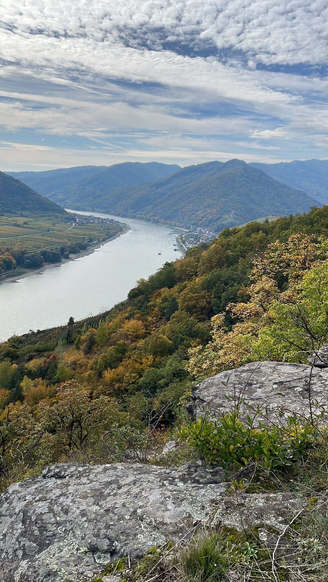
<p>Starting from the well-known wine-growing town of Spitz, we begin our seven-km-long hike through the wine-growing town of Spitz. We walk through the famous vineyards already within the town (Pluris, Achspoint, Singerriedel) down to the legendary "Red Gate" into the Miesling Valley. From there, it goes through beautiful natural oak and hornbeam forests to bizarre rock formations with rustic old pines (partly deadwood) over the Michaelerberg to the old fortified church and Wachau original parish of St. Michael and along the Danube back to Spitz.</p><p>The Michaelerberg holds a special surprise for us: a beautiful, gently sloping dry grassland that offers a habitat to unique plant and animal species. Now it goes past blackthorn, downy oaks, and acacias to the old fortified church and Wachau original parish of St. Michael and along the Danube back to Spitz.</p>

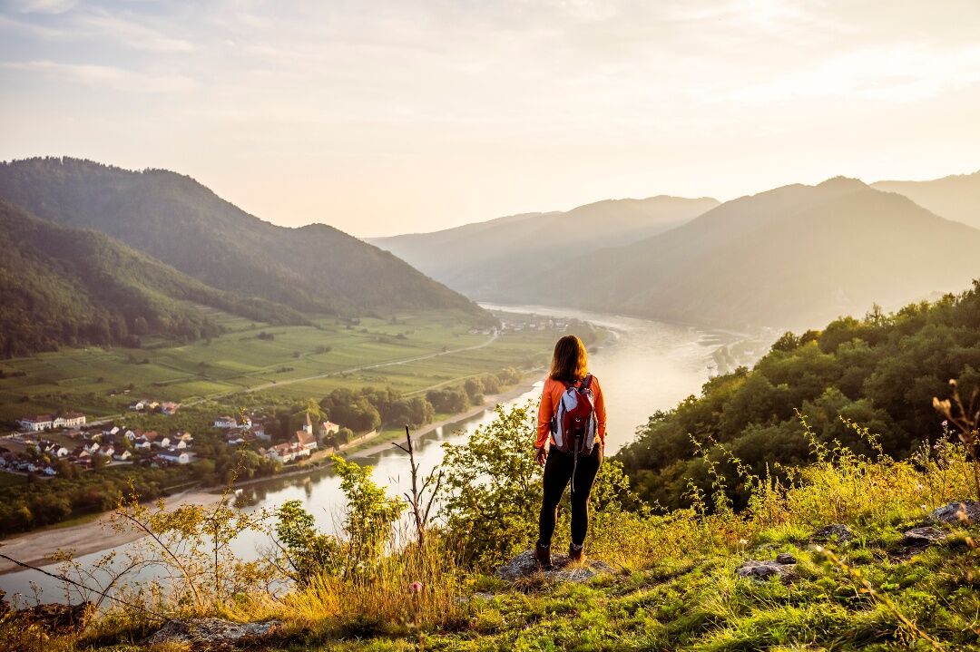
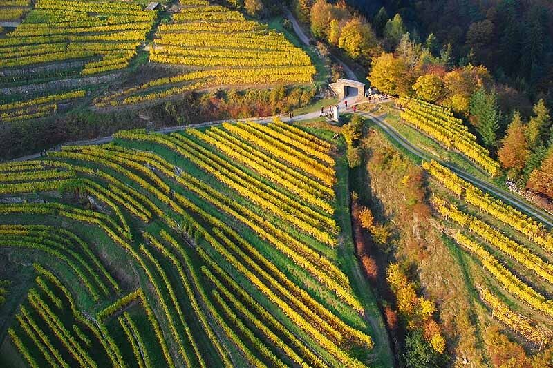
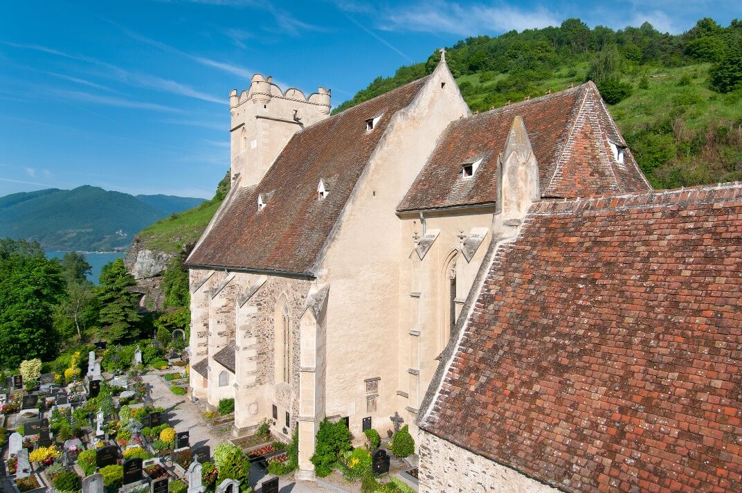
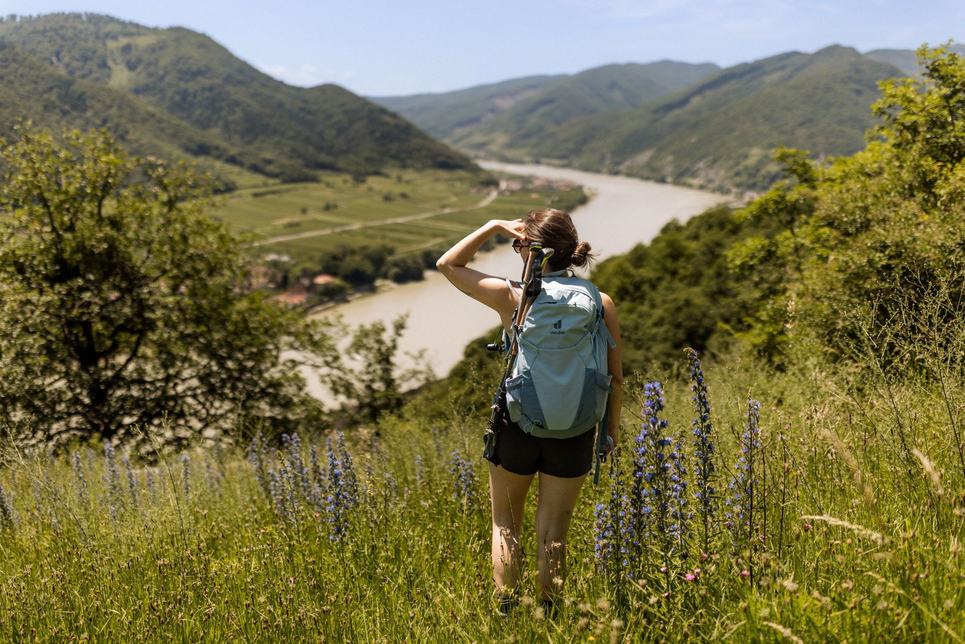
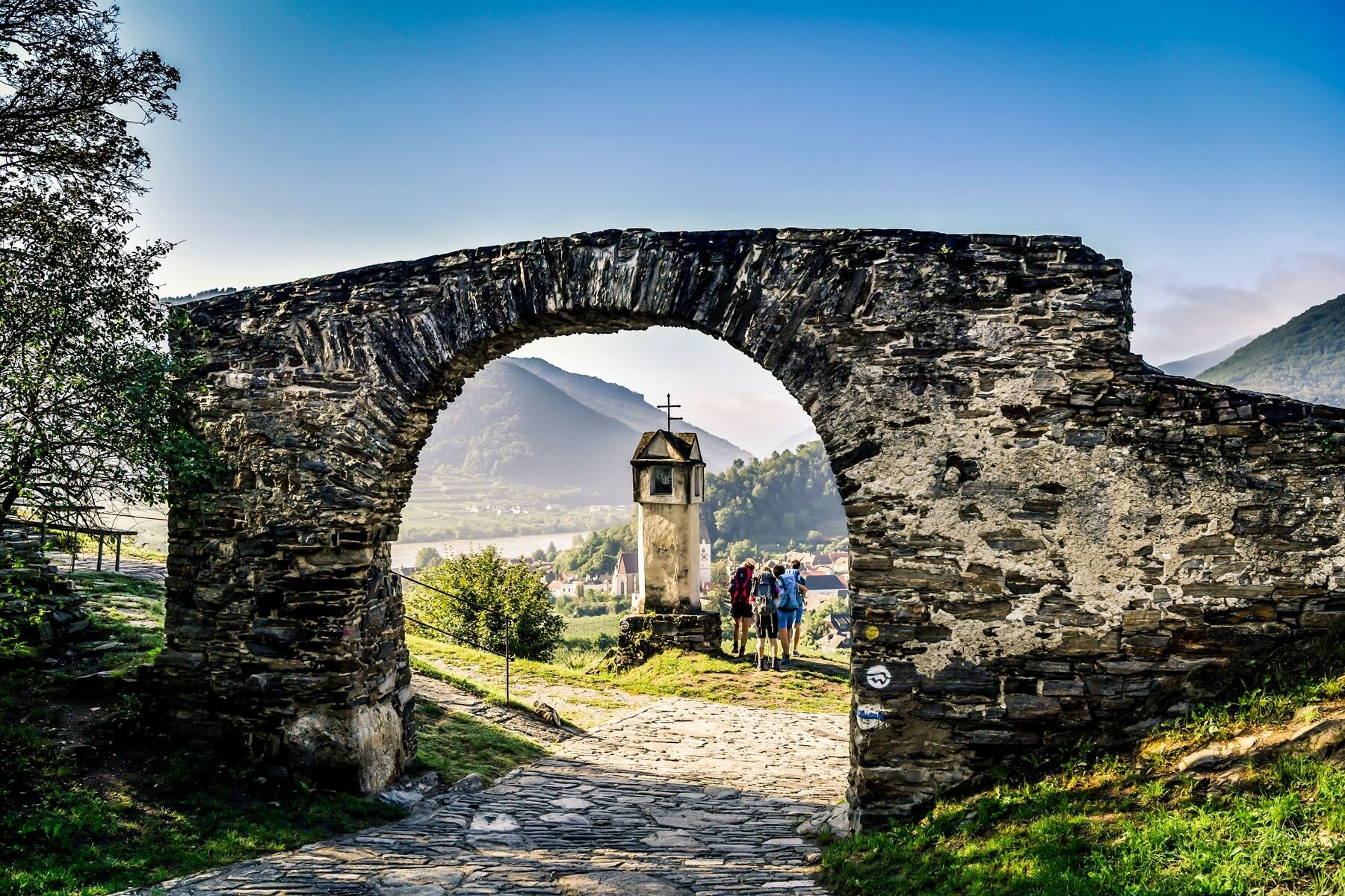
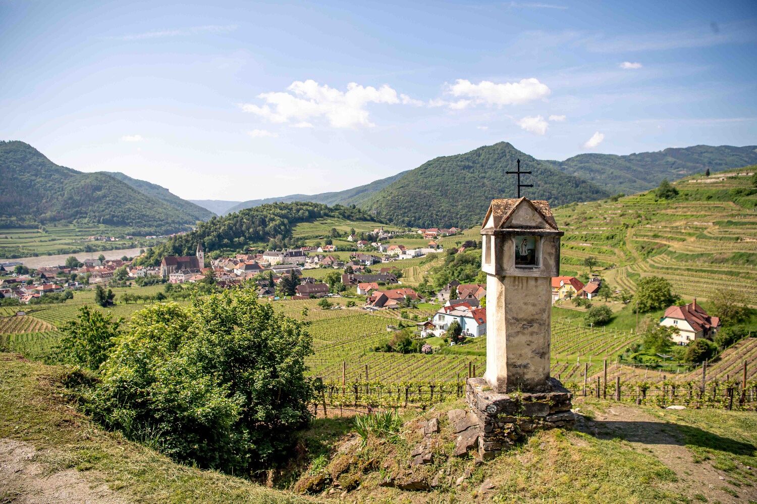
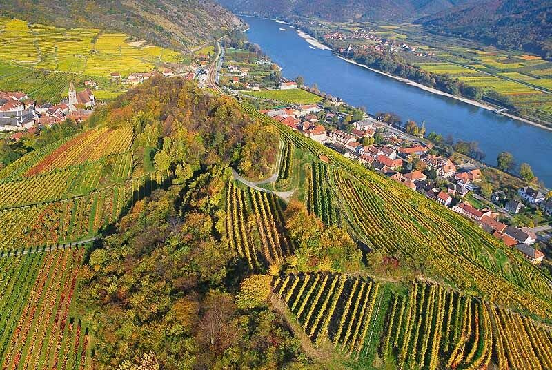
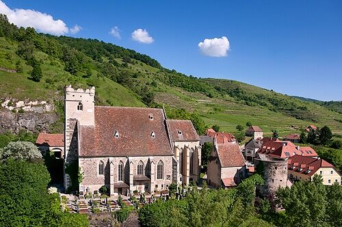
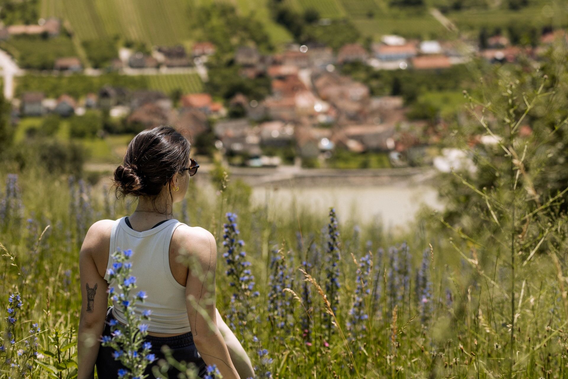
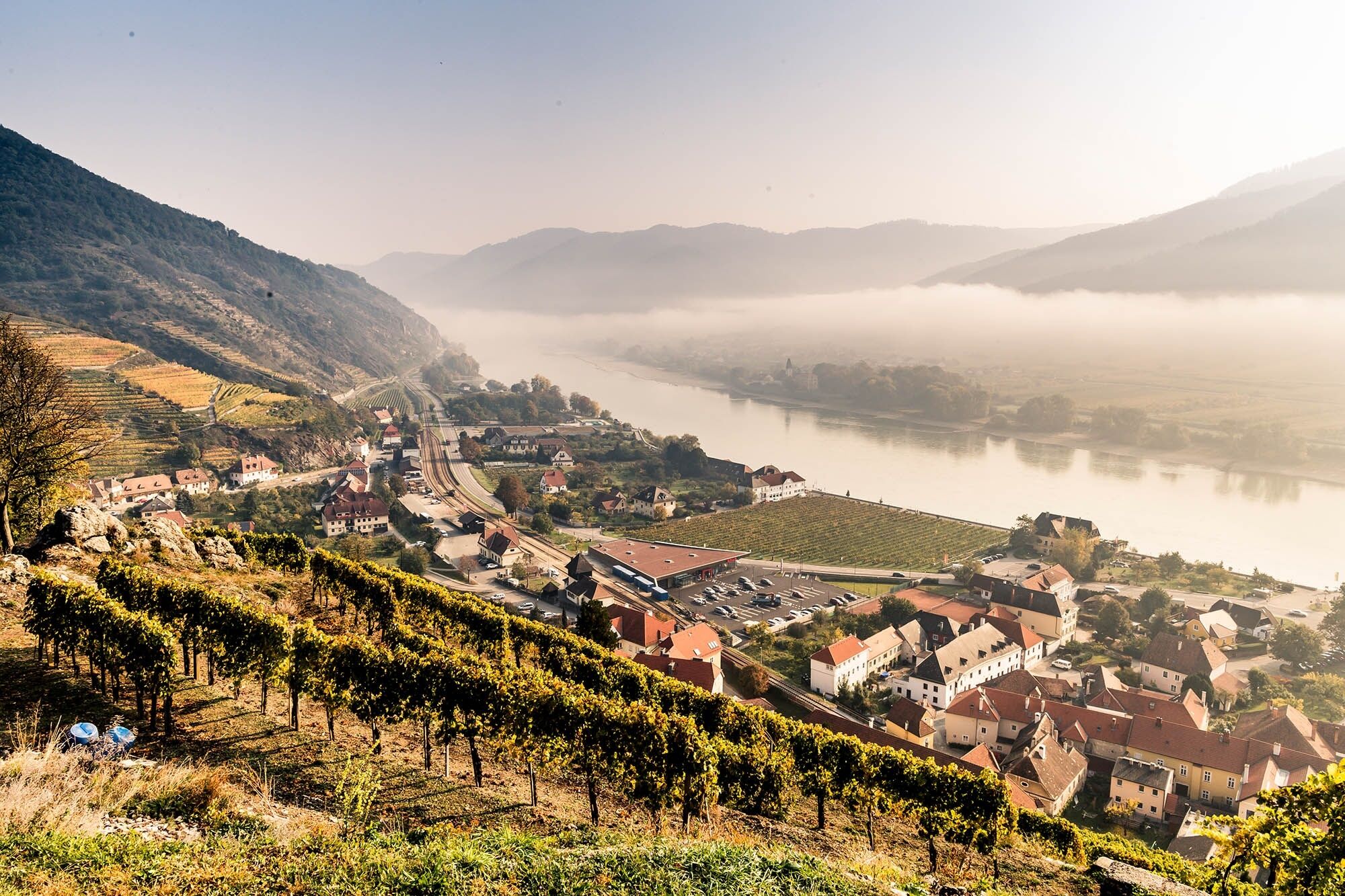
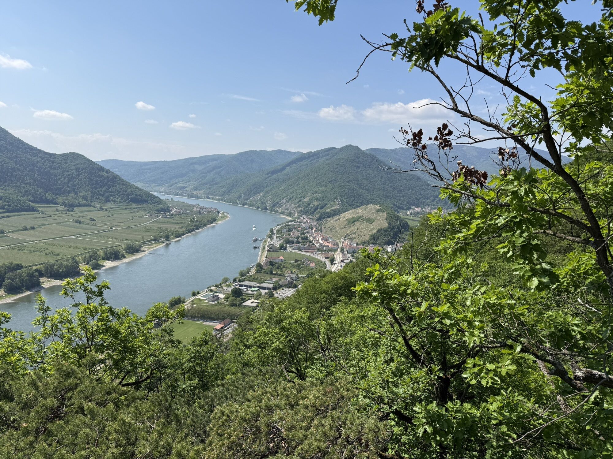
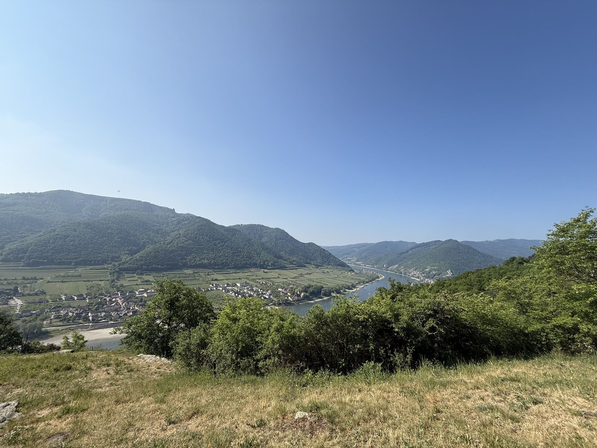
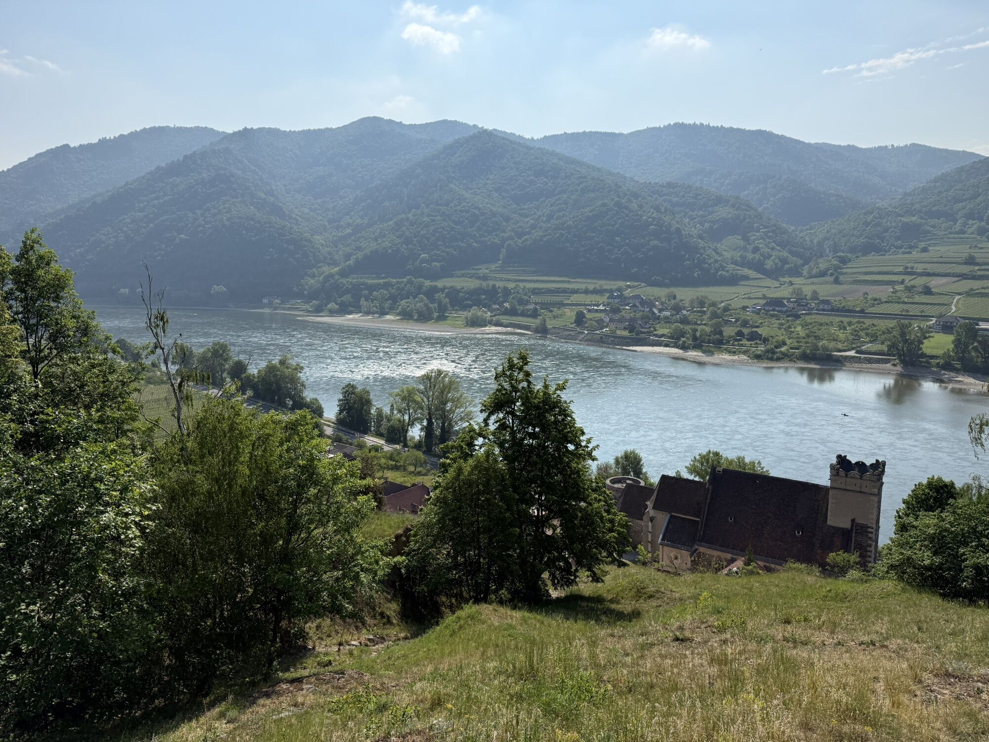
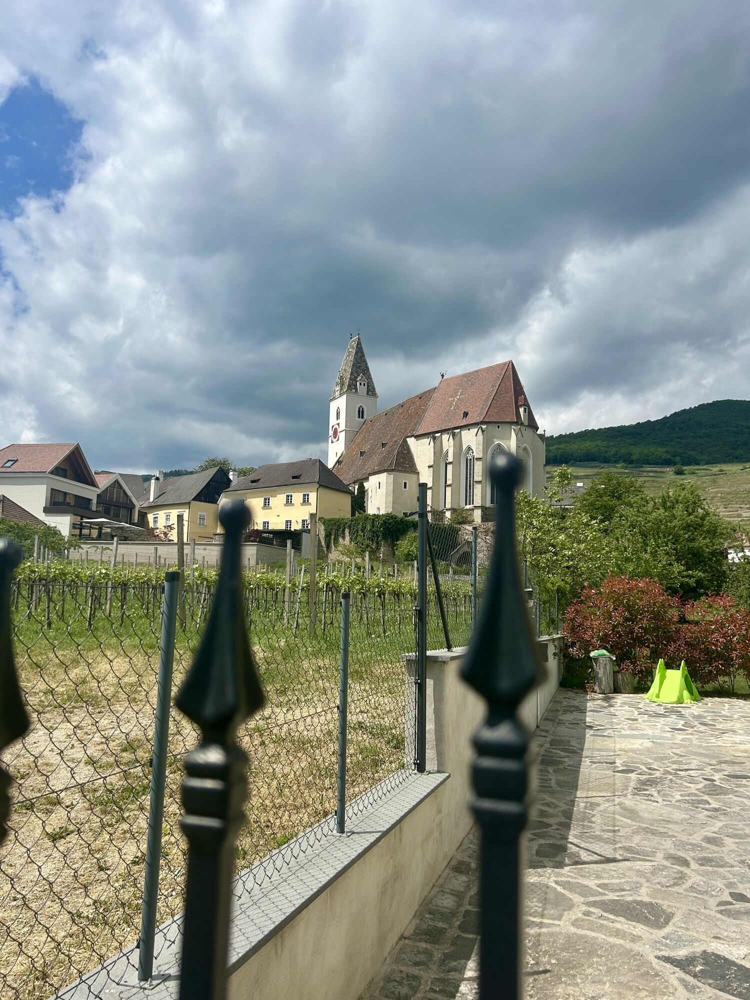
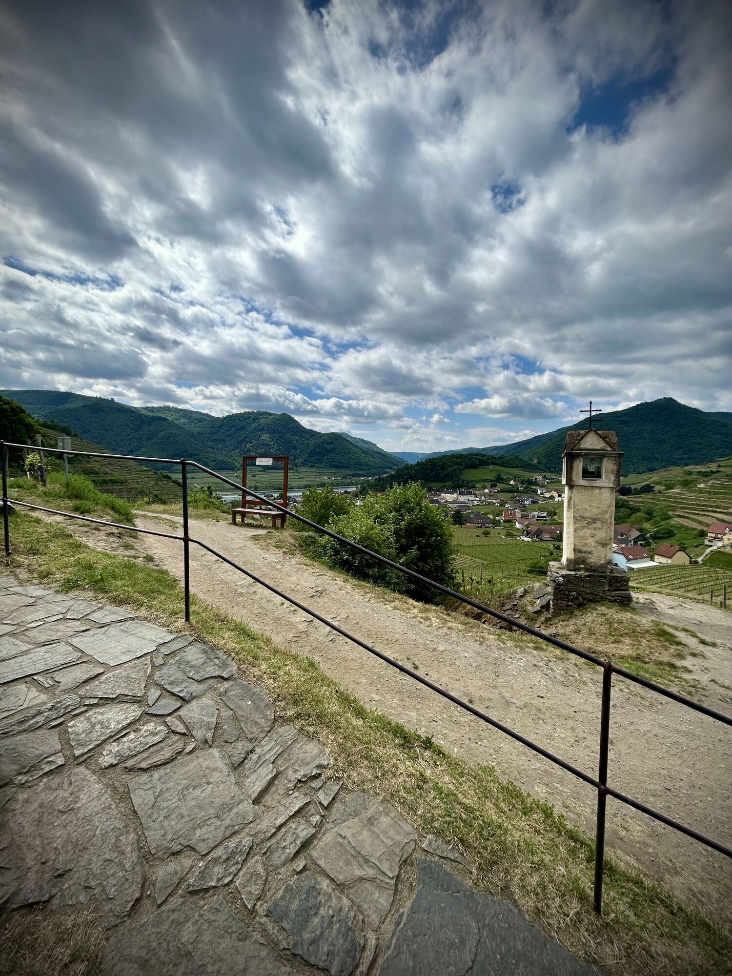
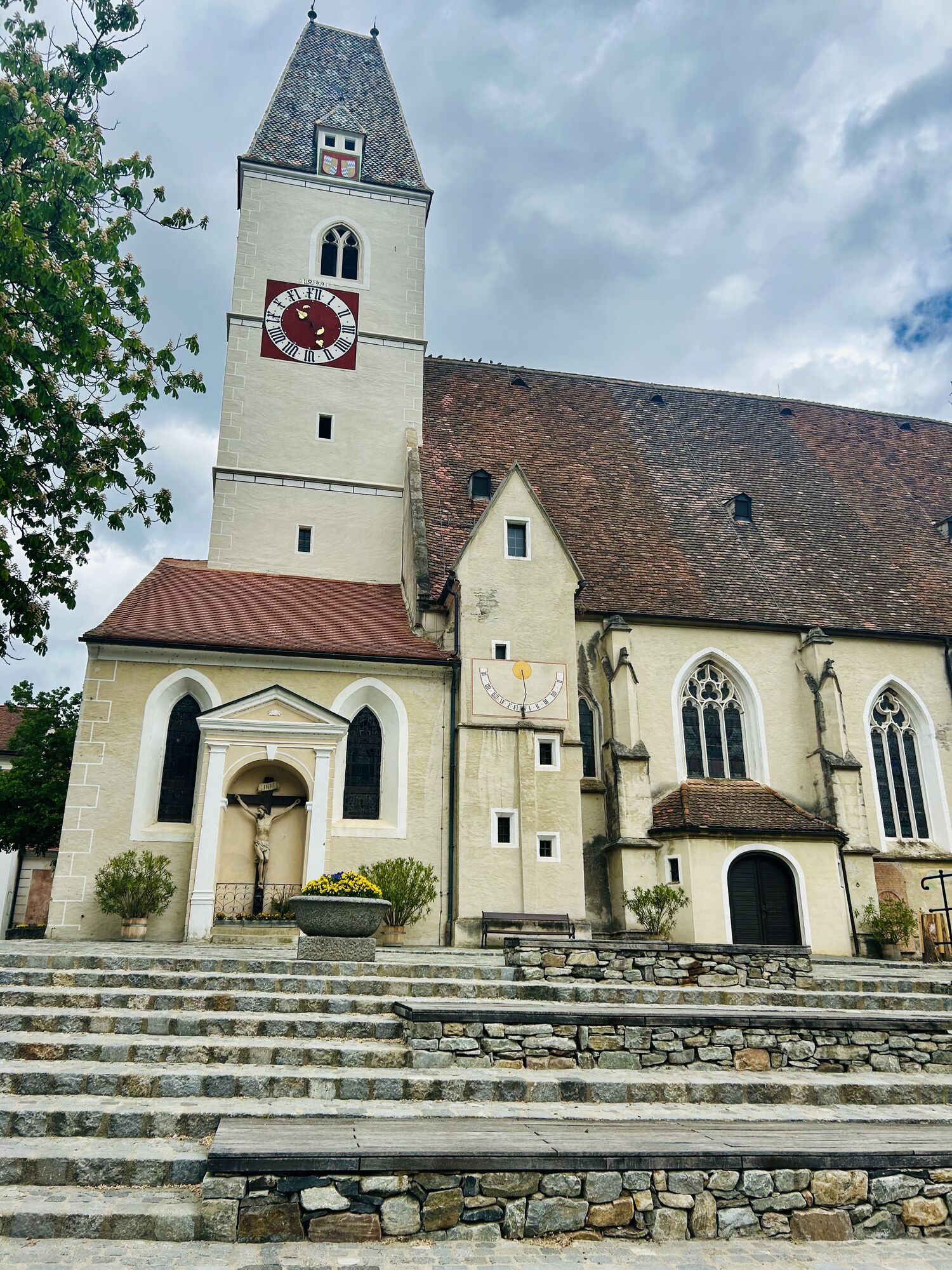
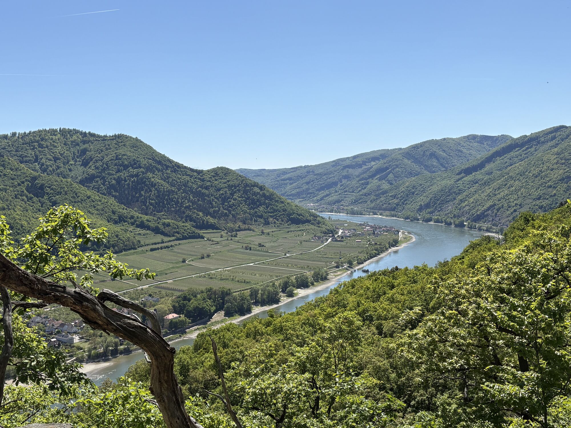
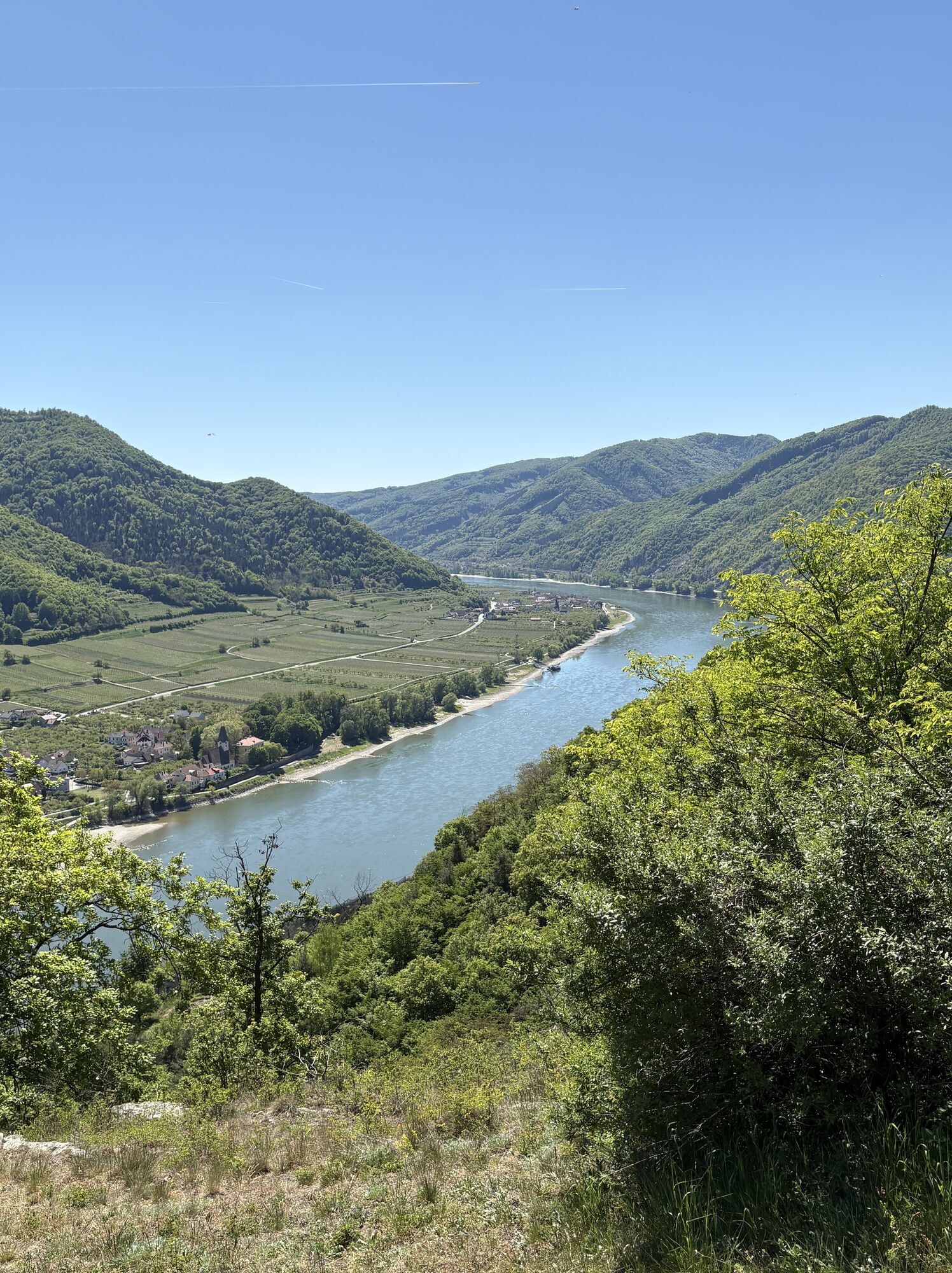
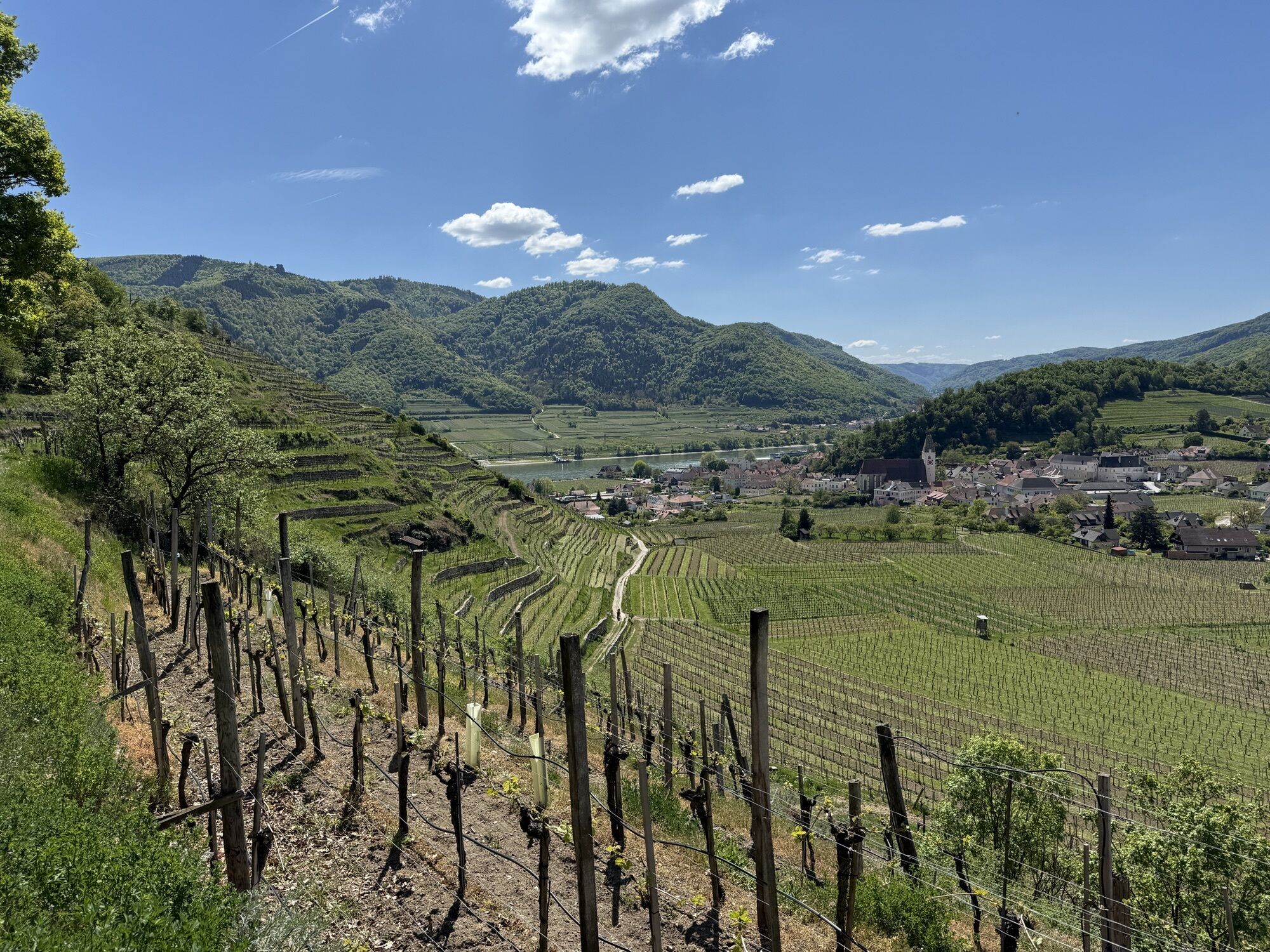
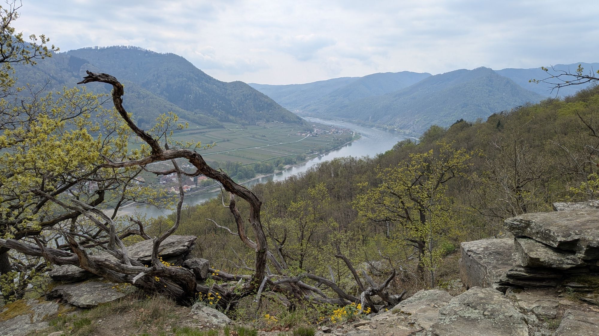
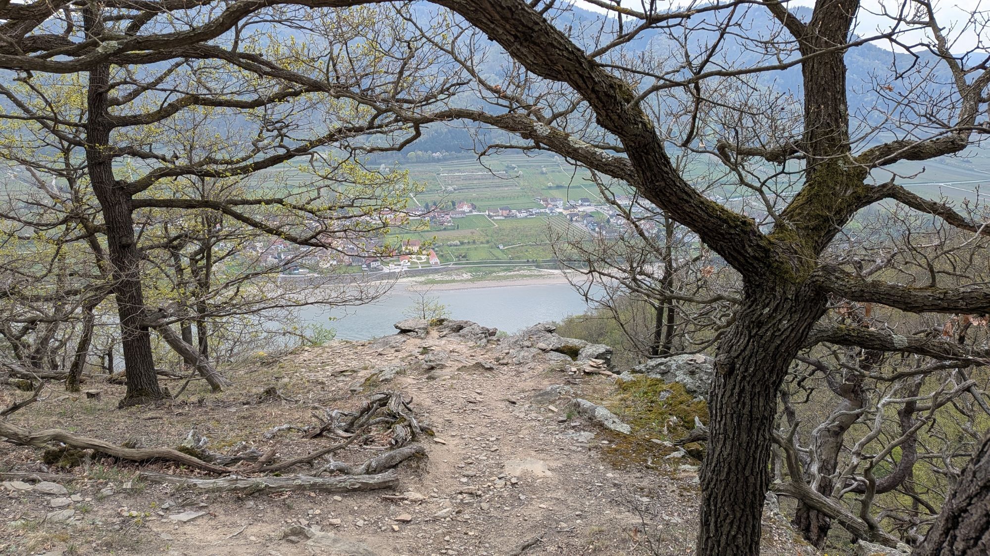
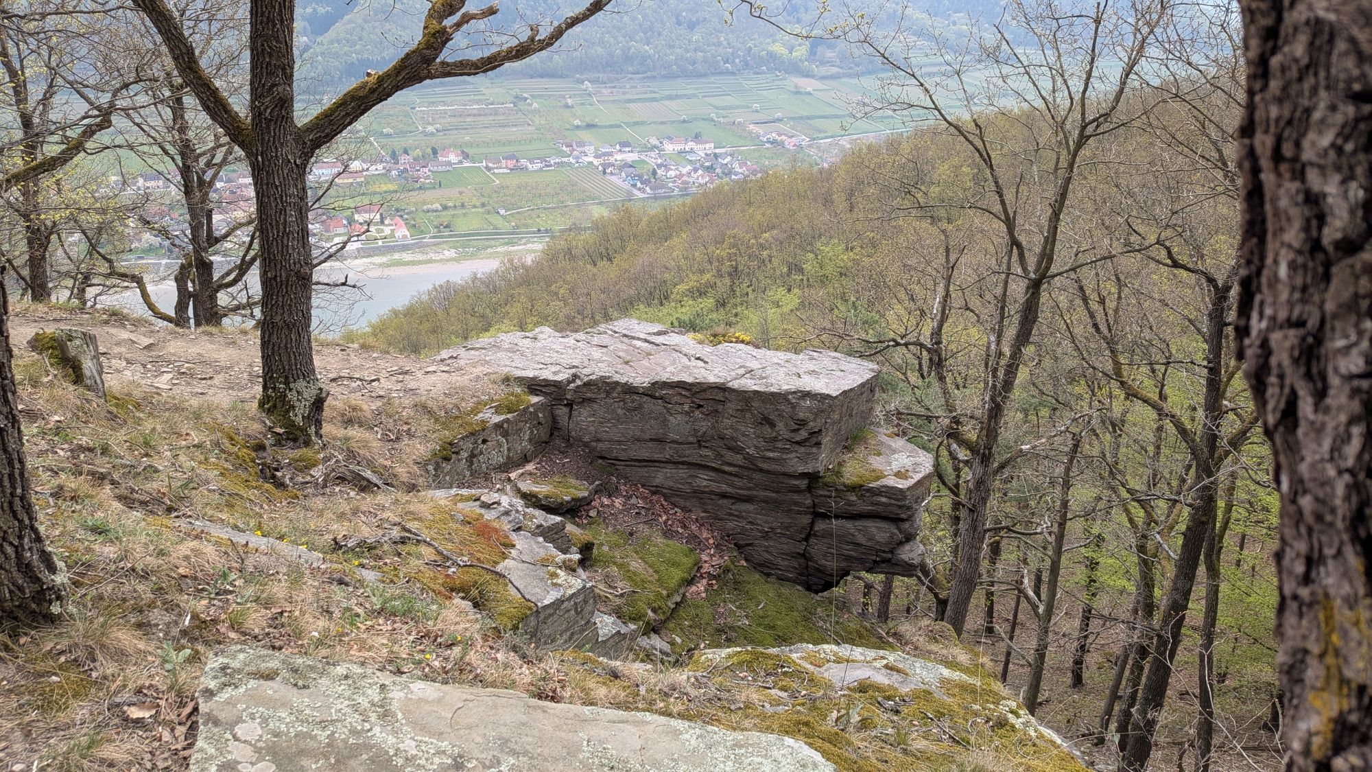
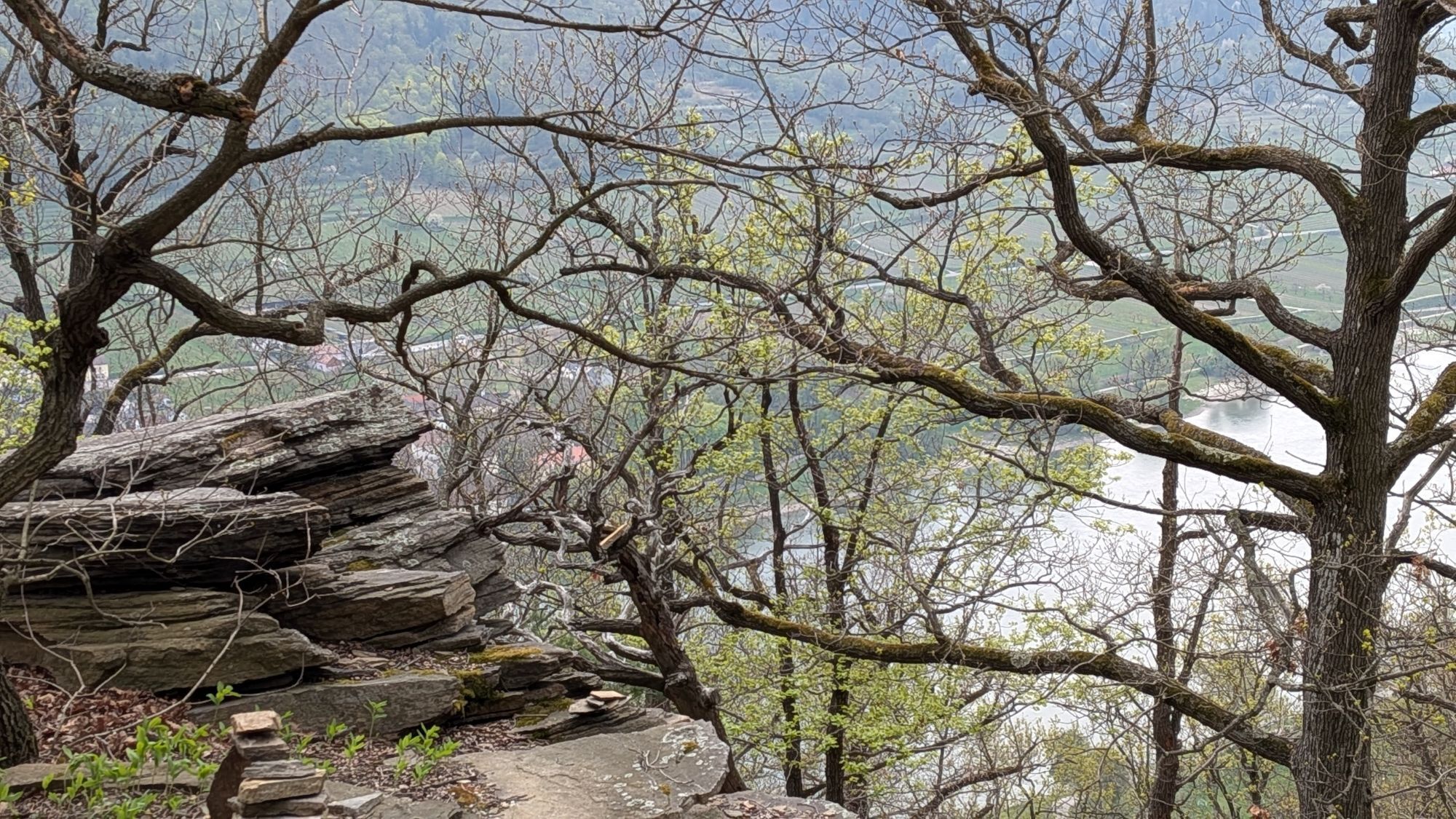
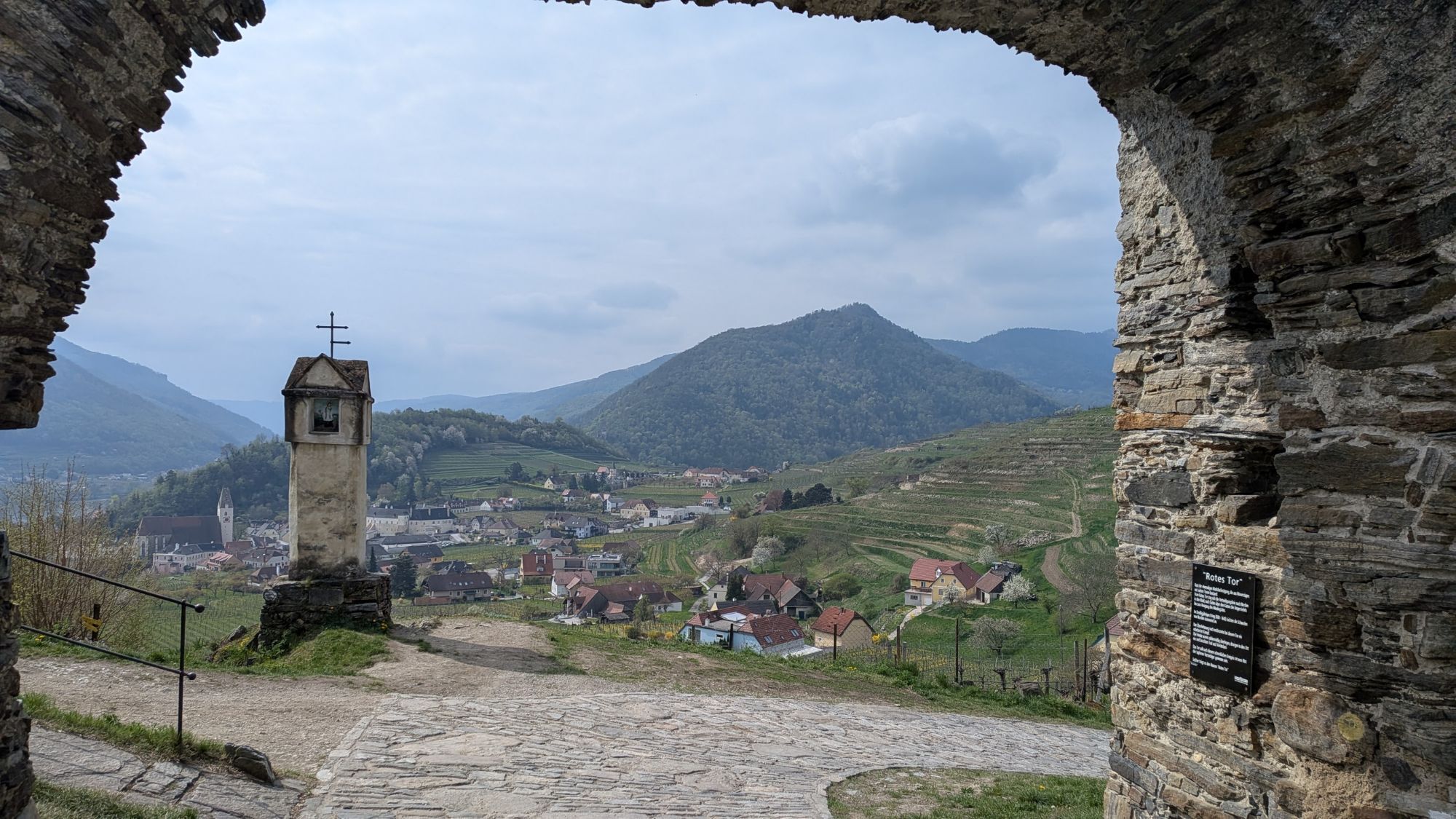
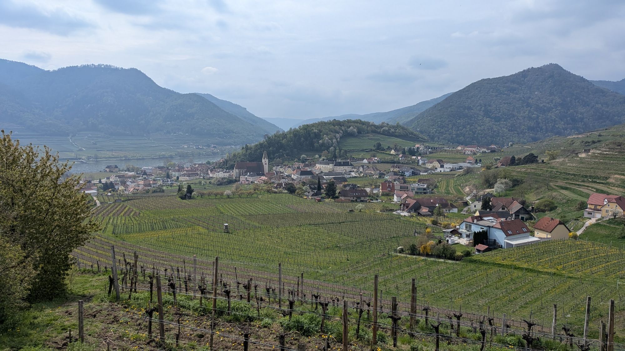
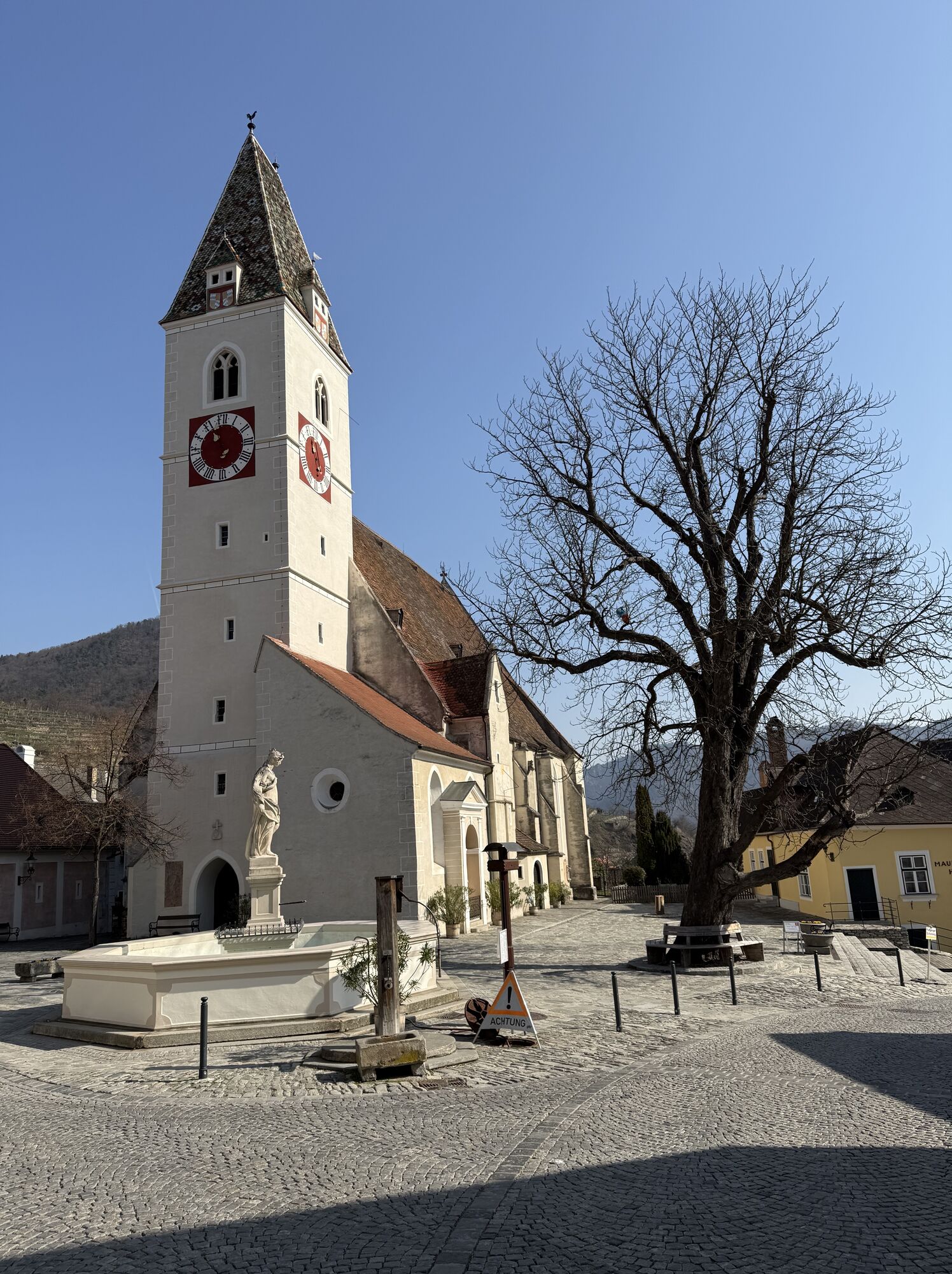
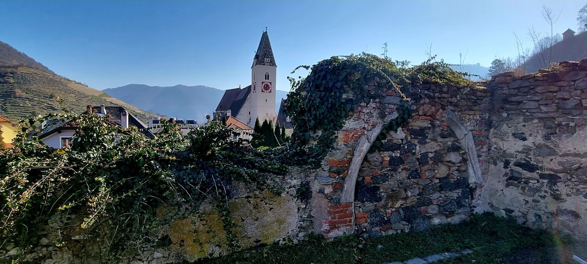
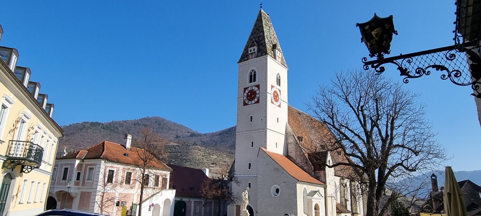
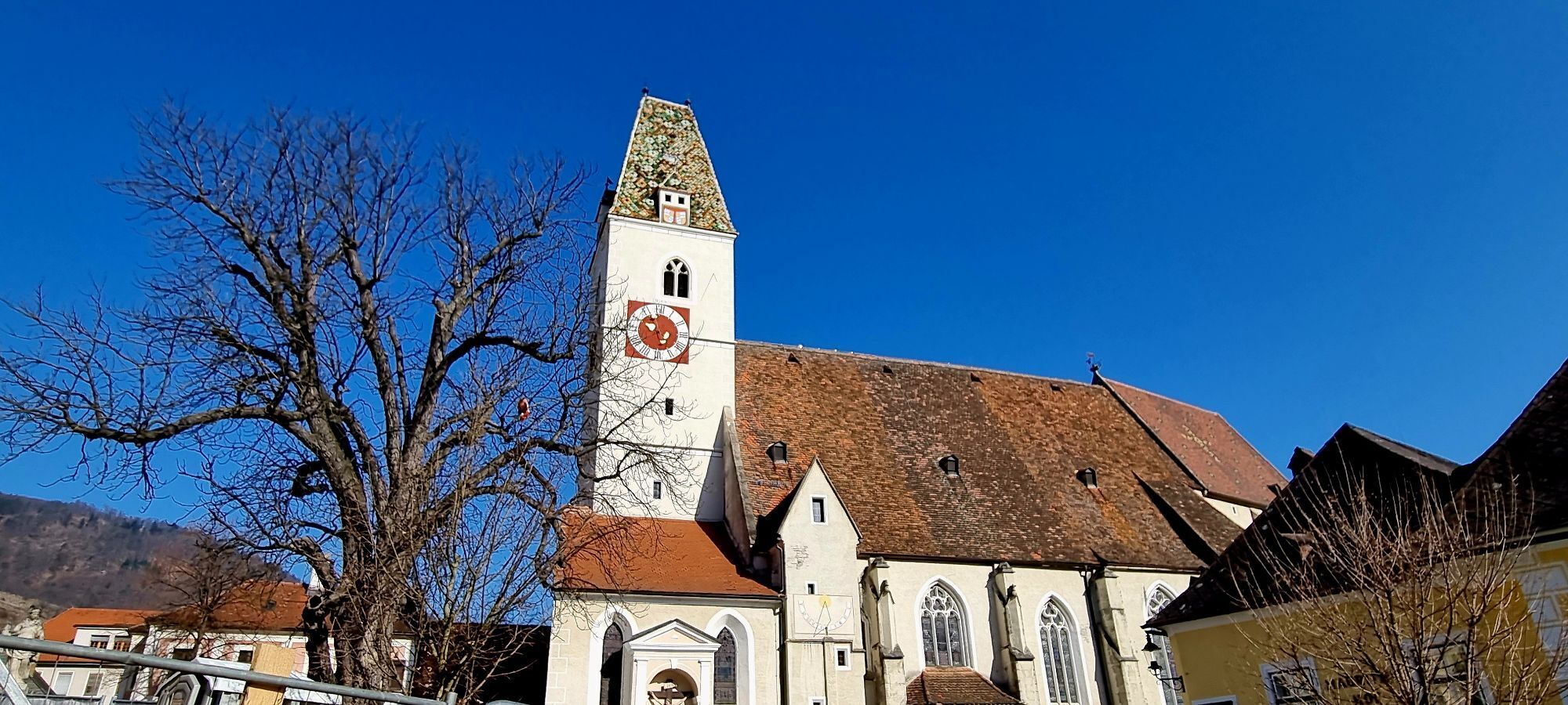
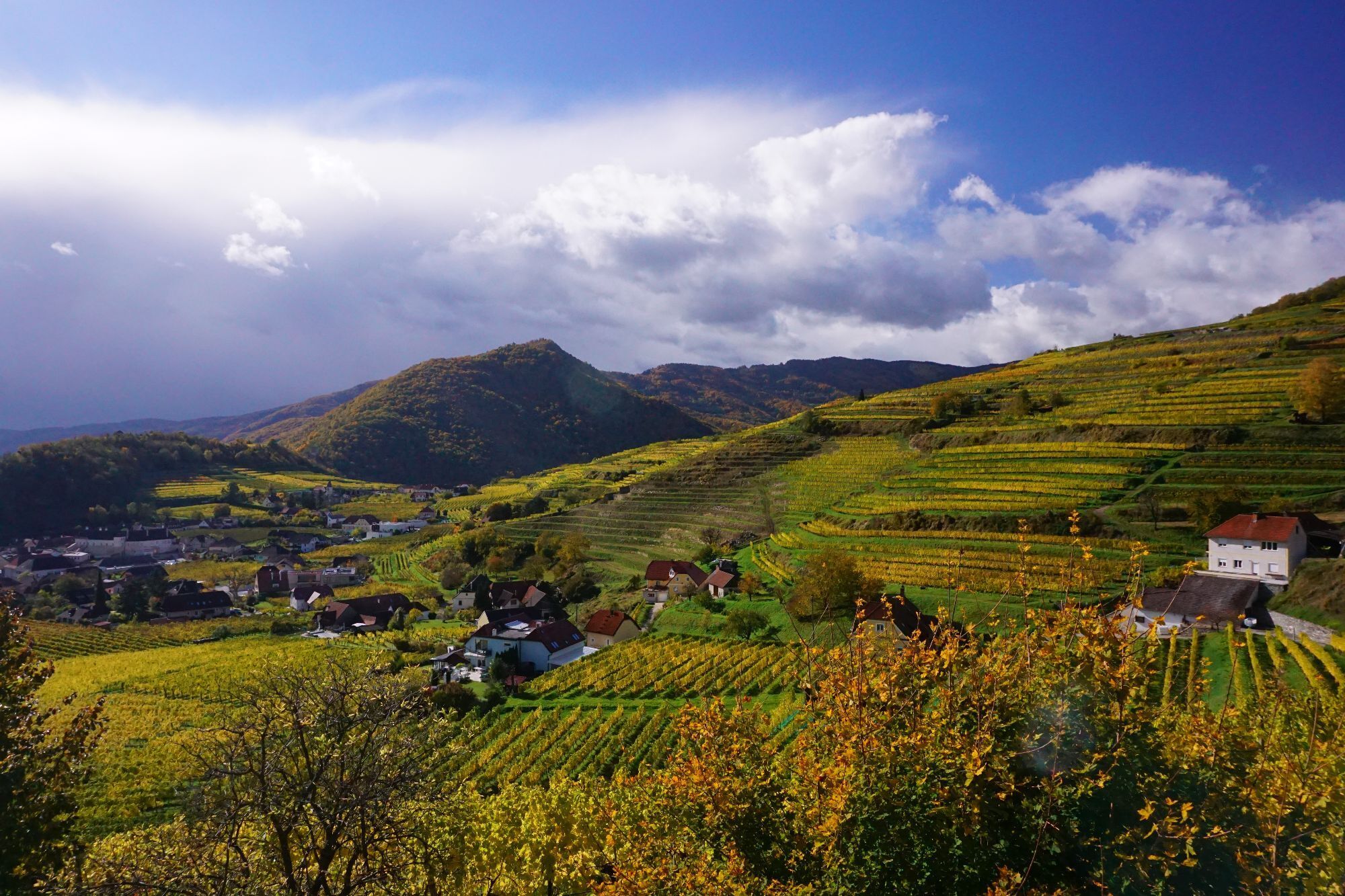
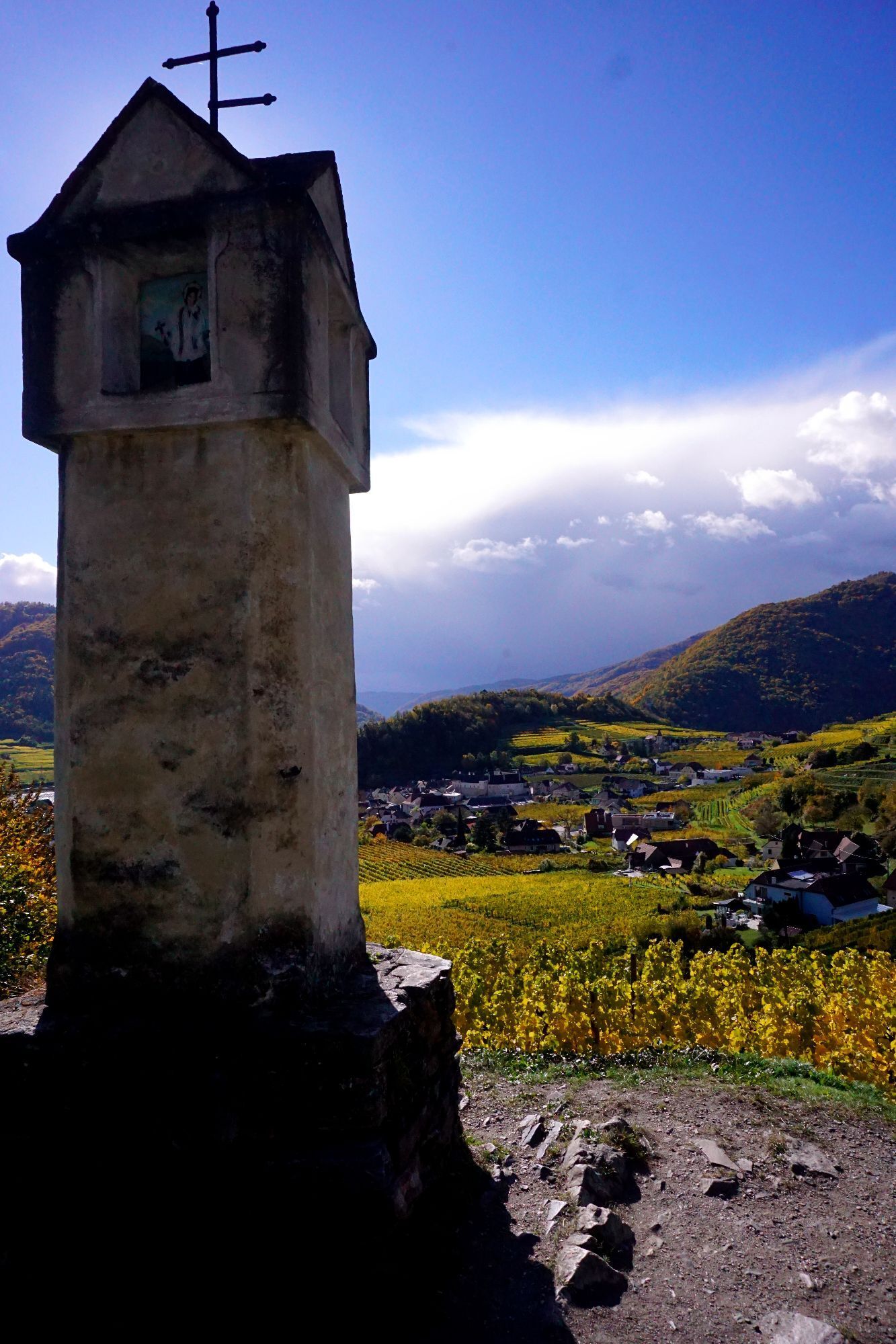
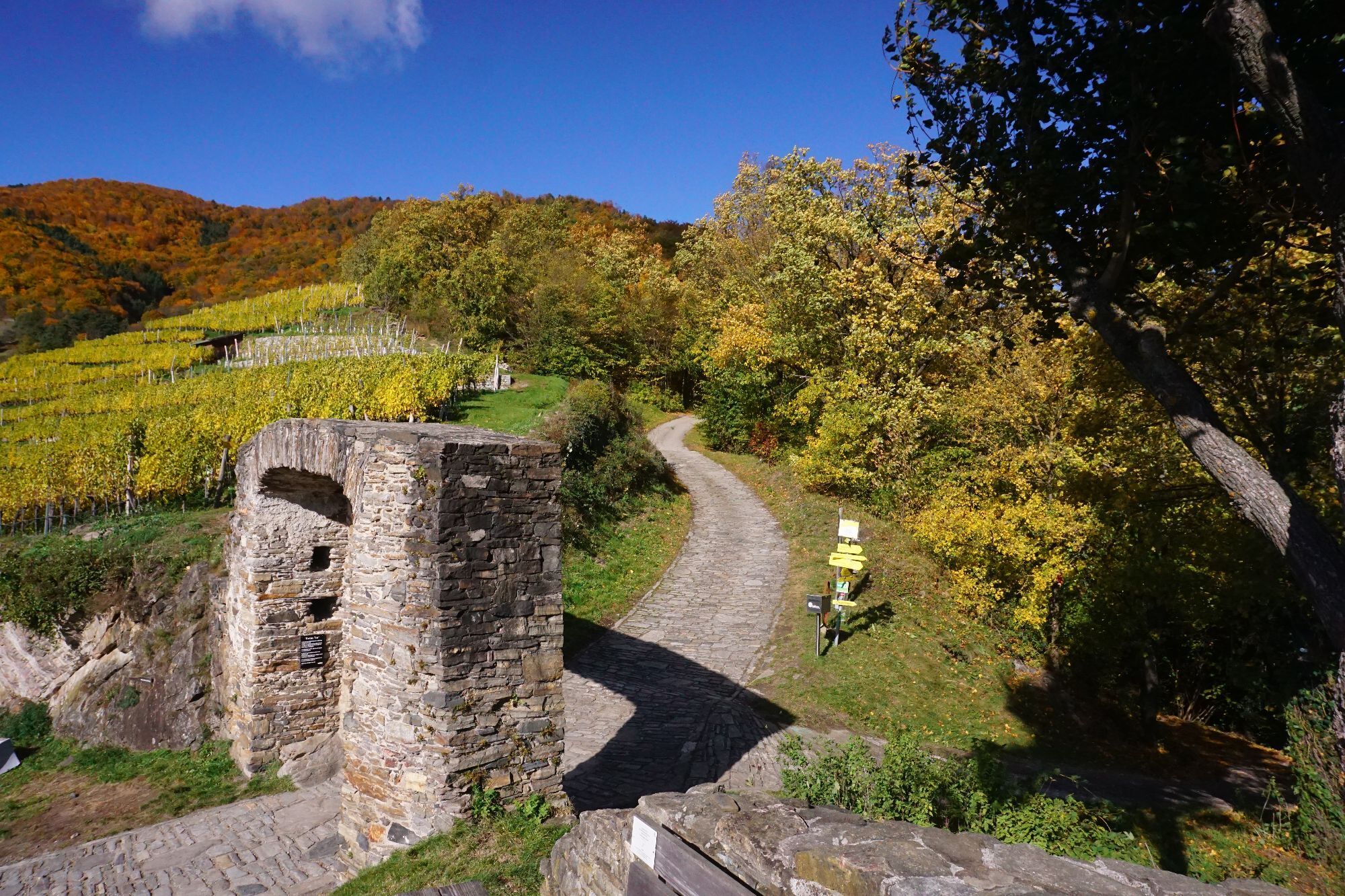
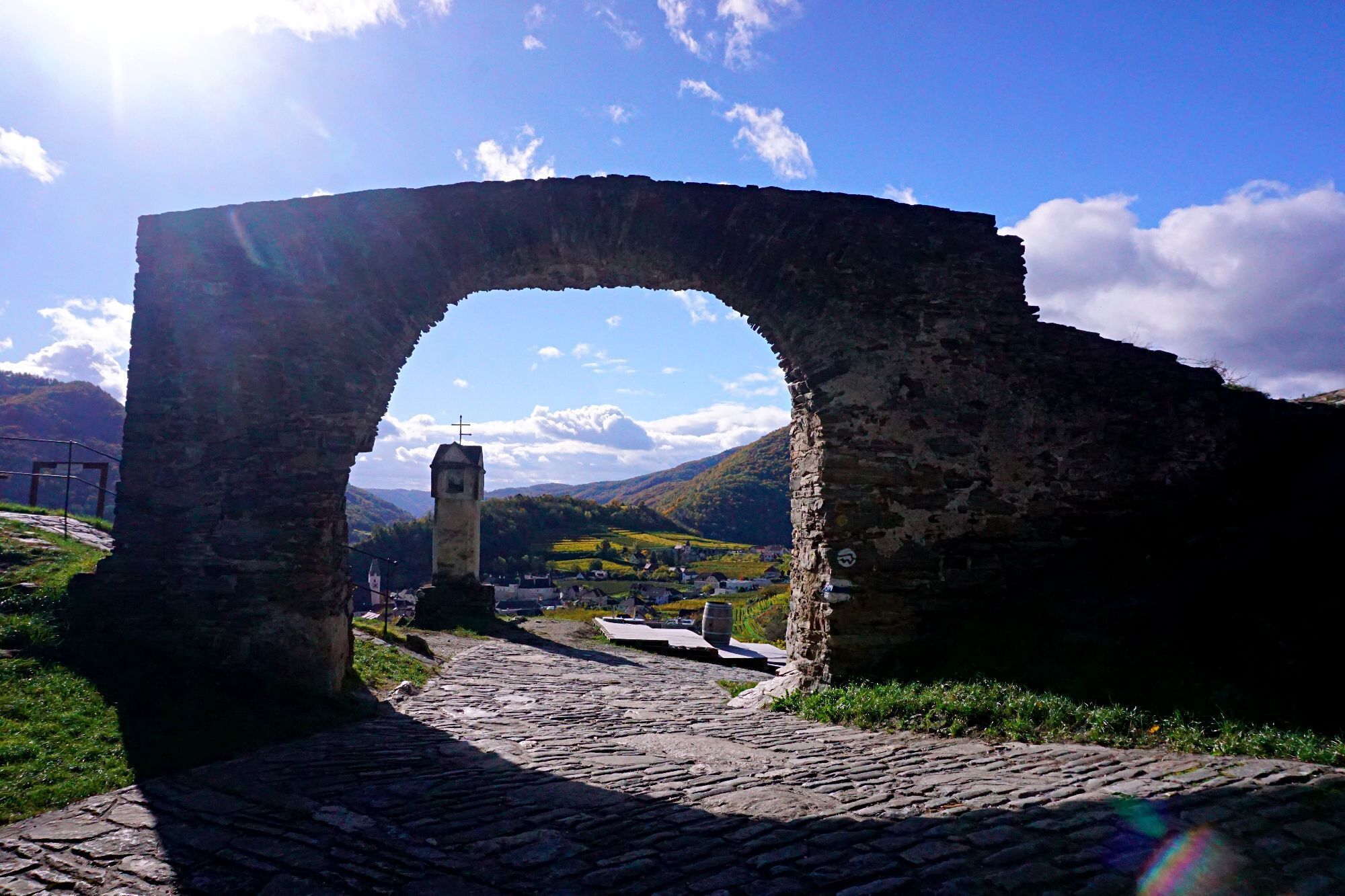
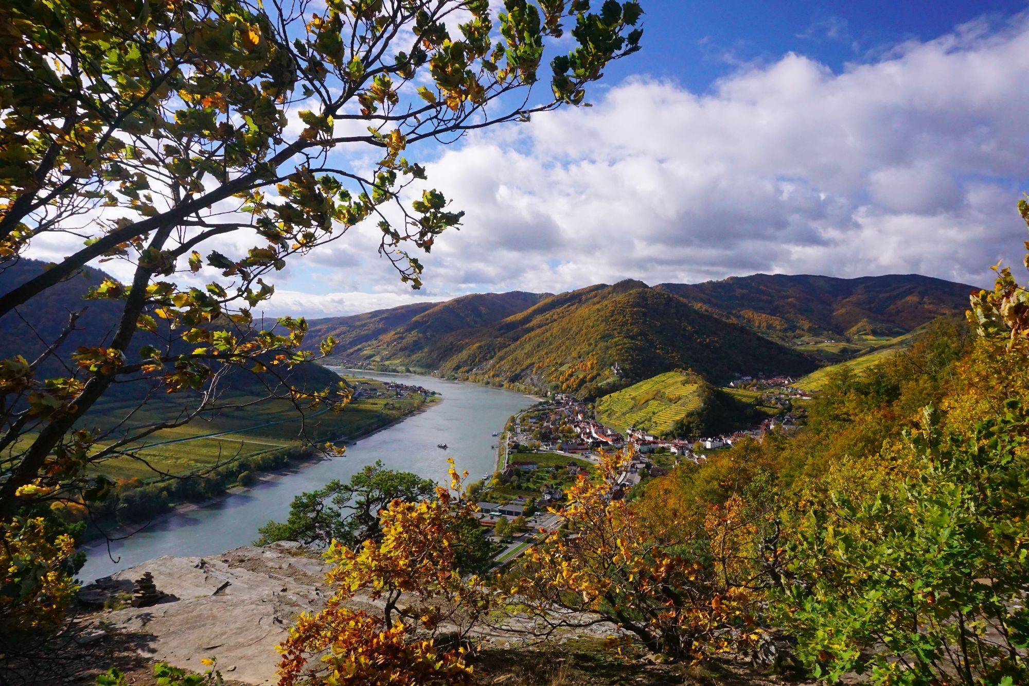
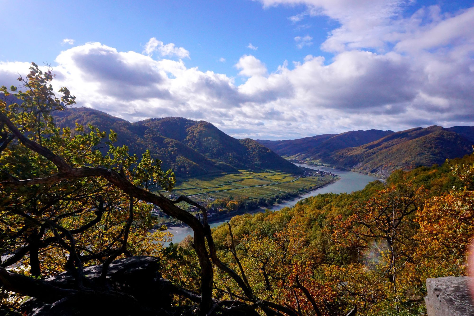
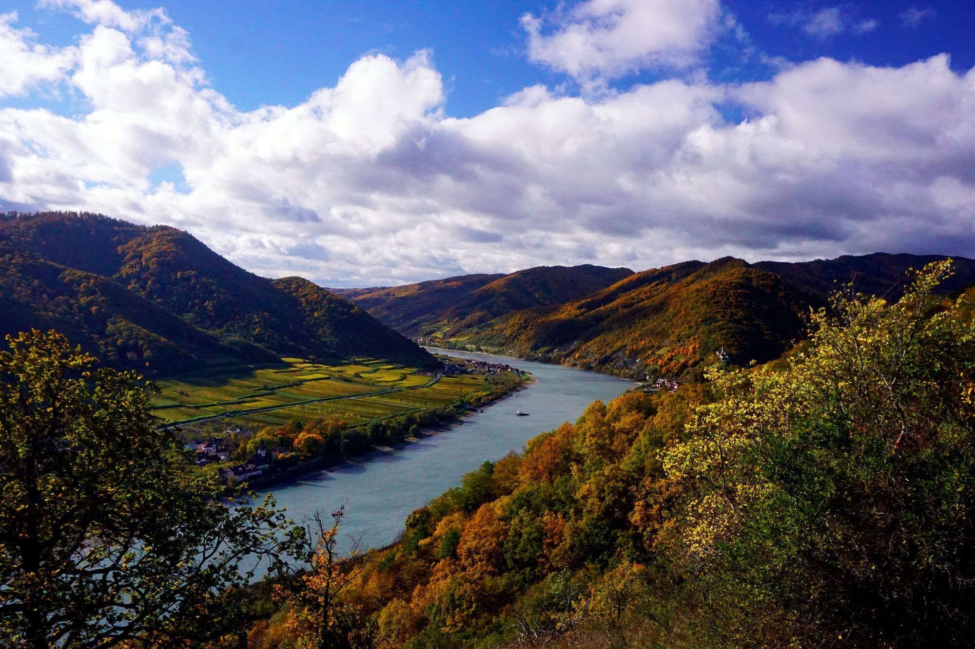
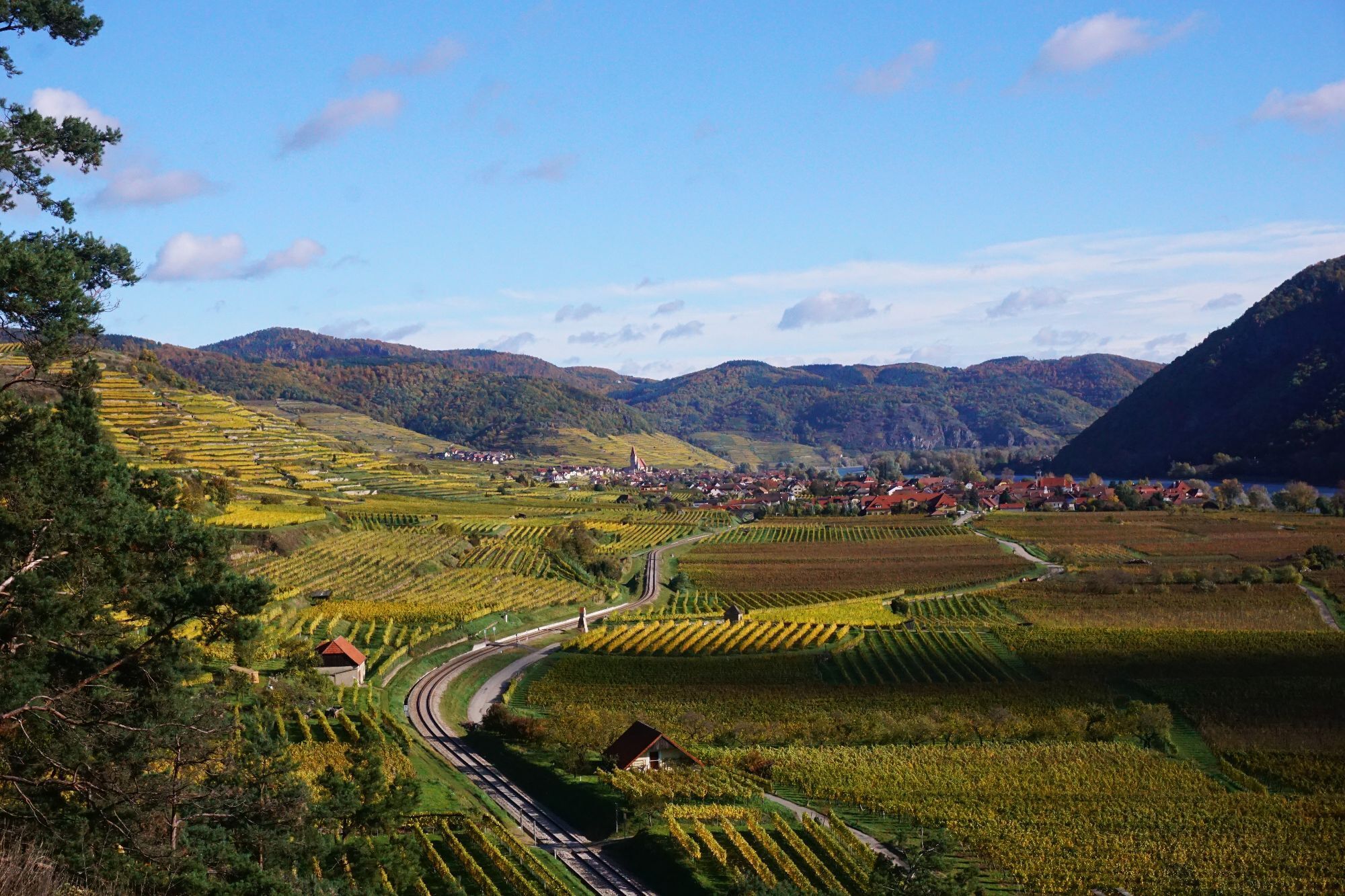
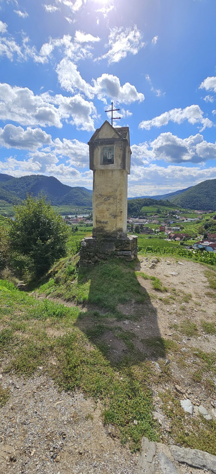
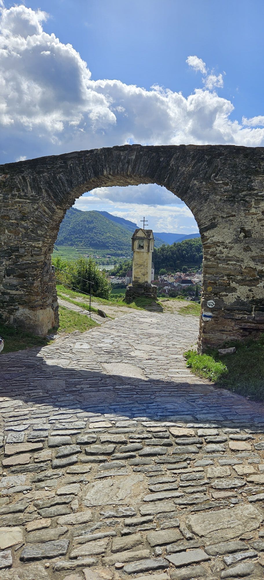
<p>Up to a trail junction above St. Michael, we follow the long-distance trail Welterbesteig Wachau (color marking white "W"). From the Spitz ferry, we cross the B3 and head north to the church square with the late Gothic Mauritiuskirche. We cross the church square, leaving the church on the right, continuing past the school. Before the school, we turn right and follow a small street straight uphill, passing winegrowers' houses up to the already visible legendary "Red Gate." There, we can enjoy the splendid view of the opposite Tausendeimerberg and Spitz from one of the benches. Then we go under the "Red Gate" and immediately afterwards turn right down to the Miesling Valley (261m).</p><p>We cross the Miesling stream via a small wooden bridge. Then we turn right and follow the Miesling stream for a short distance, then after 150 m turn left onto a forest road. We hike this road in switchbacks uphill to the "Buschandlwand Intersection," where the path to St. Michael branches off to the right onto a forest trail. We leave this trail after a few hundred meters where it leads left into a small path uphill, where after a few meters a small cave is located to the right of the path. We continue hiking through a natural beech mixed forest, past bizarre rock formations, where on the left an old pine with a stamp box is located. Through an untouched oak and hornbeam forest, we reach rustic rock formations again, from which we can enjoy wonderful views of the Danube. Soon we go gently downhill and reach the species-rich natural monument dry grassland Michaelerberg (392m). The dry grassland is bordered by blackthorn and downy oaks and provides a unique home to plant and animal species. Here we leave the Welterbesteig Wachau and continue straight downhill towards St. Michael.</p><p>Wonderful views of the Danube and the right Danube bank with the villages of Hof-, Mitter-, and Bacharnsdorf invite us to take a break to soak in the calming atmosphere of nature. Many different bird species (nuthatch, various woodpeckers, jay, birds of prey) can be observed or heard. We now follow the small footpath downhill (Note: surefootedness is absolutely necessary on the short steeper section! Especially slippery when wet!), past blackthorn and acacias until a small rest area with benches invites to snack just above St. Michael – with a view of the old fortified church of St. Michael and the wine terraces towards Weißenkirchen. Here are small, steep dry grassland islands with beautiful flowers.</p><p>Soon after, the path leads down to the right, we cross the tracks of the Wachau railway and go through a narrow alley into the small village of St. Michael and see the old fortified church on the right. We go to the main road B3, cross it, and go right down the steps to the towpath next to the Danube. We now follow this path always parallel to the river back to the ferry to Spitz.</p>
<p>Hiking boots, rainproof clothing and drinking water. The Wachau hiking map is available from Donau Niederösterreich Tourismus, www.wachau.at</p>
<p>Emergency call mountain rescue Wachau: 140</p>
<p>West Autobahn A1 to Melk and via B3 to Spitz, or via S5 or S33 to Krems and via B3 to Spitz.</p>
<p>With the Wachau railway, running from 18.03. to 01.11.2023, from Krems or Emmersdorf to Spitz, <a href="www.wachaubahn.at/fahrplan-2023"... about the timetable here</a>. Spitz can be reached hourly by bus line 715 from the Melk and Krems train stations, timetables: <a href="www.vor.at">www.vor.at</a&... A detailed timetable "<a href="www.donau.com/de/wachau-nibelungengau... in the Wachau</a>" is available from Donau Niederösterreich Tourismus.</p><p>Other arrival and departure options: Danube shipping <a href="www.brandner.at/">www.brandne... ; <a href="www.ddsg-blue-danube.at">www.... Two Nextbike rental stations (€1/hour) are located in Spitz at the train station and at the ferry. Info at +43(0)2742/22-9901 and <a href="www.nextbike.at">www.nextbike...
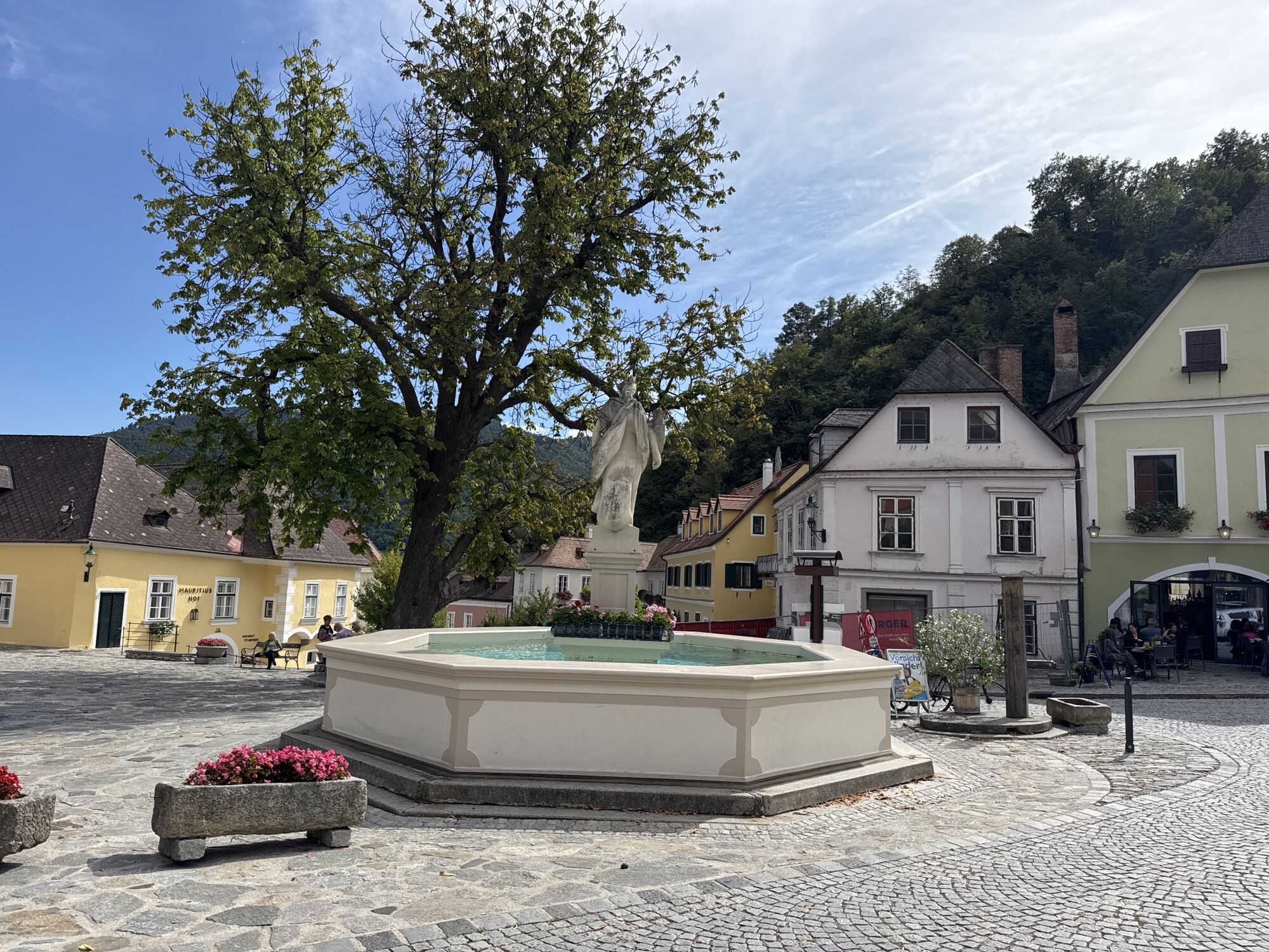
<p>Spitz, Donaulände, train station, Schloss Spitz</p>
Numerous dining and accommodation options in Spitz invite you to visit. You can find who is open when and where in the Online tavern calendar. Particularly recommended are the companies of the quality initiative Best of Wachau. www.bestof-wachau.at
The Spitz tourist information in Mittergasse 3a, 3620 Spitz a. d. Danube - at Donaulände B3, T: +43(2713)2363, www.spitz-wachau.com is happy to help with questions.
Other sights in Spitz: Shipping Museum, Hinterhaus Ruins
Kamery internetowe z trasy

Popularne wycieczki w okolicy
-
4,5
Welterbesteig Wachau 02: Dürnstein-Weißenkirchen
światłodługodystansowy szlak pieszy 15,9 km -
4,5
Welterbesteig Wachau 03: Weißenkirchen-Spitz
światłodługodystansowy szlak pieszy 10,4 km -
4,5
Welterbesteig Wachau 01: Krems-Dürnstein
światłodługodystansowy szlak pieszy 12,3 km -
4,8
Vogelbergsteig -Kanzel- Fesselhütte - Ruine Dürnstein zum Heurigen in Furth
średniWędrówka 7,59 km -
4,7
Rundhöhenwanderweg Weißenkirchen in der Wachau - Schildhütten - Cholerakreuz - Weißenkirchen
światłoWędrówka 8,75 km -
4,7
Wachau: Seekopf - Hirschwand
średniWędrówka 10,4 km -
4,6
Krems (Welterbesteig) - Dürnstein - Vogelbergsteig - Kanzel - Fesslhütte - Krems
średniWędrówka 18,0 km -
4,5
Maria Langegg - Rote Wand - Hoher Stein - Kastlkreuz
średniWędrówka 11,4 km -
4,5
Panoramaweg Weissenkirchen
światłoWędrówka 5,04 km -
4,5
Seekopf und Hirschwand
średniWędrówka 2,83 km
Wędrówki i tropienie


Nie przegap ofert i inspiracji na następne wakacje
Twój adres e-mail została dodana do listy mailingowej.