


Three-Church Route: Heiligenblut - Maria Laach
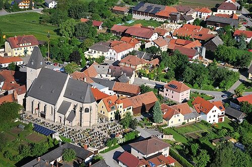
The small hamlet of Heiligenblut with its pilgrimage church of St. Andrew is the heart of the market town of Raxendorf. According to legend, the late Gothic hall church from the 15th century was founded...
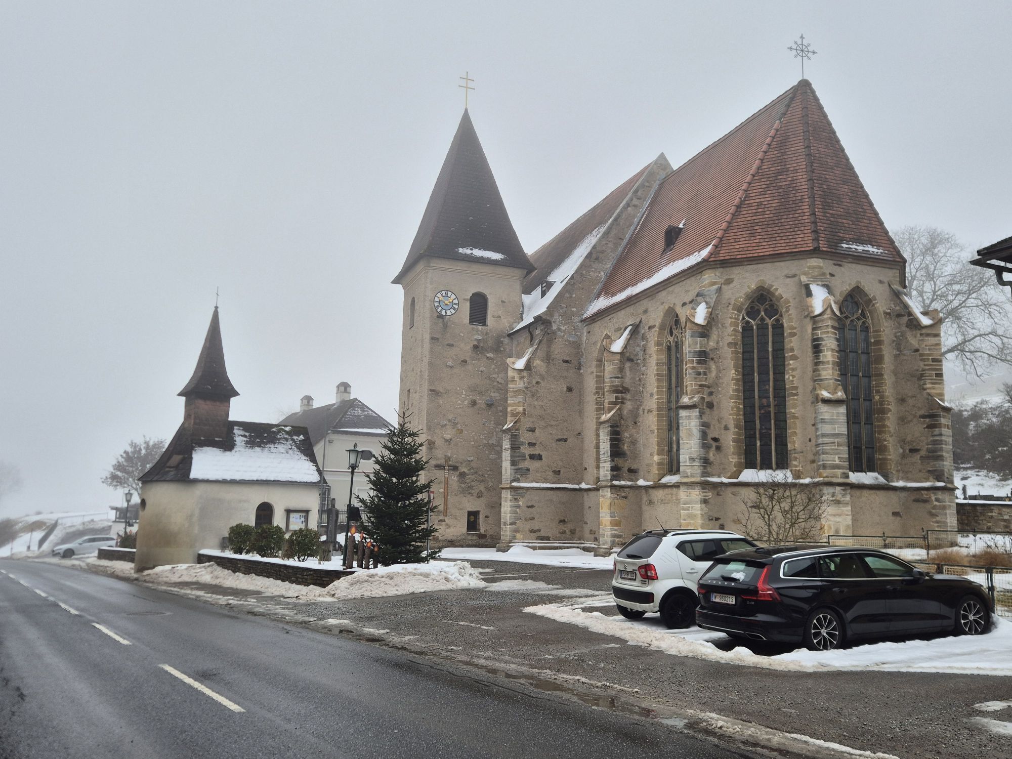
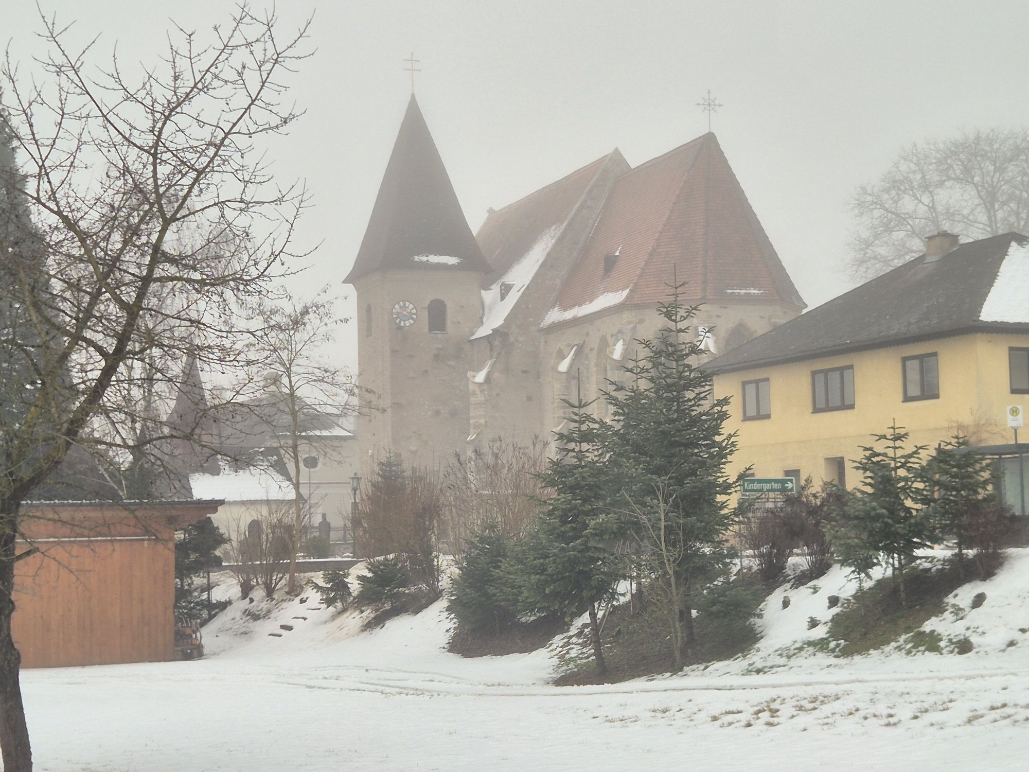
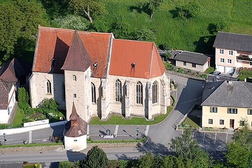
The small hamlet of Heiligenblut with its pilgrimage church of St. Andrew is the heart of the market town of Raxendorf. According to legend, the late Gothic hall church from the 15th century was founded after a miracle of the host in 1411. The baroque tower with its blue clocks, the free-standing original chapel, the fine cross and ribbed vaults and the strikingly steep roof are remarkable. In the late Gothic choir is the famous stone sacrament house, eight meters high and decorated with filigree tracery. The actual heart of the church, the Gothic altar - the Roggendorf Altar - is located in Belvedere Palace in Vienna.
Maria Laach is outshone by its pilgrimage church of the Visitation of the Virgin Mary. The monumental stepped hall building from the 15th century is one of the most valuable late Gothic buildings in Austria. The church is one of the rare cases that was not baroqueized and was able to preserve its Gothic interior. 1680 was the third great plague year of this century; the entire southern Waldviertel made a vow to make a pilgrimage to Maria Laach every year. After the miraculous healing of a blind child in 1719, the number of pilgrims increased steadily. The miraculous image of "Maria Sechsfinger", the Gothic double-winged altar and the Renaissance tomb of the nobleman Hans Georg von Kufstein from 1607 are the church's most valuable artifacts.

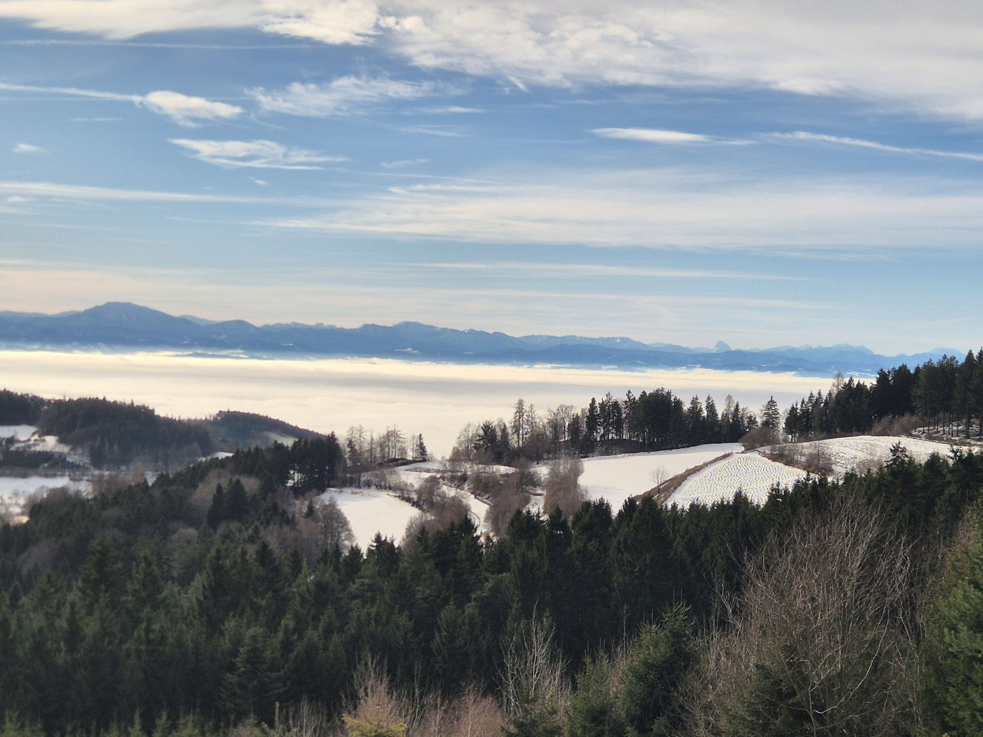
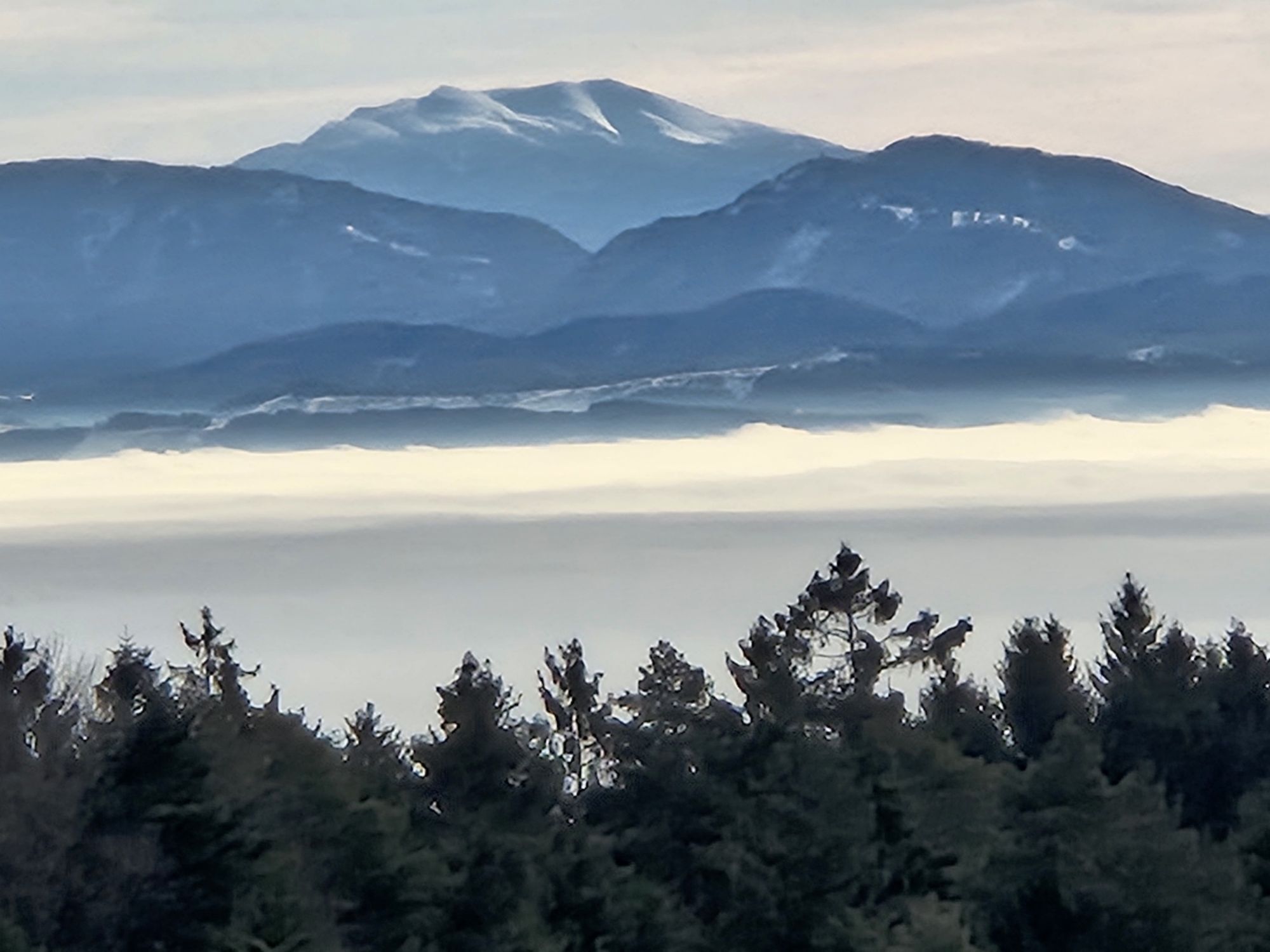
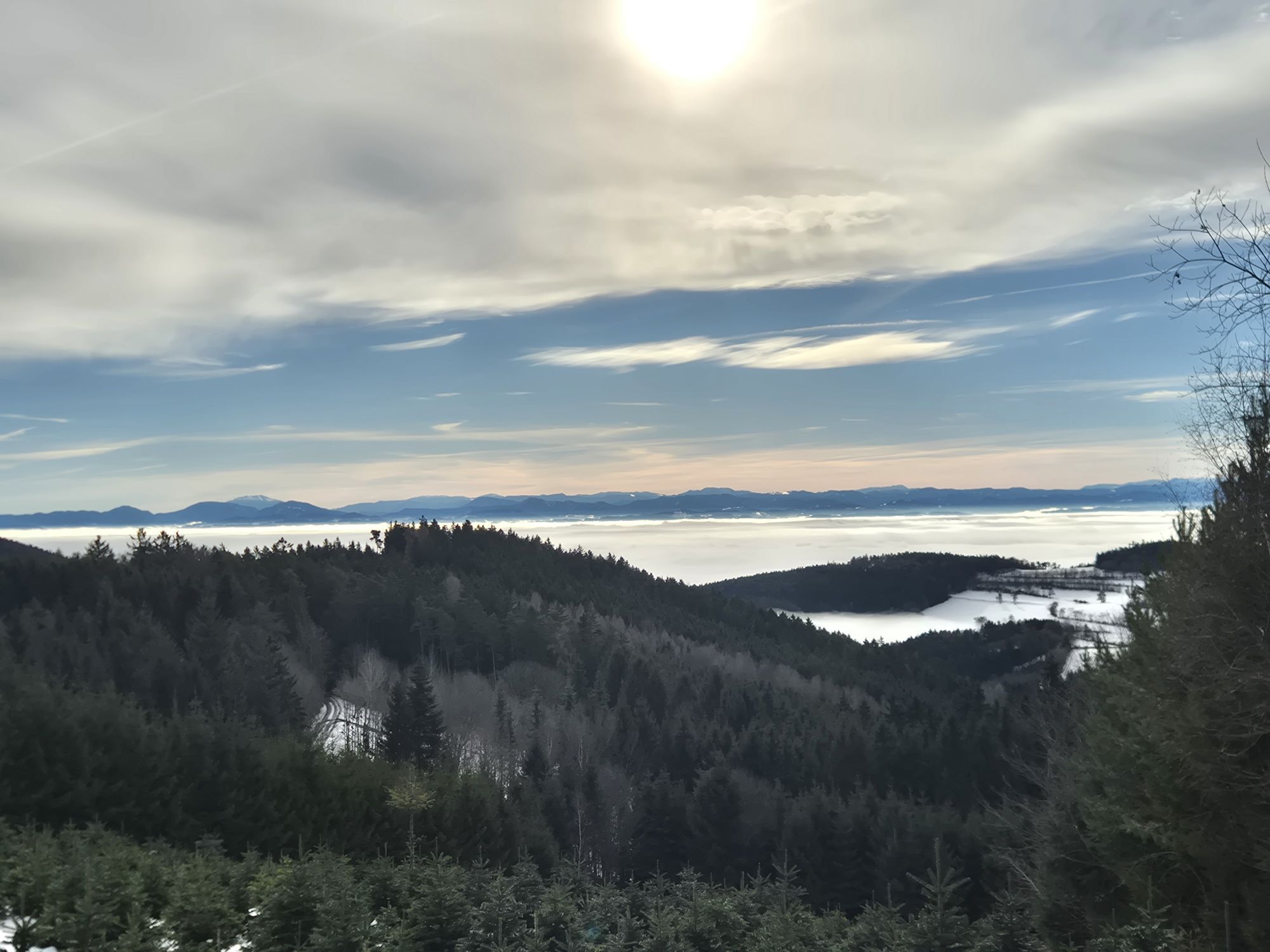
We start at the pilgrimage church of St. Andreas, cross the main road and then cross the stream. At the last house of the local association, we continue straight ahead. To the right, the Three-Church Route leads to Weiten. Through switchbacks uphill, we reach the last house above Heiligenblut with a beautiful view over the pilgrimage church. Now we enter the forest. On forest paths, it goes steadily uphill to the crossroads and the wayside shrine "Nonnersdorfer Kreuz", which is located to the left of the crossing – to the right, the Three-Church Route leads to Weiten and the original parish of St. Stephanus. We turn left towards Maria Laach and after almost 100 m turn right. On quiet paths and trails, we now pass through the Jauerling Forest to the high plateau above Maria Laach before the hamlet of Weinberg. We reach an asphalt road. We follow this downhill and reach Maria Laach. At the first possibility, we turn left and then right again and arrive at the pilgrimage church of the Visitation of Mary.
Hiking boots, rainproof clothing, drinking water, as well as the Wachau hiking map are available from Donau Niederösterreich Tourism, www.wachau.at
Mountain rescue emergency Wachau: 140
A1 to Melk, B3 to Weitenegg, then right on B216 towards Leiben/Pöggstall to Weiten. Then at the intersection at Schuss, turn right and continue to Heiligenblut.
From Monday to Friday, the Waldviertel buses run. Heiligenblut can be reached from Melk (Westbahn) with line WA50 with a transfer in Weiten/Am Schuss. On weekends, the Jauerlinger call bus operates. This connects the Jauerling nature park communities (Aggsbach, Emmersdorf, Maria Laach, Mühldorf, Raxendorf/Heiligenblut, Spitz, and Weiten). The call bus must be requested by phone, Tel. 0810/810278. Routes and timetables: www.vor.at. A detailed timetable "Mobile in the Wachau" is available from Donau Niederösterreich Tourism.
Pilgrimage church Heiligenblut
For dining and overnight stays, we recommend in Heiligenblut: Gasthaus Geyer, Feistritz 6, A-3654 Raxendorf, Tel+43(0)2758/7181 and Gasthaus Mitterbauer, Heiligenblut 12, A-3654 Raxendorf, Tel+43(0)2758/7145.
In Maria Laach, we recommend the Best-of Wachau establishment Hotel Ringl, Am Hauptplatz 3, A-3643 Maria Laach, Tel+43(0)2712/8303, www.hotel-ringl.at
The Association of Friends of the Heiligenblut Pilgrimage Church offers free guided tours. Contact Ms. Waltraud Bock, Tel. 0664/4909209. In Maria Laach, the farmers’ market of the Maria Laach farmers is open every Saturday from 9:00 a.m. to 3:00 p.m. in the Kerblerhaus in the village center.
Popularne wycieczki w okolicy
- 4,5
Welterbesteig Wachau 03: Weißenkirchen-Spitz
światłodługodystansowy szlak pieszy 10,4 km - 4,7
Wachau: Seekopf - Hirschwand
średniWędrówka 10,4 km - 4,5
Maria Langegg - Rote Wand - Hoher Stein - Kastlkreuz
średniWędrówka 11,4 km - 4,5
Seekopf und Hirschwand
średniWędrówka 2,83 km - 4,5
Hirschwand und Seekopf
średniWędrówka 9,09 km - 4,9
LAIMBACH Ostrong Peilstein 20220716
średniWędrówka 7,70 km - 3,9
Spitz a. d. Donau Jauerling Schwallenbach retour 16.04.2016
średniWędrówka 20 km - 3,9
Spitz - Buchberg - Runde
średniWędrówka 9,60 km - 4,5
Welterbesteig Wachau 08: Emmersdorf-Melk
światłodługodystansowy szlak pieszy 9,90 km - 4,0
Rote Wand und Hoher Stein
średniWędrówka 7,80 km
Wędrówki i tropienie


Nie przegap ofert i inspiracji na następne wakacje
Twój adres e-mail została dodana do listy mailingowej.