







Janetschek Trail in Hochwolkersdorf

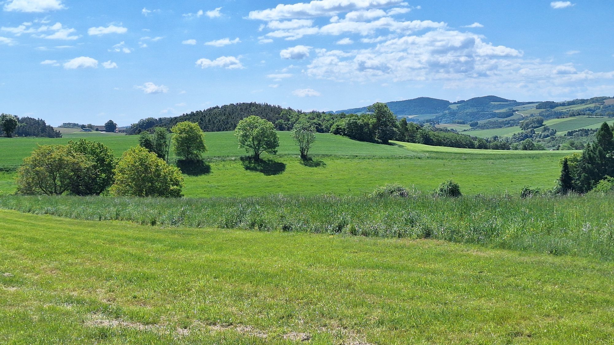
A hike of a special kind awaits you in Hochwolkersdorf. There is the Janetschek Trail to discover. The writer and poet Albert Janetschek was born in Hochwolkersdorf and the trail was set up to commemorate...
A hike of a special kind awaits you in Hochwolkersdorf. There is the Janetschek Trail to discover. The writer and poet Albert Janetschek was born in Hochwolkersdorf and the trail was set up to commemorate his 80th birthday. Hikers can learn more about his life at eight stations. The walk is around four kilometers long and impresses at its highlights with a fantastic view over the Bucklige Welt to Hochwechsel, Semmering, Rax and Schneeberg. The starting point of the hike is in the village or at the Furthof inn, from where wonderful, extensive country lanes and roads with idyllic surroundings stretch out. A special highlight is stop five, the Lustriegel, which promises an unforgettable view. At the end of the hike, the Gasthof zur Gemütlichkeit in the heart of the village invites you to stop for a bite to eat.

The starting point of the hike is located on Dorfstraße at the Gasthaus zur Gemütlichkeit or alternatively on Brombergerstraße at the Gasthaus Furthof, where Station 1 is located. The circular hiking trail covers a total of four kilometers. At the beginning, the path leads west, always along the stations that describe Albert Janetschek's life journey. Soon the second station is reached. Turn left onto Hahnhof street to Station 3 and follow it south until the Hübenweg is reached. Turn left there to Station 4. Follow the path until the Lusthauriegelweg branches off on the left. The path leads over a field to Station 5, the Lustriegel. After enjoying the view, go back the same way and turn left into Schulgasse. At the end of Schulgasse, turn right onto Unter-Ort street, until Kirchenplatz becomes visible on the left. Stations 6 and 7 are located almost opposite each other there. Follow Hofstraße southeast and turn right before the Raiffeisenbank towards Gasthaus zur Gemütlichkeit. At the end of Dorfstraße, the culinary destination, Gasthaus zur Gemütlichkeit, is reached.
Always take suitable maps. Wear sturdy shoes suitable for the route, bring sun and rain protection as well as water and a snack. Take your mobile phone and save the mountain rescue emergency number: 140
Your hikes in the Vienna Alps should be a completely beautiful and safe experience. Please observe the following:
Preparation
Make sure when choosing the route that it matches your mountain experience and fitness. Get information about the weather forecast in advance. Weather in the mountains can change surprisingly quickly. Therefore, always start adequately equipped (e.g. rain protection).
Check whether the huts and snack stations you want to visit are open. Inform someone about your chosen route and your planned return before you set off.
More safety tips for your hike can be found here.
From Vienna: start on A23, then A2 to Frohsdorfer Straße, take the S4 exit towards Lanzenkirchen, follow Frohsdorfer Str., then take Wiener Neustädter Str., Schleinz and L148 to Hochwolkersdorf
For more information visit www.oebb.at and www.vor.at
A parking lot is available in front of Gasthaus Furthof.
You can also park at Gasthaus zur Gemütlichkeit or on Dorfstraße itself.
More info:
Vienna Alps in Lower Austria, www.wieneralpen.at, +43 / 2622 / 78960
Opening hours: Mon - Thu 08:30 - 16:00 / Fri 08:30 - 13:00
Gasthaus Furthof is closed on Mondays and Tuesdays, Gasthaus zur Gemütlichkeit on Wednesdays and Thursdays.


Popularne wycieczki w okolicy
- 4,5
Bucklige Welt: Auf dem Pittentaler Klettersteig zum Türkensturz
średniVia ferrata 1,96 km - 4,8
Seebenstein - Türkensturz - Burg Seebenstein
światłoWędrówka 7,50 km - 4,3
Türkensturz Rundwanderung
średniWędrówka 2,56 km - 4,3
Naturlehrpfad Katzelsdorf
światłoWędrówka 3,81 km - 4,0
Bucklige Welt: Burg Grimmenstein und Kulmriegel
światłoWędrówka 10,5 km - 4,5
To the Wiesen/Lanzenkirchen observation tower from the Rosalia
światłoWędrówka 4,25 km - 4,6
M32 On the Gspitzter Riegel from Bad Sauerbrunn
średniWędrówka 8,73 km - 4,2
Türkensturz große runde
średniWędrówka 11,4 km - 4,7
Forchtenstein-Rosalienkapelle
światłoWędrówka 7,86 km - 4,6
Gespitzter Riegel - Bad Sauerbrunn
światłoWędrówka 8,85 km

Wędrówki i tropienie


Nie przegap ofert i inspiracji na następne wakacje
Twój adres e-mail została dodana do listy mailingowej.





