


Meditation Path Wolfsbach
The meditation trail is first and foremost a spiritual path that conveys silence in the lee of the noisy world and leads through the diverse landscape in the "heart of the Mostviertel". The special features...
The meditation trail is first and foremost a spiritual path that conveys silence in the lee of the noisy world and leads through the diverse landscape in the "heart of the Mostviertel". The special features of the fauna and flora are to be discovered on the melodic ups and downs over gentle hills, through dark coniferous forests or all-encompassing rows of trees. As our senses are perfectly adapted to the slowness of walking, the aim is also to distract us from everyday life and focus our attention on the beauty of nature - less with our intellect and more with our feelings. The extensive view of the Alpine foothills and further into the Alps - from Ötscher to Traunstein - makes the heart of every hiker beat faster!

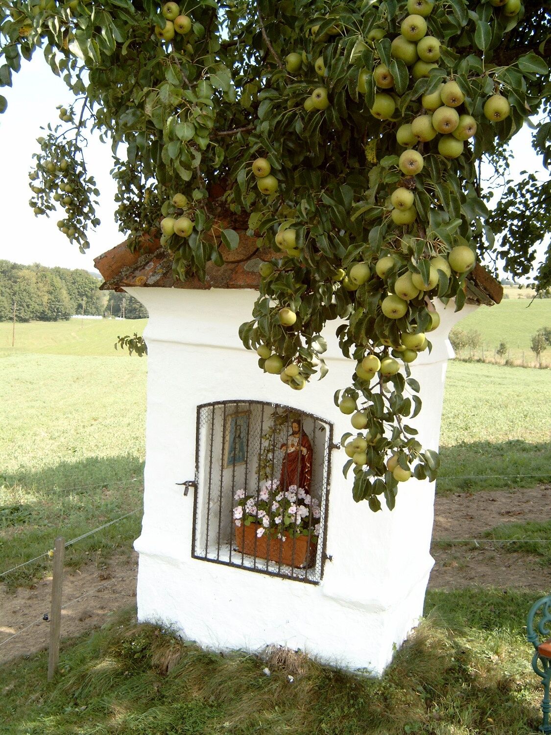
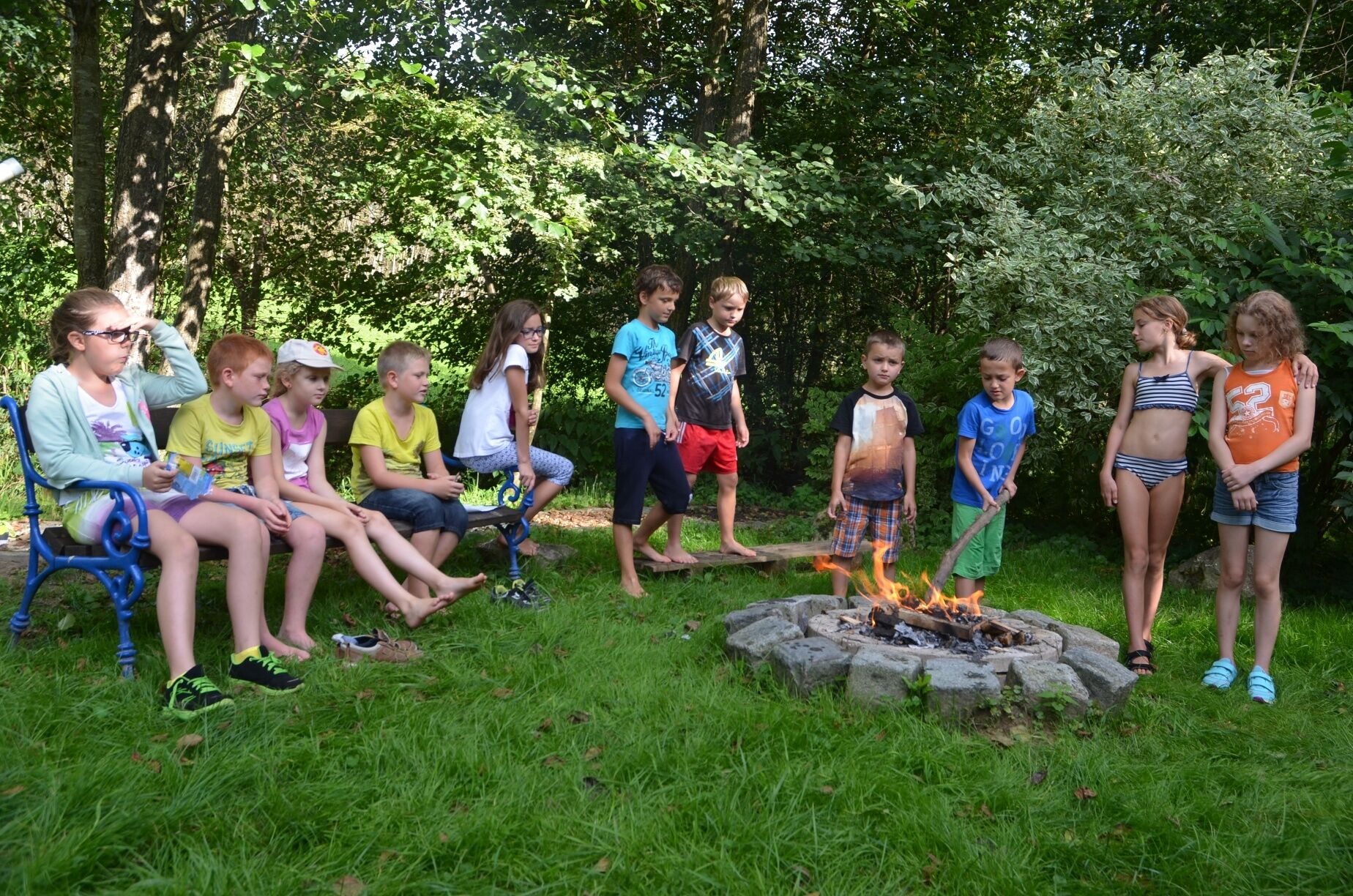

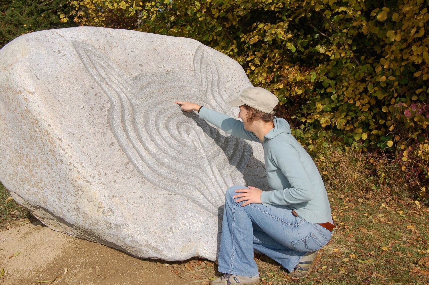
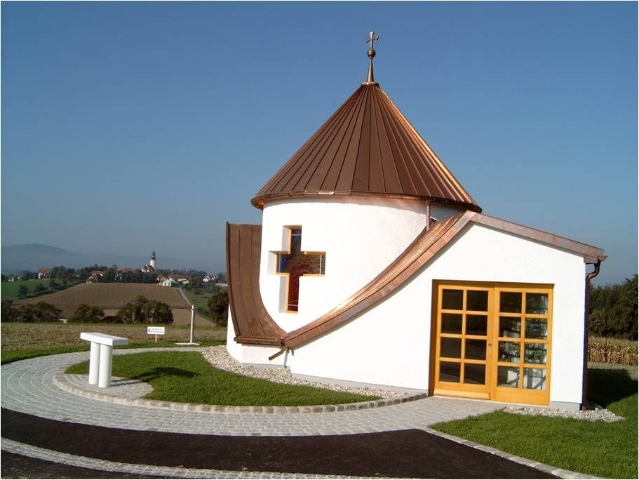
We start at the Gasthaus Karan in the town center, walk past a Marian chapel towards Hinterberg, then continue to the Labyrinthstein (finger labyrinth by Johannes Domenig) and after a Sacred Heart chapel on the hill, we reach the Ötscherblick. A stone cross along the way invites reflection before we come to the highlight, the village chapel built in 2003 – a place of power where one learns to breathe and recharge with new life energy (design by DI Friedrich Fischer, art project “Full House” by Manfred Erjautz). Then follow the dream place/silence place and as the second to last station, we reach the barefoot path as well as the fire and water spot in the brook valley (with barbecue facilities). Afterwards, the climb back to the town center awaits us. A walk through the cemetery should remind us of transience, the parish church in neo-Gothic style is worth seeing.
Light hiking equipment
Motorway exit Oed (coming from Vienna), motorway exit Haag (coming from Linz)
Westbahn station St. Peter/Seitenstetten (5 km away)
Parking available in the town center.
www.wolfsbach.gv.at
Pick up the hiking map at the Tut-Gut information board at the parking lot or at Gasthaus Karan.

Popularne wycieczki w okolicy
- 4,1
Wallsee Altarmrunde
światłoWędrówka 8,19 km - 3,8
Mitterkirchen: Devil's Path
światłoWędrówka 12,5 km - 4,2
Kelten-Radroute
światłoJazda na rowerze 69,3 km - 4,2
Kürnberger Panoramastrecke
średniE-MTB 34,3 km - 5,0
Elisabethwarte Runde
światłoWędrówka 3,98 km - 3,0
Herz-Mostviertel-Tour
średniJazda na rowerze 63,8 km - 5,0
Machlandweg R29
Jazda na rowerze 30,8 km - 4,0
Inspirationsweg
średniWędrówka 6,31 km - 5,0
Mostobst-Wanderweg / Gemeinde Seitenstetten, Niederösterreich/Österreich
światłoWędrówka 7,18 km Donausteig Stage 4_G04 Perg - Mitterkirchen: "Along the log rafting canal through Machland"
światłodługodystansowy szlak pieszy 12,0 km

Wędrówki i tropienie


Nie przegap ofert i inspiracji na następne wakacje
Twój adres e-mail została dodana do listy mailingowej.