


Jewish cultural route Endingen - Lengnau
The excursion following the footsteps of Charles Lewinsky's bestselling novel "Melnitz" leads to the two former Jewish villages Endingen and Lengnau. The highlight is the visit to the distinctive synagogues.

Arrival by train to Baden station, continue by postal bus to Lengnau (stop Bridge).
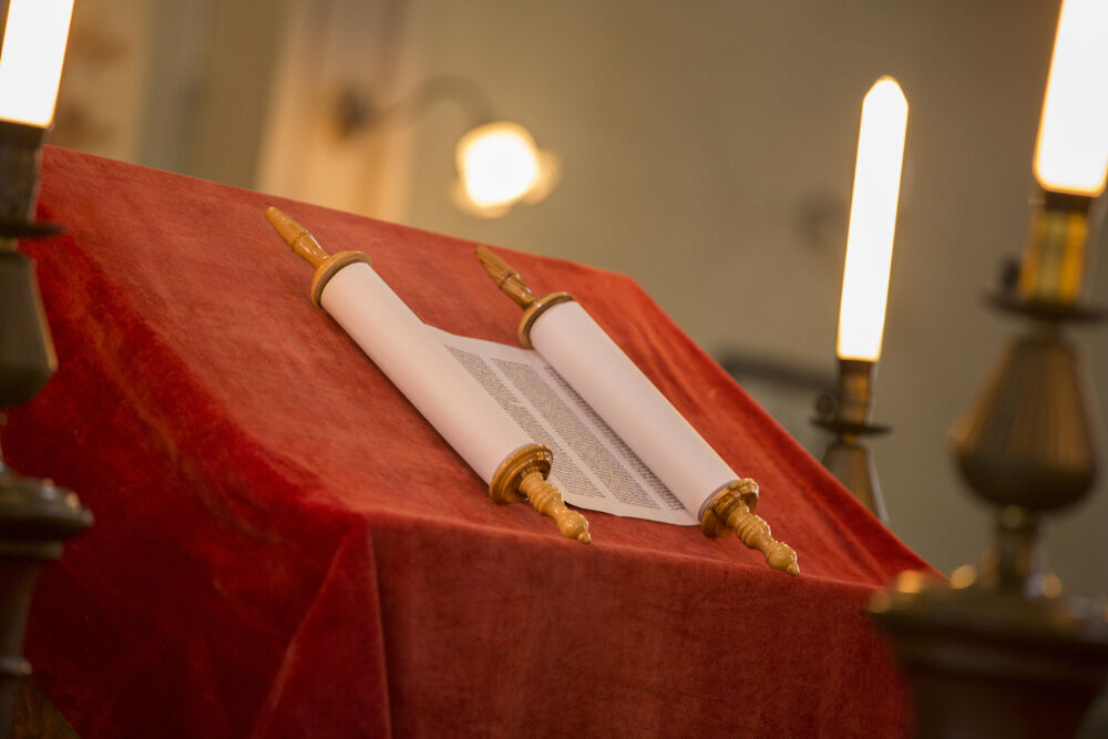
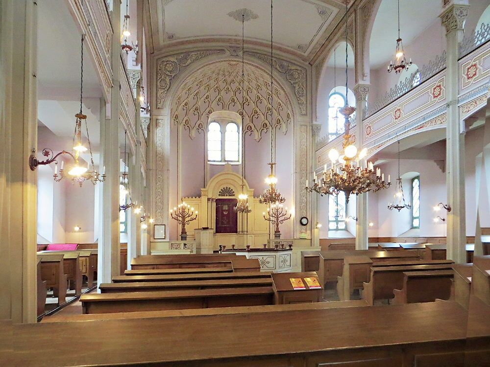
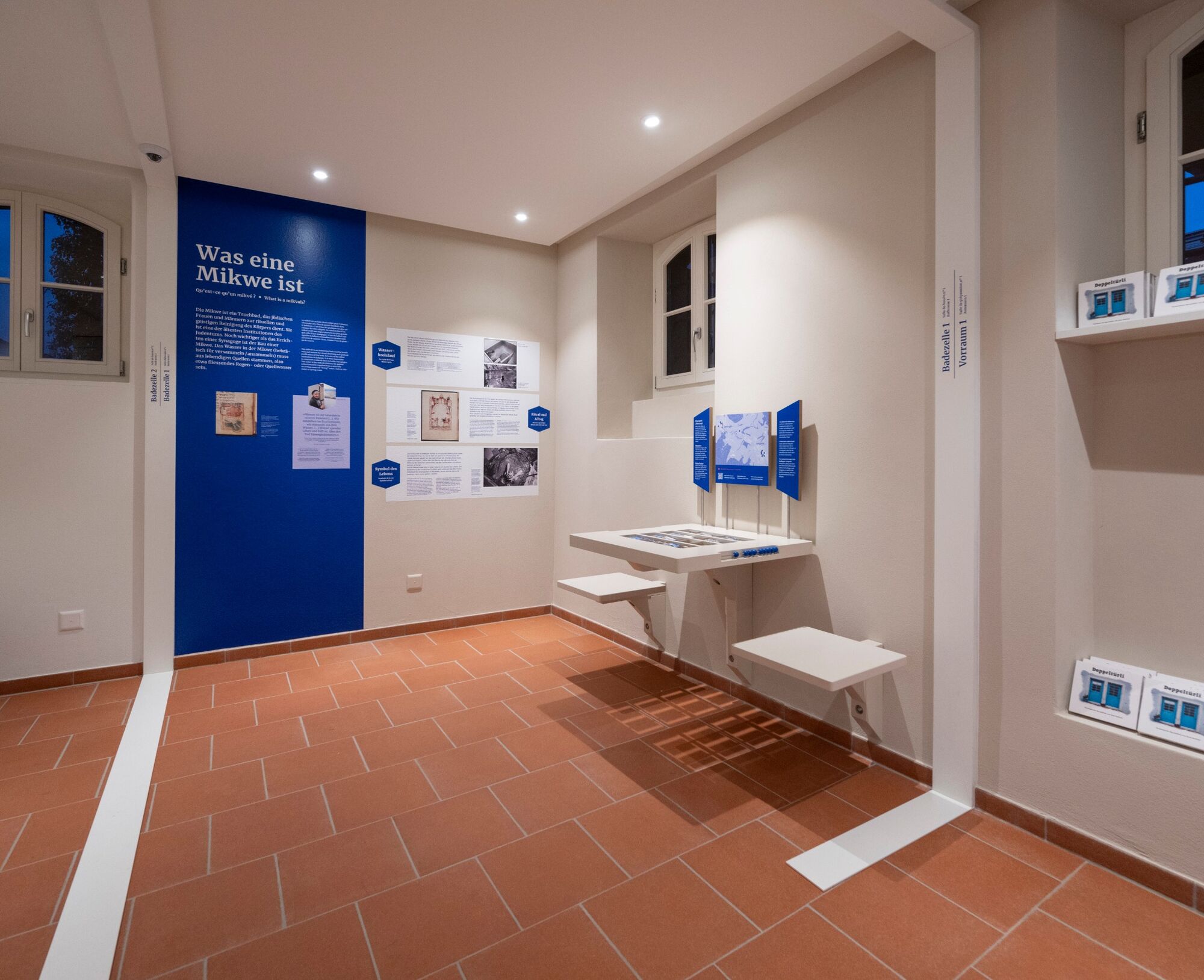
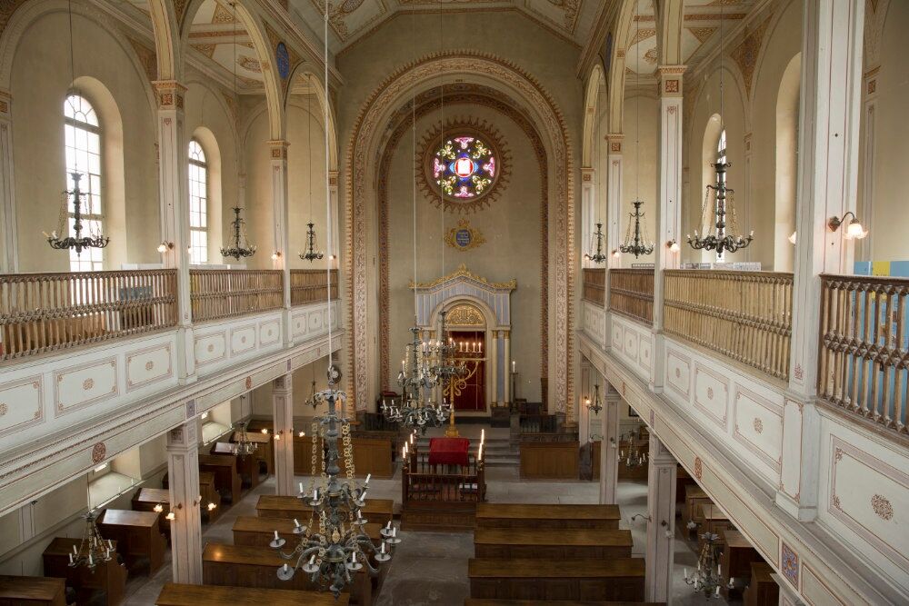
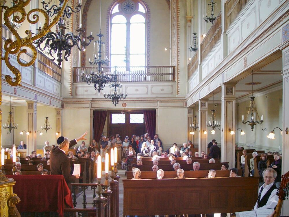
Jewish families, expelled from the cities in the Middle Ages, were allowed to settle in the two Surbtal villages of Endingen and Lengnau according to a decree of 1678. Until the mid-19th century, they were not allowed to live anywhere else. Even today, houses with separate entrances for Christians and Jews can be visited in the village center. On a slightly elevated platform stands one of the oldest synagogues in Switzerland. It was built in 1750 and replaced between 1846 and 1849 by a new building designed by Ferdinand Stadler.
The hike leads from Lengnau to Endingen, with a stop at the Jewish cemetery established in 1750. The graves are arranged in a north-south direction, with women and men buried separately. According to Jewish belief, the rest of the dead must not be disturbed; some of the graves therefore last for centuries.
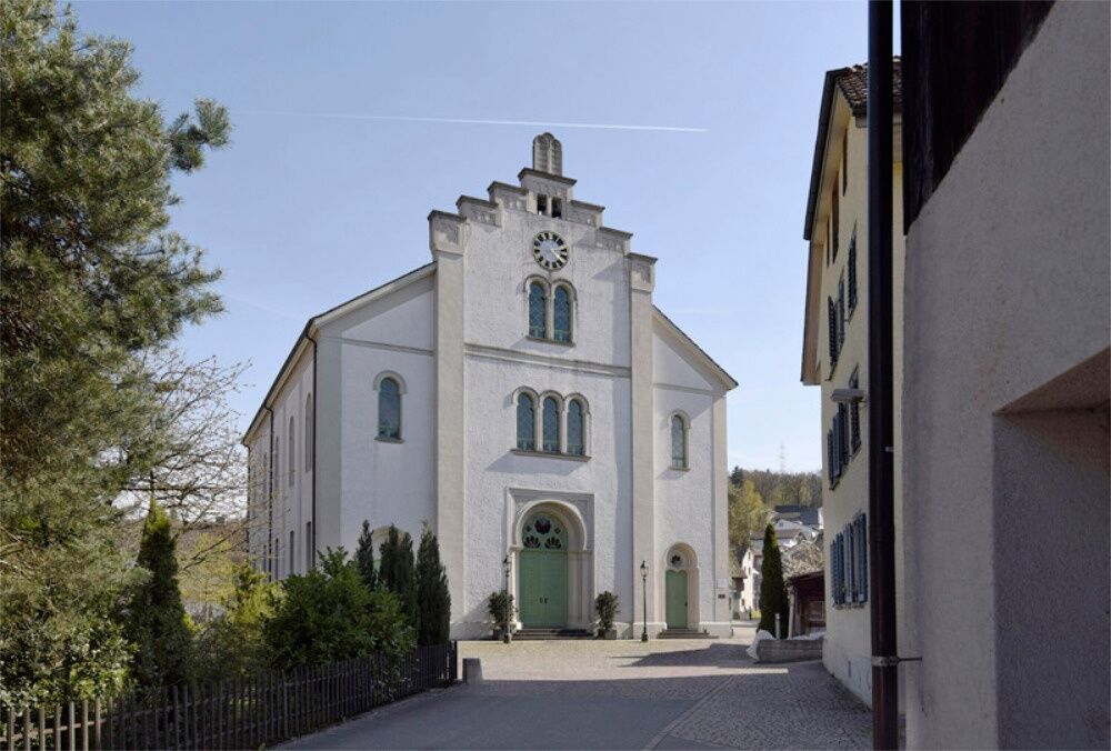
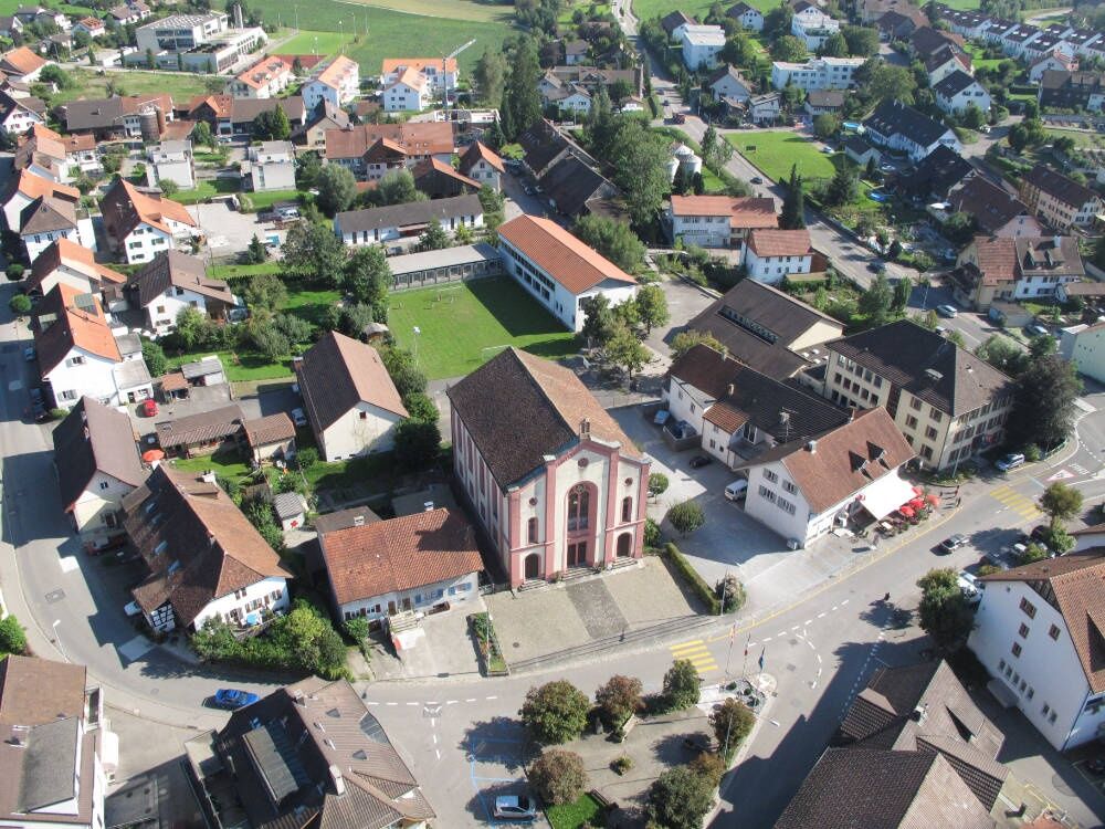
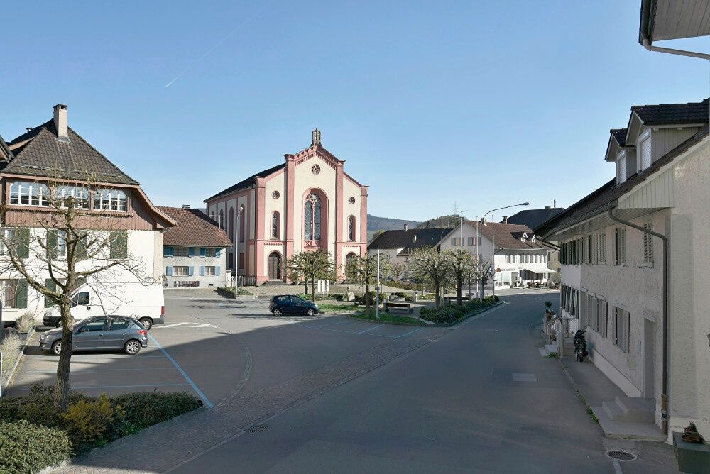
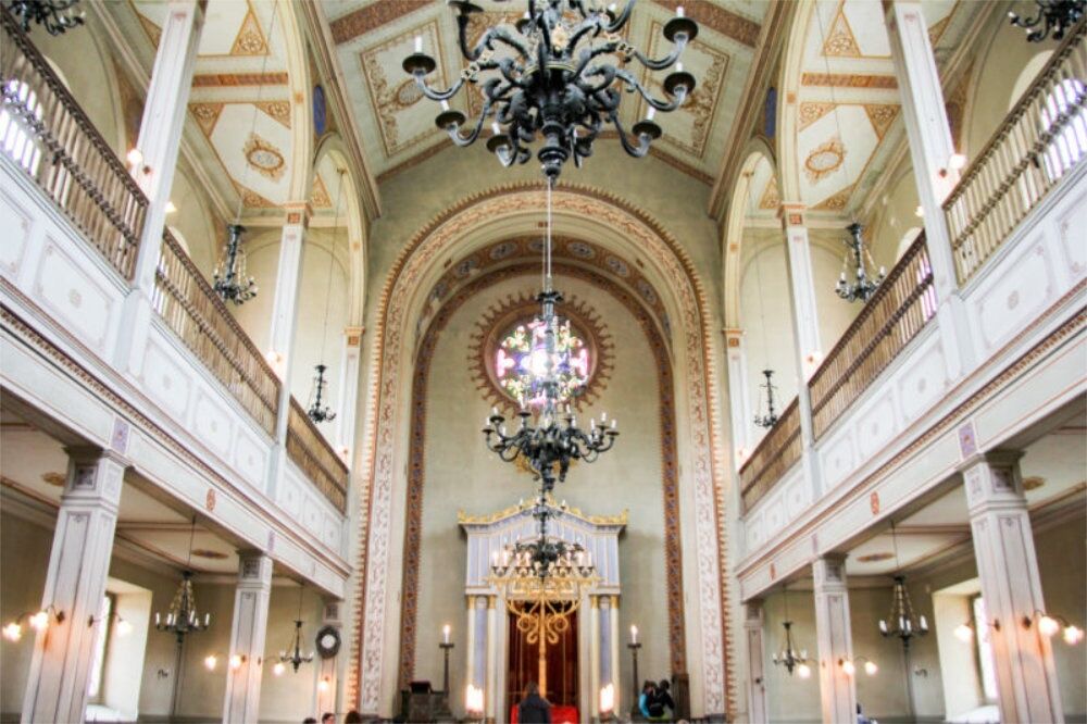
The first Endingen synagogue from 1764 soon proved too small, so a larger one was built between 1850 and 1852. It has a three-aisle facade with a stepped gable. Above the entrance, unusually for synagogues, there is a clock. The reason is the absence of churches with corresponding bell towers – the synagogue is the only house of worship in Endingen.
The return journey takes place from the postal bus stop Endingen Zentrum to Baden station.
Comfortable footwear is recommended as well as a water bottle, as there are only limited refreshment options along the way.
By car, you can reach Lengnau in 15 minutes from Baden, 35 minutes from Zurich or Kloten Airport, 40 minutes from Schaffhausen, 60 minutes from Basel, 70 minutes from Lucerne, and 90 minutes from Bern.
By car, it takes about 5 minutes from Lengnau to Endingen.
Lengnau and Endingen can be reached by bus from Baden, Brugg, Niederweningen and Döttingen.
There is a parking lot at the synagogue in Lengnau.
Municipality of Endingen + Lengnau
Jewish Cultural Route: Discover the Jewish cultural route on an interactive station run
Travel information
Level: recommended for grades 7 to 9 Route: Baden station – Lengnau – Synagogue Lengnau – Jewish Cemetery Endingen – Synagogue Endingen – Endingen – Baden stationA visit to the synagogues in Endingen and Lengnau is worthwhile!
Popularne wycieczki w okolicy
-
5,0
Lägern ridge hike
średniWędrówka 12,0 km -
3,8
Chänzeli -Tour: Eine Panorama - Stadtwanderung
światłoWędrówka 7,81 km -
4,5
Lägern Rundwanderung
średniWędrówka 13,0 km -
4,0
Gratwanderung über die Lägern
ciężkiWędrówka 14,8 km -
4,0
Cross-border Rhine riverside path
światłoWędrówka 7,81 km -
Around the Klingnau reservoir
światłoWędrówka 10,7 km -
5,0
Schinznach Bad - Brugg, Schweiz
światłoWędrówka 10,5 km -
5,0
Bad Zurzach - Hörndli - Rekingen - Bad Zurzach
średniWędrówka 9 km -
5,0
Limmat Cultural Route
światłoTrasa tematyczna 8,77 km -
Bad Zurzach-Achenberg-Zurzacherberg-Bad Zurzach
średniWędrówka 8,74 km
Wędrówki i tropienie


Nie przegap ofert i inspiracji na następne wakacje
Twój adres e-mail została dodana do listy mailingowej.