







Cima Piazzi - Campaccio

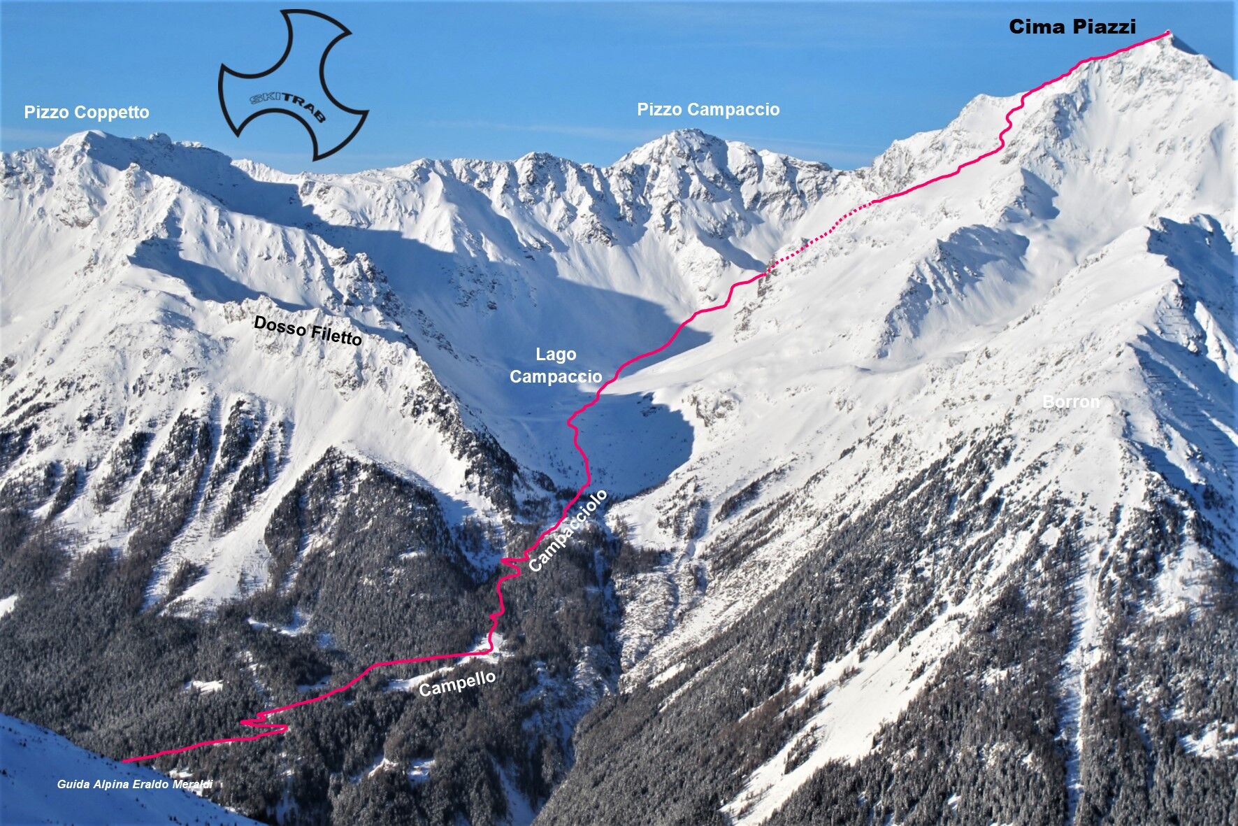
From Monte you climb, following the small road that leads to the Campacciolo locality, passing by the Campello and Campello Alto huts. Then you enter the Campaccio valley and come to the vicinity of the...
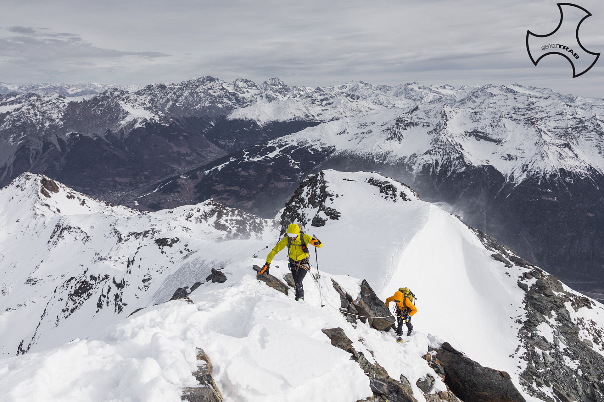
From Monte you climb, following the small road that leads to the Campacciolo locality, passing by the Campello and Campello Alto huts. Then you enter the Campaccio valley and come to the vicinity of the lake of the same name after passing a steep section. From here you continue straight west on terrain that gradually rises and then bends to the right on a steep section that leads onto a small plateau; you then climb a gully to the right that narrows, arriving on a flat area. Now diagonally to the right for a few hundred meters and then climb a steep, slightly concave slope that leads to the southern ridge of Cima Piazzi. From here stay to the left of the ridge to the eastern shoulder of the anticima. Traverse on horizontal ridge westward for about fifty meters to the base of the final rocky cusp. Leaving the skis behind we climb staying more or less on the edge (grade II pitches with anchors in place) we briefly reach the summit. DESCENT: along the ascent route.


Forte d'Oga, Malga San Colombano, Corno San Colombano.
Self-rescue equipment (ARTVA, shovel and probe). Rampant, crampons, ice axe.
The final section of the ridge is usually walked.
The route description and trail are approximate and should be checked on site depending on the condition of the snowpack present during the hike.
Because this is a hike in a snowy mountain environment at high altitudes subject to continually changing snowpack conditions, it is advisable to have adequate experience in ski mountaineering, knowledge of the area, and up-to-date information on snow conditions.
Accompaniment with a professional guide is recommended.
At the entrance to the village.
The route description and trail are approximate and should be verified on site depending on the condition of the snowpack present during the hike.
Because this is a hike in a snowy mountain environment at high altitudes subject to continually changing snowpack conditions, it is advisable to have adequate experience in ski mountaineering, knowledge of the area, and up-to-date information on snow conditions.
Accompaniment with a professional guide is recommended.
Popularne wycieczki w okolicy
-
5,0
Mountain hike to Lagh da Saoseo
ciężkiWędrówka 15,0 km -
4,6
Stelvio Epic Rides: Passo dello Stelvio
ciężkiDroga rowerowa 20,9 km -
4,0
Ortler Höhenweg
ciężkiWycieczka wysokogórska 123,2 km -
5,0
Monte Scale Loop Trail
ciężkiWędrówka 7,53 km -
4,5
Da Sfazù a lago Saoseo
światłoWędrówka 11,0 km -
5,0
Livigno–Tour of the Lakes: Cancano–San Giacomo
średniMountainbike 47,1 km -
Stelvio Epic Rides: Passo Gavia
ciężkiDroga rowerowa 25,8 km -
3,0
Transalp: St. Anton/ Arlberg nach Riva
ciężkiMountainbike 277,3 km -
Val da Camp (724)
średniWędrówka 5,33 km -
4,0
Adamello - Val Grande - Biwak
średniE-MTB 22,8 km
Wędrówki i tropienie


Nie przegap ofert i inspiracji na następne wakacje
Twój adres e-mail została dodana do listy mailingowej.





