


Sisgartner - T42
Poziom trudności: S2
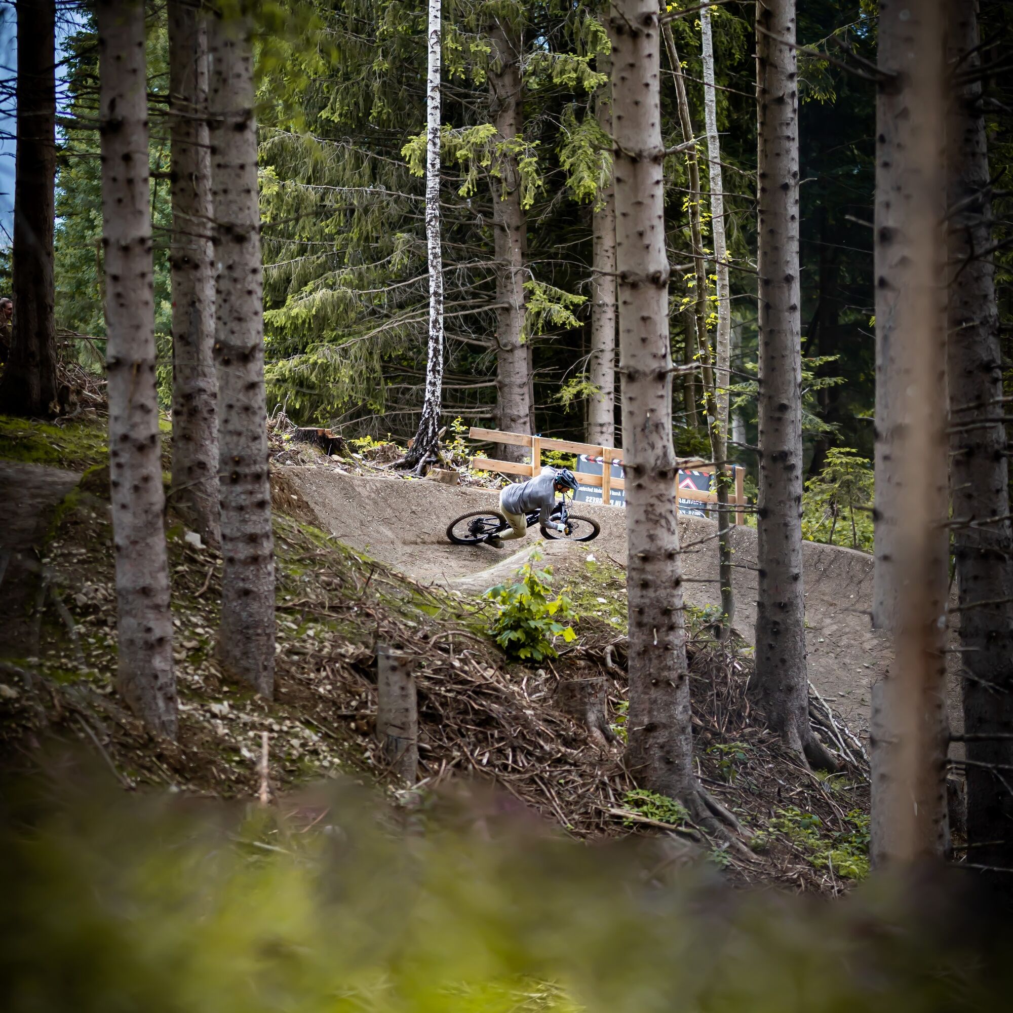
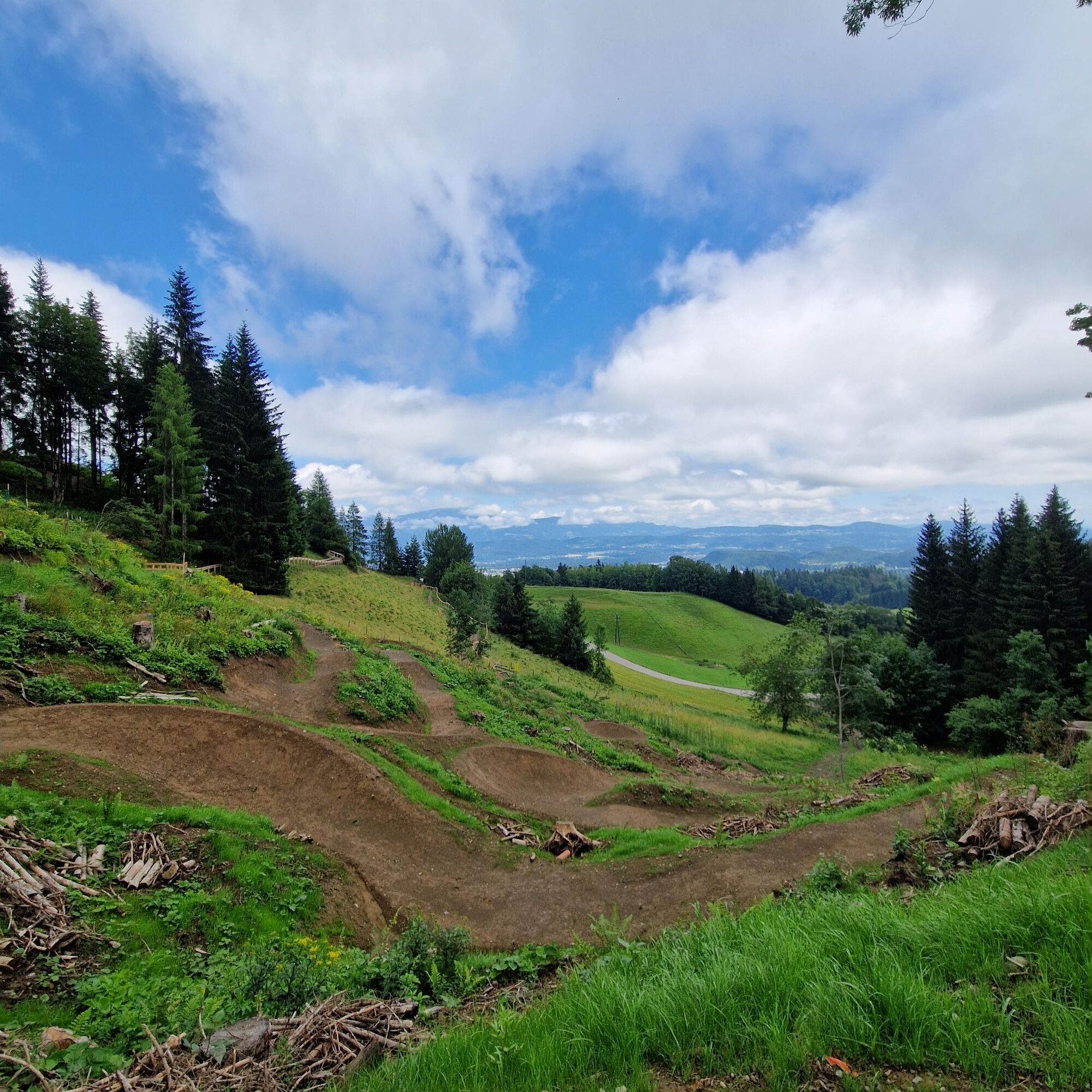
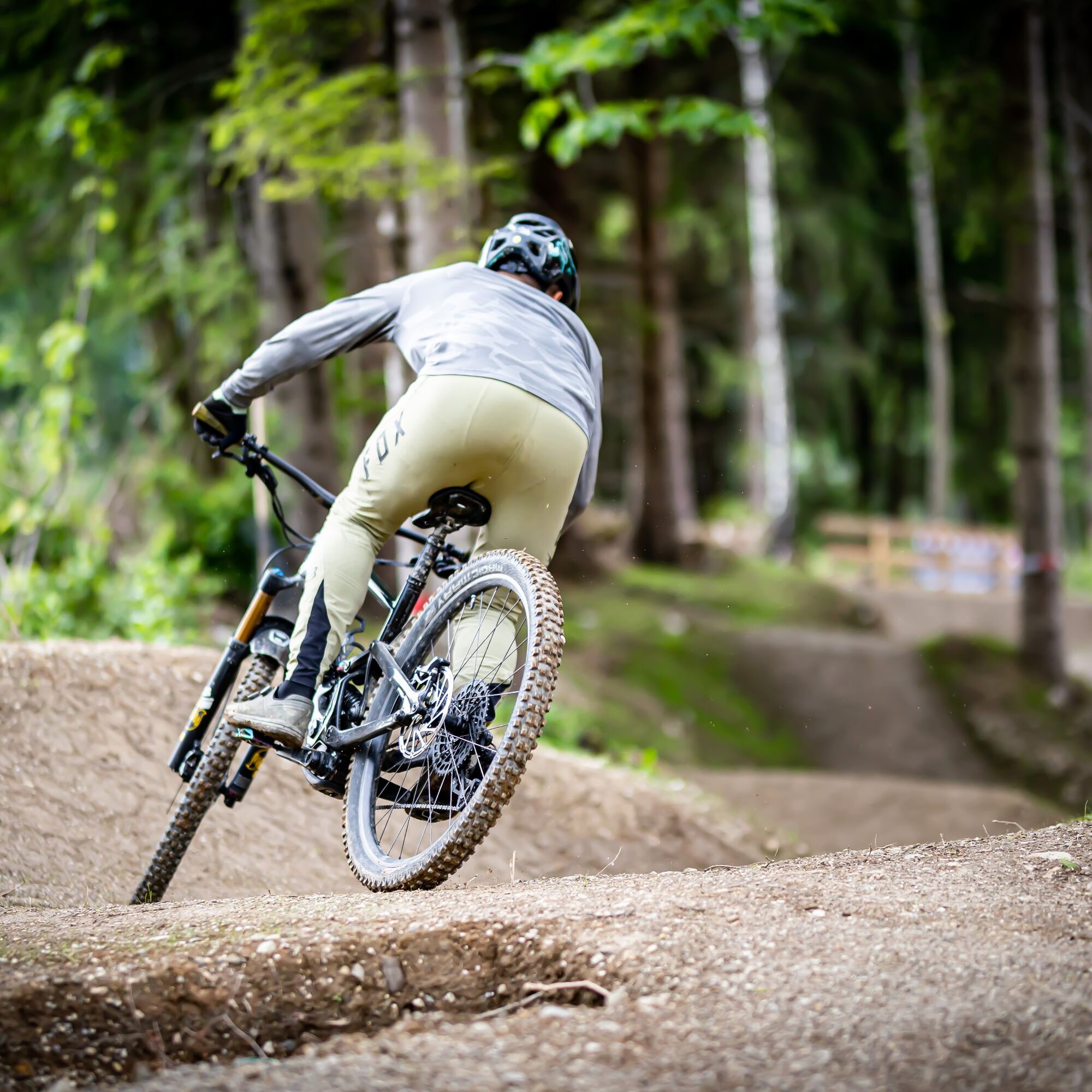
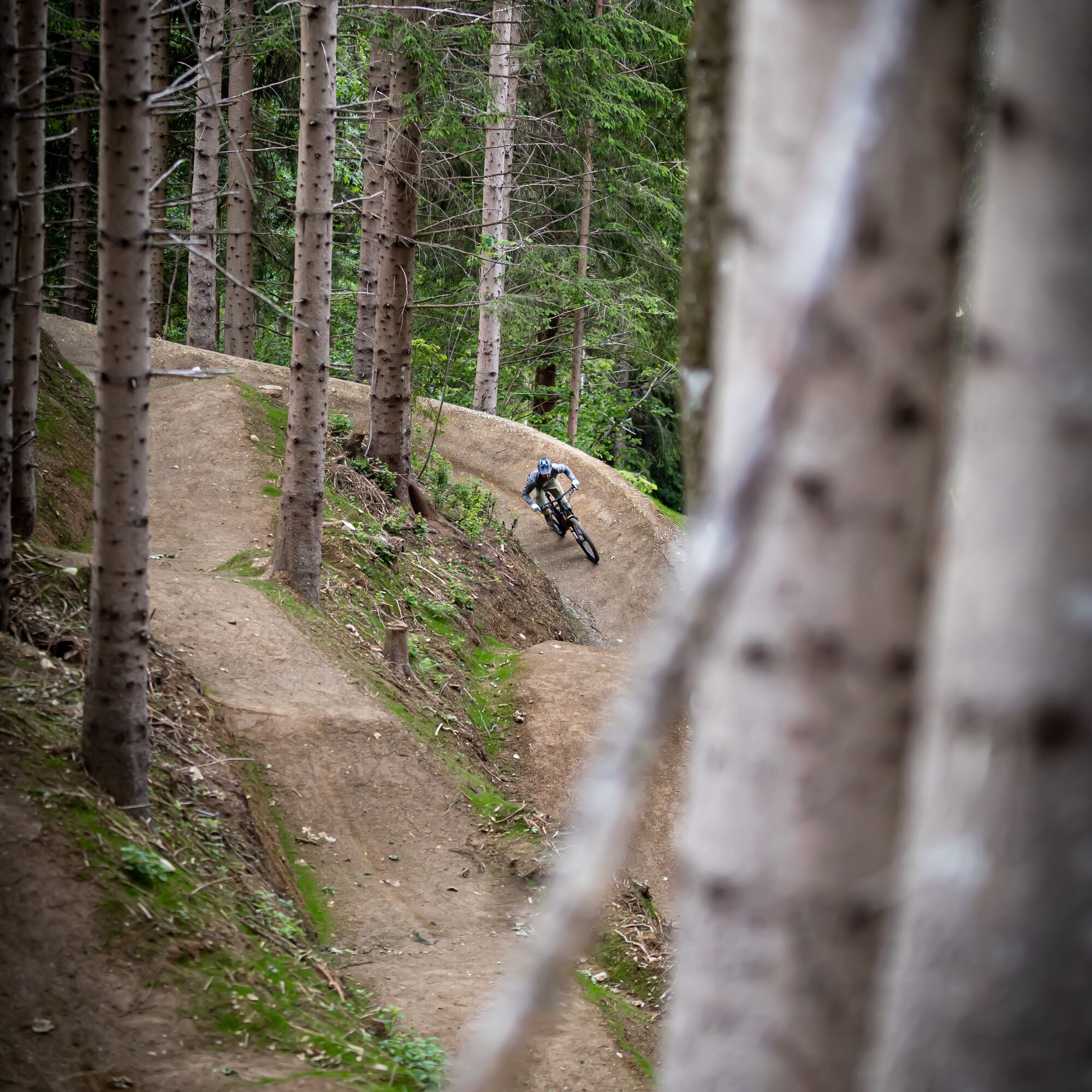
The Sisgartner Trail T42 impresses with its fluid character, which still allows a fast descent due to the slope. With clean berms, cool tables, and breathtaking views, it is a delight. Additionally, it...
The Sisgartner Trail T42 impresses with its fluid character, which still allows a fast descent due to the slope. With clean berms, cool tables, and breathtaking views, it is a delight. Additionally, it is quickly accessible via the adjacent uphill trail.

From the start of the trail, always follow the signs for Sisgartner Trail T42 to the end of the trail.
(e)MTB, helmet, protective gear, water, mobile phone, GoPro ;-)
Please use a suitable mountain bike and the appropriate protective equipment.
Arrival at the starting point of the transfer route for mountain bikers:
From Villach via B 83 and B 85 or via B 84 and L 53 to Faak am See. From here, drive directly to the parking lot of the tourist information Faak am See or to the Faak am See train station.
Tourist information Faak am See or Faak am See train station
S2
www.lake.bike
Popularne wycieczki w okolicy
-
4,6
Rotschitza Klamm Klettersteig B/C
średniVia ferrata 3,73 km -
4,4
Finsterbach Waterfalls - Circular route
średniWędrówka 3,87 km -
3,9
Faakersee Rundweg
światłoWędrówka 9,55 km -
3,3
Around Lake Ossiach
średniJazda na rowerze 68,7 km -
4,6
Spaziergang entlang der Pišnica
światłoWędrówka 8,13 km -
5,0
Kathreinkogel
średniWędrówka 3,56 km -
4,3
Mittagskogel - Rundwanderung
ciężkiWędrówka 14,5 km -
4,3
Lake circular trail
światłoNordic Walking 9,85 km -
4,5
Baumgtn. Höhe, Mallestiger Mittags- und Schwarzkogel
ciężkiWędrówka zimą 10,7 km -
4,4
Hüttenkult - Koča v Krnici
średniWędrówka 14,9 km
Wędrówki i tropienie


Nie przegap ofert i inspiracji na następne wakacje
Twój adres e-mail została dodana do listy mailingowej.