
From the Somme to the Santerre
światło
Pobierz tę trasę na swój telefon komórkowy
From the Somme to the Santerre
światło
Droga rowerowa
68,71
km
Zeskanuj kod QR i rozpocznij nawigację w aplikacji bergfex.


Wędrówki i tropienie



From the Somme to the Santerre
światło
Odległość
68,7
km
Czas trwania
03:30
h
Ascent
237
hm
Poziom morza
32 -
107
m

Nawiguj po trasie w aplikacji
Zainstaluj aplikację za darmo i śledź trasę dzięki nawigacji GPS i funkcji śledzenia.
Skorzystaj już teraz z funkcji „ bergfex ” w aplikacji
Zeskanuj kod QR za pomocą aparatu
Po zainstalowaniu aplikacji treść otworzy się od razu. Jeśli jeszcze nie masz tej aplikacji, zostaniesz przekierowany do strony, z której możesz ją bezpłatnie pobrać.
Ścieżka do pobrania
From the Somme to the Santerre
światło
Droga rowerowa
68,71
km
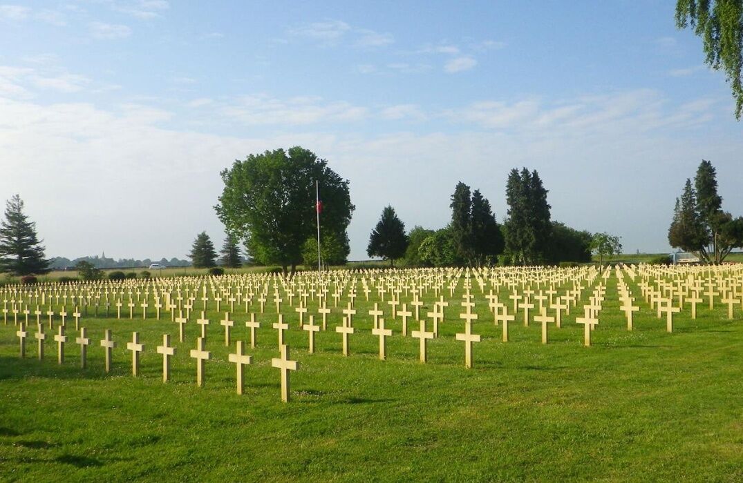
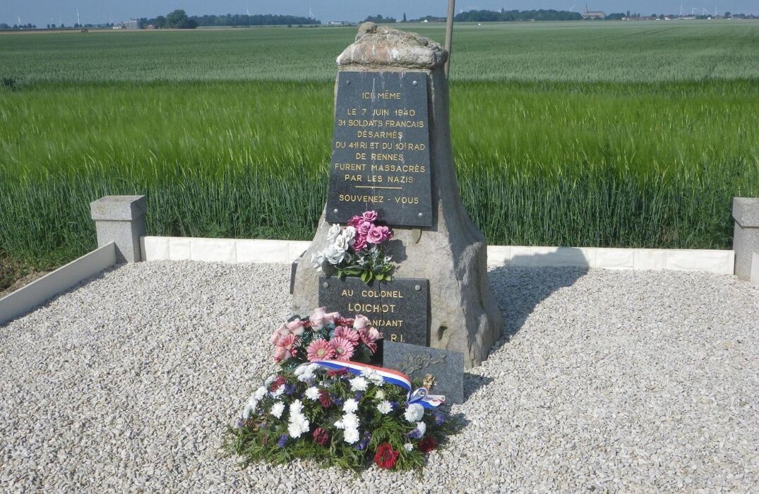
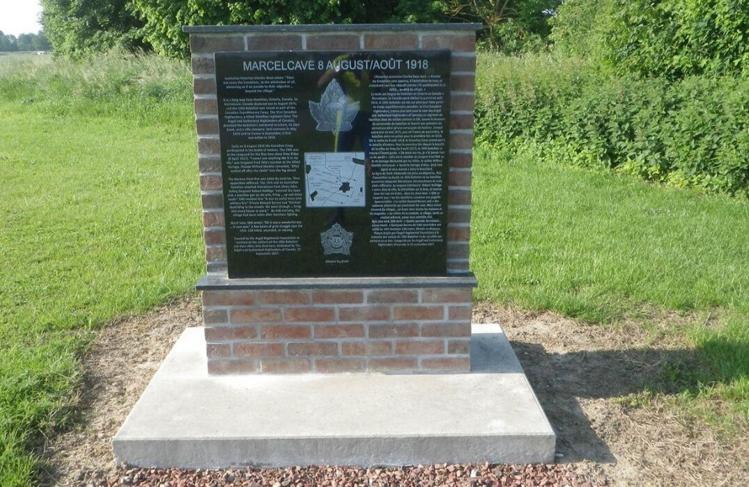
This cycling route from the Somme Valley to the Santerre plateau offers you the opportunity to discover different heritages from the wars of 14/18 and 39/45 along the way. As well as villages with remains...
Opis
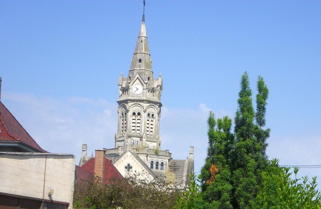
This cycling route from the Somme Valley to the Santerre plateau offers you the opportunity to discover different heritages from the wars of 14/18 and 39/45 along the way. As well as villages with remains of the former presence of cattle breeding, cider apple trees, and modern agriculture (cereals, beets, potatoes, preserves cultivation, peas, green beans, salsify, ...).
Trasa
Église Saint-Médard
(48 m)
Miejsce kultu
6,2 km
Le Hamel
(44 m)
Wioska
6,3 km
Église Notre-Dame de l'Assomption
(97 m)
Miejsce kultu
26,6 km
Chapelle Notre-Dame de Lourdes
(99 m)
Miejsce kultu
29,2 km
Église Saint-Martin
(106 m)
Miejsce kultu
40,6 km
Église Saint-Martin
(94 m)
Miejsce kultu
49,5 km
Église Saint-Quentin
(53 m)
Miejsce kultu
54,4 km
Trasa
From the Somme to the Santerre
światło
Droga rowerowa
68,71
km
Fouilloy
(34 m)
Wioska
0,1 km
Hamelet
(37 m)
Wioska
2,0 km
Église Saint-Nicolas
(39 m)
Miejsce kultu
2,2 km
Vaire-sous-Corbie
(38 m)
Wioska
3,5 km
Église Saint-Médard
(48 m)
Miejsce kultu
6,2 km
Le Hamel
(44 m)
Wioska
6,3 km
Marcelcave
(97 m)
Wioska
13,1 km
Marcelcave
(92 m)
Stacja kolejowa
14,0 km
Wiencourt-l'Équipée
(90 m)
Wioska
16,4 km
Guillaucourt
(88 m)
Wioska
17,6 km
Caix
(76 m)
Wioska
21,2 km
Église Sainte-Croix
(68 m)
Miejsce kultu
21,3 km
Église Notre-Dame de l'Assomption
(97 m)
Miejsce kultu
26,6 km
Beaufort-en-Santerre
(96 m)
Wioska
26,9 km
Warvillers
(97 m)
Wioska
28,5 km
Église Saint-Martin
(98 m)
Miejsce kultu
28,8 km
Chapelle Notre-Dame de Lourdes
(99 m)
Miejsce kultu
29,2 km
Folies
(99 m)
Wioska
31,2 km
Bouchoir
(103 m)
Wioska
32,3 km
Arvillers
(105 m)
Wioska
37,3 km
Hangest-en-Santerre
(106 m)
Wioska
40,6 km
Église Saint-Martin
(106 m)
Miejsce kultu
40,6 km
Le Plessier-Rozainvillers
(105 m)
Wioska
44,4 km
Église Saint-Martin
(103 m)
Miejsce kultu
44,5 km
Église Saint-Martin
(94 m)
Miejsce kultu
49,5 km
Mézières-en-Santerre
(97 m)
Wioska
49,5 km
Chapelle Notre-Dame-de-Liesse
(73 m)
Miejsce kultu
53,9 km
Ignaucourt
(59 m)
Wioska
54,3 km
Église Saint-Quentin
(53 m)
Miejsce kultu
54,4 km
Marcelcave
(97 m)
Wioska
57,4 km
Fouilloy
(34 m)
Wioska
68,6 km
Autor
Dostarczone przez Somme Tourisme
Wycieczkę From the Somme to the Santerre zapewnia outdooractive.com.


Dodatkowe informacje i wskazówki
Dodatkowe informacje
Nie ma jeszcze recenzji
Popularne wycieczki w okolicy
-
Three Doms Circuit (Loop A)
światłoDroga rowerowa 44,0 km -
On the French front
światłoDroga rowerowa 43,9 km -
The Montagne de Fignières
światłoWędrówka 3,37 km -
Circuit of the 3 Doms (Loop B)
światłoDroga rowerowa 39,5 km -
Guerbigny - Lignières - Église Saint-Martin - Église Saint-Marie-Madeleine
średniWędrówka 11,1 km -
Faverolles - Église Sainte-Barbe - Église Notre-Dame-de-l'Assomption - Église Saint-Pierre
średniRower szutrowy 52,8 km -
Le Hamel - Mont de Forestel - Église Saint-Pierre - Église Saint-Martin
ciężkiJazda na rowerze 58,3 km -
Guerbigny - Église Saint-Martin - Église Saint-Pierre
średniRower szutrowy 35,6 km -
Péronne - Église Sainte-Jules - Église Saint-Didier - Église Saint-Médard
średniDroga rowerowa 69,5 km -
Assainvillers - Église Saint-Pierre - Église Saint-Marie-Madeleine - Église Saint-Étienne
średniRower szutrowy 47,7 km
Wędrówki i tropienie

Ponad 550.000 propozycji wycieczek, szczegółowe mapy i intuicyjny planer tras sprawiają, że aplikacja jest niezbędna dla wszystkich entuzjastów przyrody.

Nie przegap ofert i inspiracji na następne wakacje
Zapisz się do newslettera
Błąd
Wystąpił błąd. Spróbuj ponownie.
Dziękujemy za rejestrację
Twój adres e-mail została dodana do listy mailingowej.
Wycieczki po całej Europie
Austria
Szwajcaria
Niemcy
Włochy
Słowenię
Francja
Holandia
Belgia
Polska
Liechtenstein
Czechy
Słowacja
Hiszpania
Chorwacja
Bośnia i Hercegowina
Luksemburg
Andorra
Portugalia
Islandia
Wielka Brytania
Irlandia
Grecja
Albania
Macedonia Północna
Malta
Norwegia
Czarnogóra
Mołdawia
Kosowo
Węgry
San Marino
Rumunia
Estonia
Łotwa
Białoruś
Cypr
Litwa
Serbia
Bułgaria
Monako
Dania
Szwecja
Finlandia


