


Innauenweg Samedan-La Punt (SchweizMobil Route 312)
Poziom trudności: 1
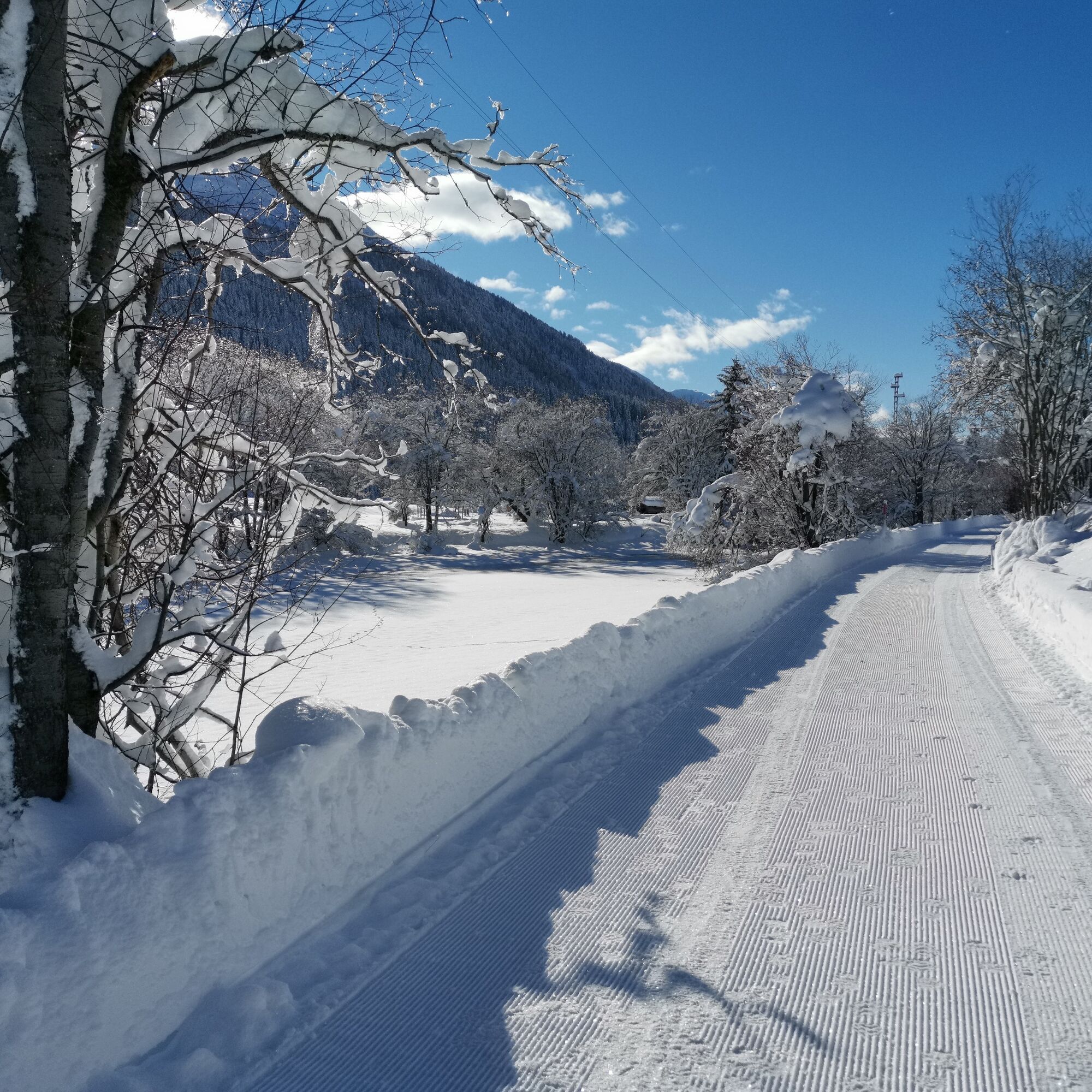
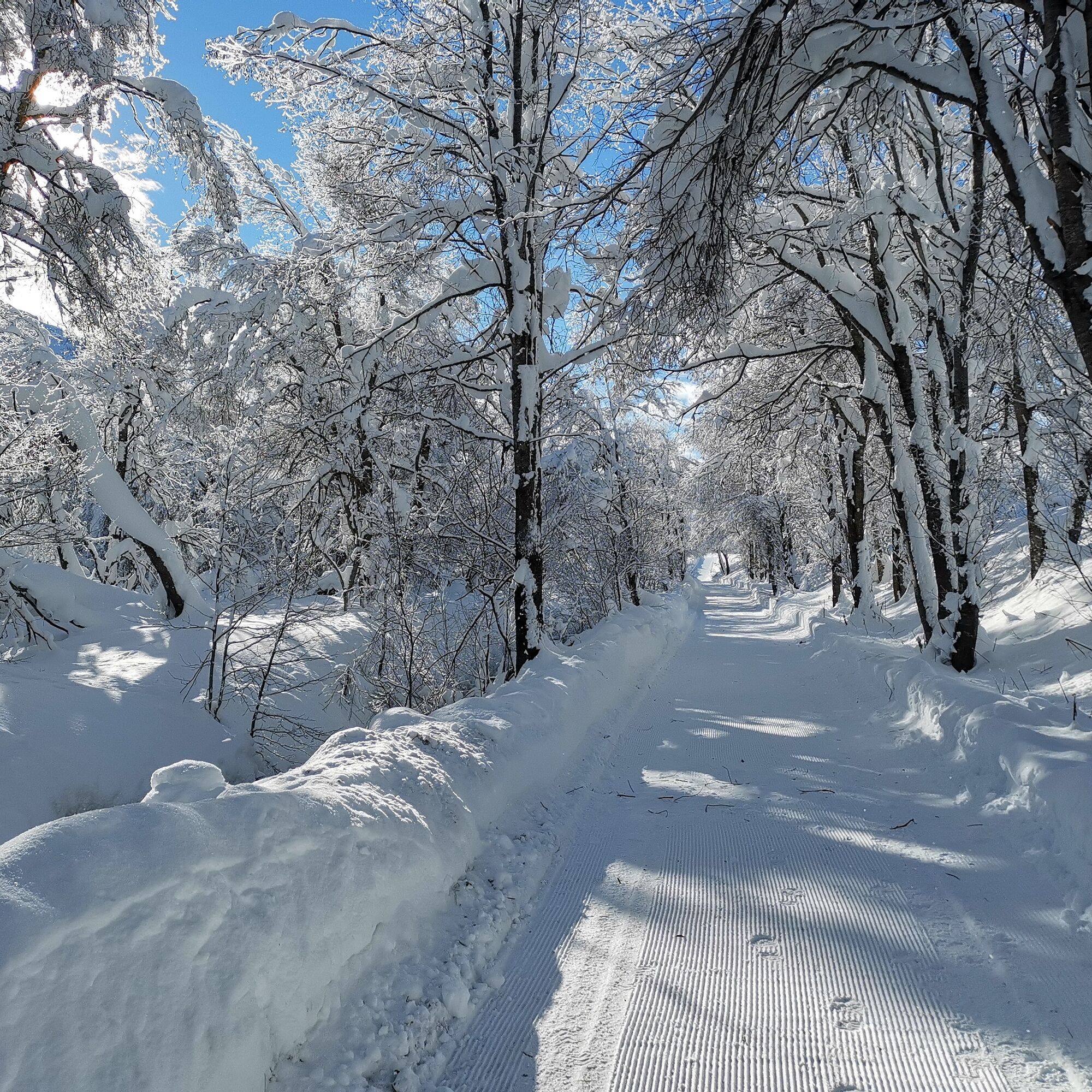
The path starts at the Promulins Arena in Samedan near the train station. Following the tracks of the renaturation "Innauen," it leads to La Punt. Initially, the old Inn dam is followed, past the airport...
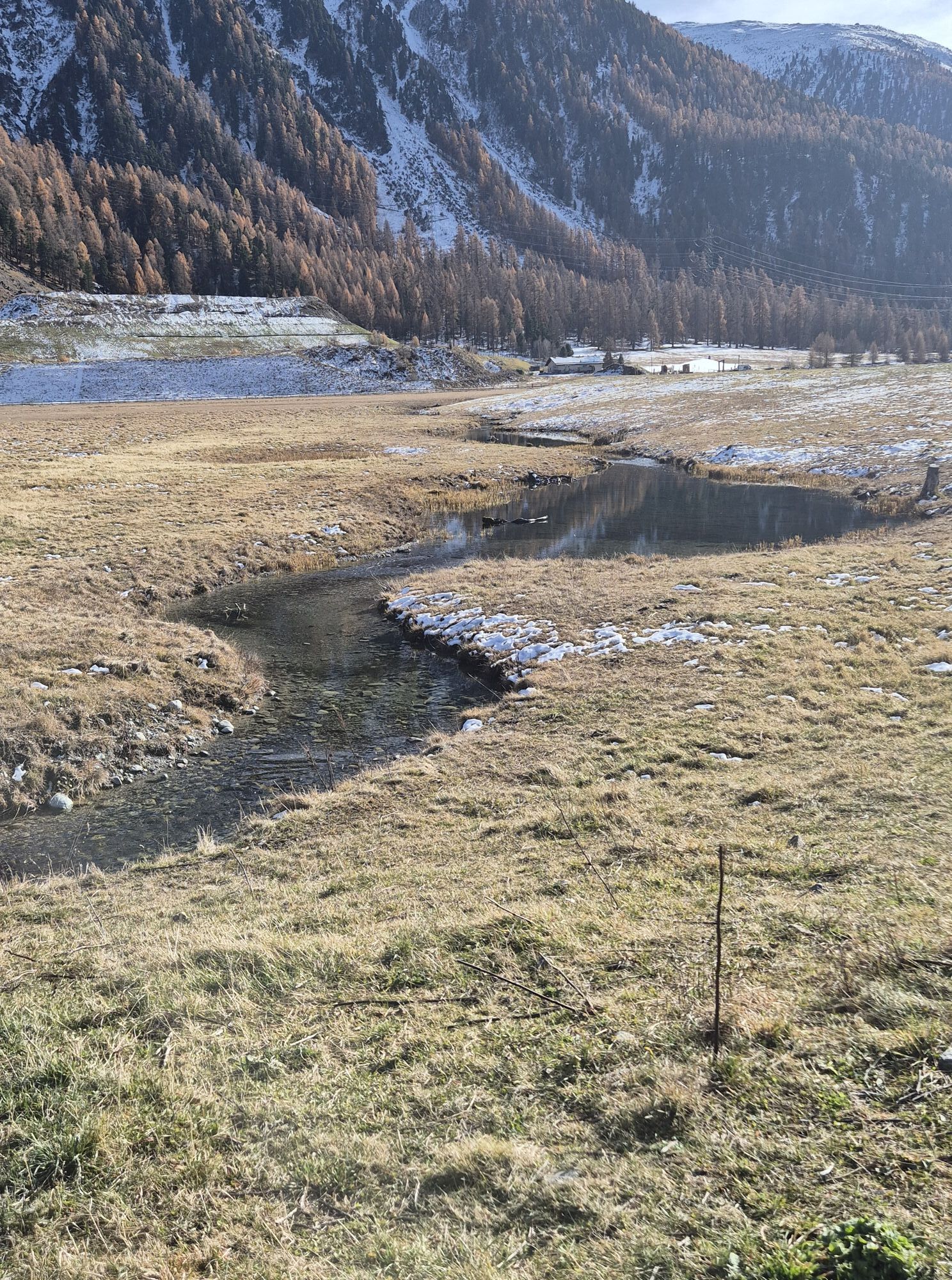
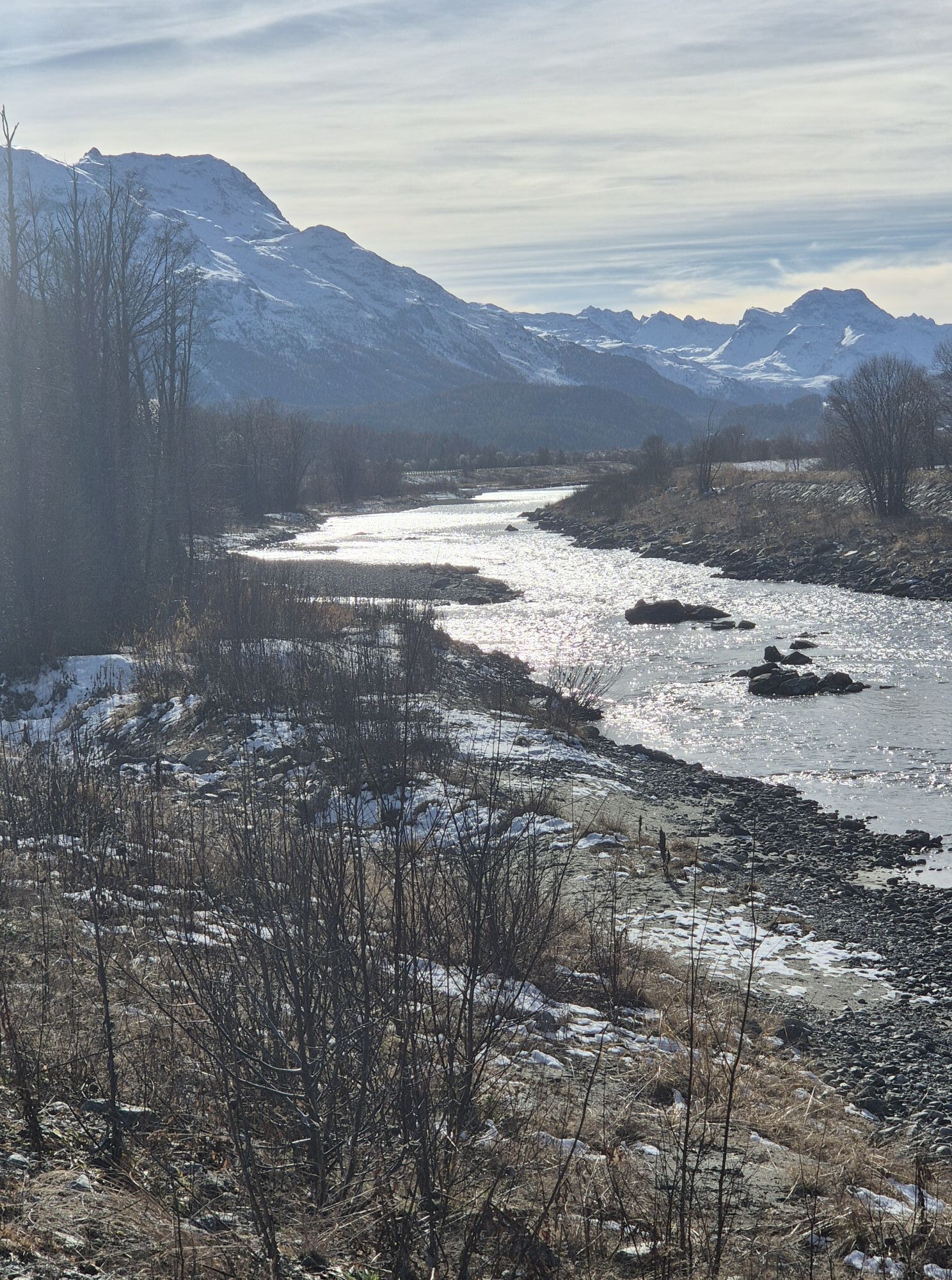
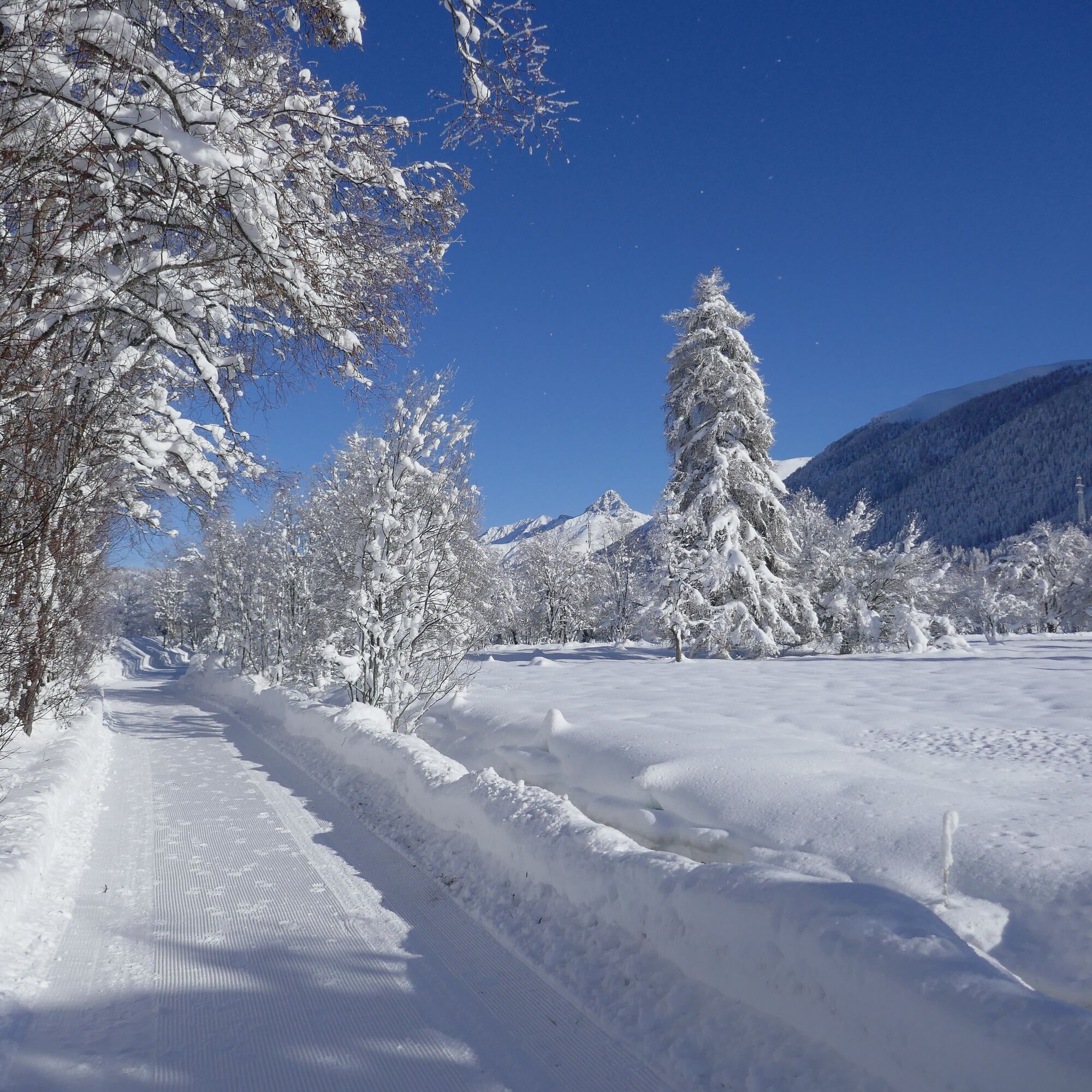
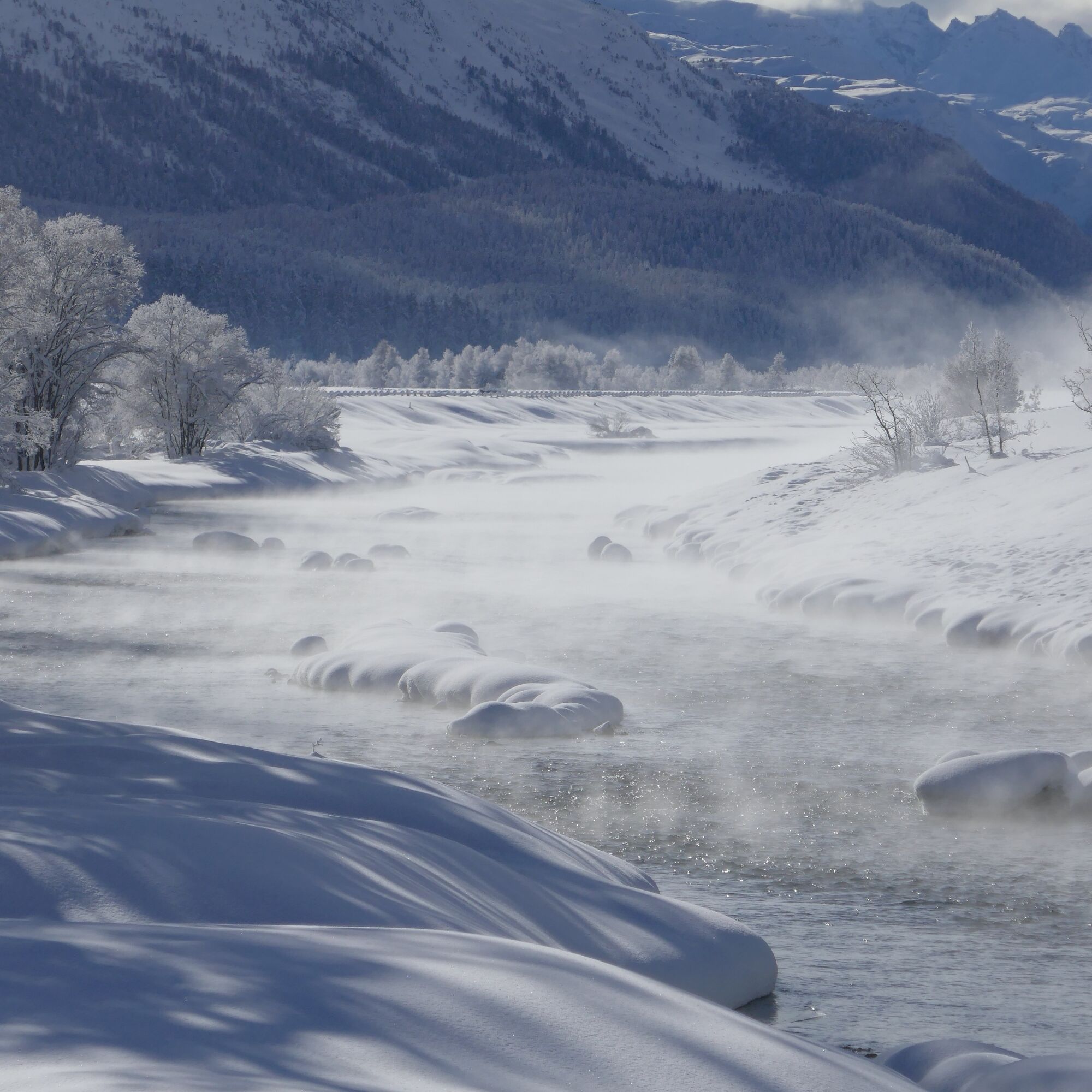
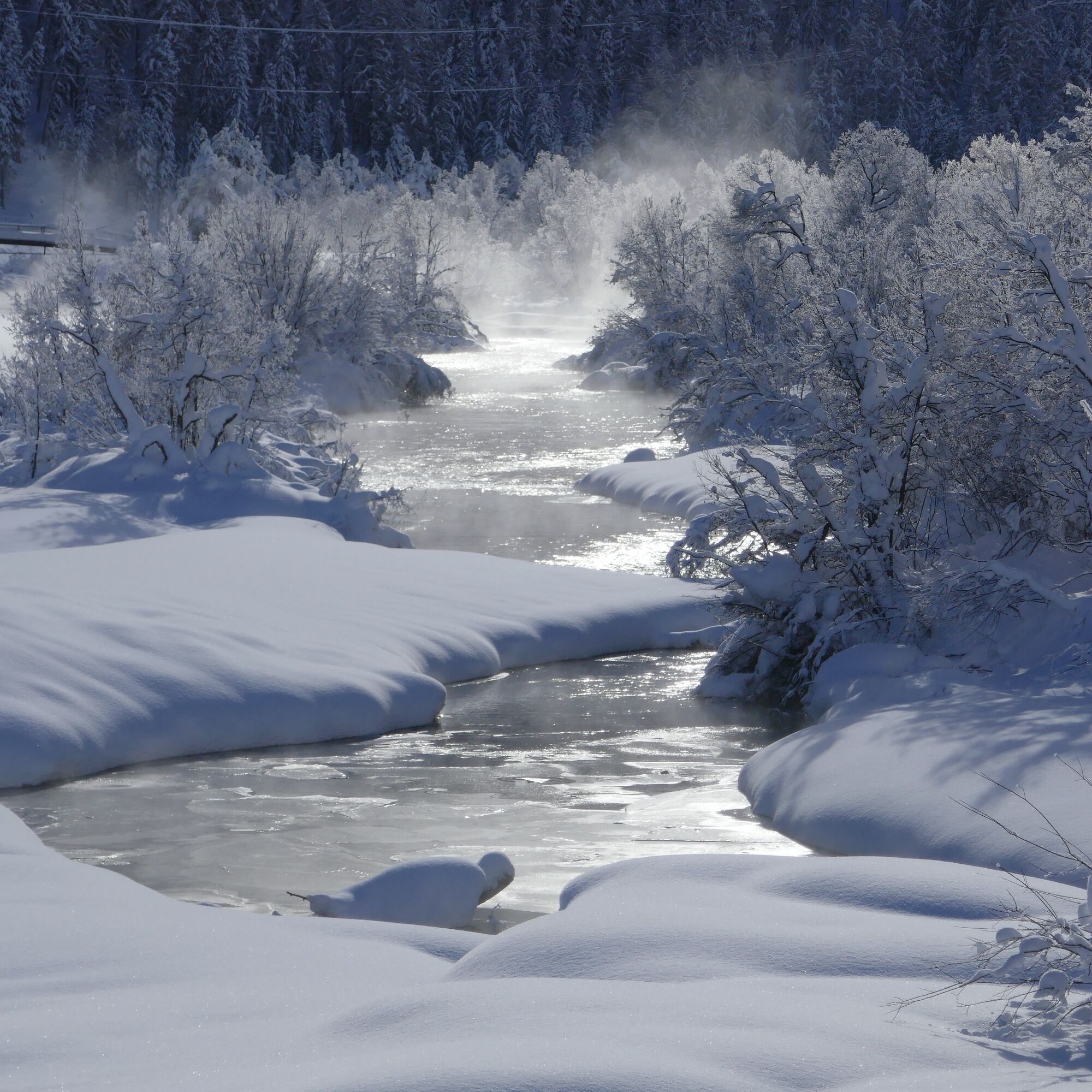
At the Beverin mouth, the route changes from the left to the right riverbank. Here also begins the revitalized Inn section: over about two kilometers, the dams were dismantled and the riverbed expanded. The Inn flows downstream up to 200 meters wide. The works were completed at the end of 2020; however, the Inn has long taken over the construction management and continues to shape the landscape with its floods and high waters. The area is habitat to many endangered animal and plant species. Mobile panels provide year-round information about flora and fauna. The hiking path detours to Isellas and then returns to the Inn bank. It runs directly along the river up to La Punt. From the municipal border to La Punt, the Inn flows again between high dams — straight as an arrow. It is, however, unclear how much longer. There are efforts to free it from its "corset" and to give it more space again. Taking a seat is also worthwhile in the crown of La Punt, where the hike can be ended with a warm drink. From here, there is a regular bus connection back to Samedan.
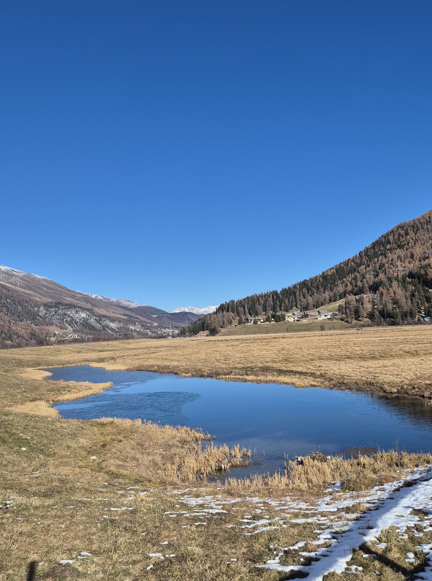
A natural paradise thanks to revitalisation
The Inn floodplains near Bever are the result of one of Switzerland's largest water revitalisation projects. In two stages, the previously canalised Inn was restored to a near-natural state by 2020. Where dams on both sides used to constrain the water, the river can now flow freely – up to 200 metres wide during floods. This dynamic floodplain landscape of national importance is constantly changing due to high and low water levels – the Inn forms new gravel banks, islands and riparian landscapes, creating valuable habitats for rare pioneer plants and endangered animal species such as the common sandpiper. Even a family of beavers feels at home here! The revitalised Inn floodplains are not only a boon for biodiversity, but also an attractive local recreation area that delights locals and visitors alike.
Further information
Engadin Tourismus AG
Via Maistra 1
CH-7500 St. Moritz
Phone: +41 81 830 00 01
E-Mail: allegra@engadin.ch
Internet: www.engadin.ch
Condition of winter hiking trails: www.engadin.ch/de/pisten-loipen-wege/winterwanderwege/

Samedan Promulins Arena - Lej Gravatscha - Isellas - Inn dam - La Punt Chamues-ch
Tak
Tak
1
Depending on the direction of the wind, the hike can also be done in the opposite direction.
Kamery internetowe z trasy
St. Moritz / Samedan - Muottas Muragl
Samedo - Engadin Golf
St. Moritz / Samedan - Muottas Muragl
Celerina - Cresta Palace
Zuoz
Celerina - Skiwiese Provuler
St. Moritz / Trais Fluors Bergstation
La Punt - Wasserreservoir
La Punt - Wasserreservoir
La Punt - Wasserreservoir
La Punt - Wasserreservoir
Samedan - Engadin Airport
Zuoz - Engadin Golf
Trais Fluors Bergstation
Trais Fluors Bergstation
Pontresina - Eiskletter-Schlucht
Popularne wycieczki w okolicy
- 5,0
Morteratsch station - Boval Hut
średniWędrówka 10,5 km - 4,8
Circular hike Val Trupchun in the Swiss National Park
średniWędrówka 13,8 km - 4,6
Panoramic route Muottas Muragl
światłoWędrówka 6,75 km - 5,0
Muottas Muragl - Segantini hut - Pontresina
średniWędrówka 6,46 km - 4,5
Pontresina - Val Roseg - Pontresina
światłoWędrówka 13,8 km - 4,7
SAC Tschierva
światłoWędrówka 24,7 km - 4,7
Morteratsch Glacier route
światłoTrasa tematyczna 2,88 km Muottas Muragl - Segantini Hütte - Pontresina
średniWędrówka 17,5 km- 5,0
Lej Muragl
średniWędrówka 7,39 km - 4,8
Around Lake St. Moritz
światłoWędrówka 4,32 km
Wędrówki i tropienie


Nie przegap ofert i inspiracji na następne wakacje
Twój adres e-mail została dodana do listy mailingowej.