


767 Alteinsee Schiesshorn

The circuit of one of Arosa's most beautiful local mountains offers both challenge and enjoyment. From the village, the route initially goes downhill, passing the Untersee, to the starting point at the...
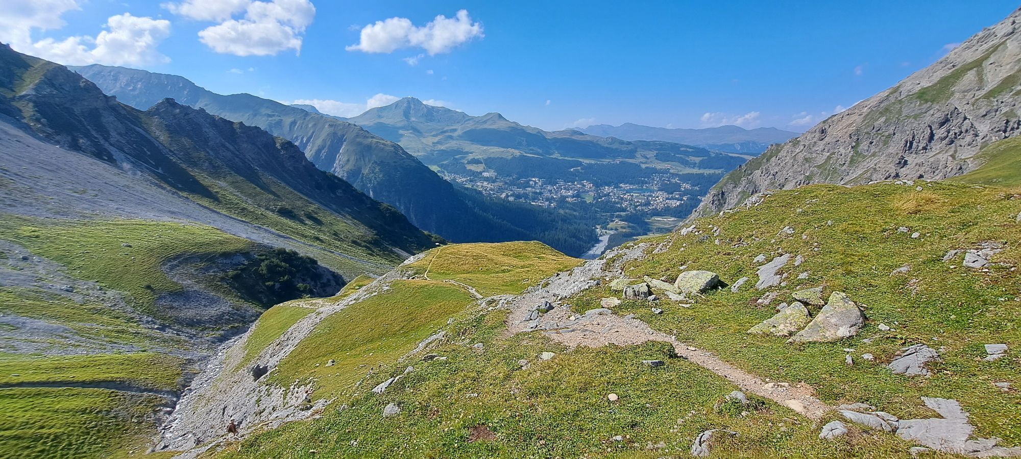
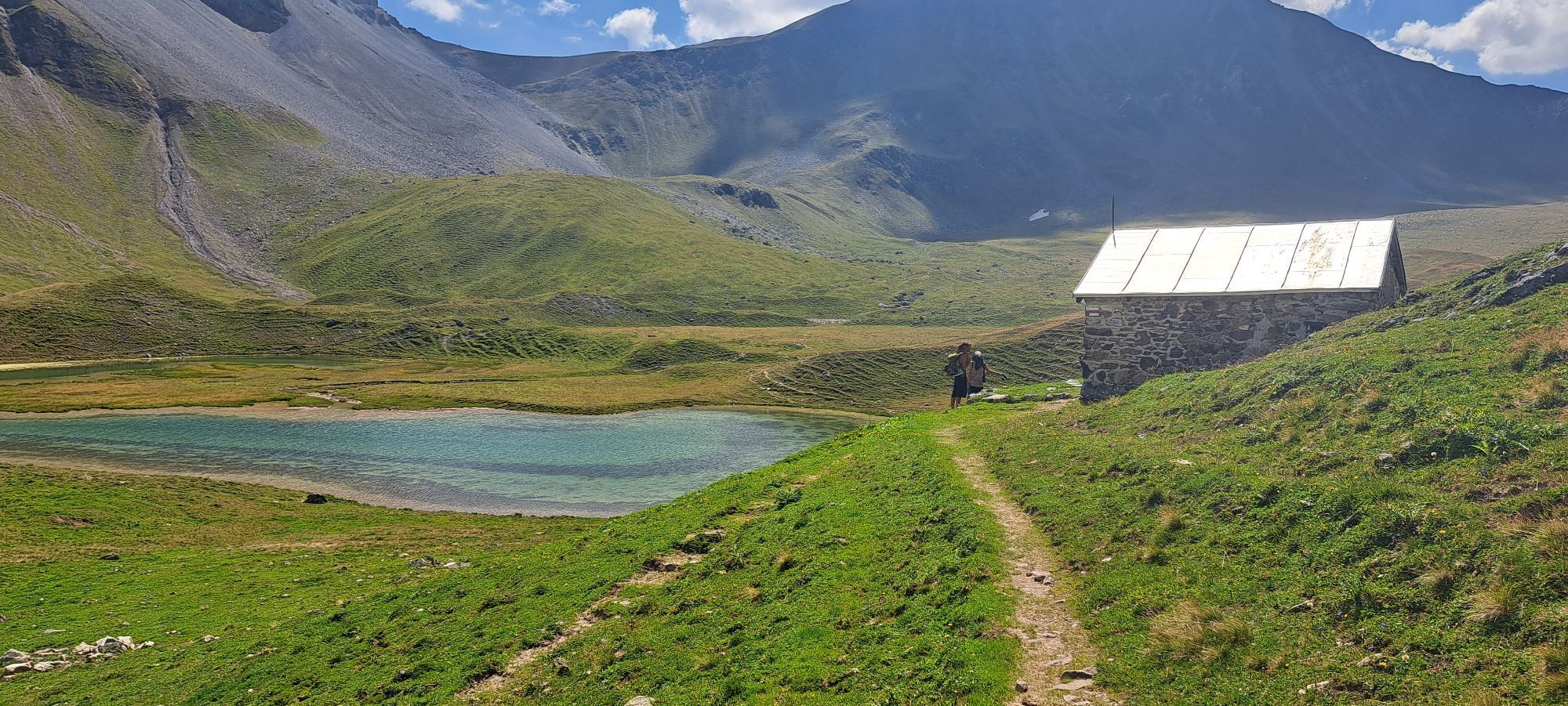
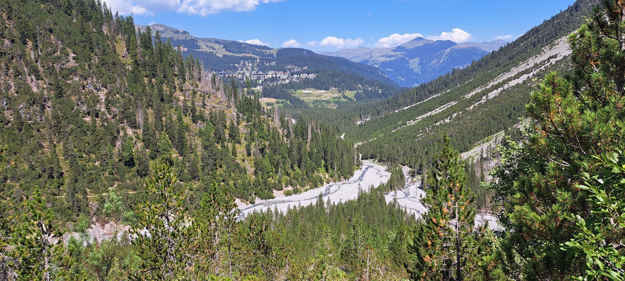
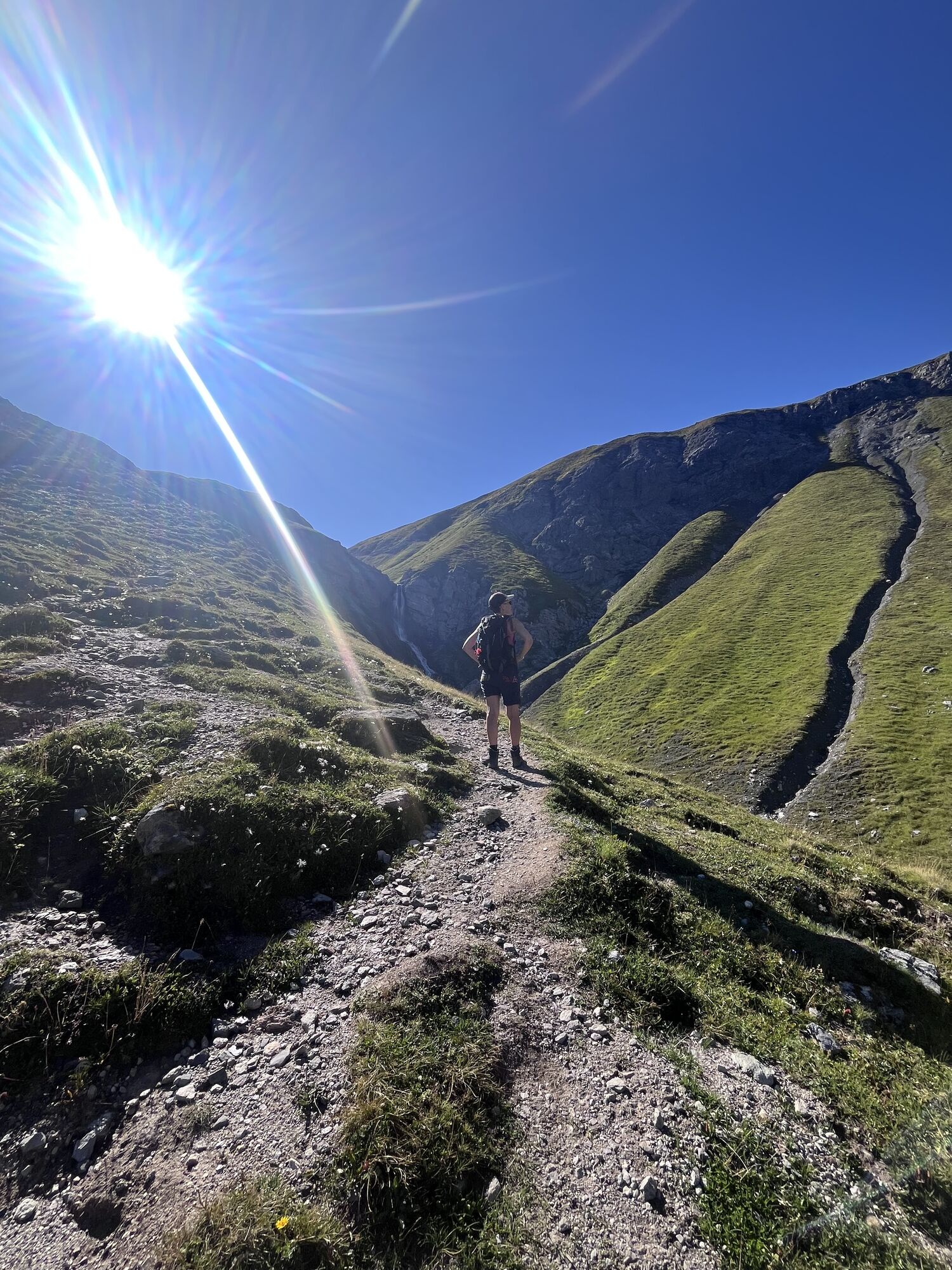
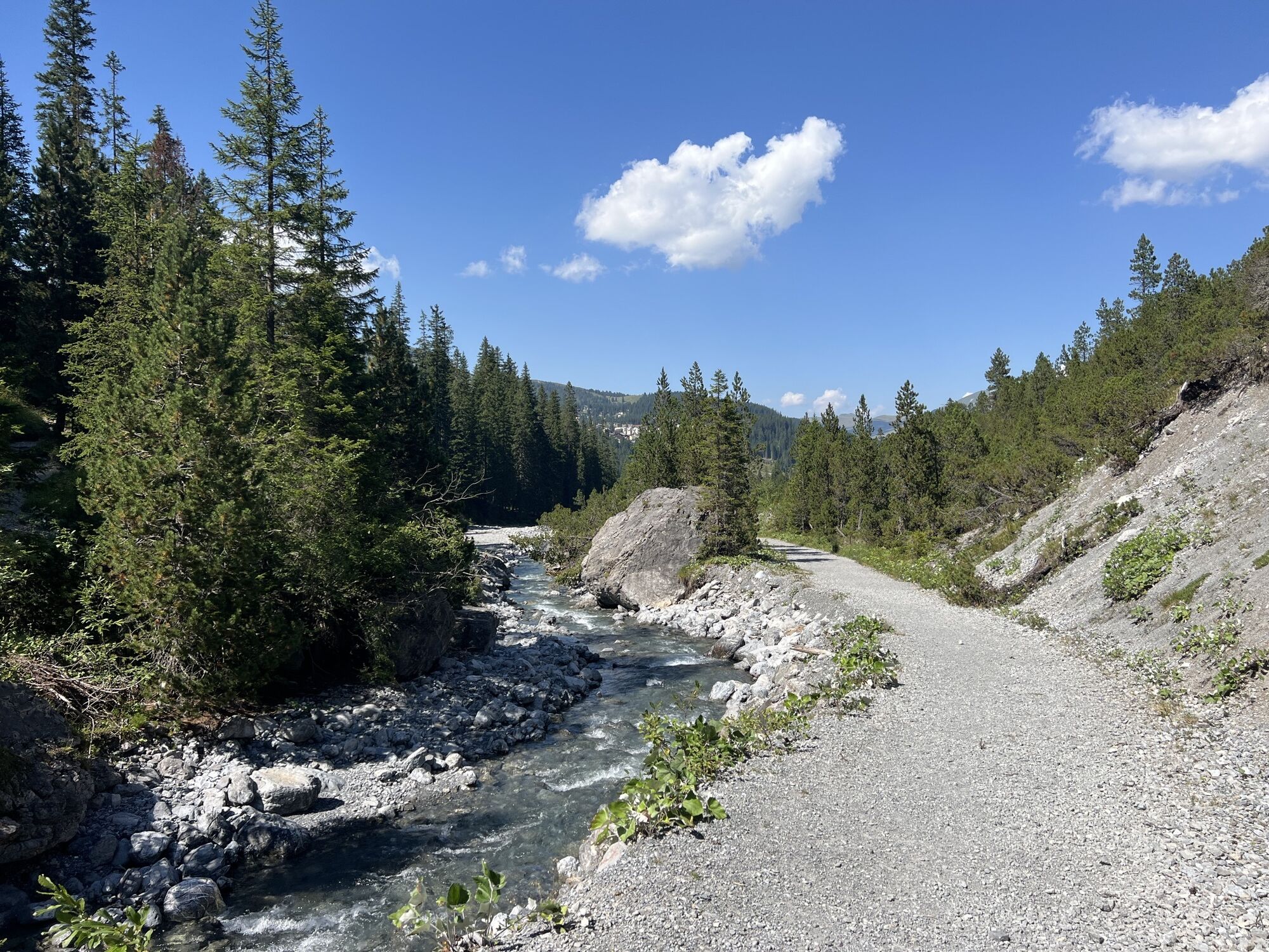
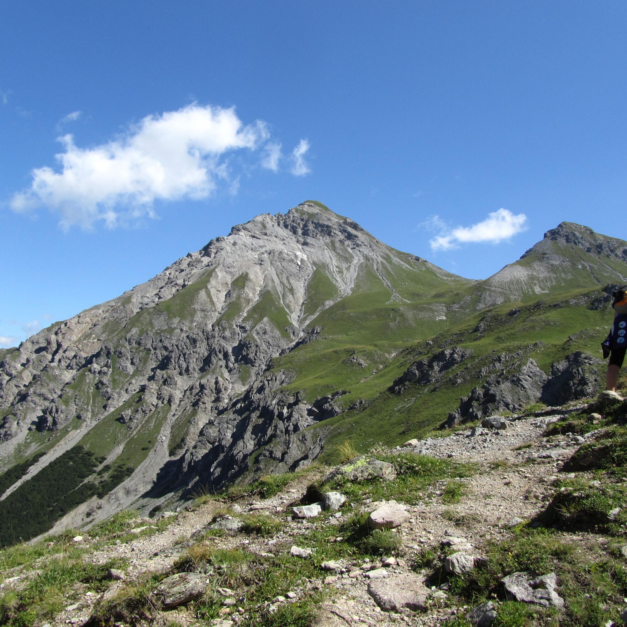
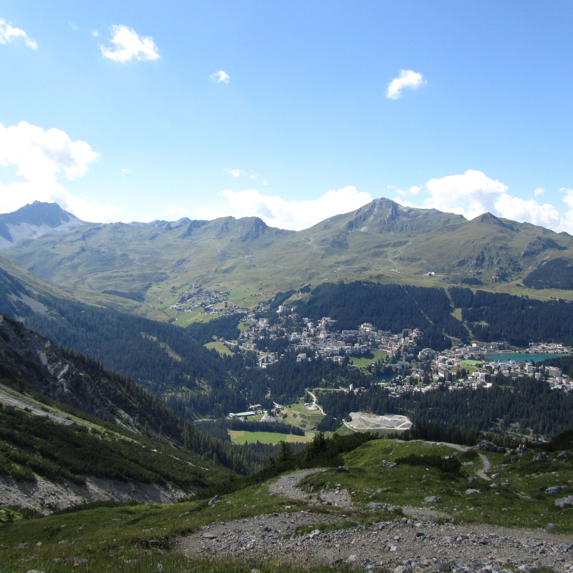
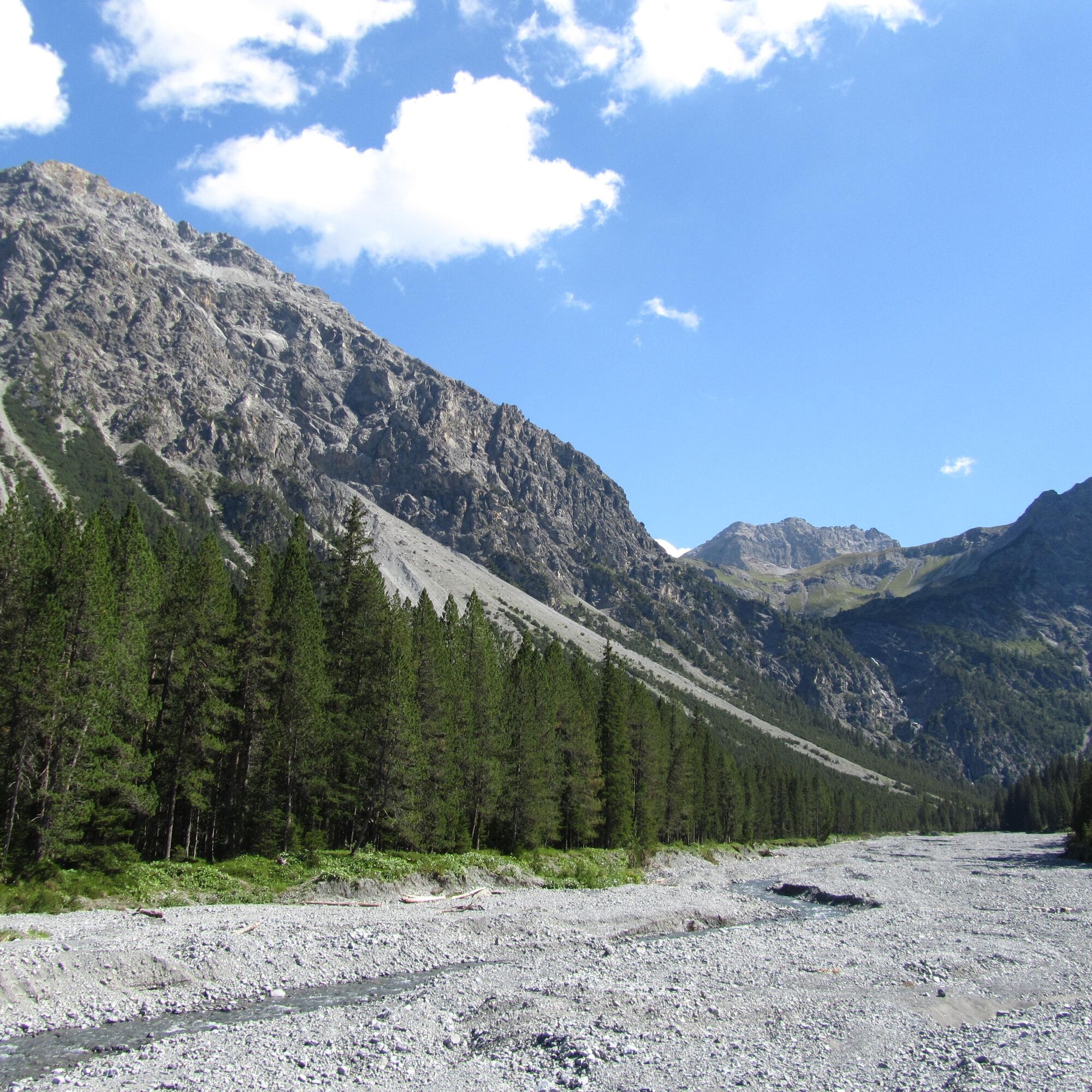
The circuit of one of Arosa's most beautiful local mountains offers both challenge and enjoyment. From the village, the route initially goes downhill, passing the Untersee, to the starting point at the ARA. After the first nature experience past the Altein waterfalls, your fitness will be challenged by the rather steep ascent to Alteinsee. Located in the alpine plateau of the Strelakette, the lake is an ideal resting place with a view of the Schiesshorn. Further uphill to the Schiesshorn Furgga, the summit seems within reach. The final detour to the summit cross over the grassy east flank follows a narrow, unmarked path. A rewarding viewpoint over Arosa from a bird's eye perspective is guaranteed. The hiking trail leads back downhill along the Furggatobel, crossing extensive alpine meadows into the valley until it disappears into the fairytale forest. Down over the Isel, a large clearing with a barbecue site, you reach the starting point again.

From Arosa railway station, you hike past the Untersee to the wastewater treatment plant (ARA) Arosa. From here, follow the signposts toward Alteinsee. From there, follow the junction toward Schiesshorn Furgga. From the Furgga, an unmarked path leads to the summit. From the Furgga, it goes downhill toward Isel and Arosa back to the starting point.
Tak
Tak
Parking is available at the Arosa wastewater treatment plant (ARA), which is the start and end point of the route.
Attention: From Schiesshorn Furgga, the ascent to the Schiesshorn summit is unmarked. Surefootedness and a head for heights are especially required here.
Car parking available at the Arosa Sewage Plant (Abwasserreinigungsanlage - ARA), which serves as the starting and end point of this tour.
Arosa Tourism
Sports and Congress Centre Arosa
Poststrasse
7050 Arosa
Tel: +41 (0)81 378 70 20
arosa@arosa.ch
www.arosa.ch
Kamery internetowe z trasy

Popularne wycieczki w okolicy
-
3,9
Arosa-Medergen-Tritt-Latschüelfurgga-Strelapass-Davos
średniWędrówka 22,5 km -
Arosa-Schwellisee-Älplisee-Parpaner Rothorn
Wędrówka 12,3 km -
4,7
Arosa-Hörnli-Parpaner Rothorn-Lenzerheide
Wędrówka 11,9 km -
5,0
Arosa-Hörnli-Urdenfürrgli-Alp Scharmoin-Lenzerheide
średniWędrówka 15,3 km -
5,0
Eichhörnliweg Arosa
światłoTrasa tematyczna 1,72 km -
2,0
Arosa-Maienfelder Furgga-Stafelalp-Davos
średniWędrówka 15,9 km -
5,0
Arosa-Erzhornsattel-Arosa
Wędrówka 14,9 km -
2,0
Arosa-Furclettapass-Alvaneu
Wędrówka 21,8 km -
Prätschli-Carmennahütte
Mountainbike 6,36 km -
4,0
749 Val Meltger suspension bridge trail
średniWędrówka 8,30 km

Wędrówki i tropienie


Nie przegap ofert i inspiracji na następne wakacje
Twój adres e-mail została dodana do listy mailingowej.