


Circular route Aual Claif
In the dry Val Müstair, meadows and fields have been artificially irrigated for centuries to secure and increase yield. Water was often channeled over long distances from tributaries or even from the main...
In the dry Val Müstair, meadows and fields have been artificially irrigated for centuries to secure and increase yield. Water was often channeled over long distances from tributaries or even from the main river Rom to the agricultural areas.
As part of comprehensive agricultural land improvement, a network of modern irrigation systems was installed in Val Müstair, and the Auals gradually lost importance. With the discontinuation of the use of the Auals, the old craft and knowledge also faded from memory. Today, the value and functions of the Auals are mainly cultural-historical. But biodiversity also benefits from the still water-carrying Auals. Thanks to an initiative by the Swiss Landscape Foundation, the municipality of Val Müstair, and the nature park, selected Auals have been renovated for several years and the remains of former Auals in the terrain made visible again.

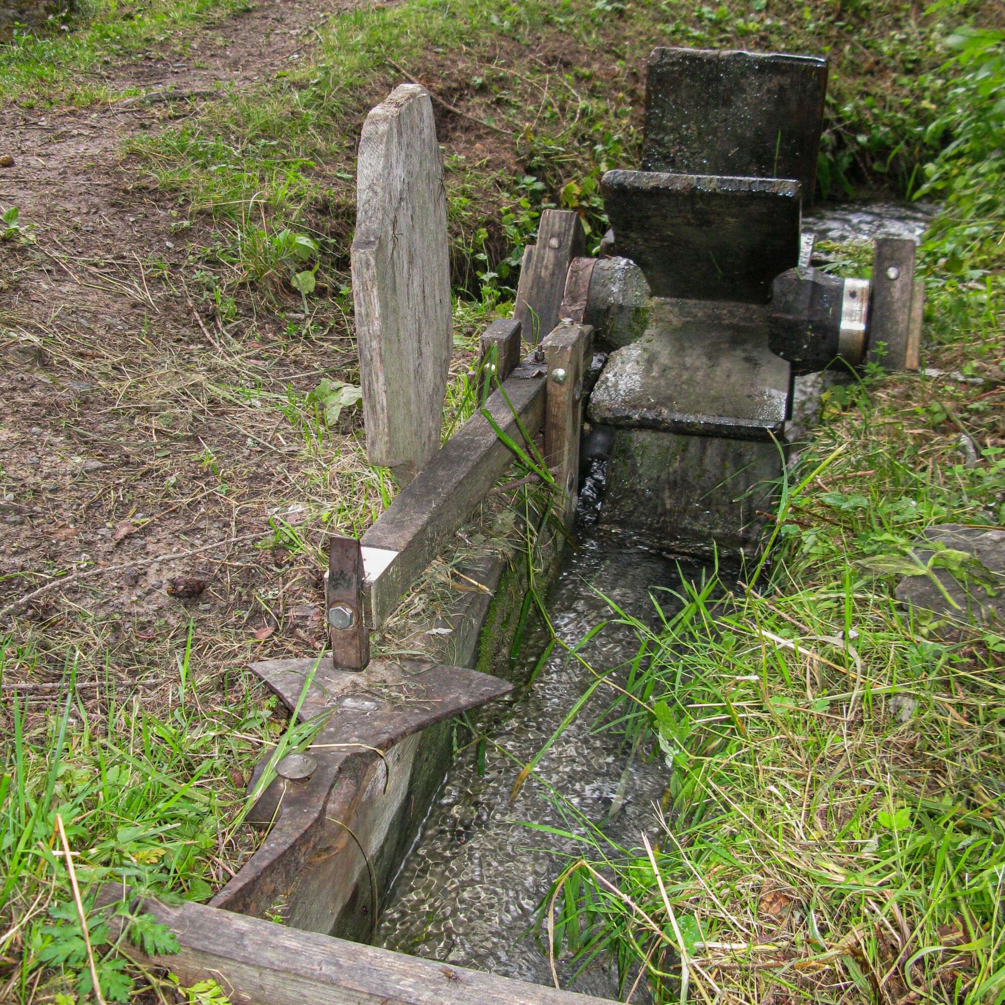
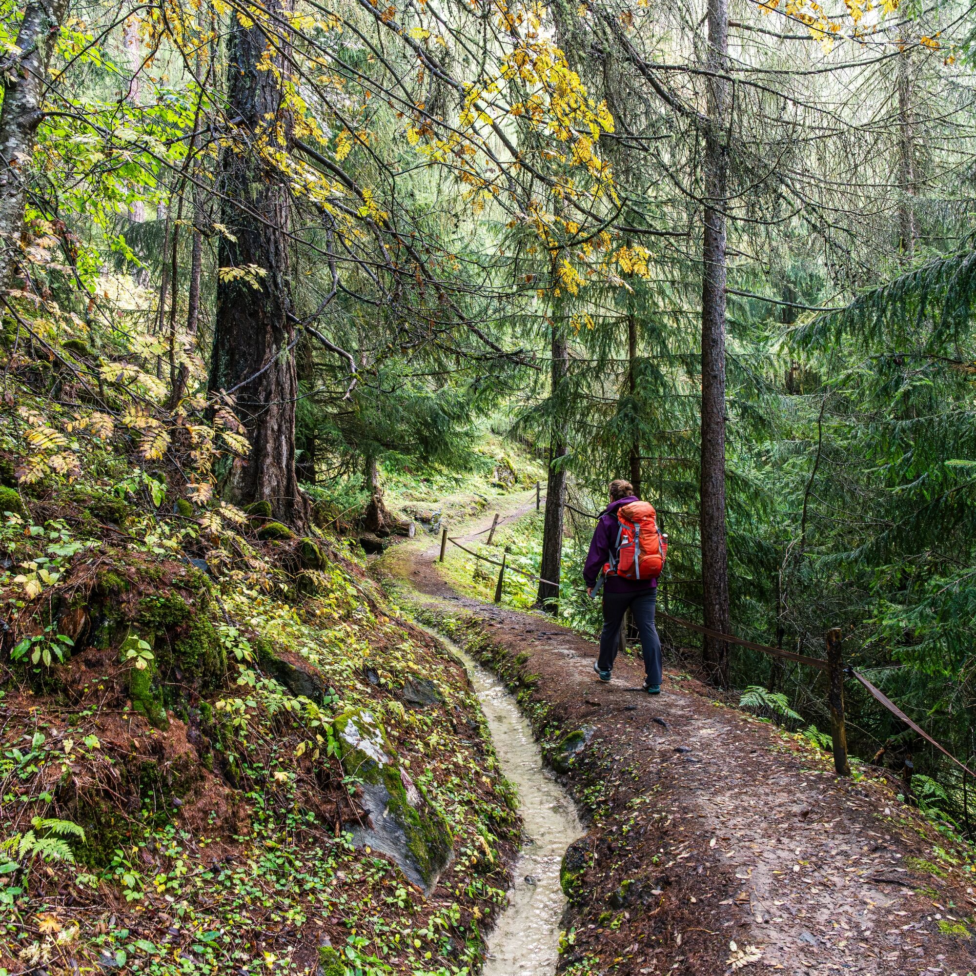
Starting from Sta. Maria, PostBus stop cumün, follow the Umbrailstraße and take the second left turn towards Guad. Then walk through the fields in the direction of Müstair. At the first crossroads, turn right up the gravel path to "Aua Naira." Here the path forks again, and follow the hiking trail to the right towards "Döss da las Levras." After a short section on the Umbrailstraße, leave it quickly again and follow the hiking trail on the right side towards "Döss da las Levras / Muranzina." After about 300 m, the hiking trail begins along the Aual Claif and goes almost to its intake at the Muranzina. The water of the Aual Claif was formerly used to irrigate most of the meadows of Sta. Maria. After the wooden bridge over the Muranzina, you can descend again to the right back towards Sta. Maria.
Good footwear, rain and sun protection, water bottle, first aid kit
The route was evaluated under favorable weather conditions; current weather conditions and forecasts must be strictly observed before starting the route.
Emergency numbers:
144 Emergency call, first aid
1414 Mountain rescue REGA
112 International emergency number
From the north: via Landquart – Klosters by car shuttle through the Vereina Tunnel (Selfranga - Sagliains). From Zernez on the H28 to Val Müstair to Sta. Maria (40 minutes drive from Vereina south portal).
From the east: via Reschen Pass (Nauders) on the SS40 to Mals. From Mals on the SS41 to the Swiss border at Sta. Maria.
From the south: via Bolzano and Merano on the SS40 to Mals. From Mals on the SS41 to the Swiss border at Sta. Maria.
By Rhaetian Railway (from Chur, Landquart/Prättigau or from the Upper Engadin) hourly to Zernez station
Then by PostBus (from Zernez or Mals) hourly to PostBus stop Sta. Maria, cumün
Free parking in Sta. Maria, behind the gas station
Popularne wycieczki w okolicy
-
5,0
Mountain restaurant Plantaptasch (without Lift)
średniWędrówka 3,42 km -
3,7
Payerhütte 3020m
Wędrówka 6,98 km -
5,0
Wanderung/Aufstieg zur Payerhütte
światłoWędrówka 15,9 km -
3,6
Easy hiking rout to the top of the Watles Moutain (2.550 m)
średniWędrówka 2,35 km -
4,3
Sonnenaufgang auf der Rötelspitze im Nationalpark Stilfserjoch
Wędrówka 2,02 km -
4,5
Rundwanderweg Wattles und Sesvenna
światłoWędrówka 16,4 km -
3,4
Sta.Maria, Prà da Vau - Lai da Rims - Alp Sot - Prà da Vau
ciężkiWędrówka 14,7 km -
4,3
Ortler – Normalweg
ciężkiWycieczka wysokogórska 7,30 km -
3,0
Wanderung zum Hinteren Schöneck
światłoWędrówka 13,2 km -
1,0
Tabarettahütte 2555m zur Payerhütte 3020m
Wędrówka 3,82 km
Wędrówki i tropienie


Nie przegap ofert i inspiracji na następne wakacje
Twój adres e-mail została dodana do listy mailingowej.