


Hora 2372 m
Zdjęcia naszych użytkowników
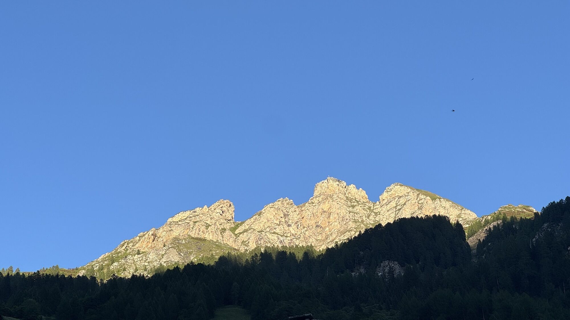

Already at Pradatsch, the view (northwest) of the Tödi chain and into Lugnez is impressive. Upstream you can see Zerfreila and some peaks of the Adula massif. And the bizarre rocks of the Hora impress...
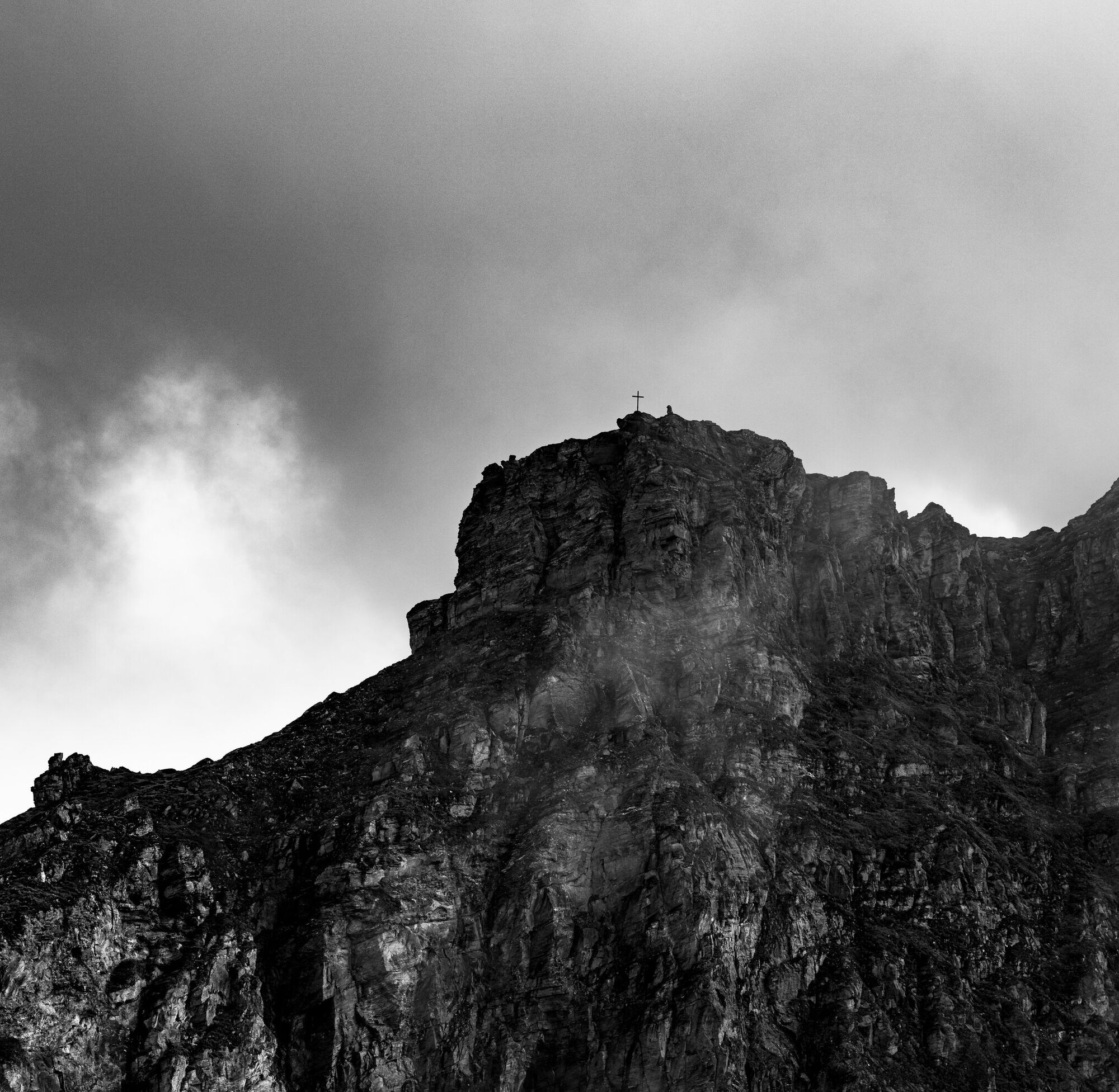
Already at Pradatsch, the view (northwest) of the Tödi chain and into Lugnez is impressive. Upstream you can see Zerfreila and some peaks of the Adula massif. And the bizarre rocks of the Hora impress on both sides of the mountain. At the summit, you enjoy a spectacular downward view to Vals and the wide panorama.

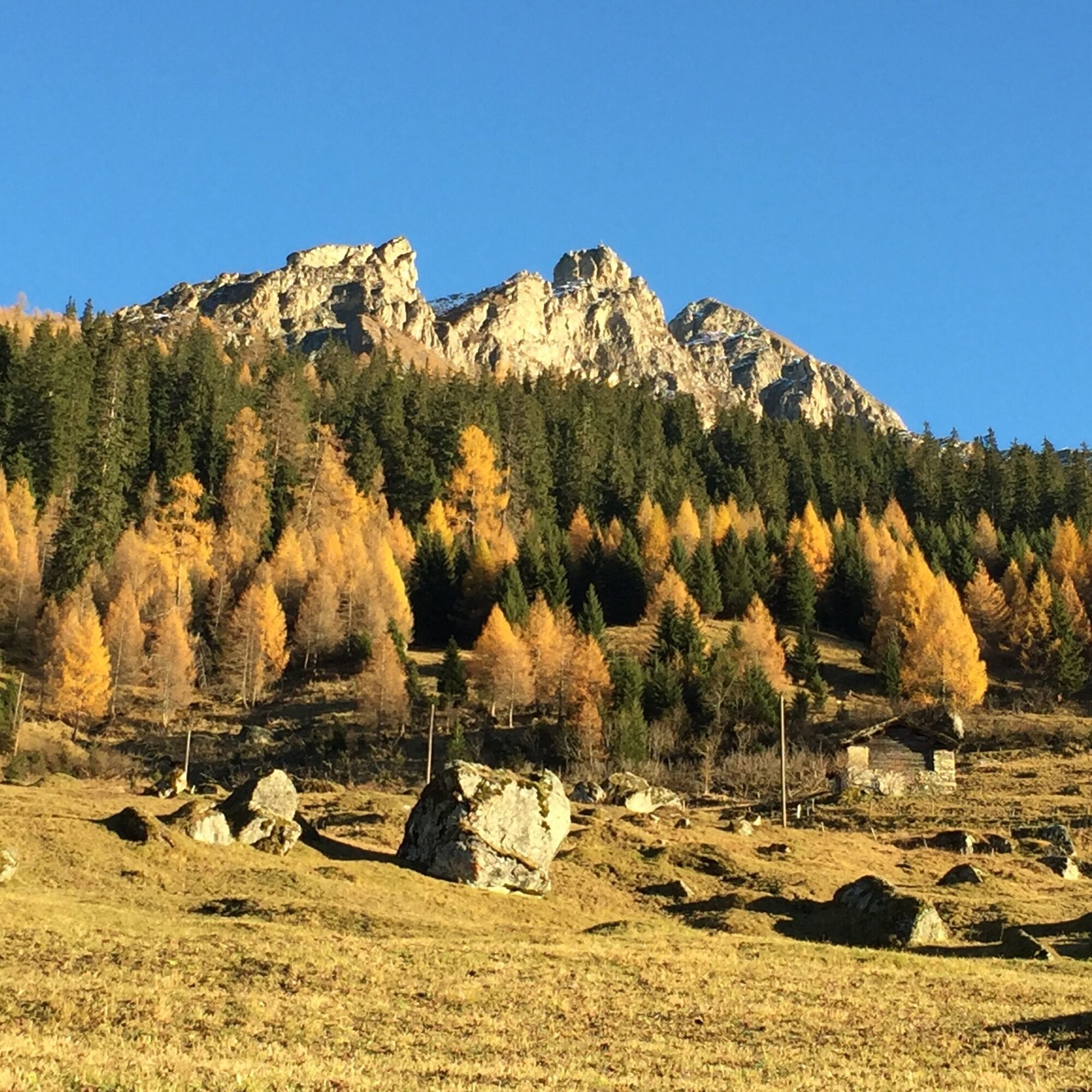
From the square north of the church, go up the village lane until above the village. From there, the path leads southeast, north of a small brook, steep, rocky, and almost without bends up the slope. In some steep hairpin bends, after crossing a farm road, you climb the slope covered with light stones below the Wissflua. The path then becomes less steep and leads northeast through shrubs and coniferous forest, then in steep curves to the height of the summer pasture Riefa (1642 m).
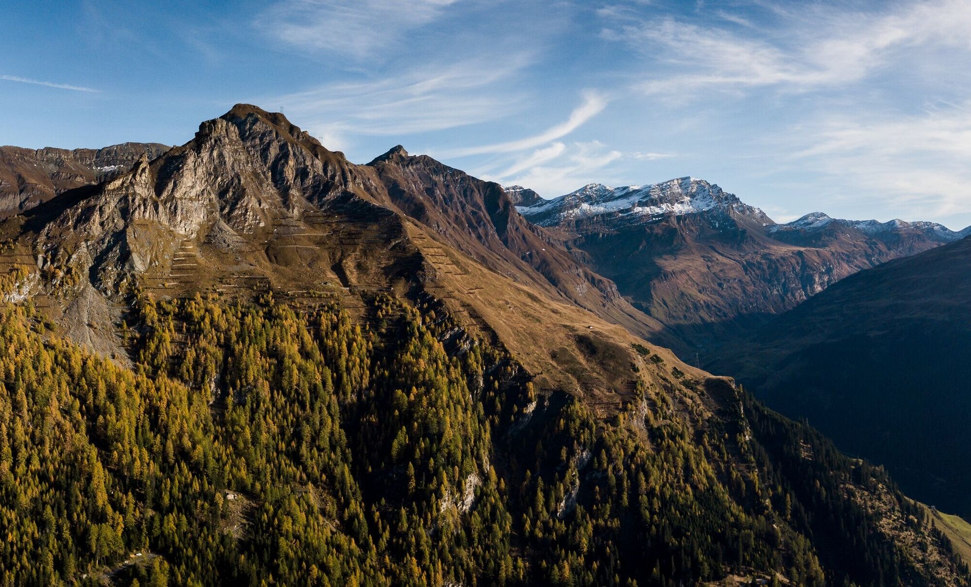
You continue hiking on the alpine path, through the Riefawald below the Horn, and after numerous bends reach Pradatsch (1953 m). Beautiful views downstream to the Tödi chain as well as upstream to Zerfreila and numerous mountain peaks of the Adula massif.
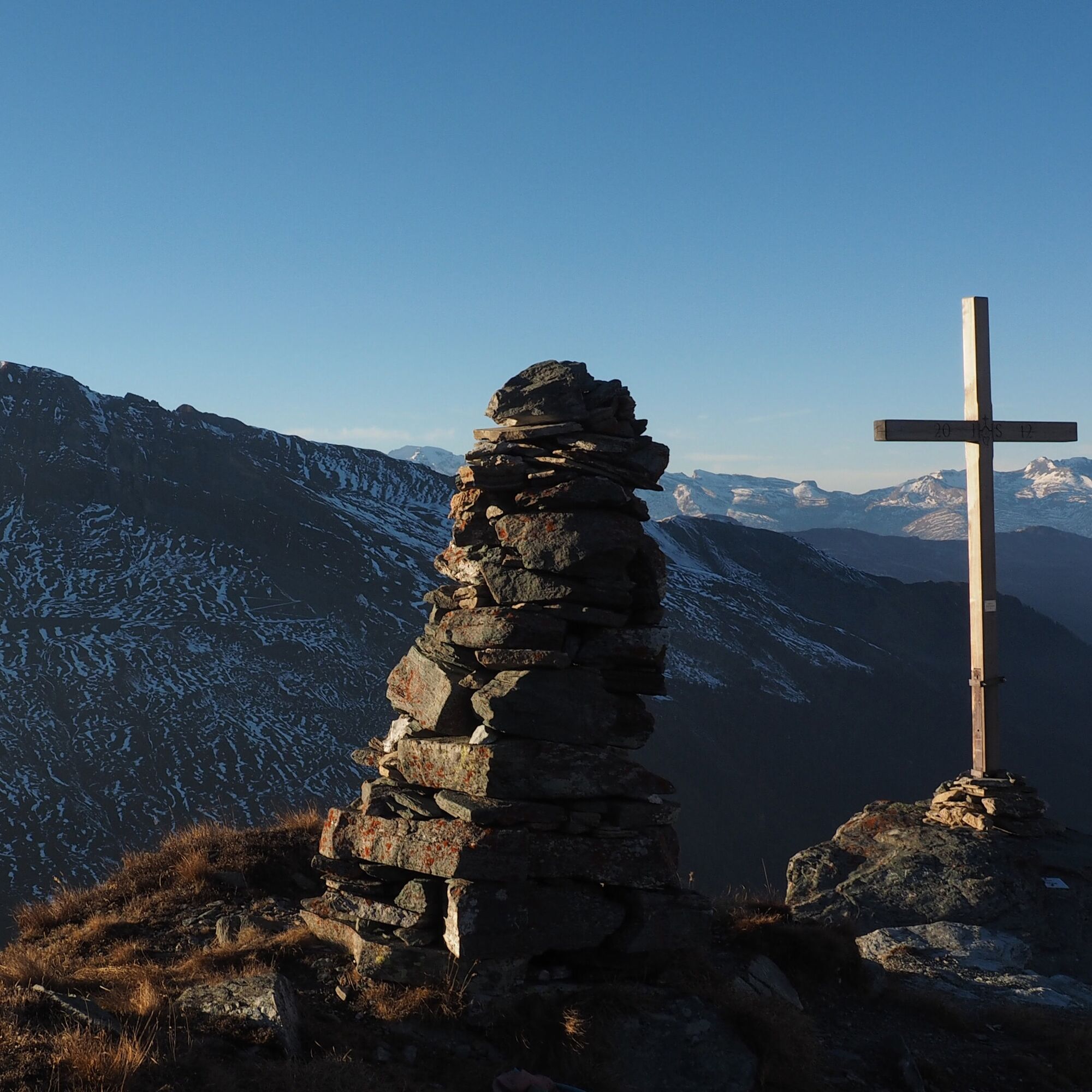
At the signpost at Pradatsch, you can see a marking (white-red-white) towards the southeast. Following the mountain trail markings, you reach the Hora summit (2372 m) after about 1.5 kilometers. Descent: via the same route.
Ascent: 3 hr 45 min (only Pradatsch-Hora: 1 hr 15 min). Descent from Hora to the village: 3 hr.
Total walking time: 6 hr 45 min.
Tak
Tak
Tak
Solid, rainproof, warm clothing. Robust mountain or trekking shoes. Gloves, hat, sun protection. Hiking poles, provisions and drinks from the backpack, emergency medical kit, topographic map, altimeter, compass, mobile phone, flashlight.
Surefootedness and freedom from dizziness required.
On this hike, you must expect to encounter cow-calf herds.
Detailed information on behavior: https://www.wandern.ch/de/wandern/sicher-unterwegs/mutterkuhherden
Via Chur-Ilanz to Vals.
To Vals by PostAuto coming from Ilanz
Parking lot "Bidem" (paid) near the village square.
You can shorten your route (time saving about 2 hr) by starting your hike at the Riefawald. Use the Valser hiking bus, which runs to the Riefawald on selected days. Registration required at Tel. 081 935 16 49. Timetable see: Hiking bus summer
Popularne wycieczki w okolicy
-
5,0
Panorama route
światłoWędrówka 5,39 km -
5,0
Hiking route Suspension Bridge Val da Tersnaus
średniWędrówka 3,24 km -
3,3
3-lake hike
średniWędrówka 12,8 km -
Panoramic route between Piz Mundaun and Péz Sezner
średniWędrówka 6,75 km -
5,0
Winter hike Gadastatt - Frunt - Zerfreila (Panorama trail)
światłoWędrówka zimą 5,36 km -
Piz Terri, 3.149 m
średniWycieczka wysokogórska 6,92 km -
5,0
Southeast Switzerland Hiking Day Vals 2017
światłoWędrówka 11,8 km -
Furggelti 2712m
ciężkiWędrówka 18,7 km -
3,5
Places of Magic - Lumbrein
średniWędrówka 8,74 km -
Fanellhorn 3124 m
ciężkiWycieczka wysokogórska 6,86 km
Wędrówki i tropienie


Nie przegap ofert i inspiracji na następne wakacje
Twój adres e-mail została dodana do listy mailingowej.