


Senda Muottas da Schlarigna
The starting point of this trail running route is Pontresina train station. The route is marked as Switzerland Mobility Route 804. To the left of the Pontresina station area, the path ascends through a...
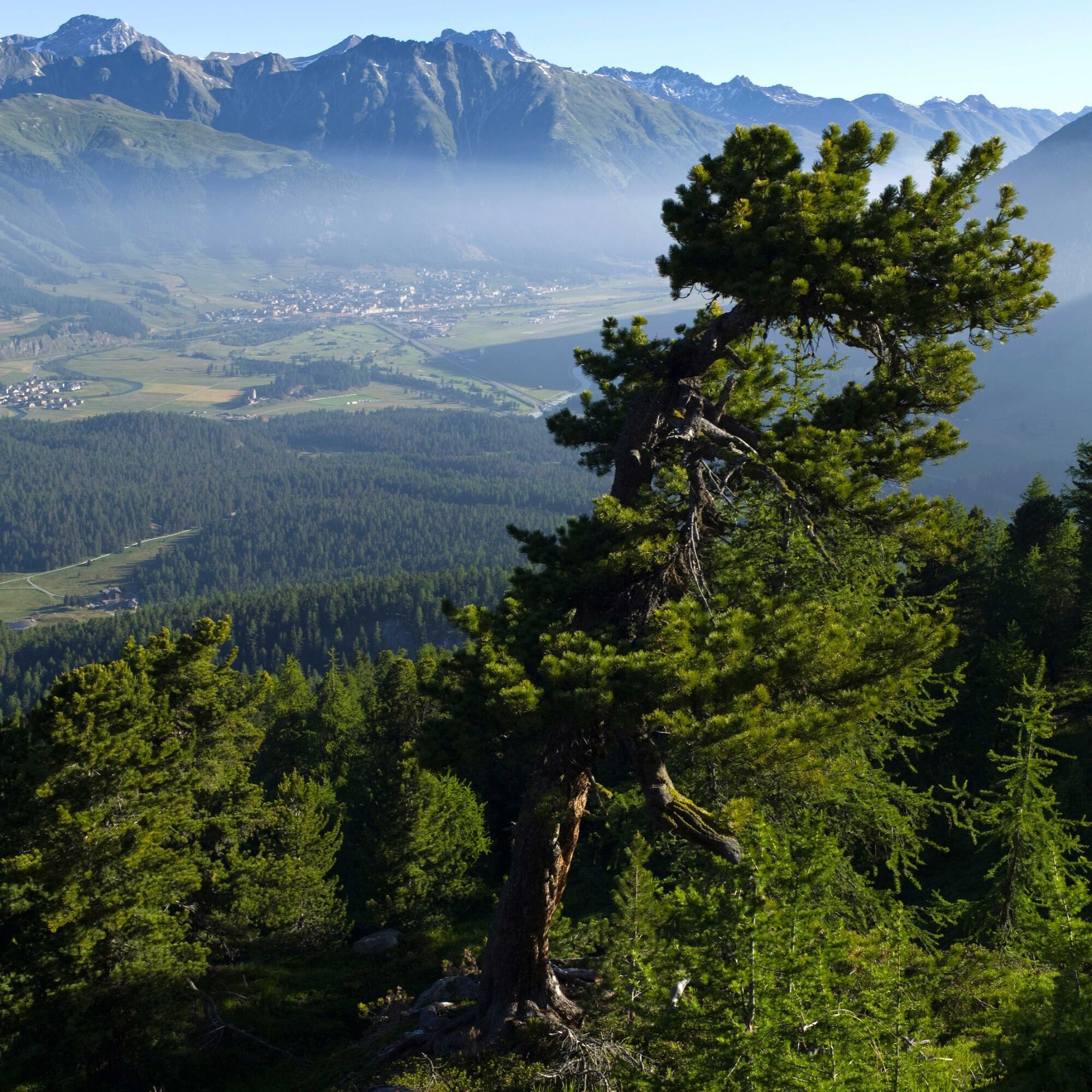
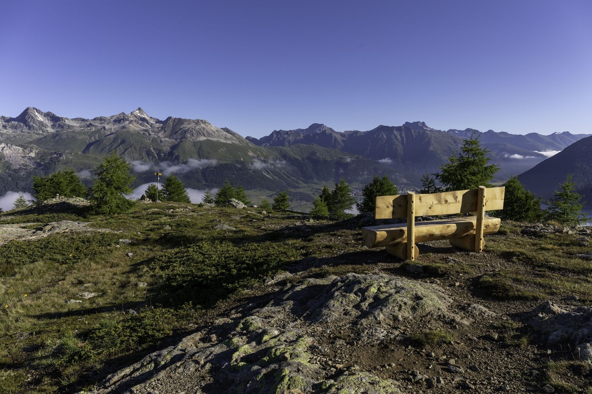
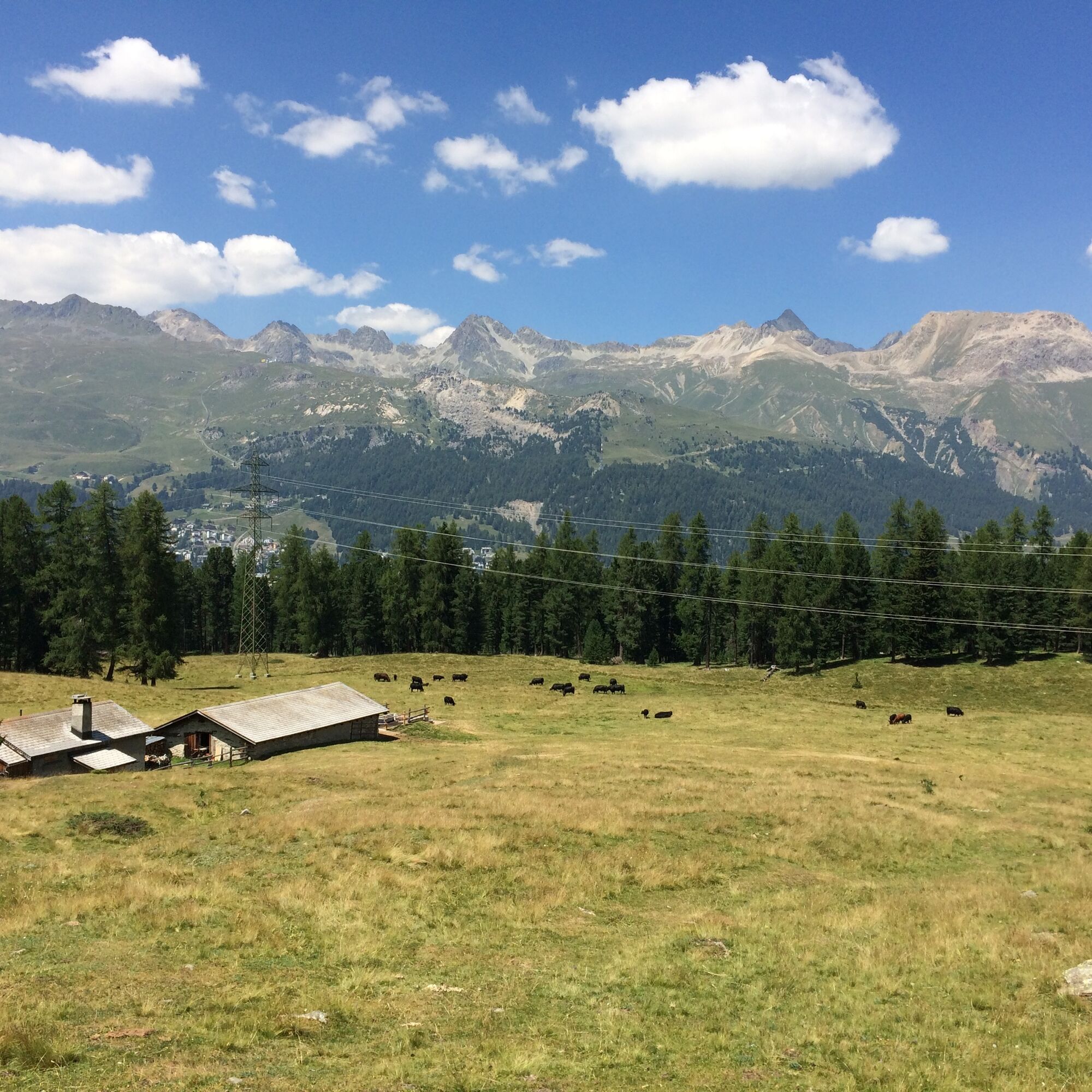
The starting point of this trail running route is Pontresina train station. The route is marked as Switzerland Mobility Route 804. To the left of the Pontresina station area, the path ascends through a light forest mixed with stone pines and larches to the Alp Staz plateau. Unexpectedly, a clearing opens here. From here the path leads quite steeply upwards through the old stone pine and larch forest to Muottas da Schlarigna (2305m). A splendid panoramic view of the elongated Pontresina and the wide valley towards S-chanf compensates for the ascent.
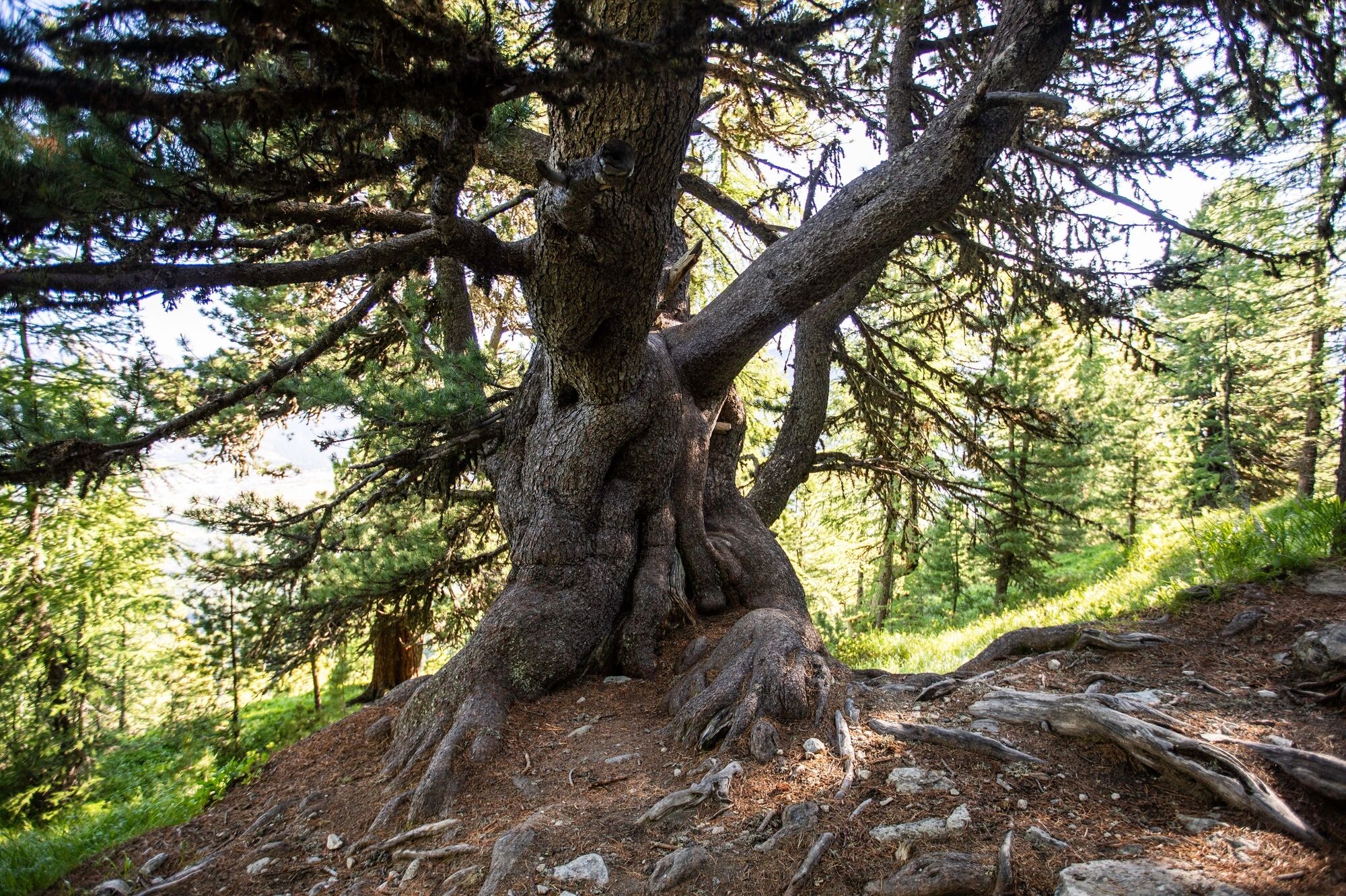
A section back on the same path to the tree line and then down towards Alp Staz, passing the over 1000-year-old stone pine. At Alp Staz, stay on the hiking trail and continue towards St. Moritz Bad.
Further information
Engadin Tourism AG
Via Maistra 1
CH-7500 St. Moritz
Phone: +41 81 830 00 01
E-mail: allegra@engadin.ch
Internet: www.engadin.ch


Pontresina train station - Muottas da Schlarigna - Alp Staz - Ovaverva indoor pool & Spa, St. Moritz Bad
At the junction for the descent to Alp Staz, there is a thousand-year-old stone pine below the bench. Nearby, there are more old stone pines.
Kamery internetowe z trasy
-
Corviglia
-
St. Moritz / Samedan - Muottas Muragl
-
Camping Morteratsch
-
Corvatsch
-
Marguns - Plateau Nair
-
Samedo - Engadin Golf
-
St. Moritz / Samedan - Muottas Muragl
-
St. Moritz / Samedan - Muottas Muragl
-
St. Moritz / Samedan - Muottas Muragl
-
St. Moritz / Samedan - Muottas Muragl
-
Corviglia
-
Corviglia
-
Corviglia
-
Corviglia
-
Corviglia
-
Corviglia
-
Corviglia
-
Corvatsch
-
Corvatsch
-
Corvatsch
-
Corvatsch
-
Corvatsch
-
Corvatsch
-
Celerina - Cresta Palace
-
Piz Nair - St. Moritz
-
Celerina - Skiwiese Provuler
-
St. Moritz - Berghotel Randolins
-
Samedan - Engadin Airport
-
El Paradiso
-
Piz Nair Bergstation
-
Piz Nair Bergstation
-
Piz Nair Bergstation
-
Piz Nair Bergstation
-
Piz Nair Bergstation
-
Piz Nair Bergstation
-
Piz Nair Bergstation
-
Piz Nair Bergstation
-
Sporthotel Pontresina
-
Corvatsch - Hossa Bar
-
Silvaplana - Hossa Bar


Popularne wycieczki w okolicy
-
5,0
Morteratsch station - Boval Hut
średniWędrówka 10,5 km -
4,7
Diavolezza - Munt Pers
światłoWędrówka 3,82 km -
5,0
Muottas Muragl - Segantini hut - Pontresina
średniWędrówka 6,46 km -
4,4
Panoramic route Muottas Muragl
światłoWędrówka 6,75 km -
Muottas Muragl - Segantini Hütte - Pontresina
średniWędrówka 17,5 km -
4,5
Pontresina - Val Roseg - Pontresina
światłoWędrówka 13,8 km -
5,0
Lagalb - Val Minor - Motta Bianca - Lagalb
średniWędrówka 9,80 km -
5,0
Lej Muragl
średniWędrówka 7,39 km -
4,5
Diavolezza - Lej da Diavolezza
średniWędrówka 6,22 km -
5,0
Alp Languard - Paradis Hut - Pontresina
światłoWędrówka 7,05 km

Wędrówki i tropienie


Nie przegap ofert i inspiracji na następne wakacje
Twój adres e-mail została dodana do listy mailingowej.