


Péz da Vrin, Lumnezia
Poziom trudności: PD+
The GPS track shows a loop tour, which we however recommend as an out-and-back tour. That means either starting in Vrin (public transport connection) or from Sogn Giusep by car.
The tour from the village...
The GPS track shows a loop tour, which we however recommend as an out-and-back tour. That means either starting in Vrin (public transport connection) or from Sogn Giusep by car.
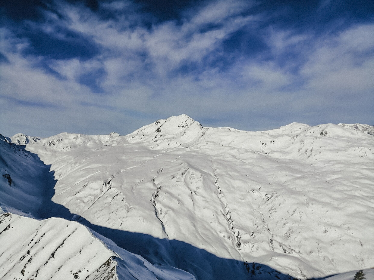
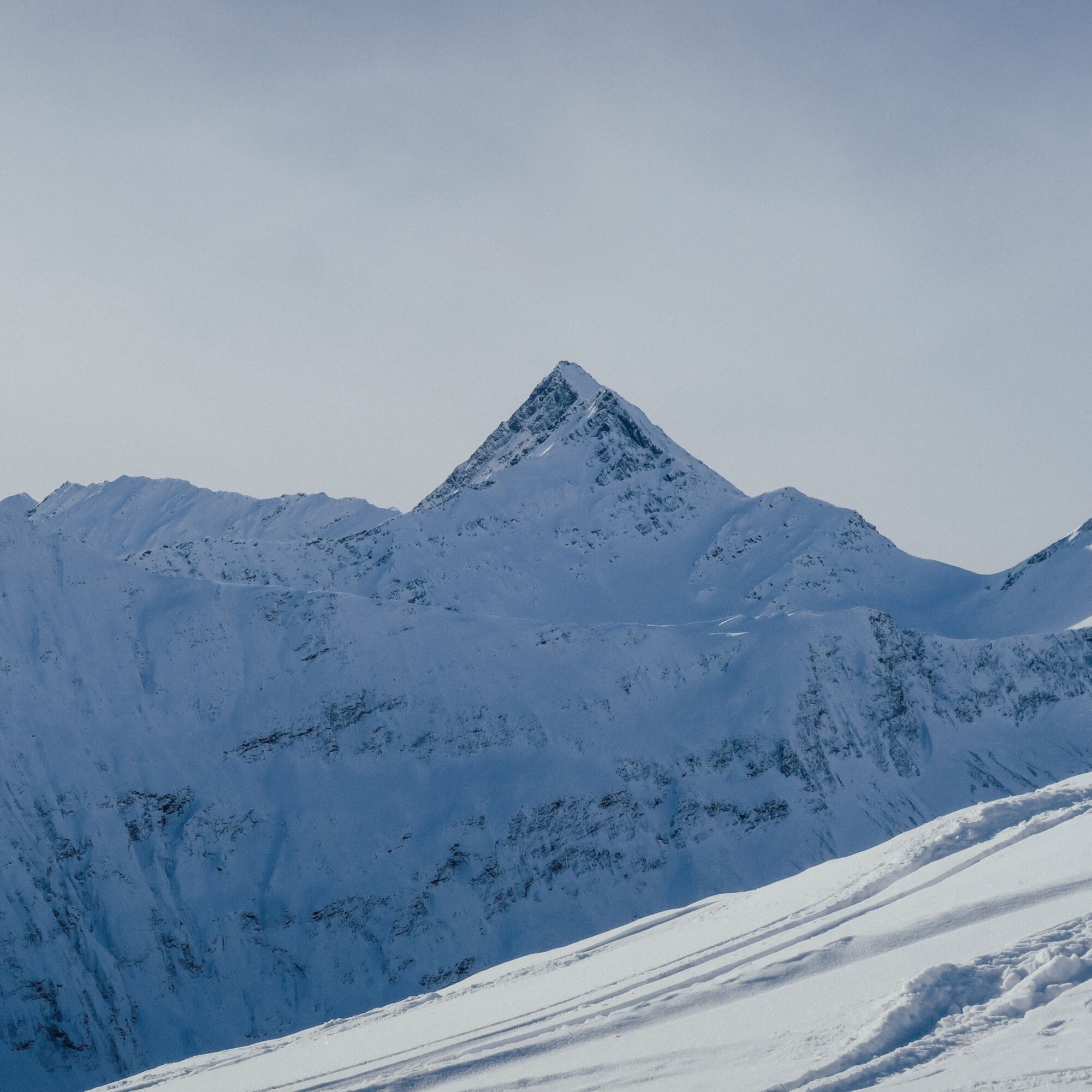
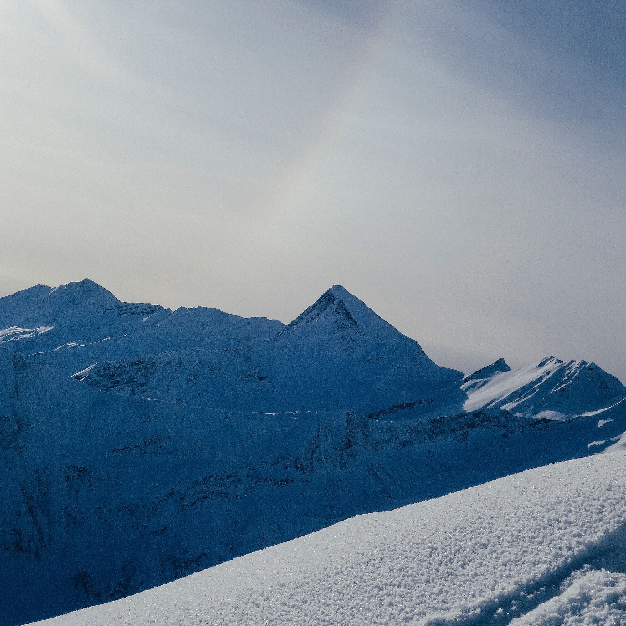
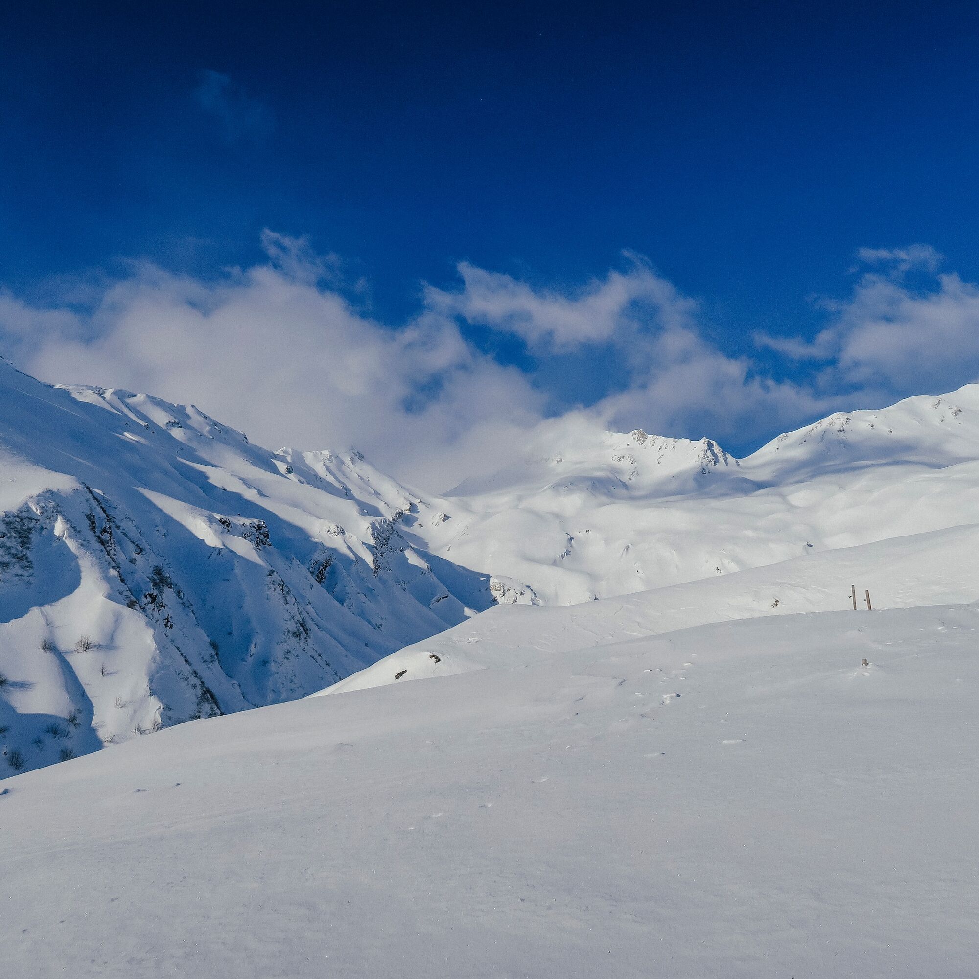
The tour from the village of Vrin is somewhat more demanding in the summit area. You ascend directly over the alpine meadows of Prada and reach Alp Dado after about 500 meters of elevation gain. It becomes more challenging in terms of avalanche risk, as steep slopes must be crossed repeatedly or you move within the influence area of steep slopes. The climb to the summit requires some hairpin turns and is not to be underestimated. The space at the highest point is limited, but the panorama certainly is not. You can then either descend along the ascent track or take the route via Sogn Giusep, with the disadvantage of having to walk along the valley road at the end.
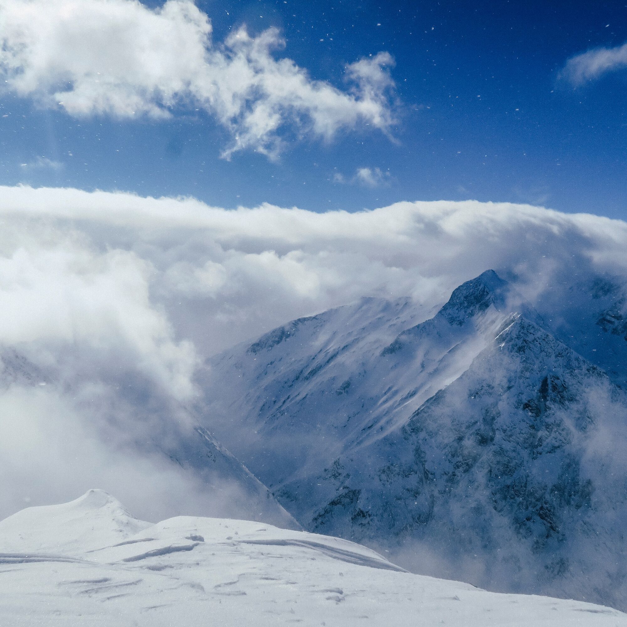
The ascent from Sogn Giusep requires arrival by car. This tour is somewhat easier but still has a few steeper sections. It ascends over alpine meadows up to the height of Stavel Liung at about 2000 m a.s.l., just right for warming up. Then further over Puozas up to below the summit. Often, a ski depot must be made here. The summit ridge is regularly wind-blown. In theory, you could now descend via Alp Dado. However, whoever has the car in Sogn Giusep must solve this logistical problem.
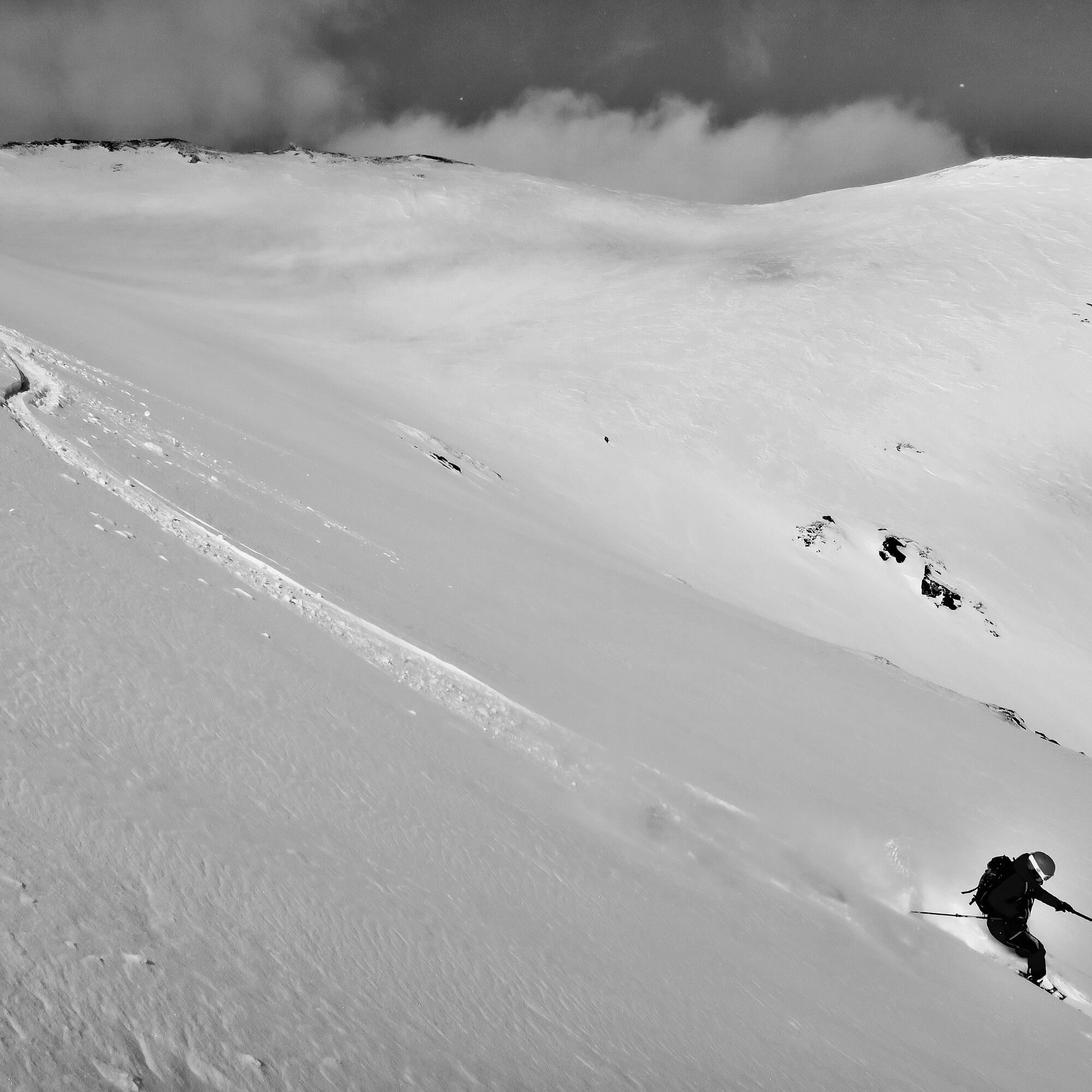
The temptation to descend via Alp Cuolm is great. However, this area is a wildlife protection zone and closed from 01.12. to 15.04. Please strictly observe this!

From Vrin
Vrin - Alp Dado - Stavel Sura - Summit - Descent via ascent route
From Sogn Giusep
Sogn Giusep - Stavel Liung - Puozas - Summit - Descent via ascent route
Tak
Tak
See safety instructions
Ski and snowshoe tours in unsecured terrain require good knowledge in avalanche risk assessment and tour planning. Furthermore, a complete safety equipment must always be carried – regardless of the current avalanche risk.
For preparation and planning of the tour, we recommend the app and website of WhiteRisk.
For an enjoyable experience, we recommend our mountain guides and snowshoe walking leaders of Surselva.
From Ilanz to Vrin
Those choosing the route from Sogn Giusep continue along a narrow road to Sogn Giusep.
From Ilanz by postbus to Vrin, vitg. Some services go up to Sogn Giusep (reservation required)
During the winter season, the postbus on the Ilanz – Vrin line as well as other lines across the entire Lumnezia municipality can be used free of charge by everyone.
Vrin: Parking near the schoolhouse. Slightly hidden from the village center to the left near the Restaurante Casa Leon.
Sogn Giusep: An official parking lot is located below the village.
PD+
Popularne wycieczki w okolicy
-
5,0
Panorama route
światłoWędrówka 5,39 km -
Giro della Greina
Wędrówka 50,6 km -
5,0
Hiking route Suspension Bridge Val da Tersnaus
średniWędrówka 3,24 km -
3,3
3-lake hike
średniWędrówka 12,8 km -
5,0
Winter hike Gadastatt - Frunt - Zerfreila (Panorama trail)
światłoWędrówka zimą 5,36 km -
Panoramic route between Piz Mundaun and Péz Sezner
średniWędrówka 6,75 km -
5,0
2-day hike Greina high plateau
średniWędrówka 14,9 km -
5,0
Southeast Switzerland Hiking Day Vals 2017
światłoWędrówka 11,8 km -
Piz Terri, 3.149 m
średniWycieczka wysokogórska 6,92 km -
4,5
Around the Grep da Plaids
średniWędrówka 8,05 km
Wędrówki i tropienie


Nie przegap ofert i inspiracji na następne wakacje
Twój adres e-mail została dodana do listy mailingowej.