


Samedan - Alp Muntatsch - Marguns - Celerina
Poziom trudności: S1
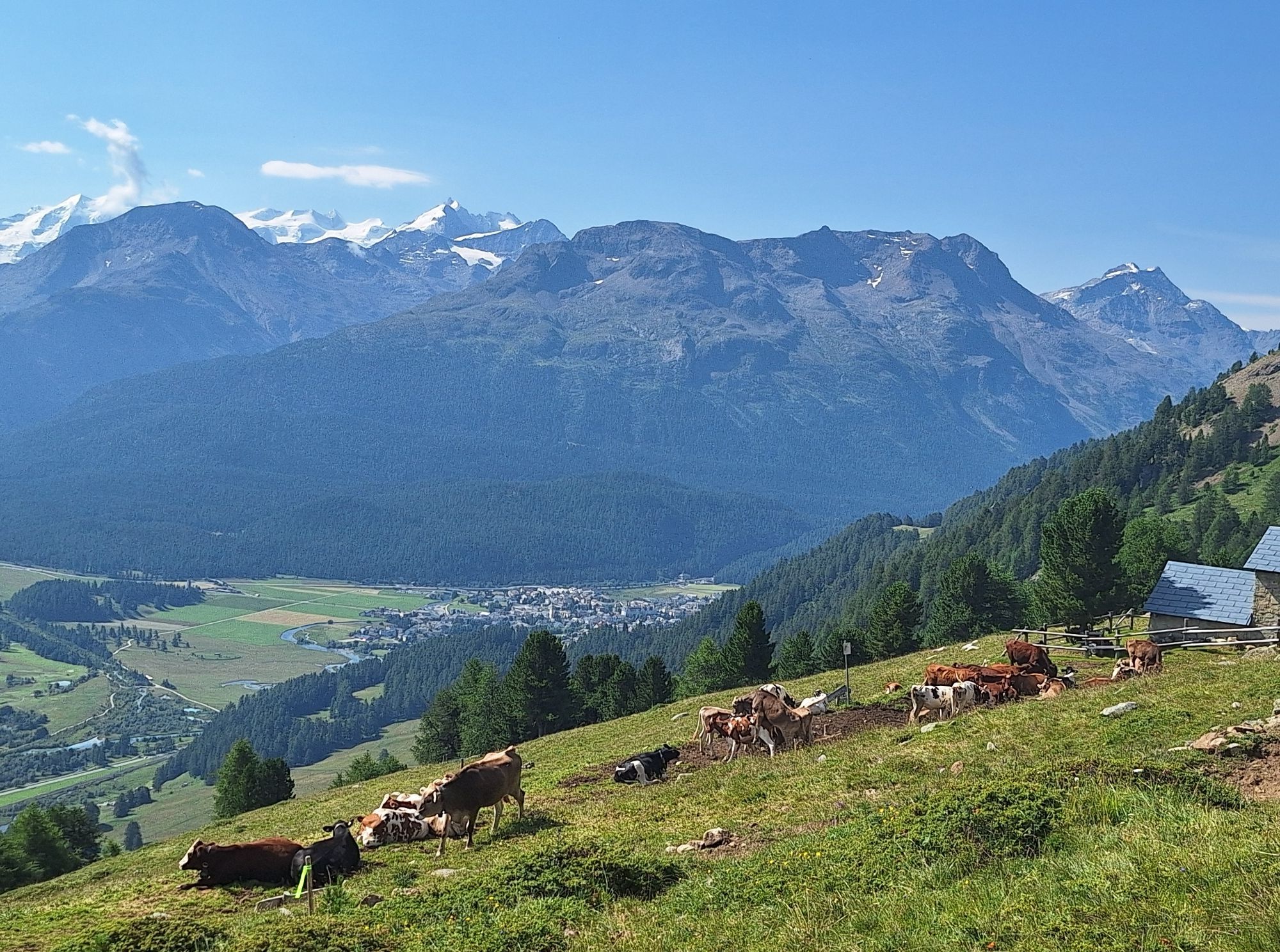
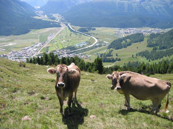
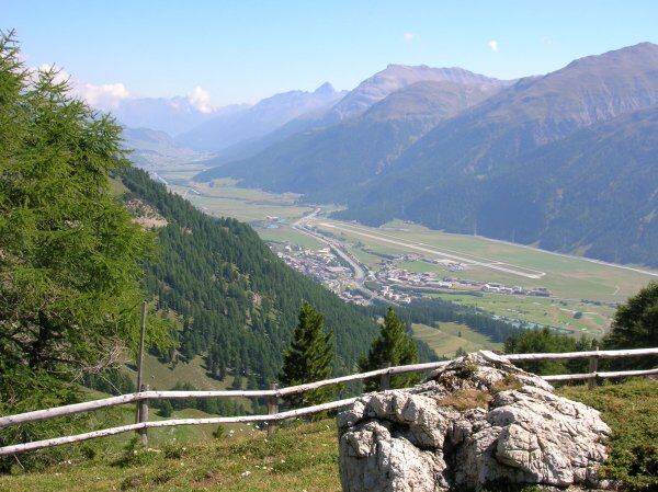
At the upper edge of the village of Samedan (near the shooting range), the first ascent can be tackled. The wide natural road winds up the mountain in wide bends, and the view through the trees becomes...
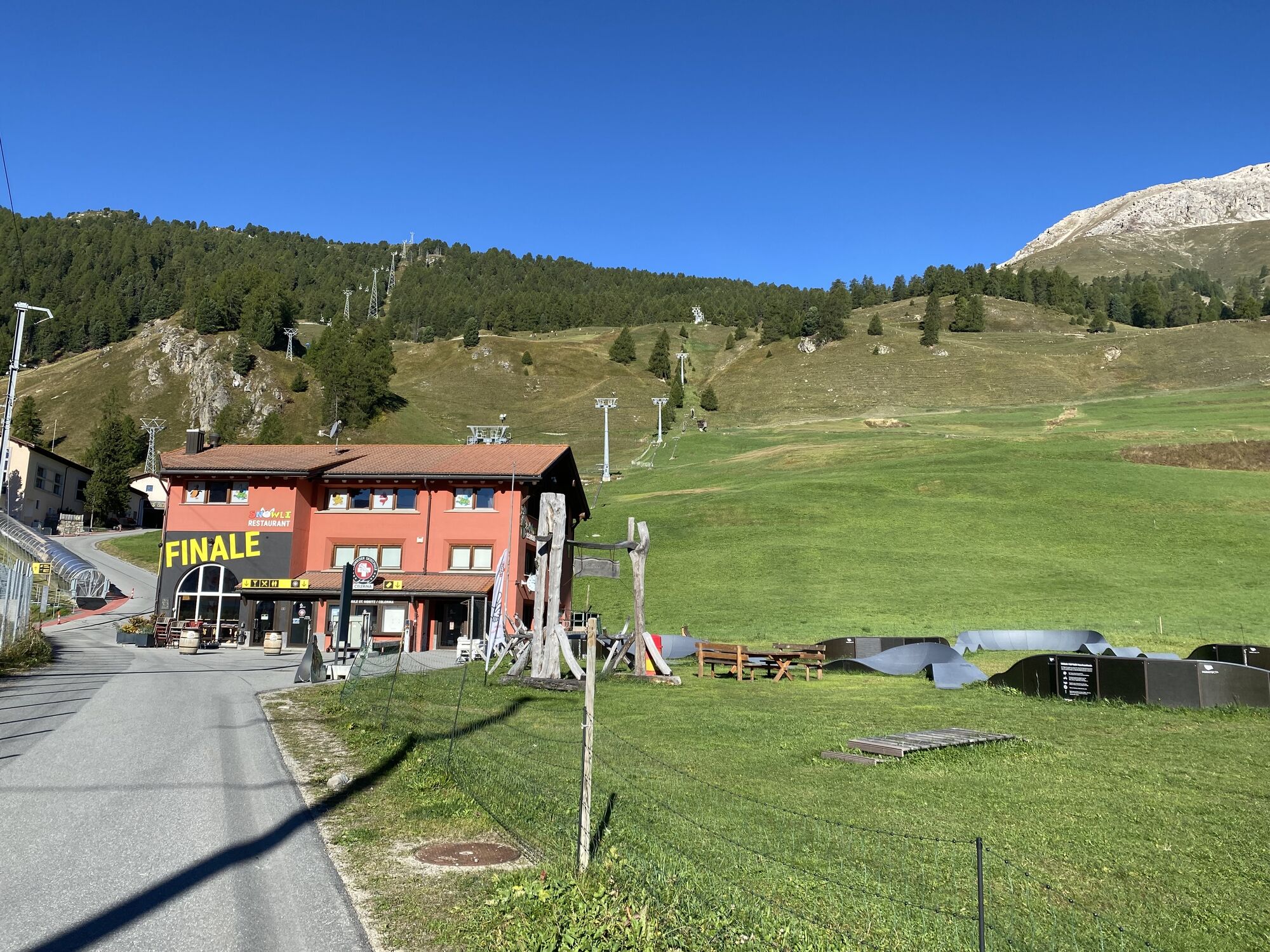
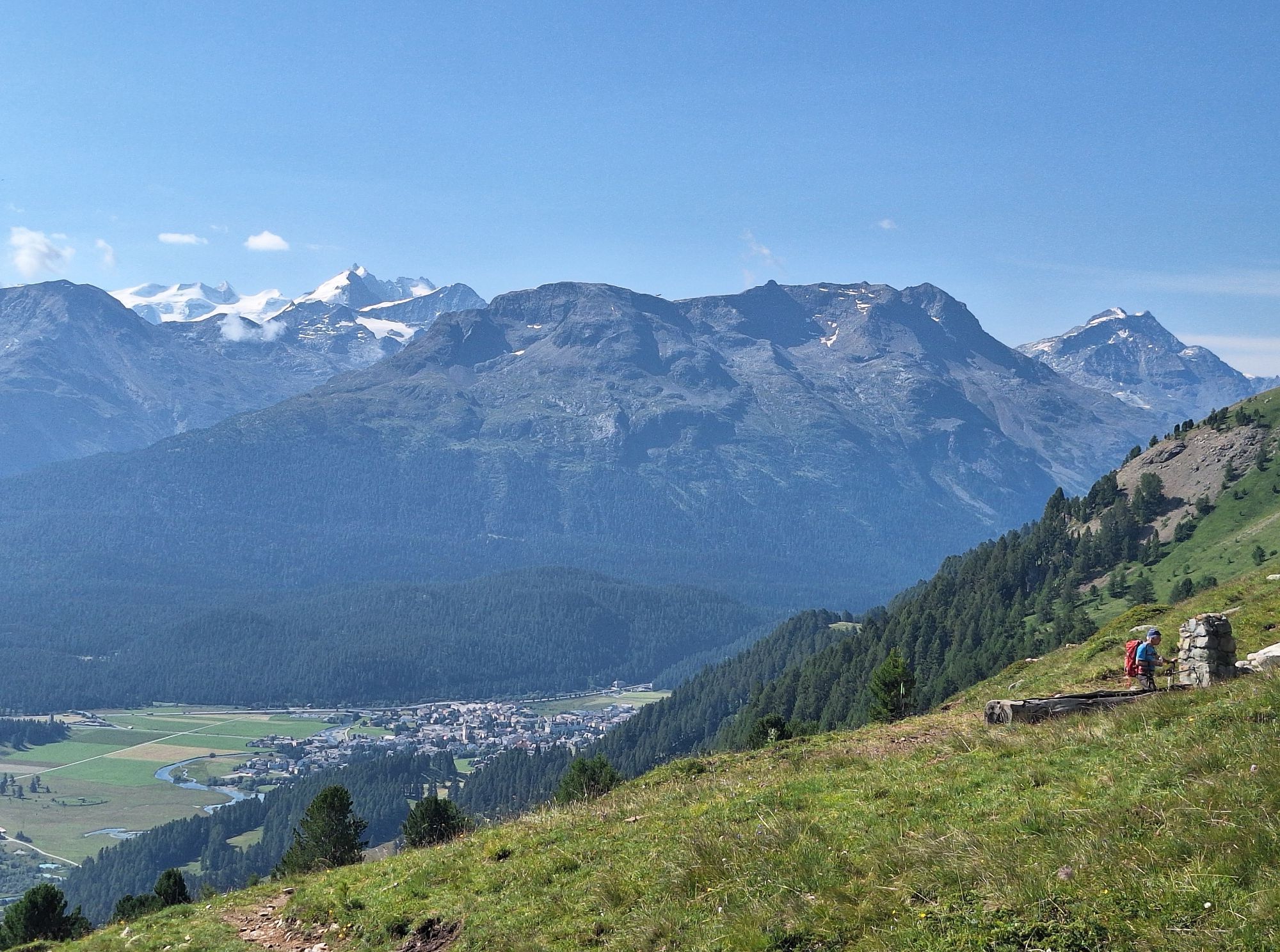
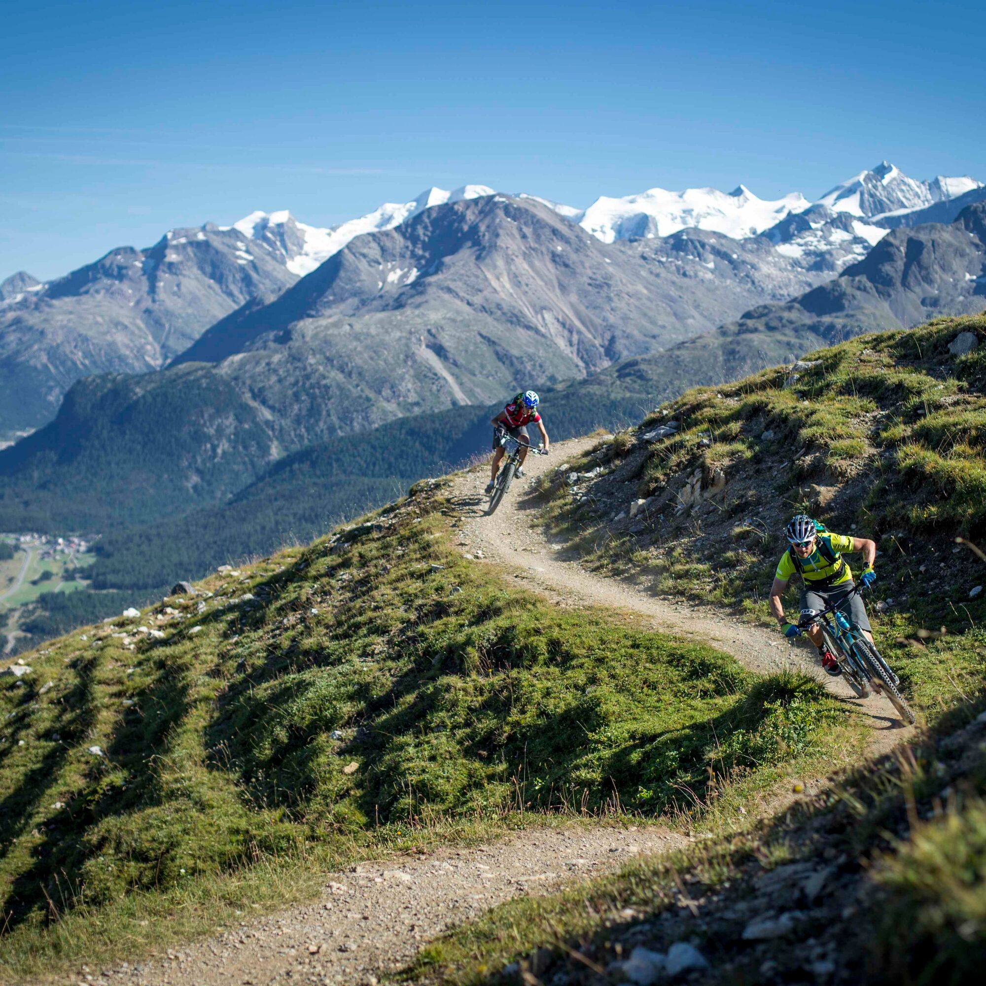
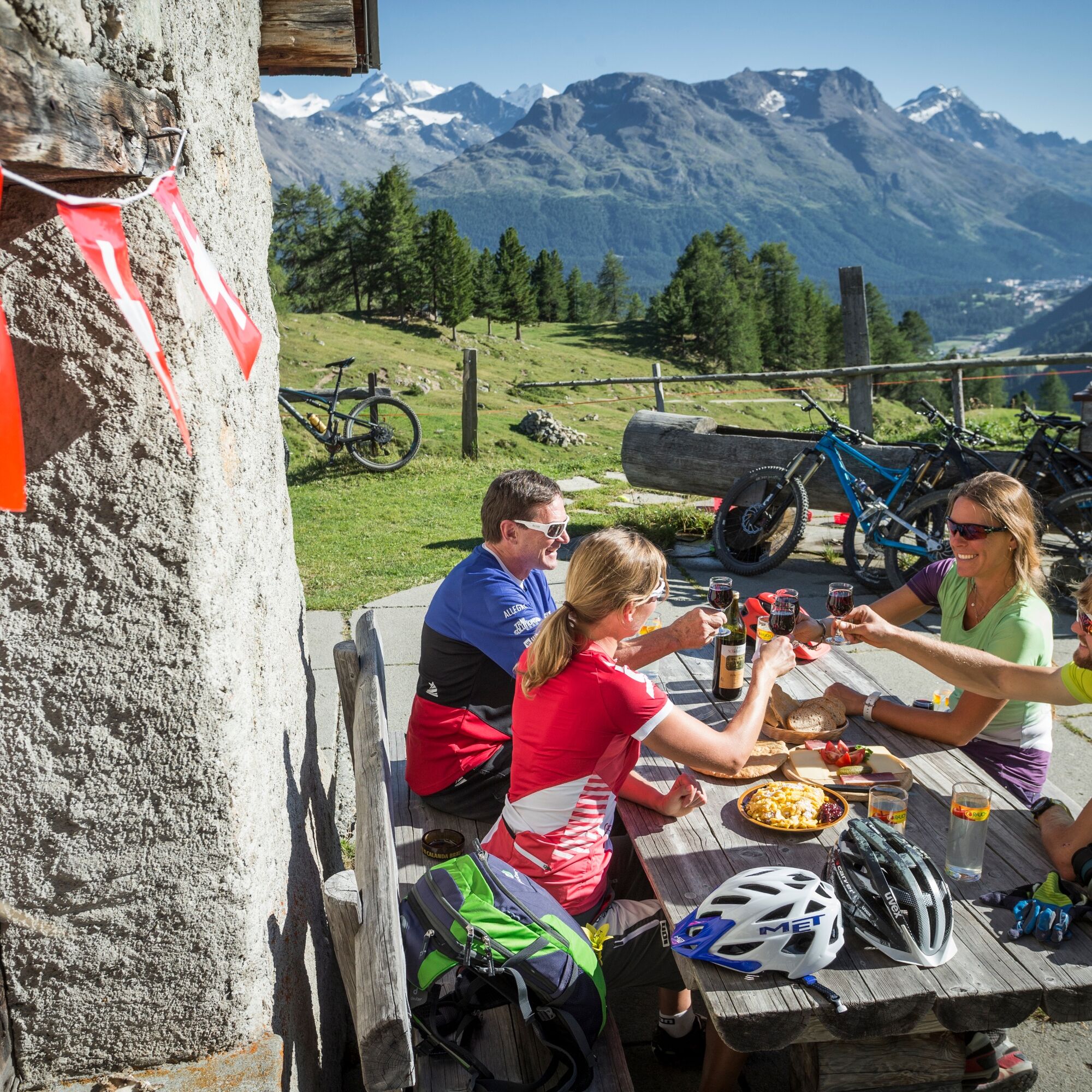
At the upper edge of the village of Samedan (near the shooting range), the first ascent can be tackled. The wide natural road winds up the mountain in wide bends, and the view through the trees becomes increasingly spectacular. It is not uncommon to meet deer or chamois along the way. Just above the tree line, the magnificent mountain panorama of Alp Muntatsch opens up. In summer, the herders of the alp serve small delicacies. The homemade apple strudel is already well known in the valley! Those who do not want to linger at the alpine hut enjoy the view over the Engadin from the saddle. The singletrail below Piz Padella repeatedly invites you to a photo stop. The descent to Marguns demands skill and concentration. In some places, it is advisable to push the bike. From Marguns, the pace can then be increased again, where the route gently leads down to Celerina on the gravel road.
Further information
Engadin St. Moritz Tourism AG
Via Maistra 1
CH-7500 St. Moritz
Phone: +41 81 830 00 01
Email: allegra@engadin.ch
Internet: www.engadin.ch

Samedan - Alp Muntatsch - Marguns - Celerina
Tak
S1
On the "Samedner Abfahrt", the ski slope that leads to Samedan in winter, the route can also be ridden as a circular route with the destination again in Samedan. The turn-off to Samedan is shortly after Marguns.
Kamery internetowe z trasy
-
Corviglia
-
St. Moritz / Samedan - Muottas Muragl
-
Marguns - Plateau Nair
-
Samedo - Engadin Golf
-
St. Moritz / Samedan - Muottas Muragl
-
St. Moritz / Samedan - Muottas Muragl
-
St. Moritz / Samedan - Muottas Muragl
-
St. Moritz / Samedan - Muottas Muragl
-
Corviglia
-
Corviglia
-
Corviglia
-
Corviglia
-
Corviglia
-
Corviglia
-
Corviglia
-
Celerina - Cresta Palace
-
Piz Nair - St. Moritz
-
Celerina - Skiwiese Provuler
-
St. Moritz / Trais Fluors Bergstation
-
St. Moritz - Berghotel Randolins
-
Samedan - Engadin Airport
-
El Paradiso
-
Piz Nair Bergstation
-
Piz Nair Bergstation
-
Piz Nair Bergstation
-
Piz Nair Bergstation
-
Piz Nair Bergstation
-
Piz Nair Bergstation
-
Piz Nair Bergstation
-
Piz Nair Bergstation
-
Trais Fluors Bergstation
-
Trais Fluors Bergstation
-
Trais Fluors Bergstation
-
Trais Fluors Bergstation
-
Trais Fluors Bergstation
-
Trais Fluors Bergstation
-
Trais Fluors Bergstation
-
Trais Fluors Bergstation
-
Sporthotel Pontresina
-
Pontresina - Hotel Walther
Popularne wycieczki w okolicy
-
4,7
Diavolezza - Munt Pers
światłoWędrówka 3,82 km -
5,0
Morteratsch station - Boval Hut
średniWędrówka 10,5 km -
5,0
Muottas Muragl - Segantini hut - Pontresina
średniWędrówka 6,46 km -
4,4
Panoramic route Muottas Muragl
światłoWędrówka 6,75 km -
4,5
Pontresina - Val Roseg - Pontresina
światłoWędrówka 13,8 km -
4,7
SAC Tschierva
światłoWędrówka 24,7 km -
4,8
Morteratsch Glacier route
światłoTrasa tematyczna 2,88 km -
Muottas Muragl - Segantini Hütte - Pontresina
średniWędrówka 17,5 km -
4,5
Diavolezza - Lej da Diavolezza
średniWędrówka 6,22 km -
5,0
Lej Muragl
średniWędrówka 7,39 km

Wędrówki i tropienie


Nie przegap ofert i inspiracji na następne wakacje
Twój adres e-mail została dodana do listy mailingowej.