







The Champ de Roches
To see: the Corbeline, a 9.4 km long stream with clear waters rising at the place called "Derrière Nayemont" in the municipality of Arrentès de Corcieux and the water mines, galleries dug into the ground...
To see: the Corbeline, a 9.4 km long stream with clear waters rising at the place called "Derrière Nayemont" in the municipality of Arrentès de Corcieux and the water mines, galleries dug into the ground to collect spring and infiltration waters. Built into a friable ground like sandstone, they were masonry. They appear as long tunnels made of rubble stones and vaulted. Some still function to supply running water to isolated houses.

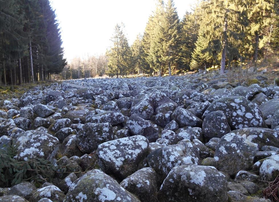
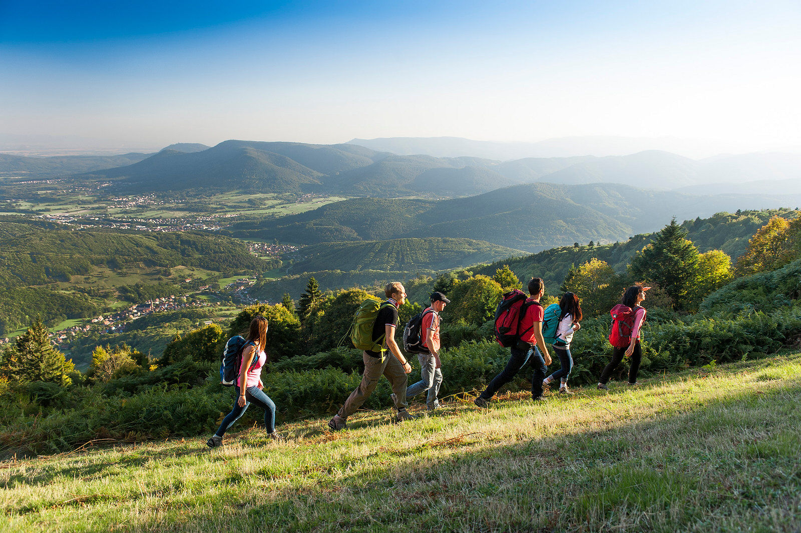

Marking: green circle. It is recommended to wear good hiking shoes, also bring a drink in a backpack, keep your dog on a leash and stay on the paths. Start: At the Col des Arrentès de Corcieux (alt 684 m), park in the parking lot opposite the restaurant. On foot: 1/ Cross the D 31 and take the C1 towards the center of the village of Arrentès de Corcieux (green circle) heading towards the Champ de Roches. You pass in front of the town hall. At the next crossroads, continue right (green circle). After crossing the Corbeline stream *, continue on the steep road. In front of an old farm, turn left onto a small path lined with stone walls, in a spruce forest. 2/ Turn sharply right and 100 m further on, go down left to reach the Champ de Roches site. You can discover explanatory panels about this geological peculiarity there. After crossing it, continue left on the paved road after the parking lot (green circle). At 150 m, at the crossroads, follow the marking and continue straight on a dirt path. Then arriving on a paved road, turn left downhill (direction Corcieux). Cross the Corbeline stream again. At the Goutelles crossroads (alt 700 m), continue always straight towards Arrentès, in the fir forest. 3/ At 800 m, leave the road and take the small path with a slight uphill on your right (green circle). At about 200 m, observe to your right in the stone wall the entrance of a water mine *. At the exit of the forest, turn left and discover the very beautiful panorama of the Corcieux basin, with in the foreground, the Col des Arrentès and on the horizon, the blue line of the Vosges. 4/ Arriving at the first houses, turn left onto the paved road to return to the starting point at the Col. To see: LA CORBELINE: This 9.4 km stream with clear waters rises at the place called "Derrière Nayemont" in the municipality of Arrentès de Corcieux. It then crosses the municipality of Barbey Seroux to flow into the Vologne at Granges sur Vologne. THE WATER MINES: These are galleries dug into the ground to collect spring and infiltration waters. Built into a friable ground like sandstone, they were masonry. They appear as long tunnels made of rubble stones and vaulted. Some still function to supply running water to isolated houses.
Clothing adapted to the season and conditions (cold, hot, humid…)
Hiking shoes suitable for the terrain (even for children!)
Hiking poles (useful for stability and to relieve the joints)
Mobile phone and spare battery
Before leaving:
Check general and local weather forecasts ensuring no precipitation
Inform yourself about the approach walk, height of the itinerary, walking time, possible rescue (IGN map, GPS, guidebook, etc.)
Evaluate possible risks by consulting mountain professionals, refuges, lodgings
Inform a close one of your plan and contact them in case of change: departure and return times, number of participants with phone numbers of each, vehicle(s), parking
Avoid going alone, use equipment suitable for the activity, adjusted and in good condition, headlamp, complete first aid kit, survival blanket, etc.
If there is a problem, call 112 (European emergency number)
At the Col des Arrentès de Corcieux (alt 684 m)
Col des Arrentès de Corcieux (alt 684 m)
At the Col des Arrentès de Corcieux (alt 684 m)
Popularne wycieczki w okolicy
-
4,5
Hike around Lake Gérardmer
światłoWędrówka 5,49 km -
4,8
Longemer Col des Feignes Walk
średniWędrówka 8,83 km -
5,0
From the Schlucht to the Hohneck
średniWędrówka 8,21 km -
5,0
Family route: the Bourrique jump
światłoWędrówka 2,74 km -
Family outing: Lake Longemer Circuit
światłoWędrówka 5,63 km -
La Mexel Farmhouse-Inn walk - Along the levées de pierres
średniWędrówka 4,43 km -
Kastelberg and Hohneck route
średniWędrówka 9,93 km -
Conquering the Vosges summits!
ciężkidługodystansowy szlak pieszy 41,6 km -
Familienroute: auf den Pisten von Gérardmer im Sommer
światłoWędrówka 3,76 km -
4,0
Rund um die Kapelle St. Anne
średniWędrówka 11,4 km
Wędrówki i tropienie


Nie przegap ofert i inspiracji na następne wakacje
Twój adres e-mail została dodana do listy mailingowej.





