


8 Nova Gorica ‒ Gorizia/Gorica ‒ Nova Gorica
Zdjęcia naszych użytkowników
Gorizia, of Roman origin, developed over the centuries under the Habsburg empire and a key point during the Great War period, and Nova Gorica, born following the border established in 1947, were not chosen...
Gorizia, of Roman origin, developed over the centuries under the Habsburg empire and a key point during the Great War period, and Nova Gorica, born following the border established in 1947, were not chosen by chance as European Capital of Culture 2025. The circular route that crosses them, point by point, crossing a border that fell in 2007, leads the tourist to observe the historical and cultural beauties present. This brings awareness of the horror and destruction caused by the First and Second World Wars and, with them, those of every other war. The mistakes of the past are thus contrasted with the splendid beating of a city now flourishing, rich in culture and vitality, finally discovered as united.
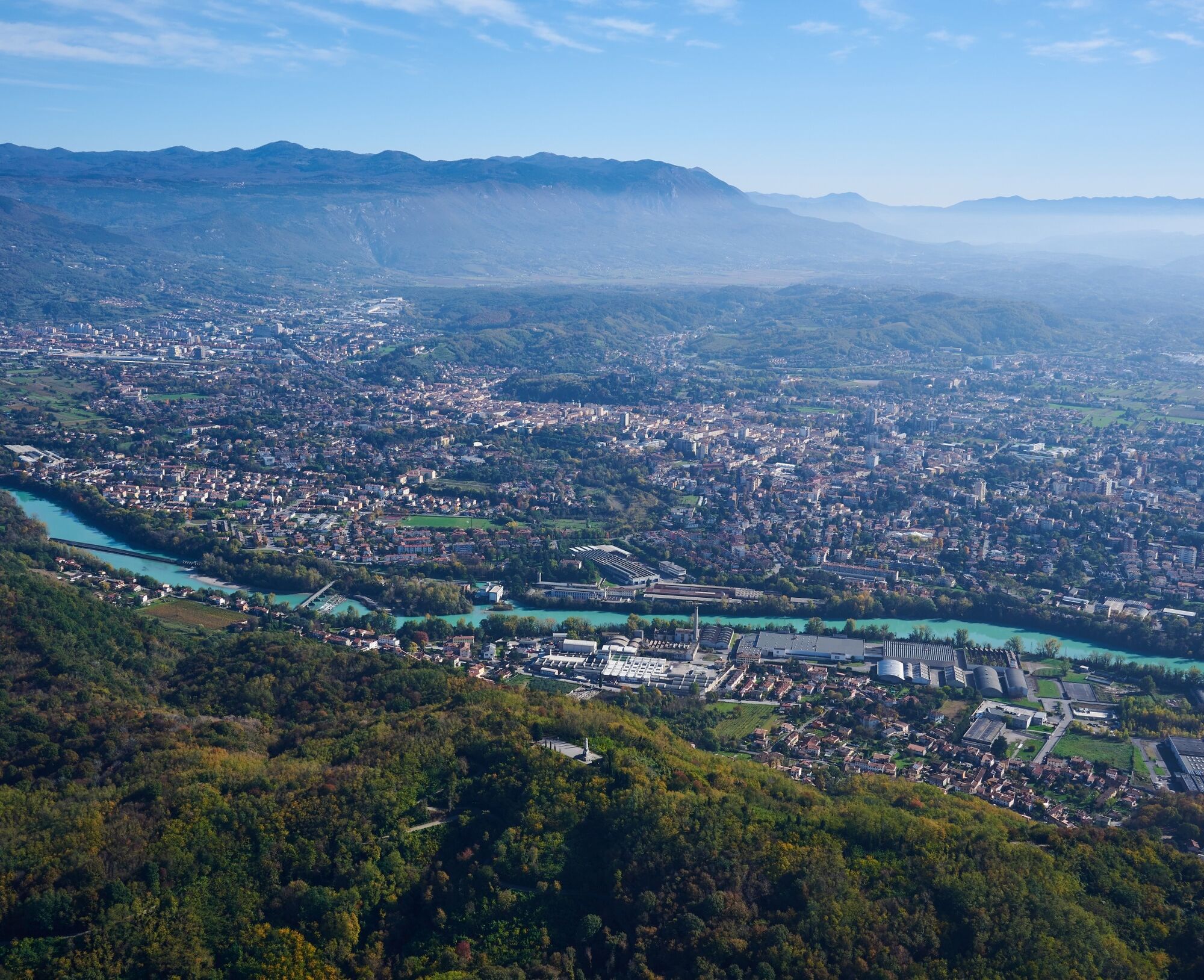
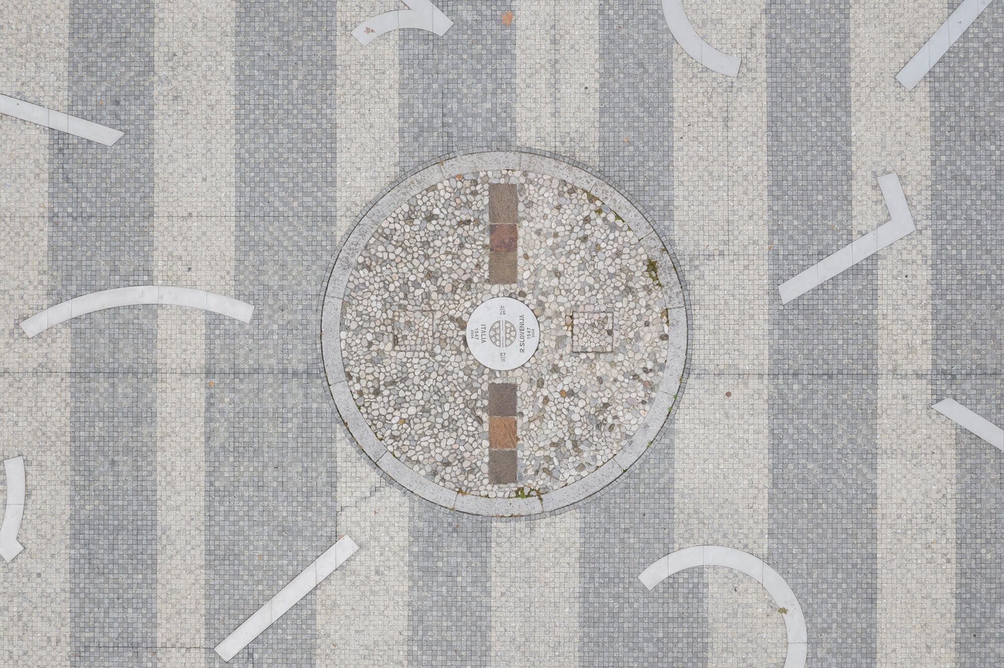
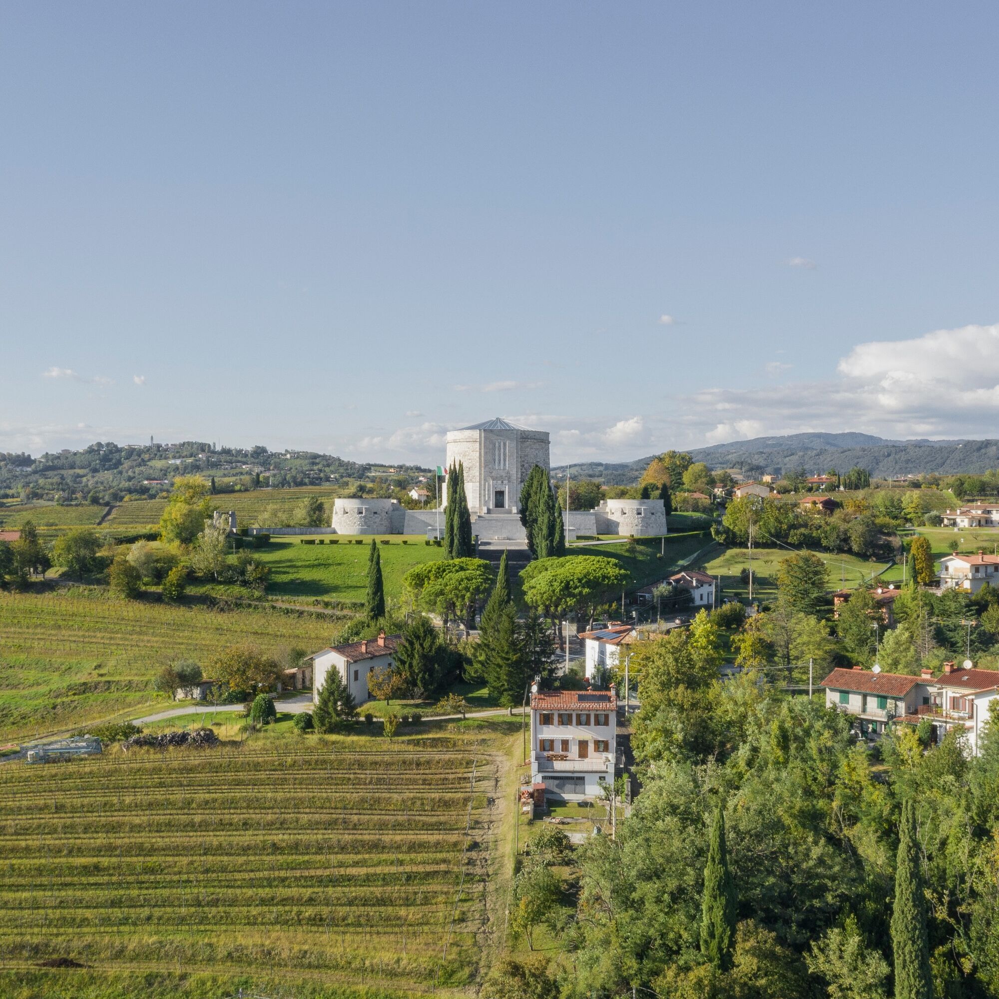
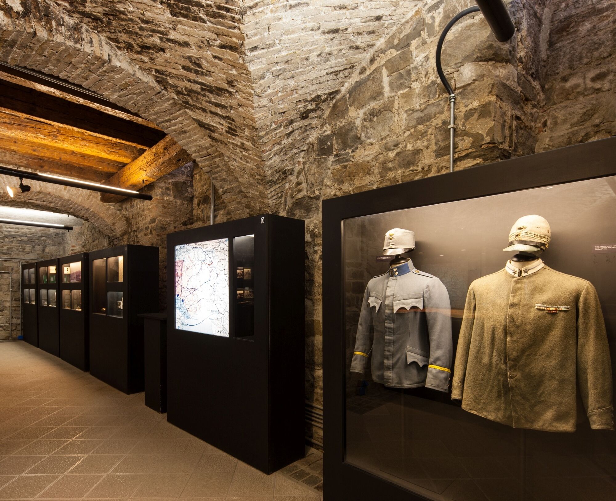
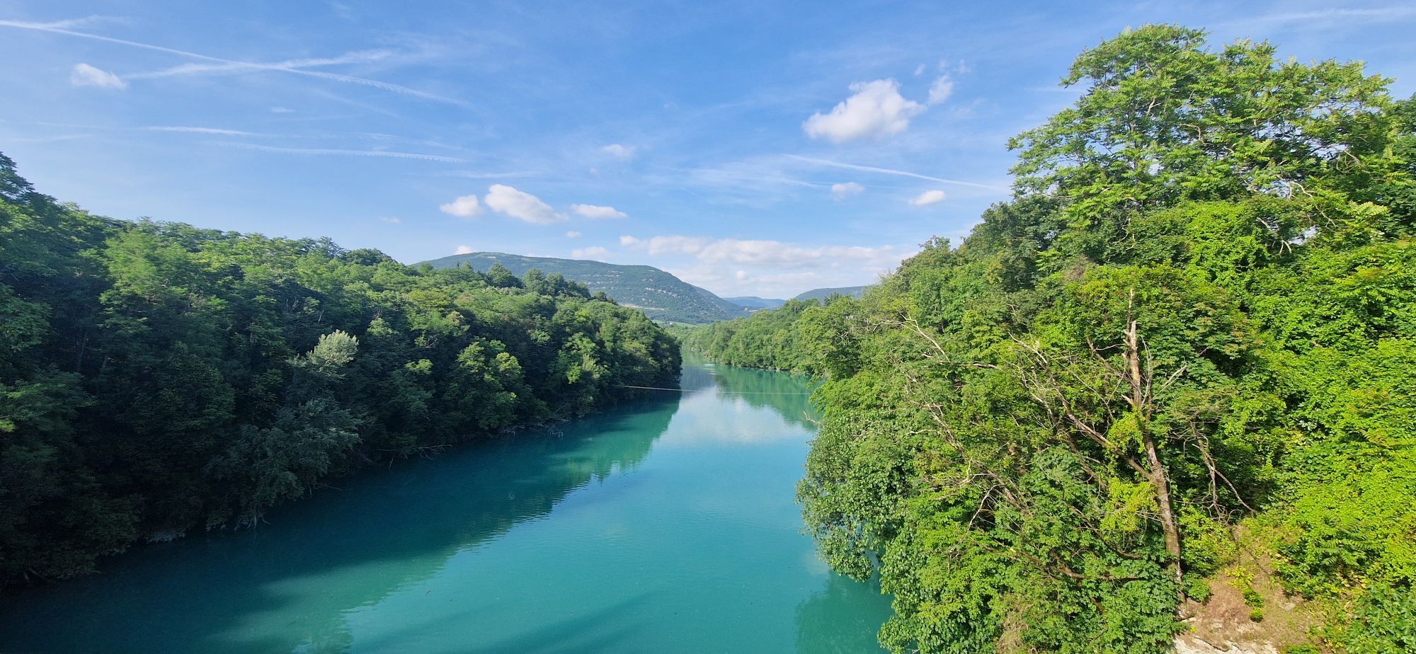
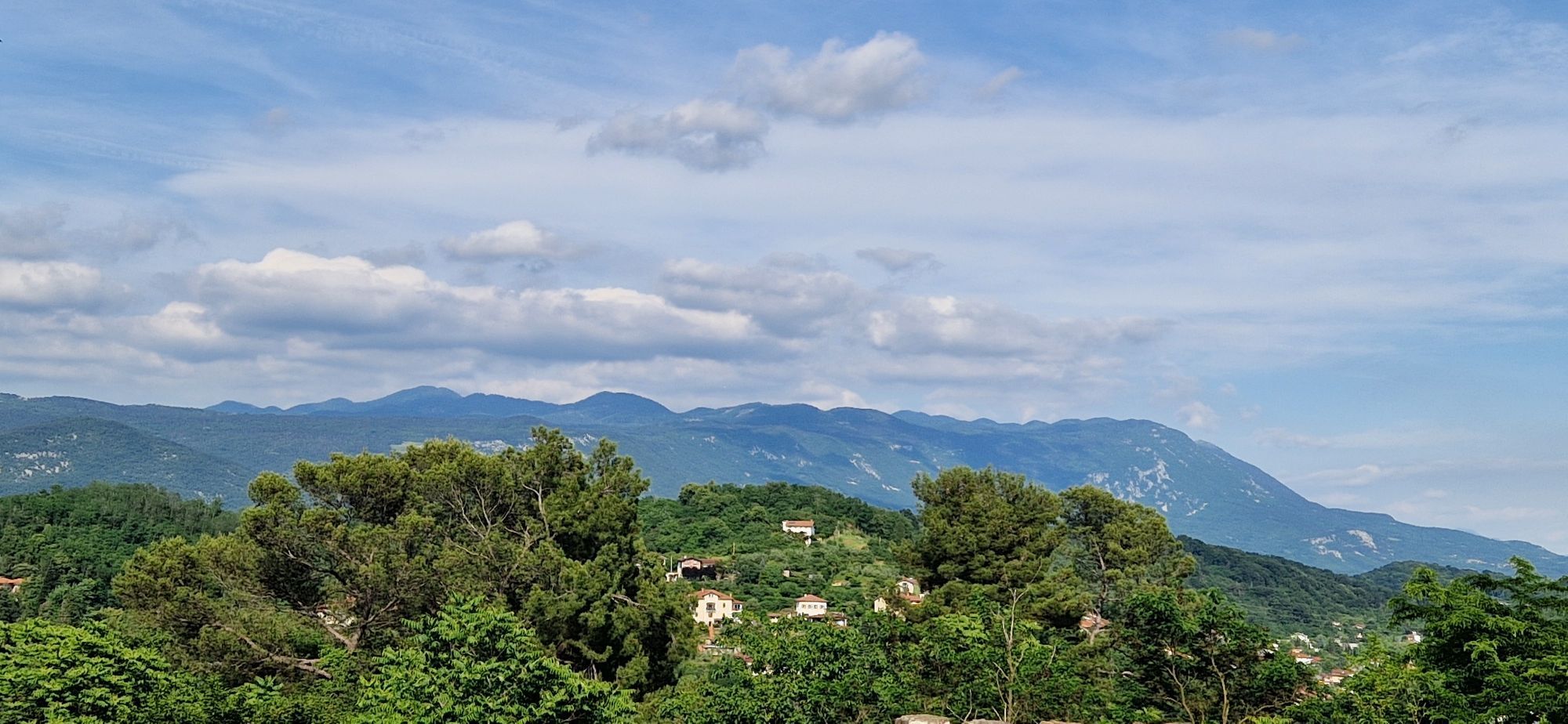
The route starts from Piazza della Transalpina/Trg Evrope, symbol of the border's fall after Slovenia joined the European Community. It continues towards the Torrione Bridge up to the Ossuary of Oslavia/Oslavje. Then it passes through Bosco Piuma to Mount Calvario/Kalvarija, the scene of bloody battles, then descends from the Square with the Obelisk towards Piedimonte/Podgora. It crosses the Baruzzi underpass and the 8 August bridge towards the center of Gorizia where the Public Gardens deserve a visit. It continues uphill to Borgo Castello where the Great War Museum is located. The loop closes descending towards the former Rafut border crossing, passing the Kostanjevica convent and returning to the starting square.
Tak
Trekking shoes and clothing, packed food and drinks, flashlight, trekking poles
Pay attention to the Aurelio Baruzzi underpass which has no sidewalk.
APT Gorizia (urban lines)
Gorizia â Nova Gorica
Urban bus â Line 1 (APT Gorizia): direction Sant’Andrea-CIP/Train Station Montesanto and return. This line travels through the entire historic center of Gorizia, starting from the Passenger Intermodal Center, arriving at Piazza della Transalpina/Trg Evrope; it passes every 15 minutes.
To Lucinico/LoÄnik:
Urban bus â Line 2 (APT Gorizia)
OUTER RED CIRCULAR: Central Post Office–Mossa–Hospital–Central Post Office Urban bus – Line 4 (APT Gorizia)
OUTER BLACK CIRCULAR: Central Post Office–Hospital–Mossa
International line (cross-border urban bus): Gorizia â Nova Gorica
This line connects the Gorizia Passenger Intermodal Center with the Nova Gorica bus station. The only cross-border line.
To Oslavia:
APT Gorizia extra-urban line G09 direction San Floriano del Collio/Števerjan
Parking (start and end point of the stage): Piazza della Transalpina/Trg Evrope
In summer pay attention to high temperatures and possible medium-length stretches without shade
Popularne wycieczki w okolicy
-
4,0
Rundgang von Cormons
światłoWędrówka 7,31 km -
3,7
Trail to the natural stone bridge Skozno
światłoWędrówka 5,62 km -
4,7
Etappe 30 Alpe-Adria-Trail: Breg bei Golo Brdo - Šmartno
średnidługodystansowy szlak pieszy 27,4 km -
Trasa Gorycja - Kanał (SLO) (P004)
średniKolarstwo długodystansowe 22,2 km -
Škabrijel
Wycieczki górskie 10,3 km -
Prepotto, Friuli-Venezia Giulia/Italia
E-MTB 34,4 km -
Collio - Pierścień Brda (R014)
średniKolarstwo długodystansowe 60,6 km -
Etappe 33 Alpe-Adria-Trail: Gradisca d'Isonzo - Duino
średnidługodystansowy szlak pieszy 27,8 km -
Szlak Vigne Alte: pełna pętla z Pradis, Spessa i Subida
średniWędrówka 14,0 km -
Cividale del Friuli - Gorizia (C304)
średniKolarstwo długodystansowe 39,4 km

Wędrówki i tropienie


Nie przegap ofert i inspiracji na następne wakacje
Twój adres e-mail została dodana do listy mailingowej.