


Du Chemin des Moines à la colline de Saint-Martin
Poziom trudności: T3
Starting from the Parc de Ruffey, the itinerary begins on the Chemin de Moines GR76, a mythical ridge path linking Sennecey to Cluny.You will leave the Chemin de Moines to go through the hamlet of Corlay,...
Starting from the Parc de Ruffey, the itinerary begins on the Chemin de Moines GR76, a mythical ridge path linking Sennecey to Cluny.
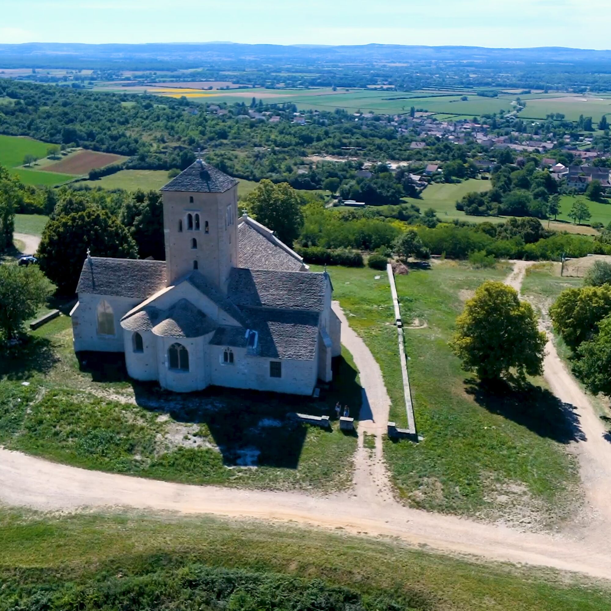
You will leave the Chemin de Moines to go through the hamlet of Corlay, a place of resistance for the maquisards. Then a long crossing of the woods, to climb the Saint-Martin hill and admire the recently restored Romanesque church. Take advantage of the viewpoint over the Saône and Grosne valleys.
In case of emergency, dial 112
Consider carpooling
Parking near the starting point
T3
Popularne wycieczki w okolicy
La Boucle de Bourgogne du Sud
światłoJazda na rowerze 145,0 kmLe chemin des Moines
średniWędrówka 35,0 kmCycloRoute71 - Etape 2 de Cormatin à Tournus
średniJazda na rowerze 31,1 kmLa Voie Bleue, Moselle-Saône à vélo : de Mont-les-Seurre à Mâcon
światłoJazda na rowerze 212,4 kmBoucle 5 : De la pierre à la vigne
średniJazda na rowerze 25,9 kmSur l'Ormeau - La Grand Croix
średniJazda konna 12,1 kmBoucle "Vélo & Fromages"
światłoJazda na rowerze 322,2 kmLa Route Européenne d'Artagnan
światłoJazda konna 327,8 kmAutour de Brancion
średniWędrówka 11,1 kmLes Chemins de Saint-Jacques de Compostelle de Remigny à Cluny
światłoWędrówka 71,2 km
Wędrówki i tropienie


Nie przegap ofert i inspiracji na następne wakacje
Twój adres e-mail została dodana do listy mailingowej.