


Crossing of the Vosges Massif - Stage 19 - Giromagny - Belfort
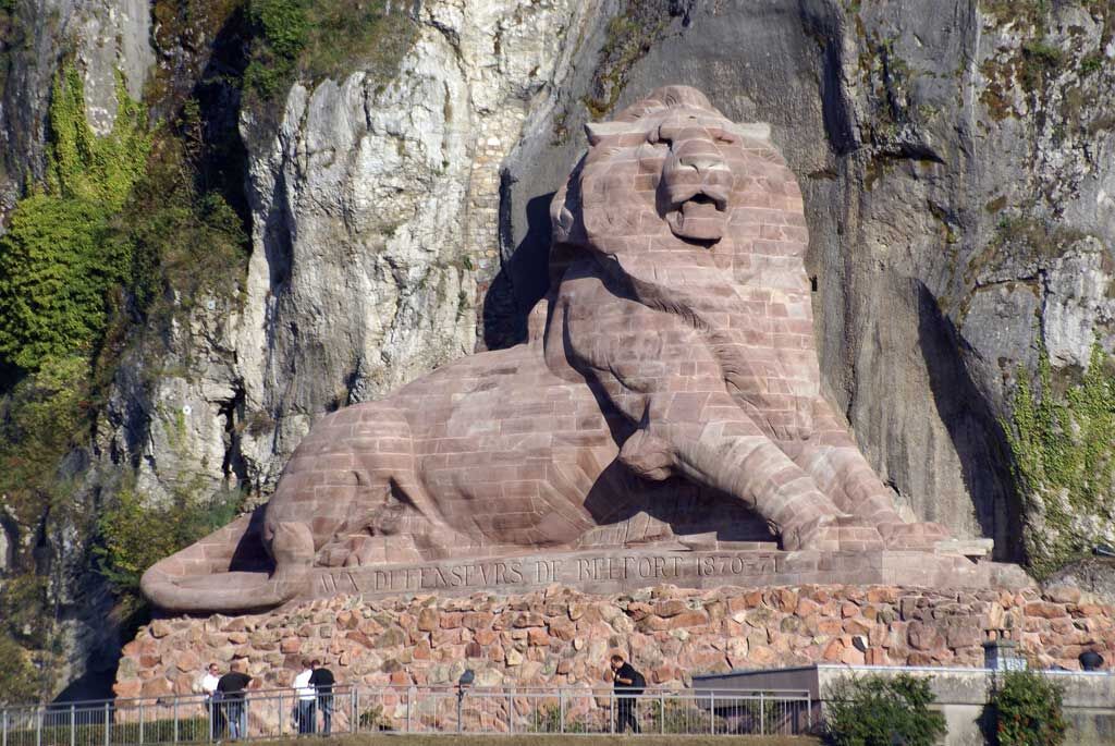
The last town of the route is none other than Belfort. The city, dominated by the citadel, is ideal for strolling through alleys with colorful facades and on the Place d’Armes. A symbol of the heroic resistance...
The last town of the route is none other than Belfort. The city, dominated by the citadel, is ideal for strolling through alleys with colorful facades and on the Place d’Armes. A symbol of the heroic resistance of the city during the 1870-1871 siege, the Lion of Belfort owes its existence to Frédéric-Auguste Bartholdi, the illustrious sculptor of the Statue of Liberty. This colossal statue is 22 meters long and 11 meters high and is now an integral part of the city's identity.
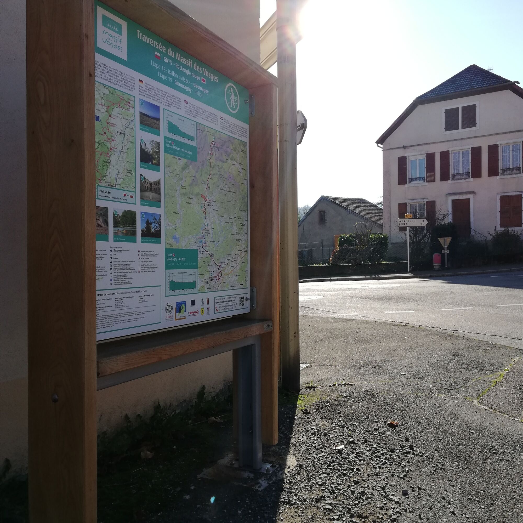


White-red marking (GR®5) of the French Hiking Federation from Giromagny to Belfort.
Tak
Clothing adapted to the season and conditions (cold, hot, wet…)
Hiking shoes appropriate for the terrain (even for children!)
Hiking poles (useful for stability and to relieve joints)
Mobile phone and spare battery
It is important to follow certain recommendations for safe hiking. You must be well informed about the route to be taken. Preparation and assessment of physical condition are necessary.
In case of emergency
Alert: call 112 (European emergency number)
5 key points to communicate your alert:
Where? town, place, route, altitude Who? identity, phone number What? type of accident, number of victims, severity, fall dynamics When? time of the accident Weather? wind, visibilityGiromagny (90200)
Belfort train station
Free parking in Giromagny
www.belfort-tourisme.com
Take a moment to relax at the Malsaucy leisure center then visit the citadel and the city of Belfort.
It is advisable to book accommodations in advance during the high season.
Popularne wycieczki w okolicy
- 5,0
Discovery trail circuit at the Ballon d'Alsace
średniWędrówka 2,69 km Farm-Auberge Grand Langenberg walk "Towards the wild forests of the Ballon d'Alsace"
średniWędrówka 6,93 kmCrossing of the Vosges Massif - Stage 18 - Ballon d'Alsace - Giromagny
średnidługodystansowy szlak pieszy 12,3 kmWalk at Bruckenwald Farmhouse Inn "On the old border"
średniWędrówka 6,41 kmLochberg Farm Inn Route - Walk accompanied by centenary beeches
średniWędrówka 3,64 kmEntzenbach Farmhouse Inn Walk "In the footsteps of a forgotten rural heritage
światłoWędrówka 5,45 kmFarm-inn hike Hinteralfeld "In the Alfeld cirque"
światłoWędrówka 3,41 kmCircuit du Baerenkopf, Grand Est/France
średniWędrówka 12,9 kmMicro Adventure 8 Crossing of the Vosges Massif - Assault on the Ballon d'Alsace
ciężkiWędrówka 60,6 kmFamily route: Lakes of Sewen and Lake Alfeld
światłoWędrówka 3,07 km

Wędrówki i tropienie


Nie przegap ofert i inspiracji na następne wakacje
Twój adres e-mail została dodana do listy mailingowej.