


Seven Linden Route
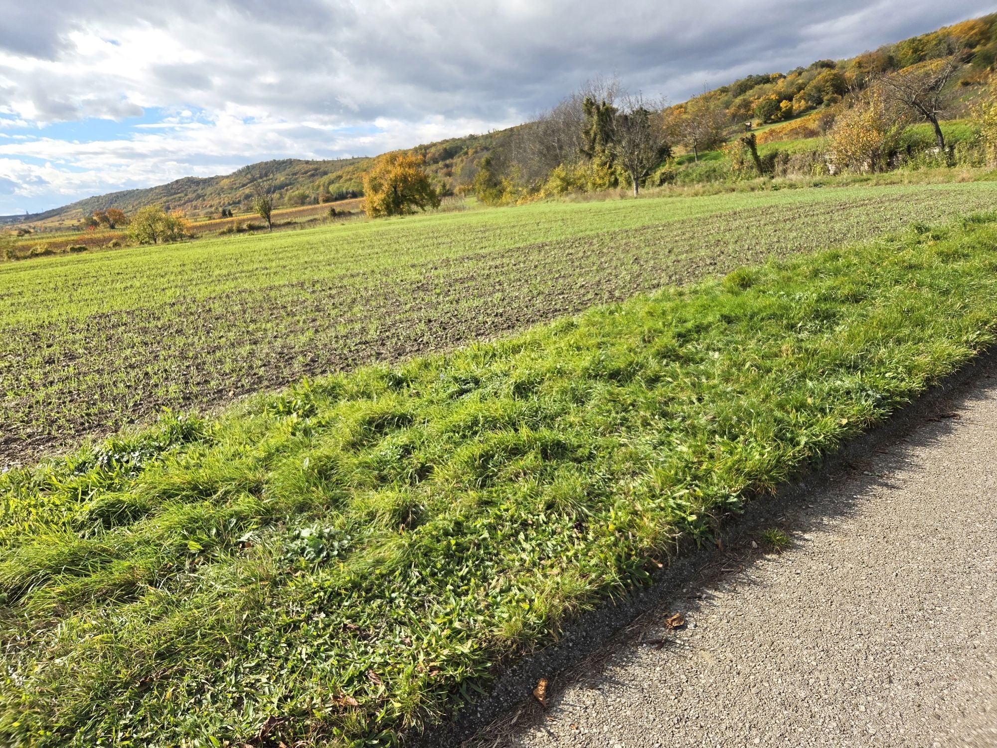
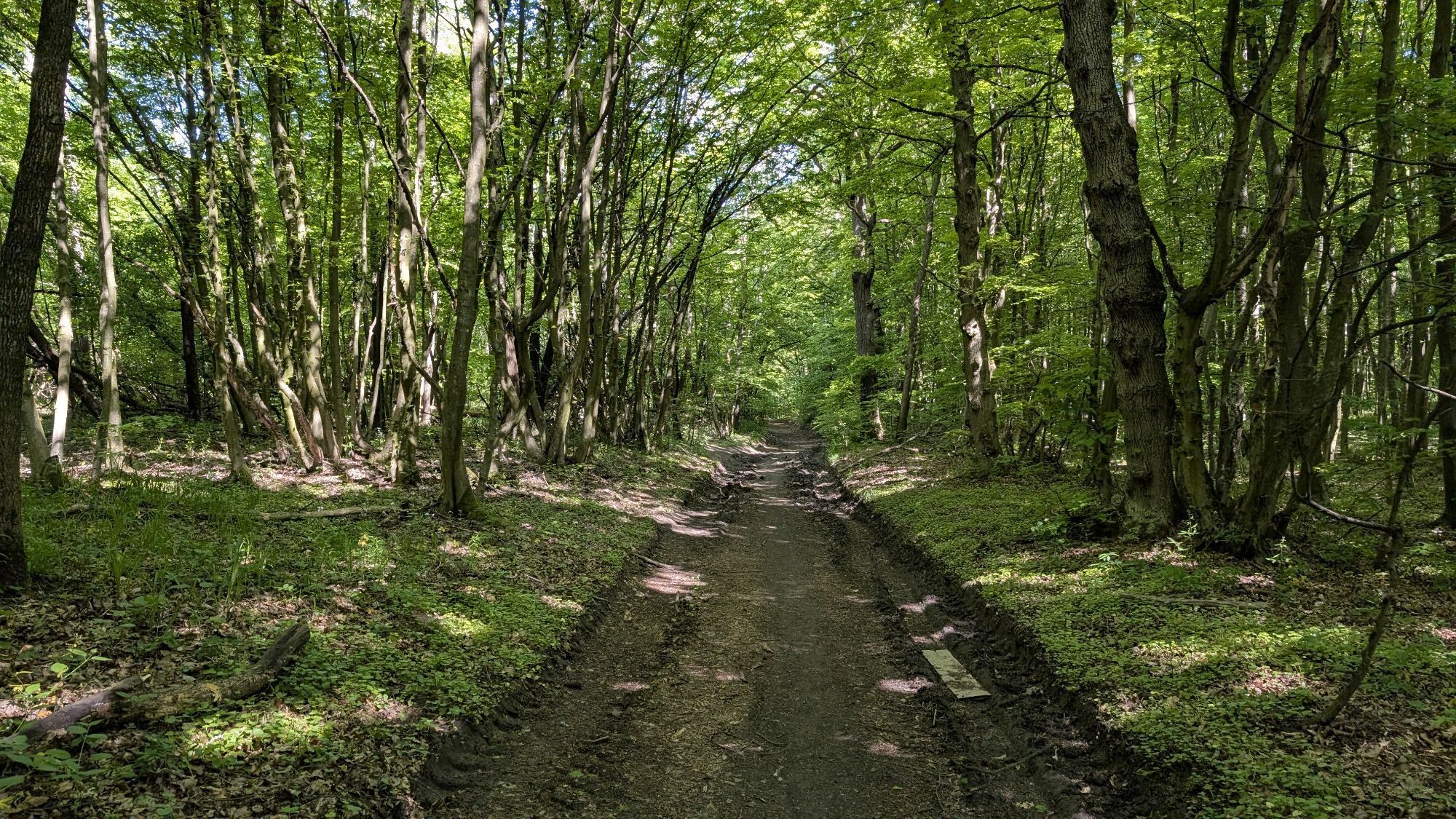
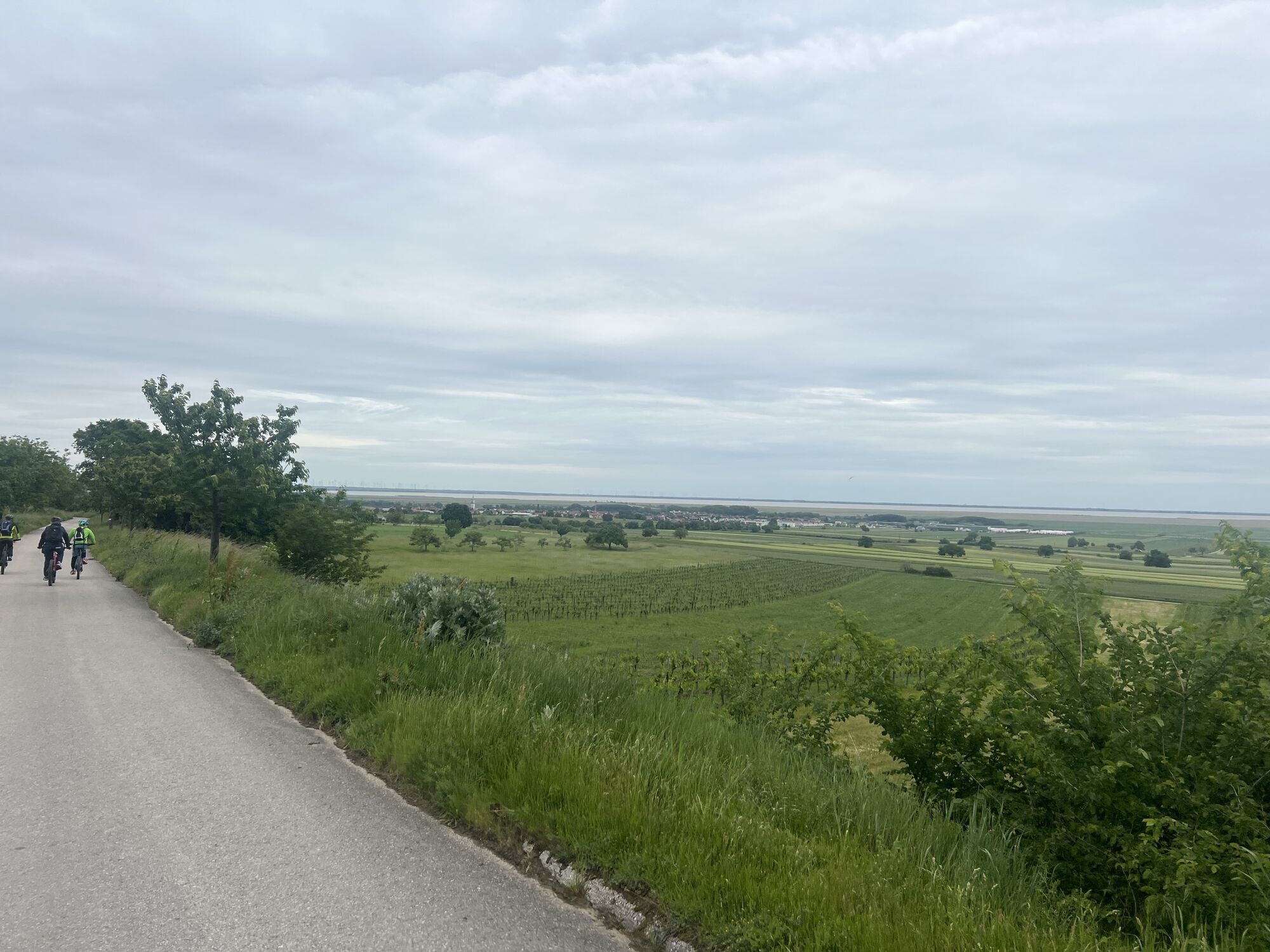


This challenging route starts at the tourist information office Haus am Kellerplatz. It leads through the Kellergasse and the Fellnergasse up to the monastery gate, further past the monastery on the Spitz, where an old, imposing lime tree stands on the left. Right next to the linden is the Mühlriegelhöhle, which offers an insight into the world of the Leithakalk. Already a few meters further, countless shells show up in a rock overhang. From here a forest road leads towards Burgstall - which, however, cannot be reached on this route because a deep ditch typical of the Leithagebirge separates the two sides. In contrast to the Leithakalk at the cave and the rock overhang, here the crystalline bedrock is shown in some places. From here you have an impressive view of the Burgstall, which was inhabited during the Hallstatt period, and in the back the valley cut gives a view of Lake Neusiedl and its reed belt. The 345-meter high Hochleitn is half-circumnavigated before you finally dive into the beech and oak forests of the Leithagebirge and also cross the state border to Lower Austria. Passing a mother cross and an artificially planted piece of forest, in which oaks and beeches are lined up, you finally reach the highest point of the route (418 meters) at the Seven Linden. The place is also suitable for a rest with table and benches. From the Seven Linden, we now head down forest paths, past a striking crossroads with boundary stone and markings to the Grünwaldberg, where a findling hides behind the trees not far from an altitude. From here you will now reach a forest path that leads into the Sopherlgraben. There the water has dug ditches into the forest floor, the ditch will eventually lead you out of the forest onto the cherry blossom path. Cherry trees and vineyards now replace oaks and beech, in the near distance the lake flashes. From the Bildstock you can already see the white church tower of Purbach and soon the monastery gate is reached, from which you return to the house at the basement square.
Highlights:
Behind the monastery at the Spitz lies the Mühlriegelhöhle, a piece further on shows an imposing rock wall countless shells - traces from the time when a sea roared over the Leithagebirge and the Leithakalk was created. Attentive hikers will gain insights into the different structure of the Leithagebirge on this tour: sometimes it is the Leithakalk that comes to light, sometimes crystalline slate. On the first section, the conical castle is usually in view: During the Hallstatt period there was a stately settlement here. Beech and oak trees are typical for the Leithagebirge, the seven linden were planted in the middle of the forest, here is a beautiful resting place. Old boundary stones mark the separation between towns or estates. Through the picturesque Sopherlgraben, you head downhill to the cherry blossom path, which is adorned in April by numerous cherry trees with their flowers.Details on travelling can be found here: Calculate route
Travelling by train:
Lake Neusiedl is easy and convenient to reach by train. Regardless of whether you are travelling from Switzerland, Germany, the west or south of Austria: You can change trains at Vienna Central Station with ease. ÖBB regional trains take you to Neusiedl am See station in just under 40 minutes, where there are also coordinated bus and train connections to Pamhagen / Fertöszentmiklos or Eisenstadt or Sopron. Bicycles can be taken on most trains: on the Railjet and EC/IC as well as on the Nightjets, a reservation for your bicycle is absolutely necessary. On regional trains, your bicycle can be taken on board without a reservation, subject to availability of the available bicycle spaces.
Timetable information: ÖBB
The Burgenland app also provides you with information about tours, routes and altitude metres while you're out and about.
Are you looking for a pre-made package for your active holiday? You'll find it here: Package deals at Lake Neusiedl
With the Burgenland Card: unlimited holiday fun & offers as far as the eye can see!
All the info you need: Burgenland Card


Popularne wycieczki w okolicy
-
4,6
Cherry Blossom Cycle Route
średniJazda na rowerze 43,2 km -
4,0
Neusiedler See cycle path with lake crossing
ciężkiJazda na rowerze 75,4 km -
4,6
Kloster St. Anna & Ruine Scharfeneck zu Mannersdorf
światłoWędrówka 5,27 km -
4,2
MANNERSDORF, St.Anna, Aussichtspkt. Stb.1 Ruine Scharfeneck, F.J.Warte, Aussichtspkt. Stb.2 20230329
średniWędrówka 16,5 km -
4,6
Ochsenbründlrunde
światłoWędrówka 8,34 km -
4,2
MTB Bäckersteig route
ciężkiMountainbike 25,5 km -
4,4
Smugglers' route "Donnerskirchen" to Mannersdorf
ciężkiWędrówka 18,8 km -
4,4
About / around the Burgstall
średniWędrówka 10,1 km -
4,8
Festival cycle route
światłoJazda na rowerze 66,3 km -
4,0
Mannersdorf Wüste - Gipfelkreuz - Ruine - Labyrinth
światłoWędrówka 9,32 km
Wędrówki i tropienie


Nie przegap ofert i inspiracji na następne wakacje
Twój adres e-mail została dodana do listy mailingowej.