


Fahrenberger Höhe with the highlight "Land-Sitz"
Uphill, downhill with fantastic views over the Black Forest.


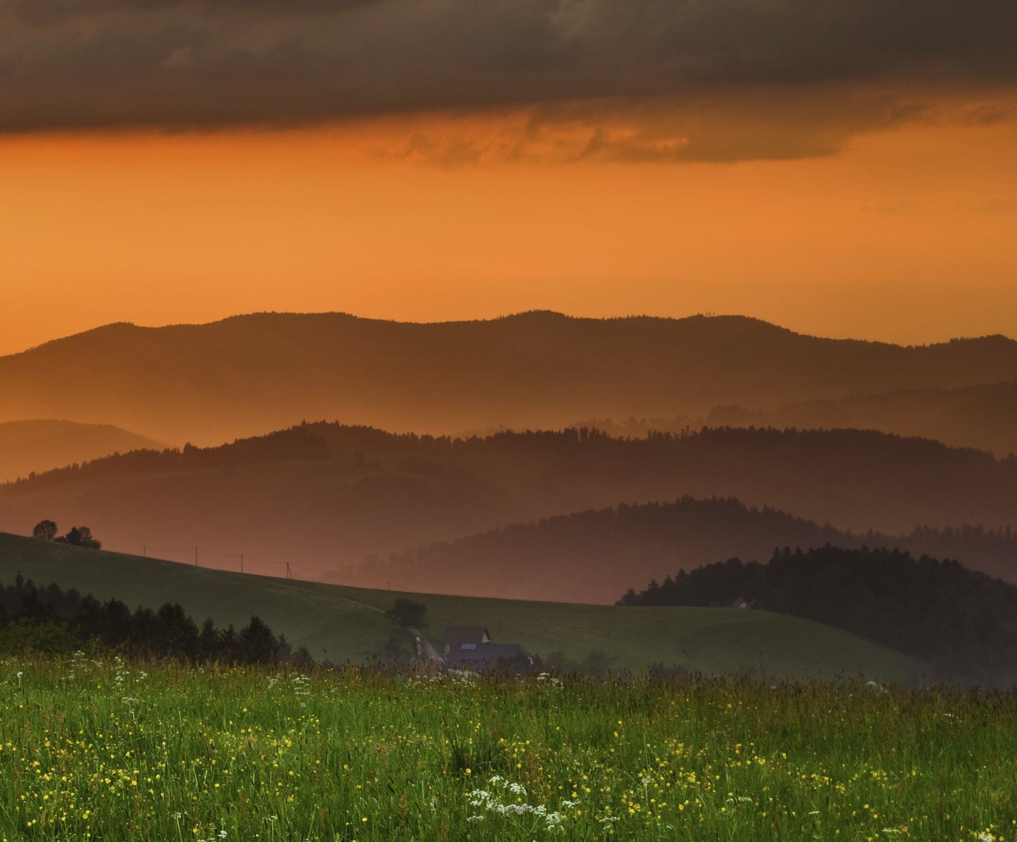
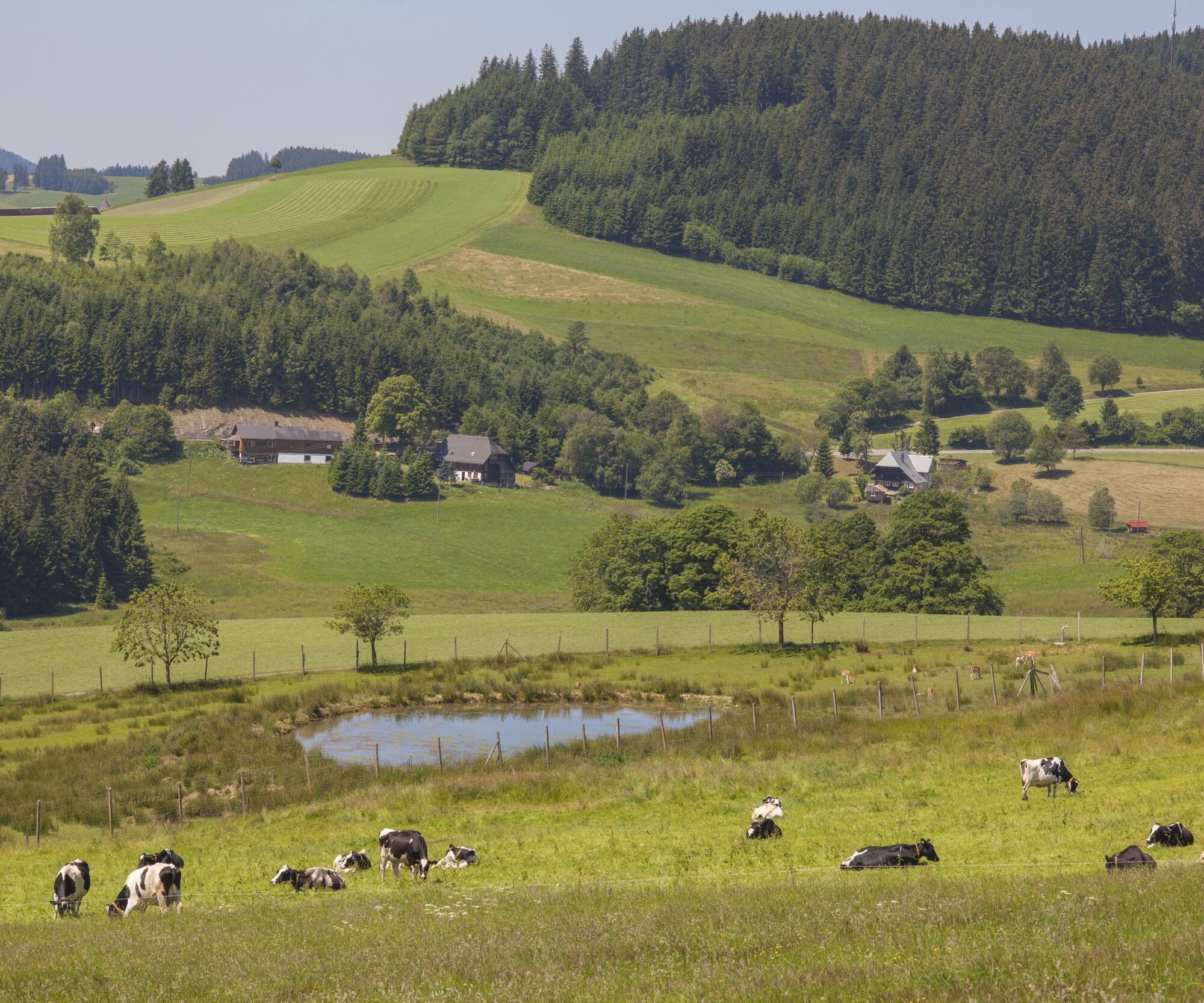

Our panoramic tour starts at the parking lot for hikers located at the church in Breitnaus’s idyllic village center. The tour takes us past the inn Gasthaus Kreuz and continues to Wirbstein. We can visit the farm shop Konradhof along the way. Then it’s slightly uphill to Gasthaus Löwen, where we cross the street and follow the guidepost in the direction of Tiefen. Once we reach the part of town called Tiefen, we walk towards Heiligenbrunnen. After reaching Gasthaus Heiligenbrunnen, we can take a small break and enjoy some culinary treats. The paths leads us further to Fürsatzhöhe. Here we take the path that leads to Thurner and has the Weißtannenhöhe, the highest point of our hike, as its destination. The bench that soon comes into our view offers marvelous views of the Feldberg, Schauinsland, and Breitnau. We soon reach the highlight of our tour: the “country seat” [Landsitz] at Fahrenberger Höhe. The view there is stunning and we can take it in while sitting on a four meter long bench shaped like a wave. After our well-deserved break, we continue our hike via Ankenbühl to the waypoint Ramshalde beside the road. We continue in the direction of Schanz Waldeck, across lush meadows and fields, until we reach the waypoint Oberer Fahrenberg. Once there, we are rewarded with beautiful views of St. Märgen and St. Peter to the north as well as Feldberg to the southwest. If desired, a shortcut can be taken via Hugenweiher and Rossberg to get to Breitnau. Otherwise, we will follow the guidepost to Schanzenhäusle. At the hostel Naturfreundehaus, we have another opportunity to stop for a bite to eat before we embark on the descent to Breitnau via Schanz Waldeck.
Tak
We recommend sturdy shoes!
Please pay attention to the signposts on the hiking trail. You can find precise and detailed information about the signposts and the hiking guidance system on our website. In emergencies, call 112.
Take B31 from Freiburg or Titisee to the B500 (road signs to Triberg/ Furtwangen/Breitnau) − turn onto Dorfstraße/K4900 (signs to Breitnau)
Bus 7216 from Hinterzarten to Breitnau
Wanderparkplatz an der Kirche Breitnau, Kirchweg 14, 79874 Breitnau
This project was supported by the Southern Black Forest Nature Park with funds from the state of Baden-Württemberg and the Glücksspirale lottery.
Try a typical snack in Gasthaus Heiligenbrunn!
Popularne wycieczki w okolicy
- 4,8
Black Forest Highlands heritage trail - mills and saws in the gorge
średniWędrówka 7,42 km - 3,7
Seerundweg Titisee
światłoWędrówka 5,84 km - 4,1
Höhenklimaweg Titisee-Rundweg
średniWędrówka 7,44 km - 4,3
Through the mystical Bannwald forest to the Zweribach Waterfall
średniWędrówka 12,3 km - 3,7
From Titisee to the Hochfirst with its stunning views
średniWędrówka 10,6 km - 3,8
Premium Hiking Trail- Säbelthomaweg
średniTrasa tematyczna 10,9 km - 4,3
Mystical path to the Mathisleweiher pond
średniWędrówka 8,94 km - 5,0
Premium Hiking Trail - Menzenschwander Geißenpfad
średniTrasa tematyczna 10,3 km - 4,8
Sonnenaufgang und Feldbergsteig
średniWędrówka 11,6 km - 4,0
Altitude on the Herzogenhorn
średniWędrówka 11,1 km

Wędrówki i tropienie


Nie przegap ofert i inspiracji na następne wakacje
Twój adres e-mail została dodana do listy mailingowej.